– Santa Fe, New Mexico to Las Vegas, New Mexico –
Today began early, despite the time change overnight. We woke up at 6am, which felt pretty early. Everyone was a little dazed when the alarm went off. Still, we rallied, and we were all showered and breakfasted by 7:30 and on the road out of Santa Fe.
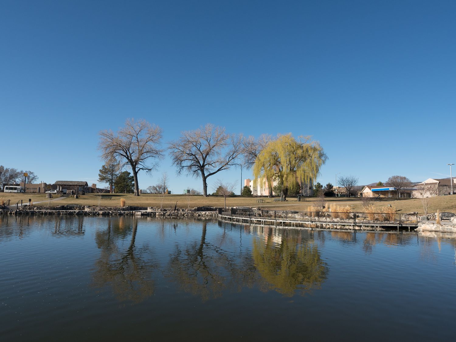
We had 3 parks from the National Park System planned today, so we had a lot to get done in a short amount of time. We drove first up to Los Alamos, where we stopped to take a photograph of the Los Alamos County Courthouse for Mark. Across from the courthouse, we found an adorable park with a pond and a large fountain, complete with a waterfall, so we wandered around and took some photos. It was still reasonably early, and no one was really out and about.
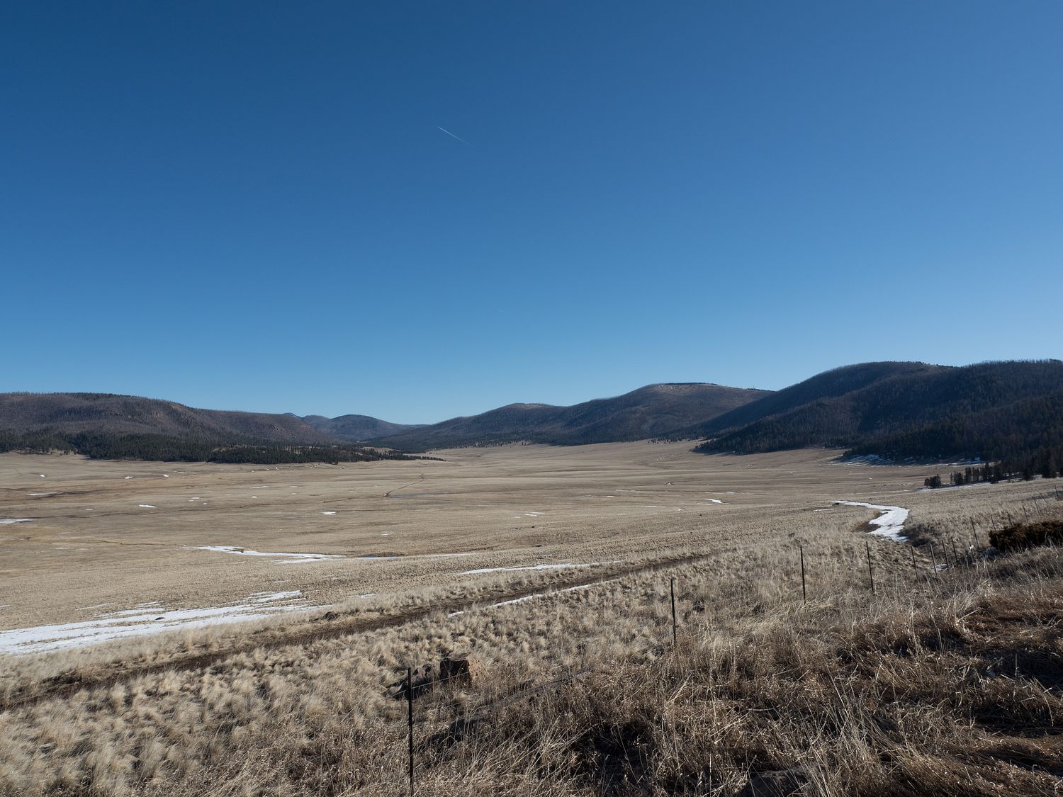
From Los Alamos, we followed the road back to Valles Caldera National Preserve, which has only been a park of the National Park System since October of last year, according to the ranger there. They didn’t even park booklets available yet. Valles Caldera is the collapsed remains of a volcano that last erupted around 50,000 years ago.
If you aren’t sure what that looks like, well, you aren’t alone. We were not sure what to expect, either. It turned out to be a moderate depression in the top of a large, flat-ish mountain, with a bare golden-colored field in the middle. The trees had not encroached on the depression, so the whole (roughly 13-mile) area was completely visible from the road. It was an impressive sight as we rounded the corner and first caught sight of it. We’d been climbing up a mountain just prior, so watching the whole area open up into a massive field was a total surprise.
The visitor center was on a dirt road that led down through the field, and we almost felt like we were going the wrong way as we approached. We saw several fluffy coyotes in the distance, which is quite different from the mangy and thin coyotes from back home in Texas. They almost looked like wolves, they were so impressive.
We took some neat pictures of the area around the visitor center and chatted briefly with the park ranger, who was working alone and had only had the office open for perhaps 30 minutes. There was still some snow on the ground from the foul weather earlier in the week, and Mom got a kick out of seeing more of it. She really missed having snow this winter.
Once we’d seen all there was to see at Valles Caldera, we back-tracked a bit to take the road down to Bandelier National Monument. It was still early when we arrived, but the parking lot was much fuller than we expected. We found a parking spot easily, but we weren’t aware of just how lucky we were, because by the time we left, parking was at a premium.
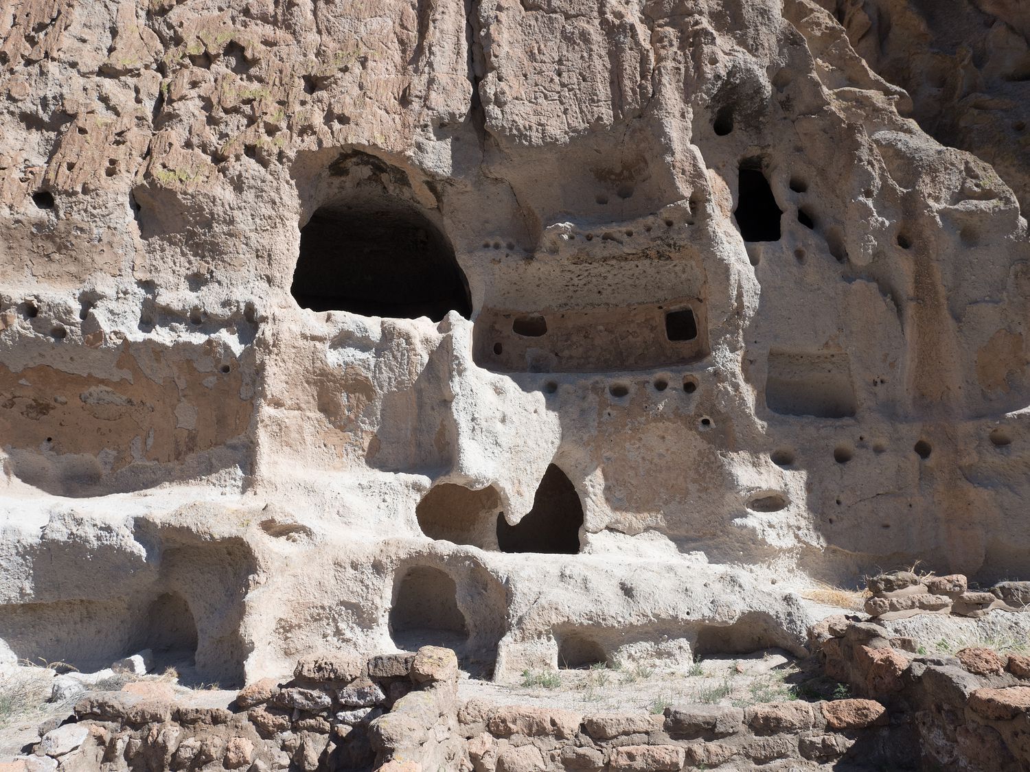
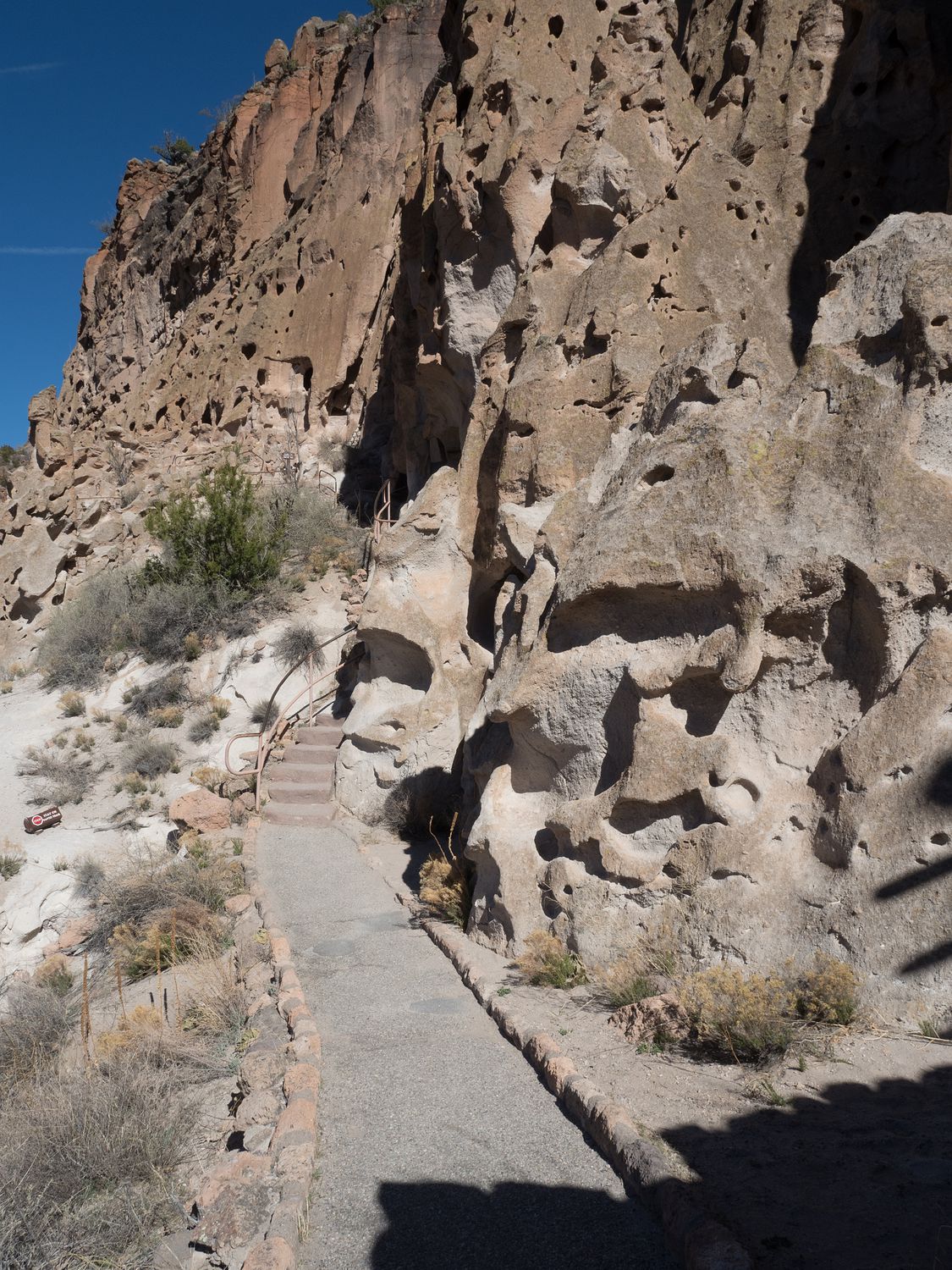
Bandelier is a cultural park, with homes of ancient Pueblo Indians built into the cliffs there in the Jemez Mountains. Ripley wasn’t allowed on the trails, which made us sad, but since the walk around the park was 1.4 miles, my parents elected to wait at the visitor center with the dogs while Mark and I made the trek back to the cliff dwellings to explore. We only took the main loop, but the park supposedly contains around 70 miles of hiking trails in total, so we didn’t see anywhere near all of it.
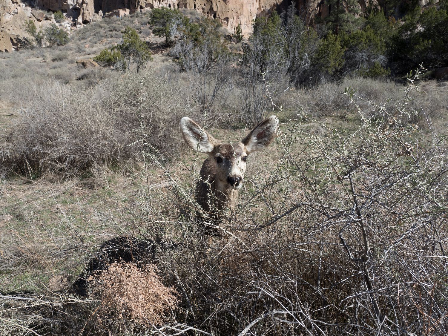
The cliff dwellings basically consist of a series of caves shaped into the sides of the mountains. A few ruined buildings stand just in front, and as we came upon this first set of ruins, we met a small herd of does standing just a few feet from the trail. They were as tame as cats, and stood around innocently while visitors took photographs. I have a feeling that had anyway had a bit of grain, the deer would’ve been eating from our hands.
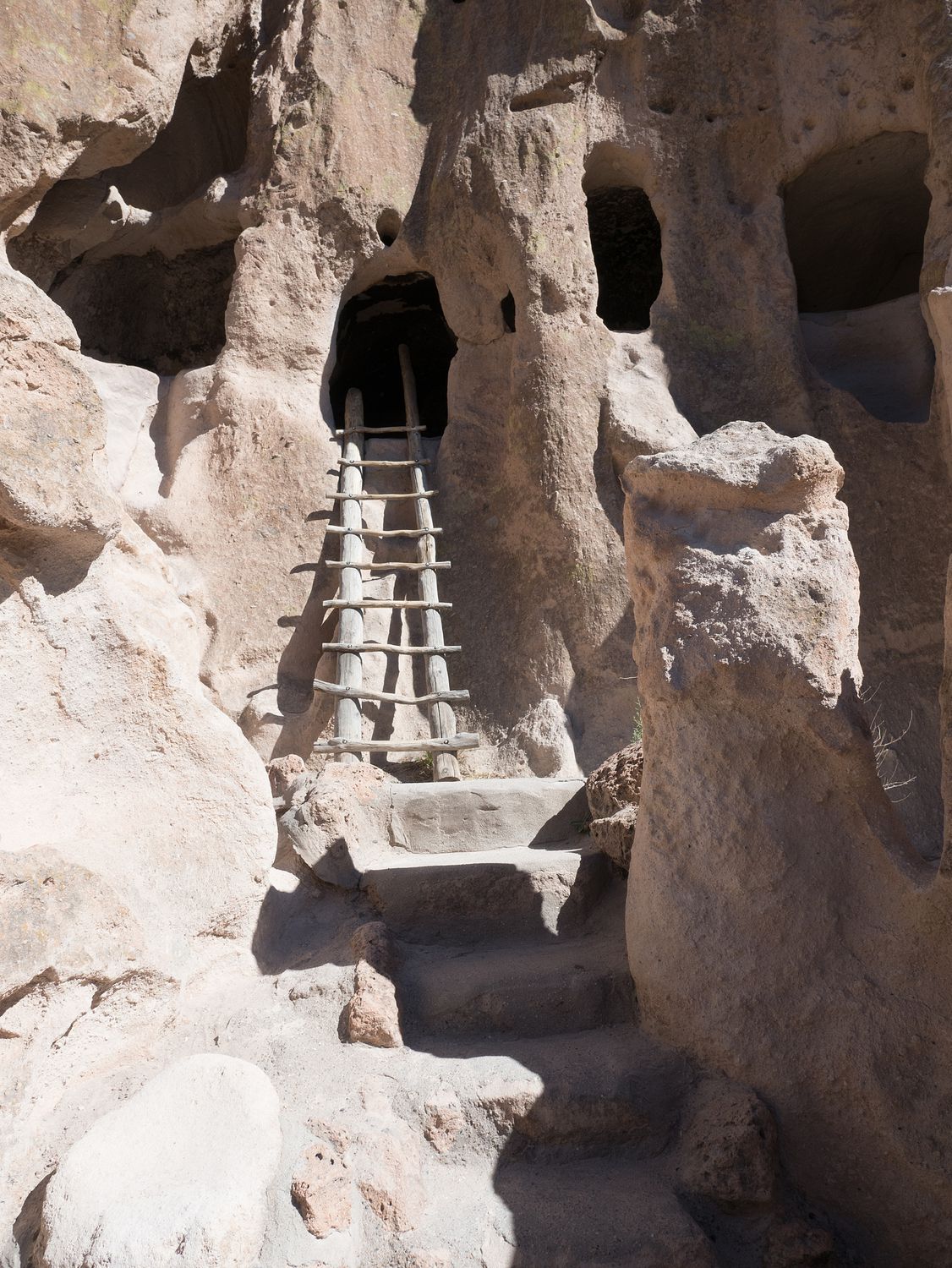
Just past the friendly deer we came upon the first set of cliff dwellings, and Mark scampered up the ladder to the first cave to look inside like a little monkey. I am not so brave, so I took the photographs from the ground. He looked quite intrepid peering down from the little cave mouth, and couldn’t resist taking a panoramic photo with his iPhone. Sometimes I think I have more photos of him taking pictures with anther camera than I have of him looking at the camera.
Some of the stairs on the loop are narrow and steep, but it is surrounded by hand rails, so even being frightened of heights, I felt pretty safe on the trail. I don’t think anyone with any physical difficulties would want to attempt to climb, but otherwise anyone can do it.
We had a lot of fun poking around in the cliff dwellings, but since Mom and Dad and the kids were waiting for us, we finished the loop up pretty quickly once we saw everything on the the main trail. When we got back to the visitor center, we found many, many cars searching for parking spaces. When we finally pulled out, some lucky person right behind us rejoiced at our front parking space.
From Bandelier, we drove through White Rock and across to Pojoaque, where we stopped for lunch at a Subway in a gas station. The town didn’t have much else in the way of food. Our goal was to drive as close to the mountains as possible and cross the Santa Fe National Forest, since Las Vegas is on the other side and it was our final destination.
We took part of the Taos Scenic Byway, which is also called the High Road to Taos. Several tiny villages dot the highway, and we happened to take the smaller of a set of roads which took us through some very interesting areas. The roads were tiny and narrow, and we passed several blind hair-pin turns that were less than a foot from the buildings on either side. We had fun, but the drive was a little nerve-wracking to say the least. You should probably take the bigger roads if you come through here, although if you are looking for an adventure, the smaller ones certainly rate.
We didn’t take the turn off to Taos, since we weren’t heading that way. Instead, we continued southwest-ish, through Tres Ritos and down to Mora. It was a beautiful drive. From Mora, we drove across to Golondrinas and then to Watrous, where we went north to our final park of the day: Fort Union National Monument.
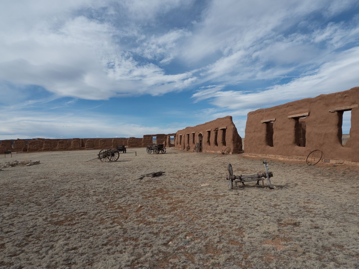
Fort Union is along the old Santa Fe Wagon Trail, and wagon ruts can be seen along the road heading into the park. We arrived pretty late, since it was 3:45pm and the park closed at 4. We rushed back to get some pictures of the fort before the park closed. Only one ranger was on duty, and when we made it back to the visitor center right at 4pm, he chatted with us for a few minutes before he closed for the day.
A large portion of the fort is still standing, and the ranger gave us a brief history of the current ruins, which are the remains of the second fort built on the site. Three total were located there. We didn’t want to keep him for too long, so we quickly bought some souvenirs and parted ways. We didn’t get to see everything, but we made a pretty good run of it considering our limited time.
With that, we had wrapped up for the day, so we drove about 20 miles down to Las Vegas and checked into our hotel. It was just about 5pm but the time we made it into our room, so we searched for some dinner and went out to grab something to eat at just after 5:30. Dinner wasn’t anything special, so I won’t mention the restaurant here. We won’t be going back anytime soon. Apparently the enchiladas weren’t bad, but not good enough to be worth mentioning.
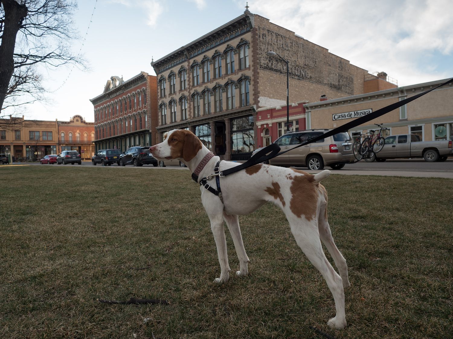
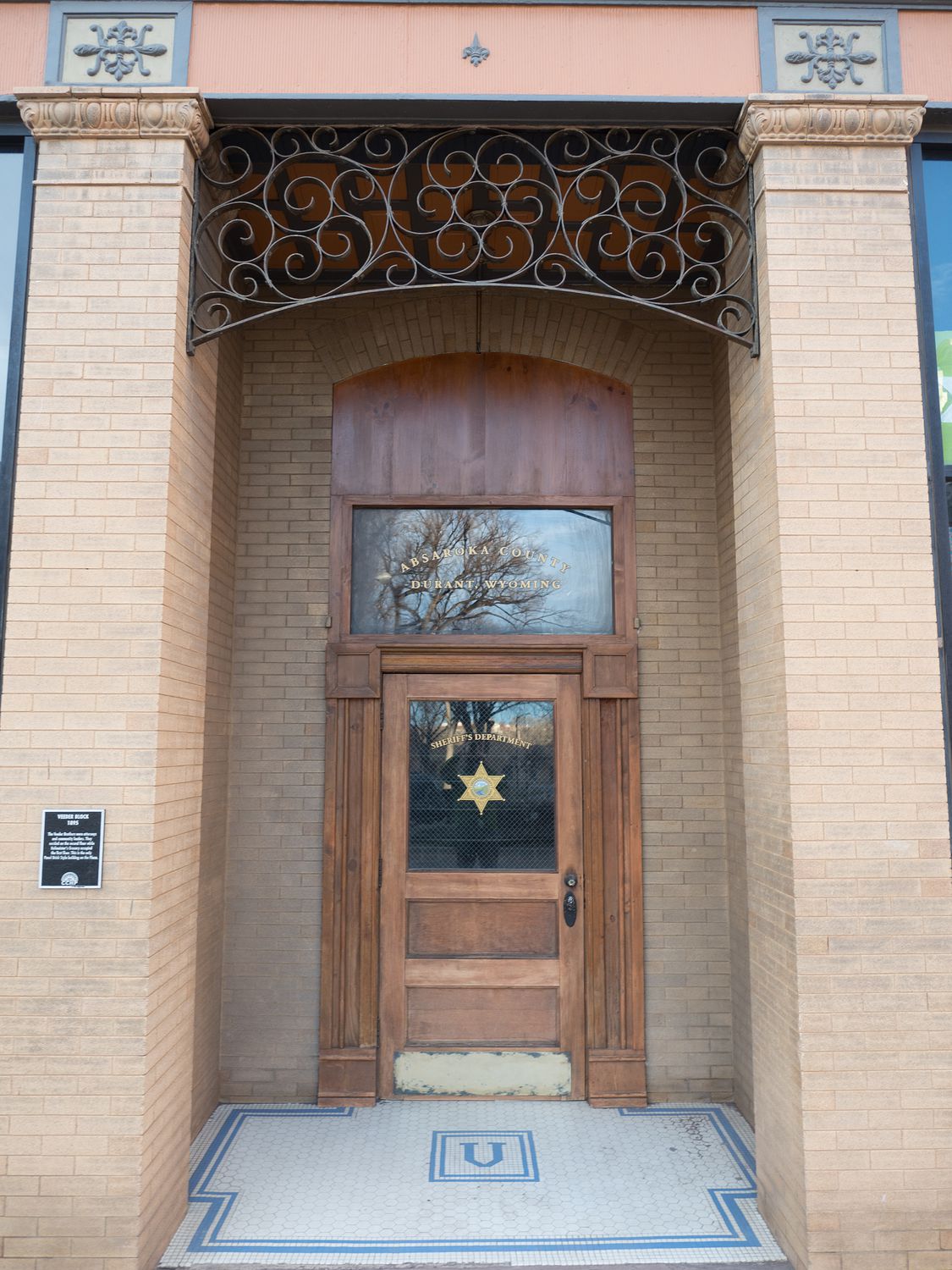
It turns out Las Vegas is where they film parts of the TV show Longmire, if you’ve ever seen it, and since Mark and I enjoy the show, we stopped by the square downtown to take some photos of the office. It’s a little funny- there’s just a door between two buildings that says it houses the Absaroka County Sheriff’s Office in Durant, Wyoming, just like on the show. Mark and I got a kick out of it, in any event.
We also took some photos of the local courthouse and an old roundhouse, where they used to work on train cars. Mark loves them, and whenever we come to an area that has one, he wants to stop and take some pictures. We ended up having a fantastic day, and we took more than 500 photographs. We were pretty busy, too.
Tomorrow we are driving home, so I expect we will be up pretty early so we can get home before it gets too late. The time change has made things a little harder, but it will all turn out.
– Trip Total : 997 miles –