– El Paso, Texas to Tucson, Arizona –
Well, today didn’t go as planned. It was also a very long day, even though we did not run this morning, and made it out of our hotel at a reasonable hour. We got up at 5, we showered and had our hotel breakfast, and we hustled out of there, but it was still 7am when we made it to the Walmart by our hotel for a quick morning grocery run.
By the time we’d bought groceries and filled up on gas and bought tea so we could leave El Paso, it was just before 8am. That’s not ideal, but it isn’t bad, either. It didn’t matter, though. It was just a very long day.
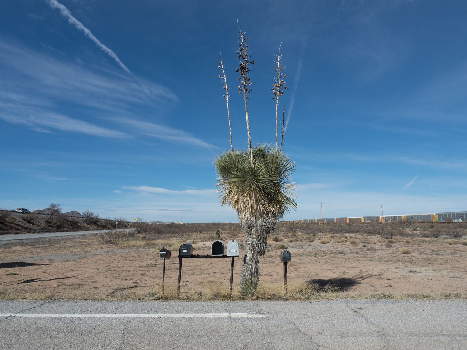
From El Paso, it was about a 3 hour drive to our first stop at Fort Bowie National Historic Site. We stopped several times along the way. If you’ve ever driven down I-10 this way, you will have seen the hundreds of billboards peppering the highway for each and every gas station along the otherwise empty stretches of road from El Paso to Las Cruces and from Las Cruces to Deming. It’s an absolute nightmare of advertisement, all for “travel stops” that really turn out to be relatively small gas stations filled with kitschy southwest-themed crap that I’m not sure anyone buys. Understand that when I say this, I’m disparaging one of Mark’s favorite stops along this road, though we didn’t drive past today: The Thing. “What is it?” as all the signs say.
At one stop, Mark took out his analog camera to take some photos, but forgot to take off his lens cap. He was very disappointed when he realized he had done it when he got back to the car. At least he got the same shot with the digital? I don’t think that made him feel any better, though. Poor fella.
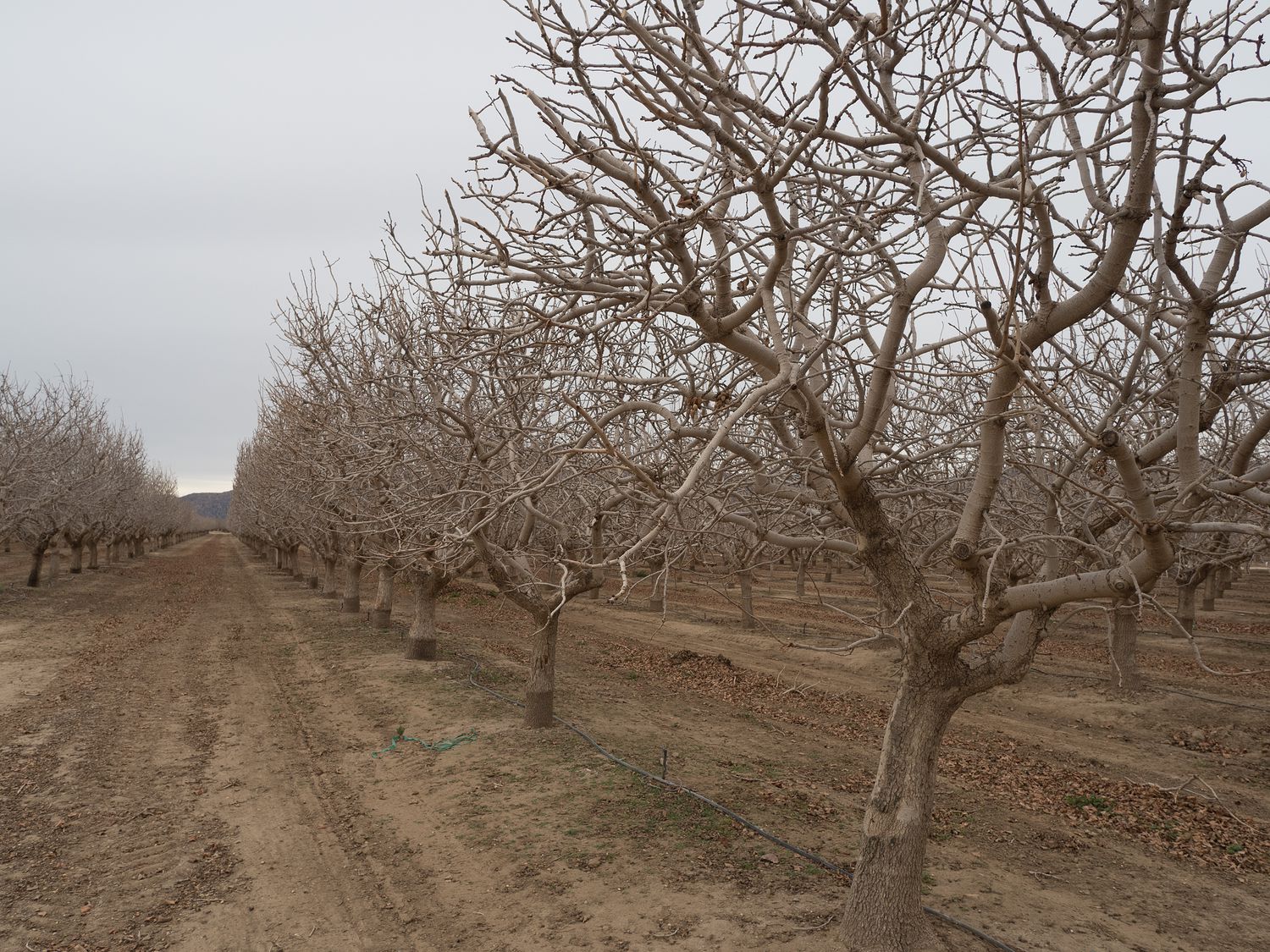
I must admit, I took an hour long nap sometime during our 3-hour drive. It’s been a rough week. We took I-10 to the little town of Bowie in Arizona, then turned south to head to Fort Bowie. On the way down, we drove through a little orchard of trees we didn’t recognize. Thanks to some helpful road signs, we finally figured out they were pistachio trees, which I don’t remember having ever seen before. They are neat looking, especially dormant as they are now.
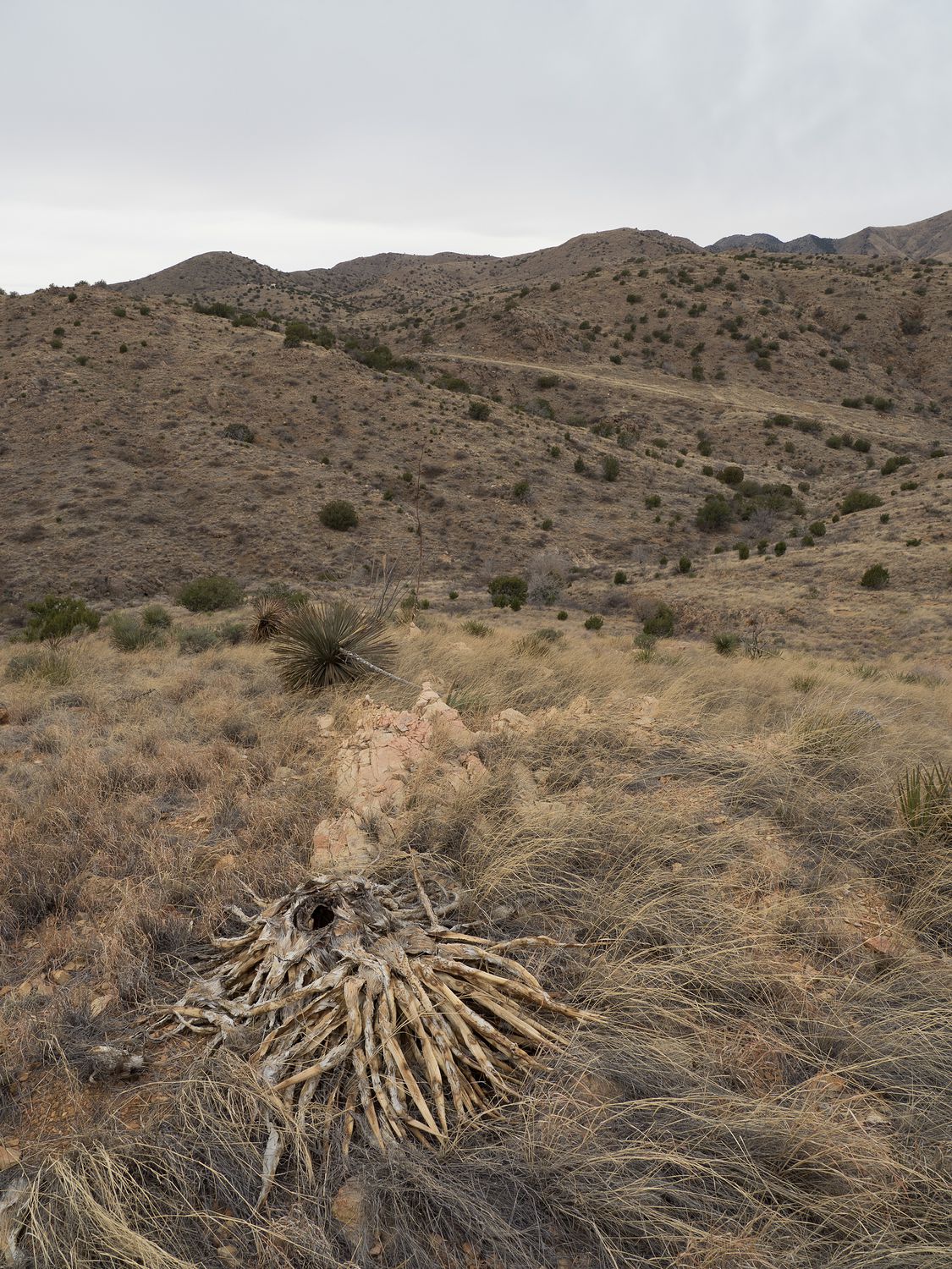
The road back to Fort Bowie eventually turns to dirt and gravel, which surprised me a bit. It’s set back in the very middle of nowhere, surrounded by smallish mountains. I can’t honestly say why anyone would fight over this land, but I know they did. This national historic site is the home of the ruins of a fort built in the 1860s to fight the Chiricahua Apaches living in the area.
It is also a 3-mile round trip hike back to see the fort, which we didn’t realize before we went. Poor planning on our part, I guess. We just didn’t have the time to make the walk. We had 3 other parks to visit today, and it was already after 11am. It also turns out, as we came to find out later, that the visitor center is back at the fort as well, so we weren’t even able to get a stamp for the park. Lame. We took a few pictures at the lookouts and did a little stomping around at a couple of pull-outs, but I can’t say we did the place justice.
On our way out, we went ahead and unpacked our lunch, since breakfast was around 6am and by now, we were starving. It’s also a little later back home in Texas, so our tummies were telling us that lunch time had passed. We ate in the truck on the short drive to our next park, Chiricahua National Monument, about another 20 miles into the middle of nowhere.
We were actually pretty surprised by how popular this park seemed to be when we were driving back to it. I know it is Saturday, but there were just so many people there! We didn’t do too much reading on this one, either, which we’ve now realized wasn’t smart, but it didn’t matter as much in this case. We are going to try to do better tomorrow, and read up a little more on the parks before we go. I usually do it myself, but this past week was so busy that I just never had the time. There also hadn’t been an internet signal for at least an hour by the time we were driving up to it, so we couldn’t even google the things we didn’t know.
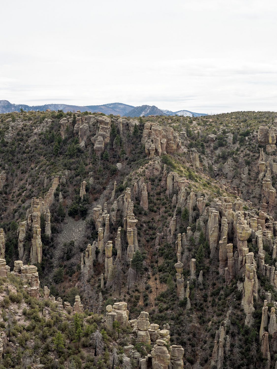
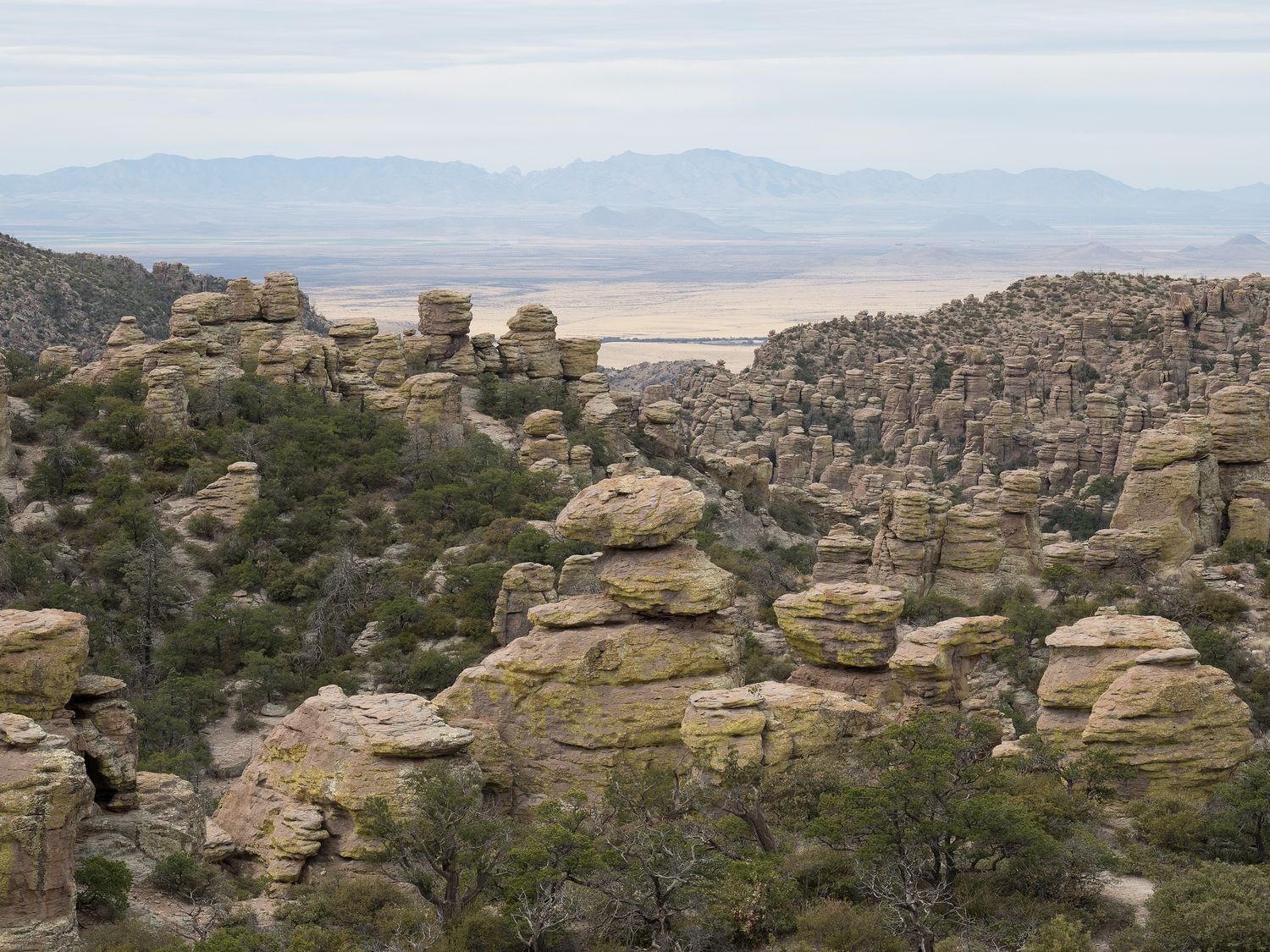
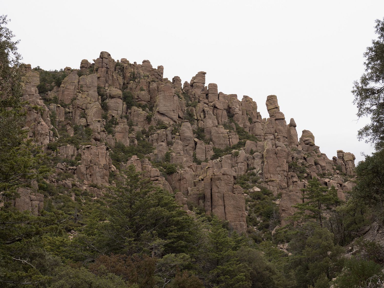
Luckily for us, Chiricahua is really cool, and we had absolutely no idea what we were driving into. We knew about the Chiricahua Mountains, and the Chiricahua Apaches, but the park was created to protect its hoodoos and balancing rocks down in a gorgeous little canyon, and we were pleasantly surprised to see them.
Part of the park used to be a big ranch, too. We didn’t walk out to the ranch, but the photos were neat in the visitor center. There are quite a few hiking trails in the park, and there’s also a long road back into the canyon and up onto an overlook to take in all of the beautiful rock formations within the park. The geology of the area was formed from volcanic activity, according to signs in the visitor center. I had told Mark on the drive in that one of the mountains looked like an an old volcano, so it was nice to be proven right. It’s funny how many old volcanoes that we’ve seen in our travels now. I suppose, especially in the case of Hawaii and Iceland, that many of them weren’t even that old.
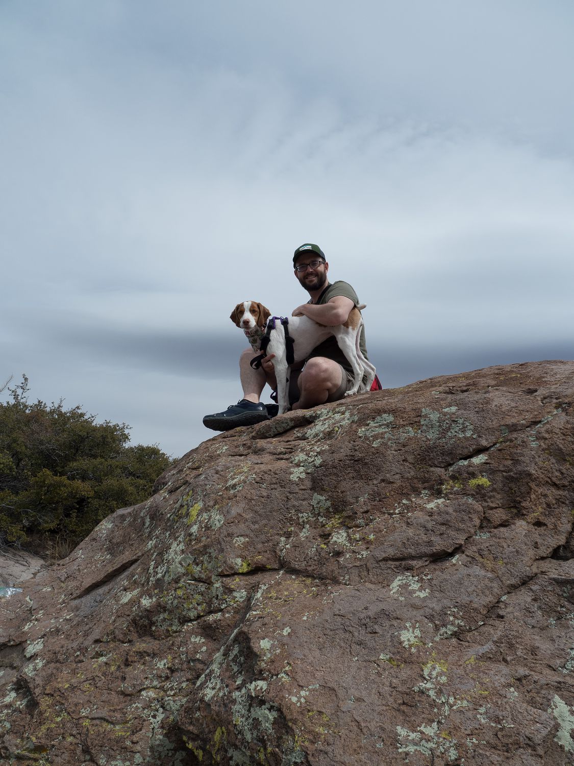
Of course we took the drive back into the park to get a good look at the canyon. It’s funny to see ponderosa pines right next to cactus, but we did see that down on the canyon floor. The major overlook at the end of the road is Massai Point. It was so popular today that it was almost difficult to find parking. Ripley wasn’t allowed out on the trails there, but Mark and I were able to walk out onto the cliff edge to take a look around.
We also took some cute pictures of little Ripley on some big rocks right next to the road, since she was allowed to be there. From what I understand, she would’ve been allowed on the trail out to the ranch, too, although we didn’t have time to take her by. We spent quite a bit of time in Chiricahua, probably more than we should’ve, considering we technically had two more parks to visit and it was after 1pm. This was, however, definitely the highlight of our day. Things went downhill after Chiricahua.
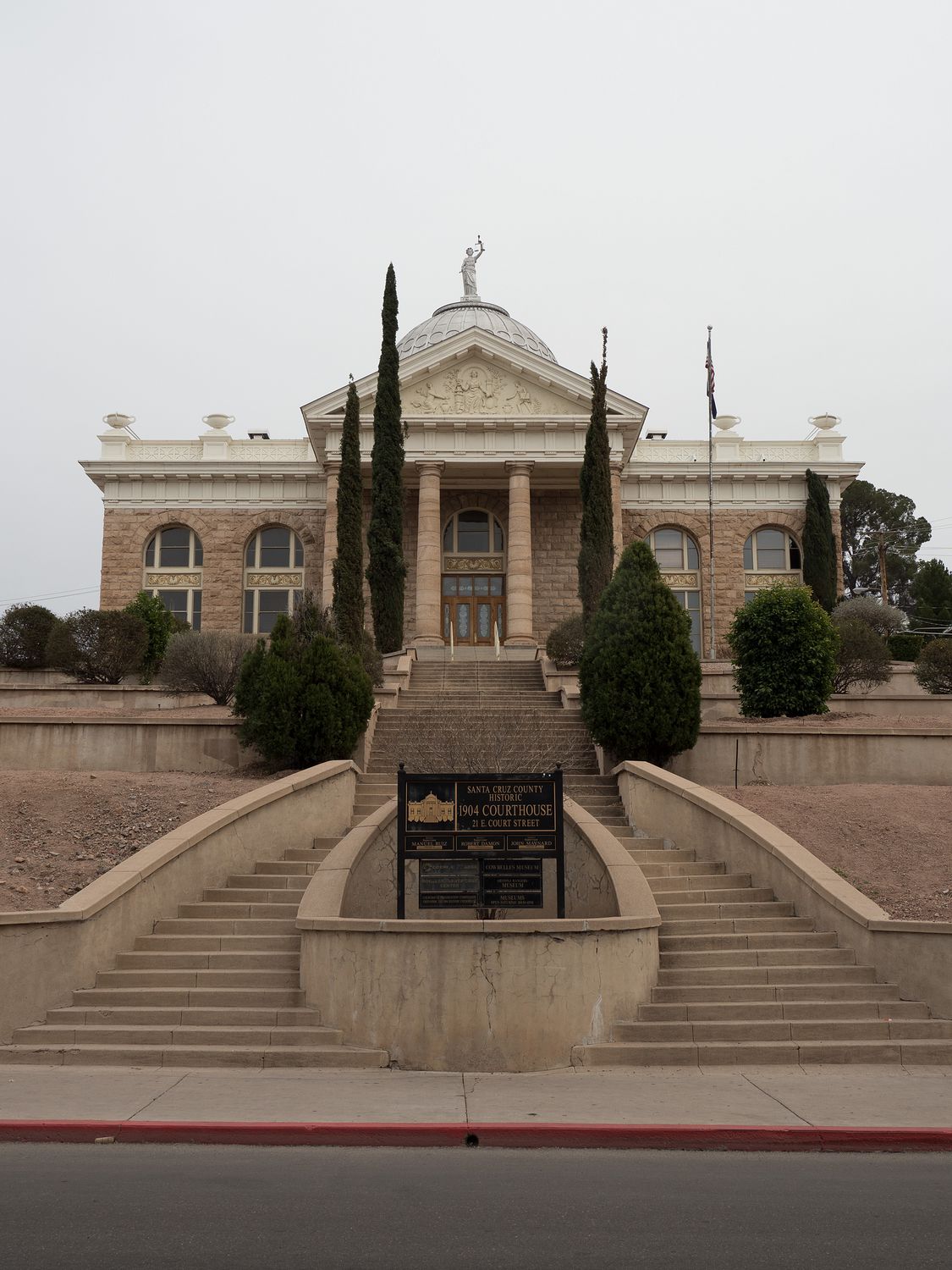
From there, it was 1 hour and 45 minutes to the next park, Coronado National Memorial, which would put us there right around 3pm. Considering the visitor center closed at 4pm, and we still had one more park to visit after that, we were really pushing our luck. Besides that, between Chiricahua and Coronado, Mark wanted to stop in Bisbee, which is the county seat of Cochise County, Arizona. You know what that means. Time for a courthouse photo.
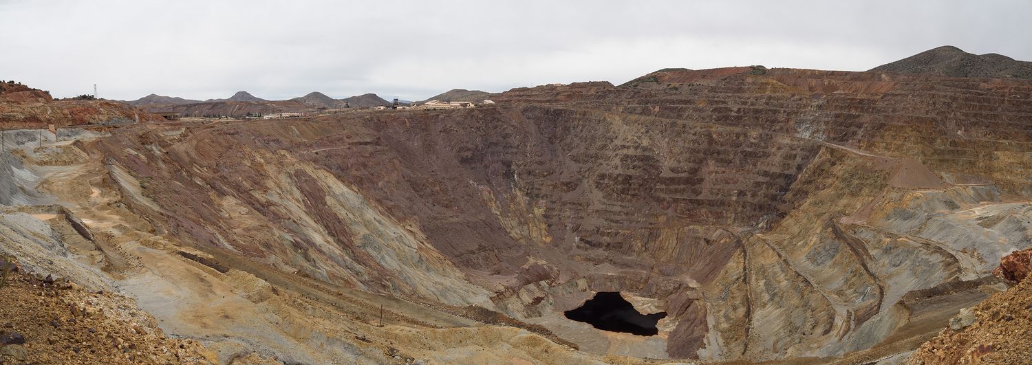
Bisbee turns out to be a really interesting little place. It has a population of less than 6,000 people, and is home to a positively massive former copper mine. It was founded around 1880 for the mine, which didn’t close until the 1970s. The town next to the mine is built into the side of the mountain over the mine. It’s an adorable tourist trap now, with tiny, building-lined streets filled with chocolate makers and coffee shops and breweries. We were not expecting it to be like that at all, when we drove out there to get our courthouse photo. I think we could go back and spend a day exploring the little town.
From Bisbee, it was still a little ways to Coronado National Memorial. It actually started to rain as we made our way there, which is somewhat surprising to me in southern Arizona, though logically I know it must rain sometime. We finally made it to the little road to the national memorial just after 3, even later than we had intended, only to find the county sheriff sitting at the end of the road, turning people away.
It turns out that they’d had some kind of major traffic accident on the road leading into the park, and you couldn’t get back to the park until the accident had been cleared away. The sheriff told us that the road would be closed for a while, and he didn’t expect to see the wrecker any time soon, even though he had called for one. We were sadly sent away, and with no other way to get into the park, we just had to skip it. Talk about frustrating. That’s the first park we’ve missed for a reason like that, I think.
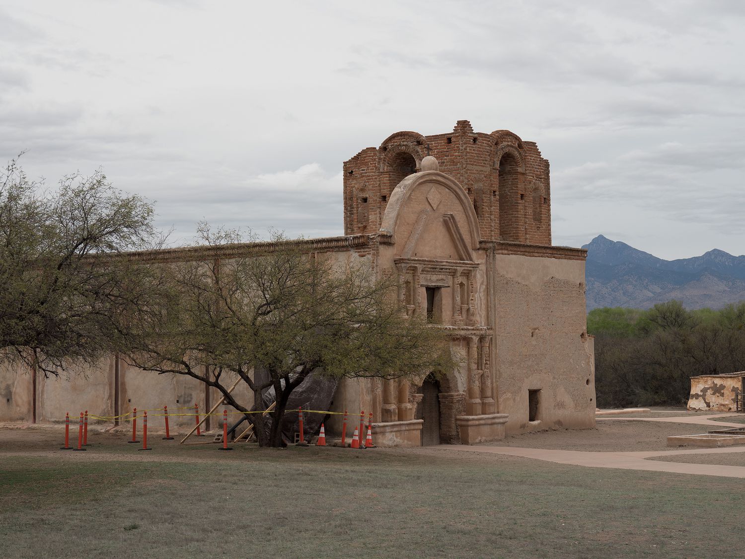
The problem there, of course, was that if we hadn’t come down to see Coronado, we could have made it to the other park, Tumacácori National Historical Park, before it closed at 5pm, but since it was after 3pm and still about 2 hours to that park, we had essentially wasted enough time that now we wouldn’t get to see either one of them.
Since we were already running so late, we drove down to the border to Nogales on the way to Tumacácori, which is the county seat of Santa Cruz County, and got our courthouse photo. It was already long after 5pm when we made it there, and it was still 20 minutes from Nogales to Tumacácori. We did stop by, but of course the place turned out to be gated, so we couldn’t even see the outside, really. The park houses an old mission, and we thought that we might be able to photograph the outside, even after the visitor center closed. We were able to, but only because Mark is so giant that he could take photos of the place over the massive wall outside of it. Yet another disappointment for today.
It was after 7pm when we finally rolled into Tucson, and it is almost 10pm as I’m writing this very paragraph. We’ve been going hard since 5am, and I am utterly exhausted. We tried to stop for dinner before we made it to our hotel, but Google maps tricked us and gave us the wrong menu for a place on the way to the hotel, so it turned out the first place we stopped didn’t actually have the vegetarian food we thought it did.
We did find a Quiktrip, though, which boosted my mood considerably. Quiktrip gas stations have the very best unsweet tea in the country, and I’ve been around, so I would know. I’m a connoisseur. After that, we went on to our hotel to unpack our things before setting out once again to try to find dinner. A little taco shop near the hotel ended up being just fine, and had giant veggie burritos, so everything worked out in the end, but we weren’t back to the hotel to eat until about 8pm, and blogging didn’t start until 8:30. I may need another car nap tomorrow.

We do, at least, get to run in the morning, which will get tomorrow off to the right start. Our big goal for tomorrow is Organ Pipe Cactus National Monument, which was one of the favorites for the trip. I’m hoping things go a little better tomorrow. I know we will at least be better prepared. All right, I’ve got to get some sleep so I can function in the morning. I can’t say I’m looking forward to getting out of bed at 5am again.
– Trip Total : 1,138 miles –