– Terlingua, Texas to Big Bend National Park–
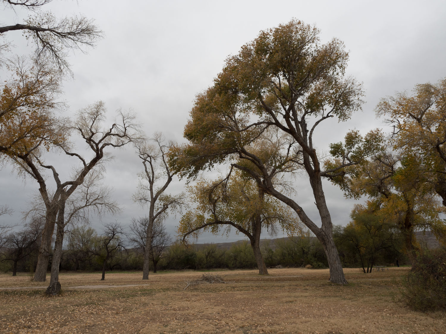
Today was our first day in Big Bend National Park. We’re here again tomorrow, too. The weather took a turn for the worse overnight, so when we woke up this morning, it was very cold and the sky was covered with unpleasant looking clouds.
We didn’t wake up until 8am. I was sick last night, so we didn’t get to bed on time. We started out pretty late, and there’s nowhere to run here in Terlingua, so we decided we would try to hike for our exercise today. Hiking was in the plan, anyway. We showered and had breakfast from our food tubs before we headed for the only local gas station to pick up a bag of ice for our cooler. The gas station is attached to a cafe, which happens to serve a buffet-style breakfast. We checked it out in case we were interested for tomorrow, but I think we will pass. I’m not big on buffets, anyway. I’m always nervous about food that’s been sitting out for longer than a half hour.
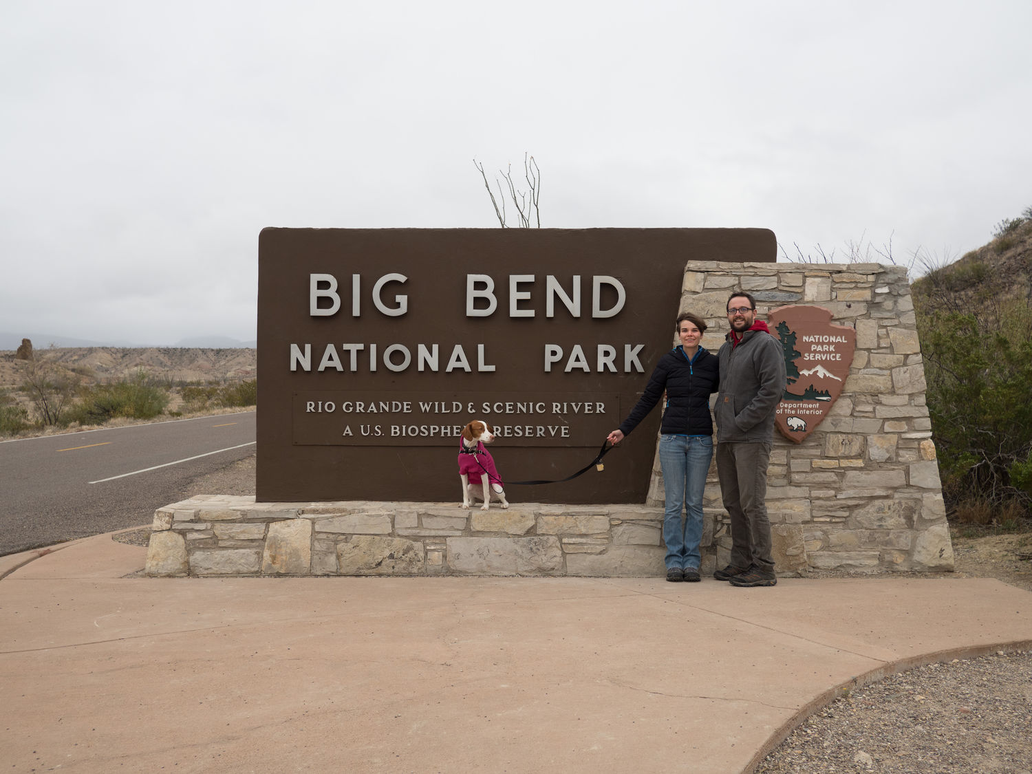
From the gas station, we made our way to the entrance to Big Bend National Park. With our annual pass we made it in free, but it normally costs about $25 per vehicle for a week’s pass. At the entrance station, the ranger informed us that the mountainous areas of the park were quite foggy, and the road to the Chisos Basin was receiving freezing rain. It was perhaps 34F in our location on the desert floor at the time, so I wasn’t surprised by the weather.
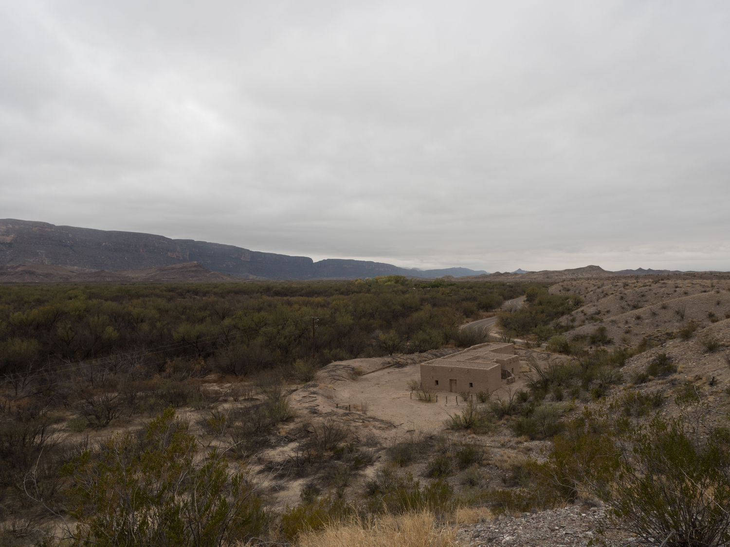
Since it was still dry in our area, we decided to head south on the unpaved Old Maverick Road to Santa Elena Canyon. The road wasn’t in great shape, and we could see from the dried mud that it had recently been nearly impassable. The road was very solid while we drove it this morning, though, so our only issues involved bouncing along in the uneven gravel.
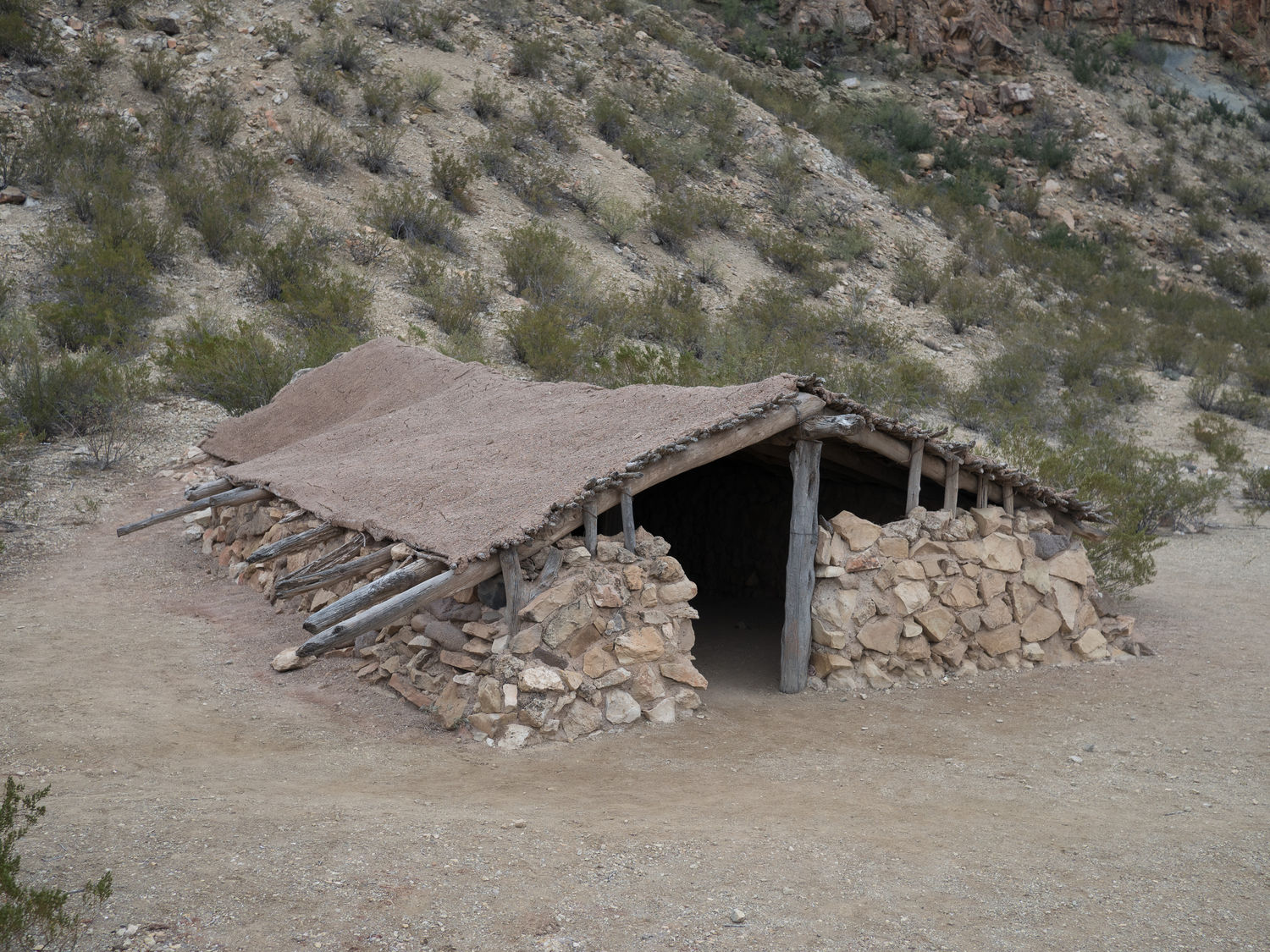
Along the way we saw an exhibit of an old jacal, which is a mud, wood, and stone house built into the earth. The jacal on display served as a family home until 1947, when its owner died at the ripe old age of 108. From the way things looked inside the house, I can’t believe anyone that lived there survived for so long. I’m not sure I would last a week without an AC.
I’d like to pause at this point and reveal an uncomfortable truth. Ripley was having a rough morning. Ever since we arrived in Terlingua last night, she had been on a bathroom strike, refusing to do any of her business in the desert sand. She doesn’t see any grass, so she won’t go, no matter how we beg. This morning, before we left the hotel, she finally peed all over the pavement when Mark was walking her back from a twenty minute trip to a sandy area near our hotel for her to go potty. She refused to go in the sand, but when she realized he was bringing her back to the room, she panicked and peed all over the parking lot. She still hadn’t taken care of the rest of business though, and refused all opportunities, so she was obviously uncomfortable as we rumbled along the dirt road to the canyon.
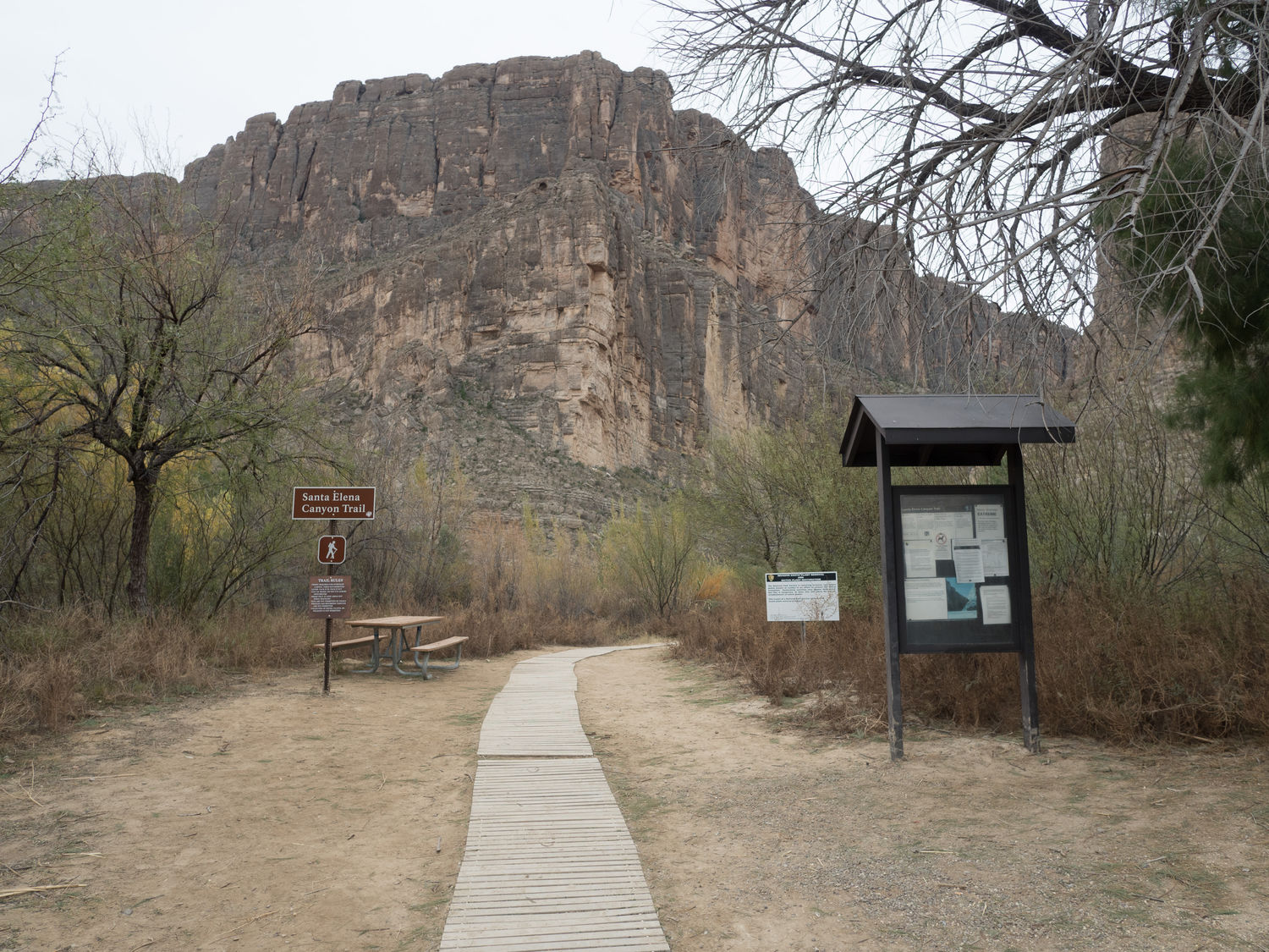
At the end of Old Maverick Road, we parked our car at the entrance to the Santa Elena Canyon Overlook trail. This was one of our major plans for the day. We got Ripley out of the car and bundled up, expecting the three of us to hike up to the overlook. When we made it to the trailhead, we realized that Ripley wasn’t allowed on the park trails. She couldn’t go along.
We were pretty disappointed that our kid couldn’t come on the hike with us, and we knew she needed to go to the bathroom, so we spent 10 minutes begging and cajoling until finally she finished her business. We bagged it up, as you are supposed to do, and were walking back to the trash can with a baggie of dog poop when we were stopped by a park ranger. He thanked us for picking up her poop, because apparently not many people do it like they are supposed to. I thought it was hilarious. You are welcome, Mr. Park Ranger. We always pack out what we pack in.
Since it was cool enough, we decided Ripley could wait in the car with her blanket while we made the trip to the canyon overlook. We gave her some water and then settled her in the car before gathering up our camera gear and making for the trail. Quite a few people were making the trip with us.
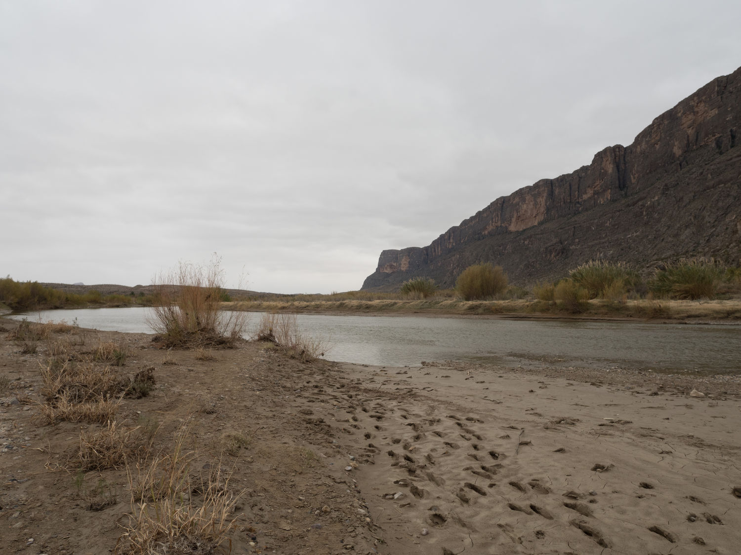
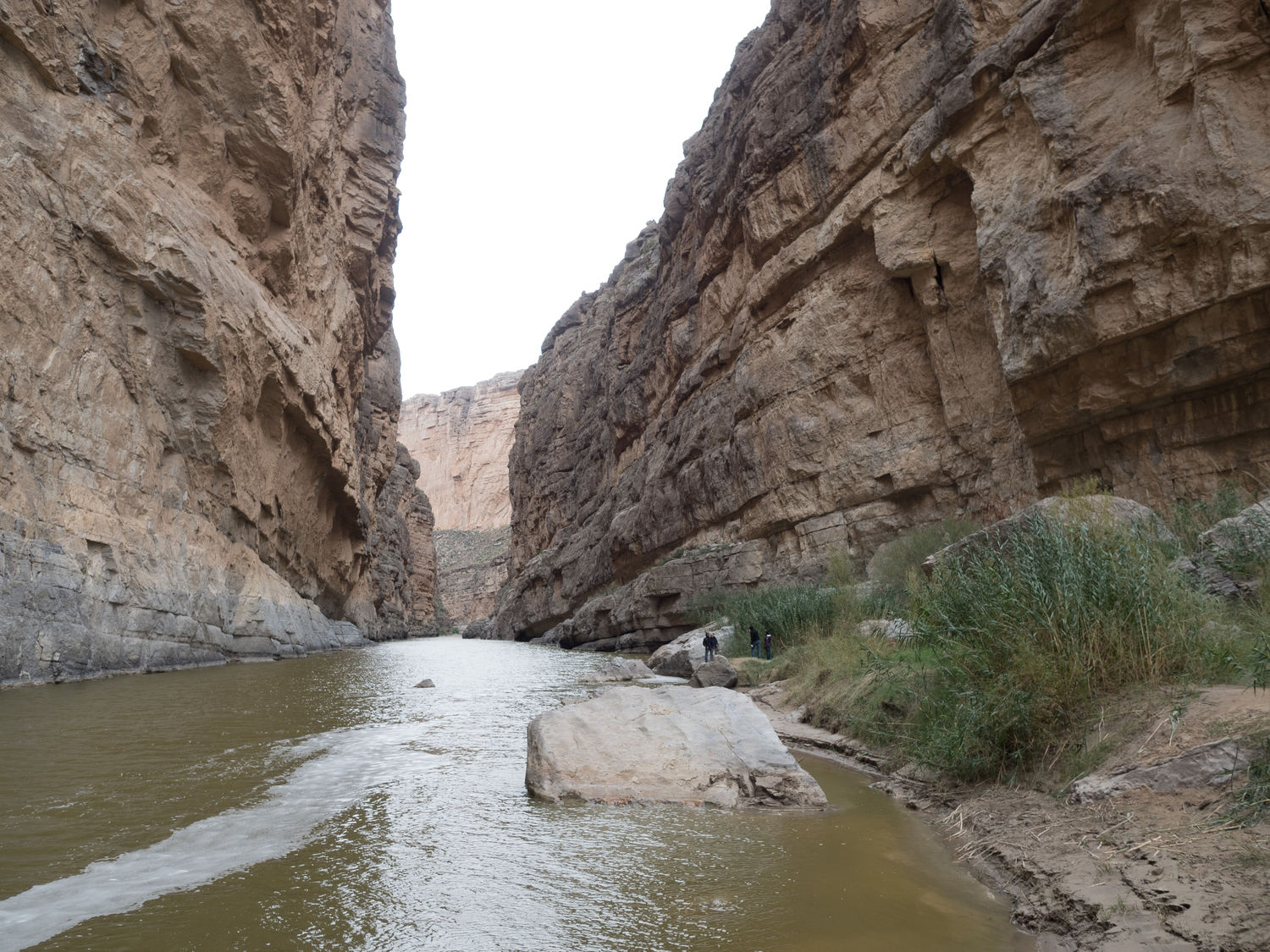
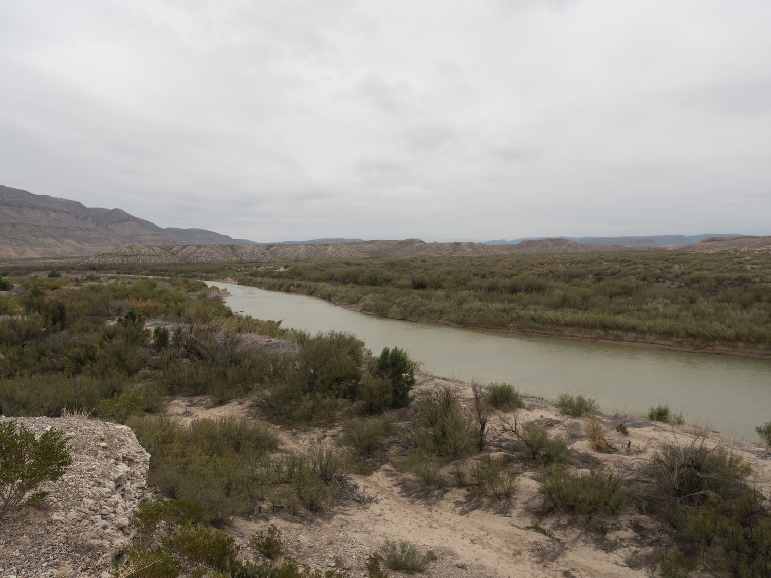
Not far along, we came to the Rio Grande, where we could see the opening to the Santa Elena Canyon. The banks of the river were muddy and very soft. You could see deep tracks from people sinking in the mud. Mark was taking pictures with his medium format camera, and I was playing with the digital. It was freezing cold, so before long, I started to wonder what was taking Mark so long. It turned out that the batteries in his film camera had died while we were standing there, and now he’d had to bring along his heavy film camera bag for nothing. The new batteries were still at home on his desk.
We were not off to a great start, but the river was pretty neat to see, and the trail up to the canyon looked promising, so we continued along the trail. Not far from our first stop, we reached a river crossing. The mud was deep and the crossing was filled in with tree limbs and grass. Mark made it across okay at first, but I made it halfway and my boot got stuck between two tree limbs. Mark had to come back for me.
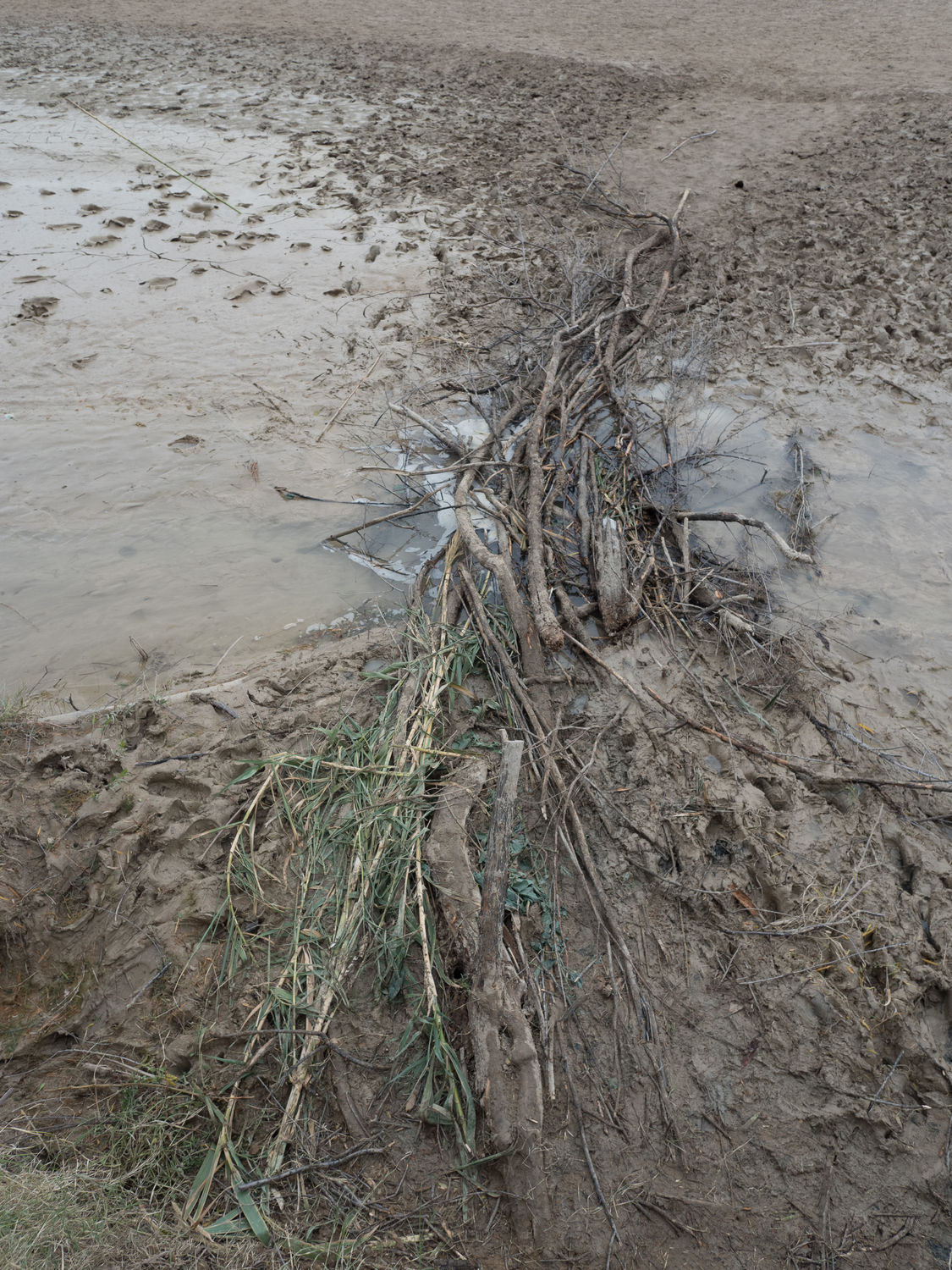
He pulled me out of the tree limbs, but then he staggered back a step and sunk his foot in to the deep mud. Without Mark’s support, I also lost my balance and had to wade through the deep mud. In the end, we were both muddy up to the ankles of our pants, but we didn’t lose a shoe like some other unlucky hiker. From there, Mark had to boost me up a 4 foot tall embankment, and then he scrambled up behind me. We were muddy, and while my feet stayed dry inside my boots, the water had made it over the top of Mark’s, so one of his feet was wet.
Despite our setbacks, we soldiered on. The trail continued on a dirt path for a bit before it suddenly became a series of steep concrete switchbacks that had very little railing and set my heart to racing before we’d even set foot on the first step. I was terrified, but now that I was already muddy, I was determined to make it up to the canyon overlook, or I would be all dirty for nothing.
At the top of the switchbacks, the trail narrowed and became a gravel and rock path that led along the riverbank perhaps 30 feet above the base of the canyon. I wasn’t pleased, I have to say, but we couldn’t stop now. There were little kids up there that had obviously braved the heights as well. I couldn’t be a bigger chicken than a four-year-old. Maybe they were too young to be afraid of falling off of a cliff?
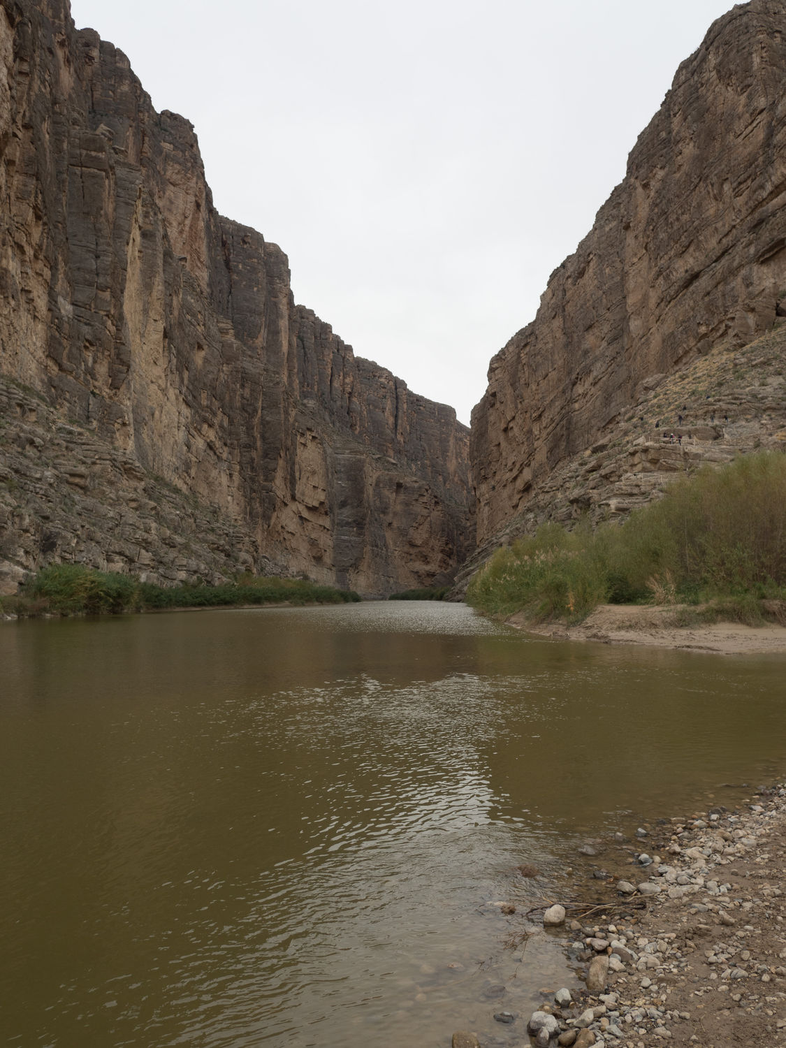
We finally made it back to the canyon viewpoint after perhaps a half mile, where we took some neat pictures back into the canyon and of the Rio Grande. I suppose it was worth it, although the wind was pretty sharp back there. I swear every person we met on that trail had a runny nose. We turned around and followed the trail back the way we came. If you are curious, or if you aren’t afraid of heights and you aren’t sure, going down is much worse than going up. While you are going down, you have to look at the spot where you could fall to your death.
Once we completed the switchbacks and made it back to solid ground, we returned to our nemesis, the water crossing. From my vantage point on top of the embankment, I could see that a few other people were crossing the river further back from where we’d made our original crossing. A smaller trail wound away from where we were to a spot some distance along, through the scrubby trees and bushes. We followed the little side trail to a new series of much smaller water crossings.
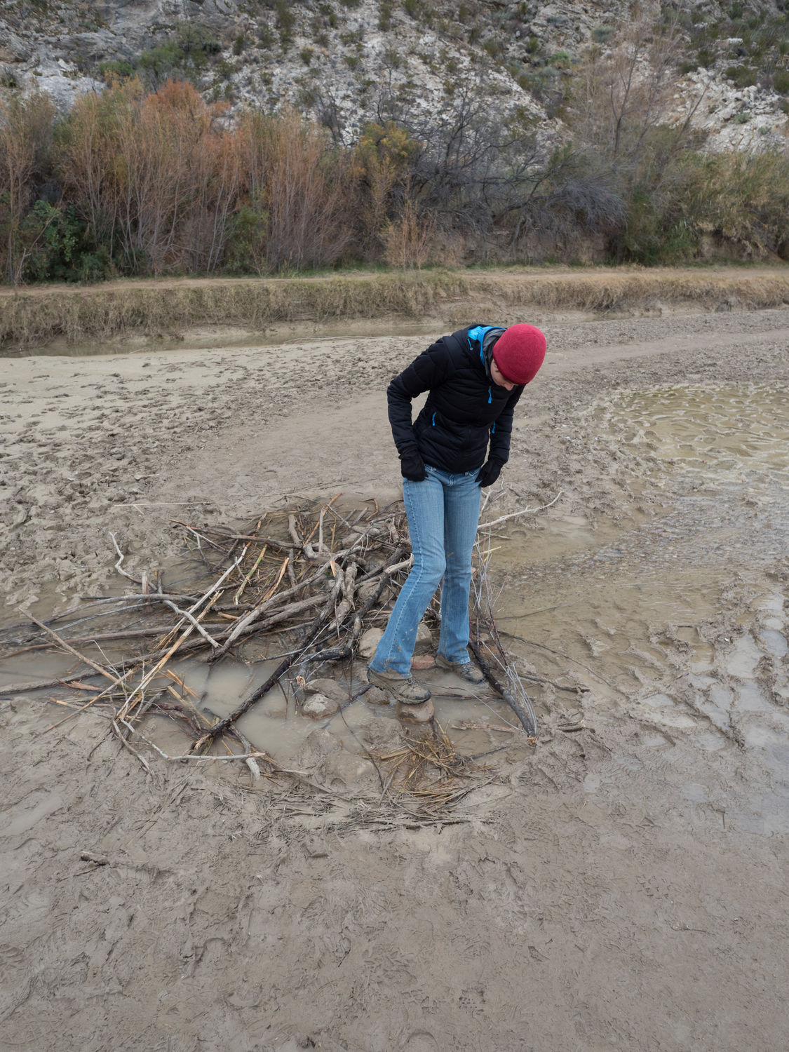
Each crossing (for a total of three) was smaller than the original, with clear, rocky water on either side of the tree limbs that people were using to cross. Mark and I actually stopped at one of the crossing to rinse our boots off in the clear water next to the crossing. Mark took some pictures of me stomping around in the puddles like a little kid. This crossing was much better than the other, and I felt bad for the people that I could still see using the large, muddy crossing we used the first time.
At the parking lot, we picked up some sticks and scraped the wet mud off of our boots. When we were as clean as we could be, we hustled back over to check on our puppy. She was sleeping soundly in her blue blanket, probably chilly from the windows we had cracked so she would get fresh air.
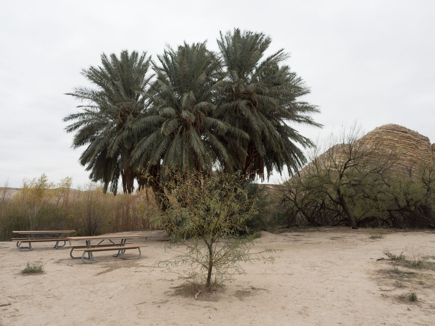
It was already nearly 1pm, so we drove (back on the paved roads!) to the Castolon Visitor Center, which had a little store where we thought we might get sandwiches. The store didn’t have any sandwiches, but we did get a national park sticker and a few postcards. Since we were hungry for our lunch, we grabbed some cheese and crackers and fruit from our food tubs and ate a snack lunch in the car. The visitor center had picnic tables, but it was just too cold to eat outside.
From Castolon, we followed the Ross Maxwell Scenic Drive up past the mountains. The further north we went, the higher the elevation was, and the higher the elevation went, the worse the weather got. We drove into a thick, misty fog that was almost worse than the fog on the first day of our trip. After a while, we couldn’t see a thing. At the Castolon/Santa Elena Junction, we turned east towards Panther Junction, and that’s where we saw the worst fog.
Before you arrive at Panther Junction, there’s a road that leads up to the Chisos Basin, which is the highest part of the park. Earlier in the day, that area had been getting freezing drizzle, so we decided to skip the mountains for today and continue along to the other side of the park, which was once again mostly desert.
We stopped at the visitor center in Panther Junction, which has a small bookstore. Mark bought a few more postcards, and we asked the rangers what the conditions in the park were like across at the Rio Grande Village. Oddly enough, they didn’t seem to know. I guess I would just assume that the rangers would communicate with one another across the park. I guess I was wrong.
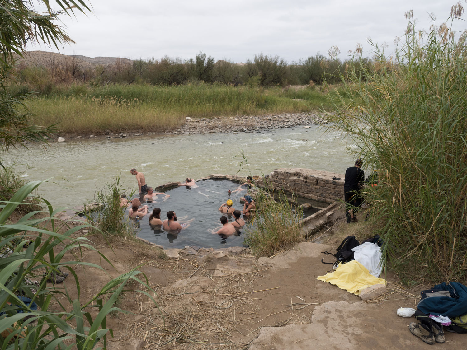
Our next stop wasn’t until the Hot Springs Trail. Did you know that Big Bend has a hot springs? Neither did I. The hot springs are about a quarter mile back from the trailhead where we parked. We didn’t plan on getting wet, but we were curious, so we went back to take a look. The park has a large, square bath built alongside the Rio Grande, where the hot springs join the river. The water is only about 105F, so “warm springs” might be a better description.
The little bath was packed, and everyone was wearing swimwear. Since I was standing outside the water in my heavy jacket and Mark’s gloves, I couldn’t even imagine stripping down to a bathing suit in the wind to hop into the water, let alone what it would be like when you finally had to get out.
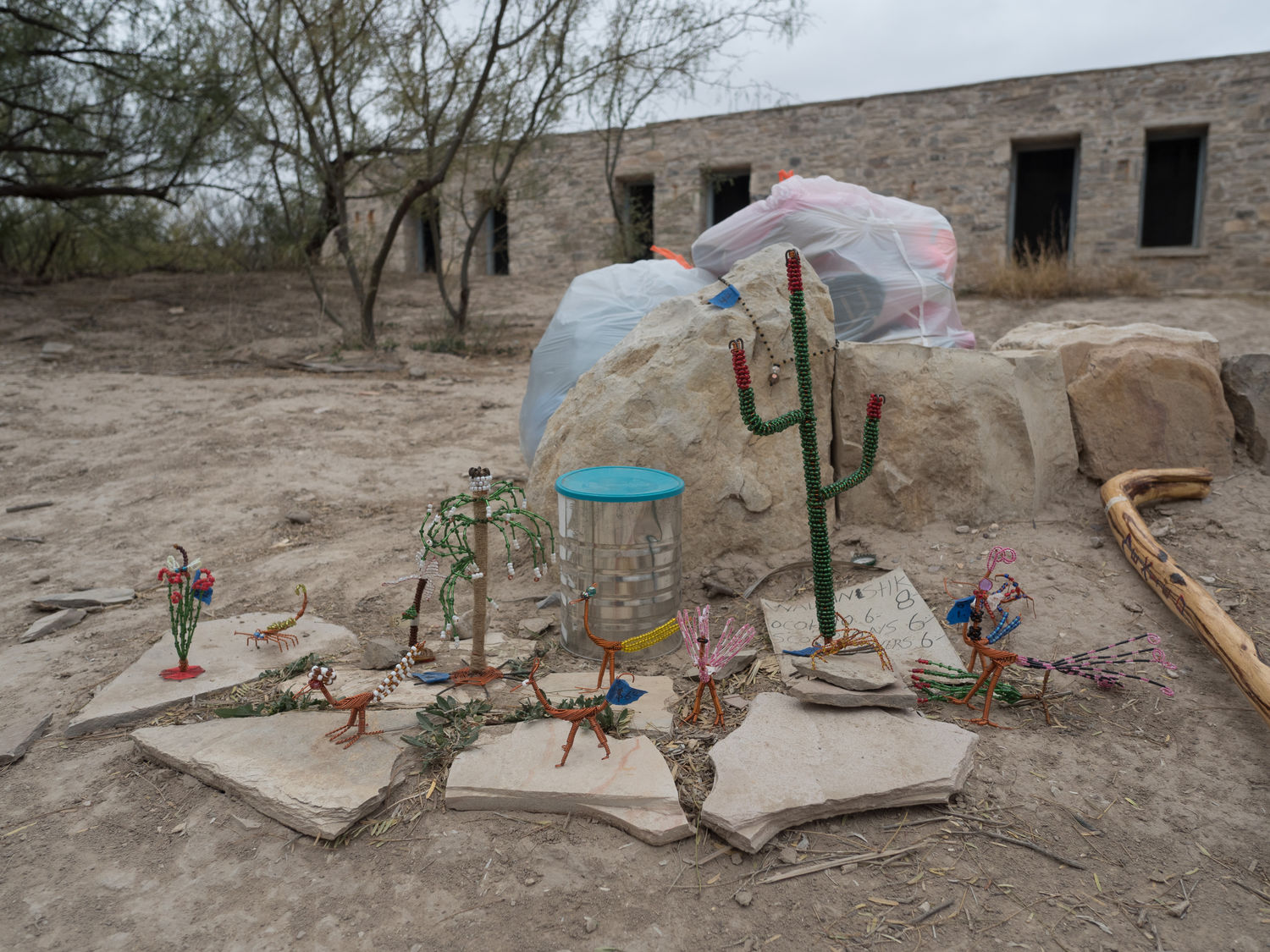
The springs used to have a series of little shops, “bathhouse style.” Back in the 40s and 50s, visitors came to bathe and shop at the little buildings in the area. They are abandoned now, but they are still a fascinating sight standing just off of the Rio Grande in what really feels like the middle of nowhere.
In front of the shops, a little bag sat with a few handmade wire crafts and some walking sticks and other items. A cardboard paper with a price list was off to the side, and Mark said he saw a little container filled with money for the trinkets alongside, although I missed it. He told me that the last time he visited, people from the Mexico side of the border were selling walking sticks along the trail for a few dollars. When tourists came back with the walking sticks, the park rangers were waiting in the parking lot to take them away and break them to discourage the practice, since selling things across the border there is illegal.
I can only assume that the little trinket sales were something of the same nature. I didn’t see anyone in the area manning the little shop, and I have no idea what kept people from stealing the items or stealing the money that might’ve been there. Maybe people are better than that? I’m not really sure. Regardless, I thought it was interesting.
When we left the hot springs, we hurried on down the road with the expectation that the visitor center at the Rio Grande Village would be closing soon, since it was already 4:30pm. When we got there, it was already closed, even though it was well before 5. I have no idea if the visitor center there was ever open, or if we had just missed it. It looked dark inside. We drove ahead to look around at the little store nearby, which is attached to an RV park.
I got Ripley out of the car to explore a nearby field while Mark ran into the little store to buy a new battery for his camera. While inside, he met a couple of people from his hometown, which was the second time today that he’d run into familiar people. He also met someone that used to work at the university with him along the Hot Springs Trail. Sometimes you forget how small the world can be.
A storm was blowing down from the mountains into the little valley we were in, so we hurried back to the car to check out our last few photographic opportunities for the day. We drove back to the Boquillas Canyon Overlook, which also happens to have an old border crossing, to look down at the canyon there and the Rio Grande.
The vista was pretty spectacular, and we got to see a little town (Boquillas) that is on the Mexican side of the border. The crossing was closed for quite a while, but has recently reopened so tourists can visit the town. At the top of the overlook, we also spotted another of the “arts and crafts” shops laying out on the ground. Once again, no one was anywhere near it.
From there, we turned back towards our hotel (stopping to photograph a tunnel for Mark along the way). Once again, as we headed past Panther Junction, the weather got worse. The fog was practically impenetrable, and the dreary mist made certain that we couldn’t see a thing. From the Castolon/Santa Elena Junction, we took a different route back to our entry point and out of the park.
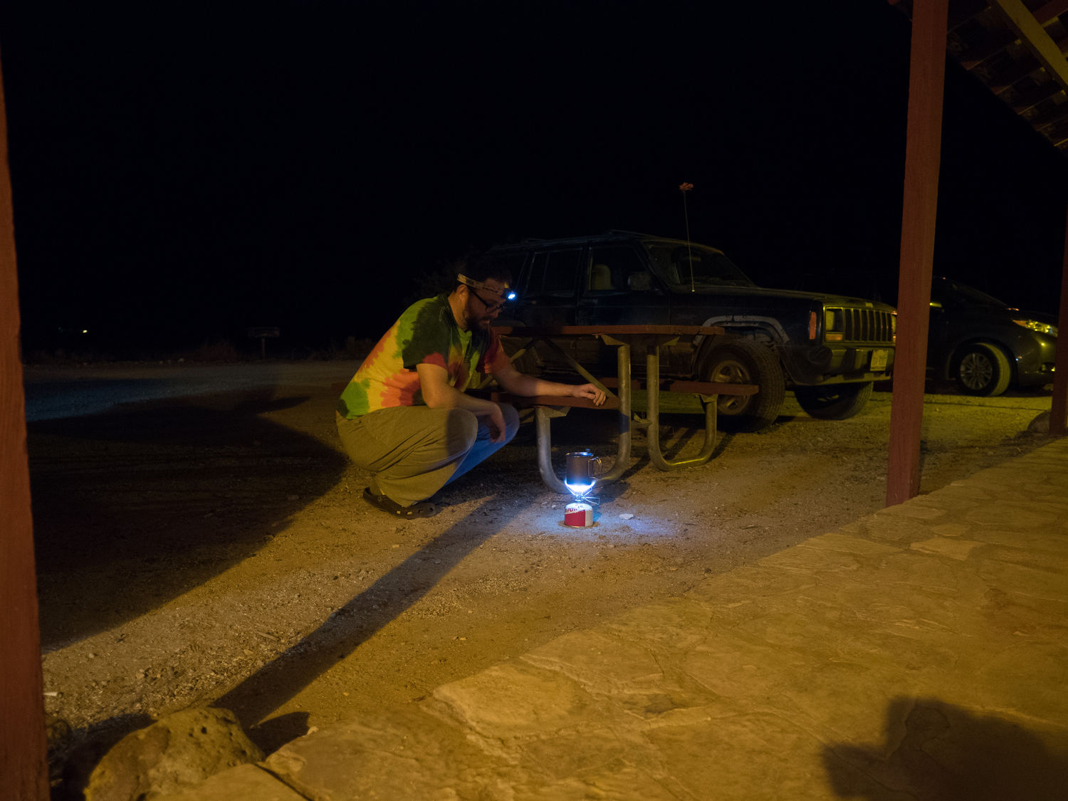
We stopped at the grocery store in Terlingua for some hummus and some tea before we made it back to our hotel. Since our shoes and pants were still muddy from our morning adventure, we hosed them off in the bathtub so they’d be all ready for tomorrow. We had hummus and yogurt dip with vegetables and chips for dinner, and then Mark made us tea on his little stove out in our hotel’s parking lot.
It may rain again tomorrow, so our plans are uncertain. If the weather is bad, we may drive over to Alpine for the afternoon to entertain ourselves. If it is nice, we’d like to see the Chisos Basin and a few other places in the national park. If only the mountains are nasty, there’s a trail we might hike back in the state park. We’re looking forward to the day, regardless.
– Trip Total : 866 miles –