– Durango, Colorado to Moab, Utah –
We had a lovely run in Durango this morning. The weather was brisk, leaning to cold, and Mark and I, in our shorts, ended with very cold thighs. Actually, Mark’s were a little funny. Since he’s so pale, when his thighs get all red from the cold, he looks almost like he has a sunburn.
We also had a little adventure along the trail. Some musty-looking hippy guys, probably in their late twenties, were walking their bikes along the lovely trail running through Durango, and since it was so early, I guess they were not expecting anyone else to be out. Mark and I had the pleasure of stumbling across one such bike hippy peeing on the wall on the side of the trail. At least Mark was with me. Lucky mom was further back and missed the whole thing. He had the grace to look a little sheepish, at least.
We three runners were a little chilly when we made it back to our hotel room, but we were pleased to discover Dad making himself some cheese toast in the oven in our little kitchenette. The oven was making it warm in there, and the cheese smelled lovely. He had already showered too, so the rest of us made quick work of getting ready for the day. Our days are much shorter on these fall trips. I miss the long daylight available to us in the summer.
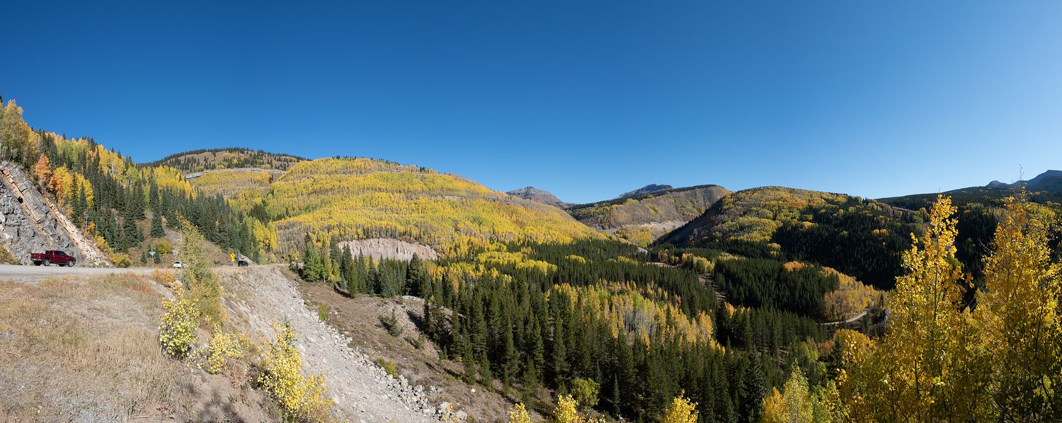
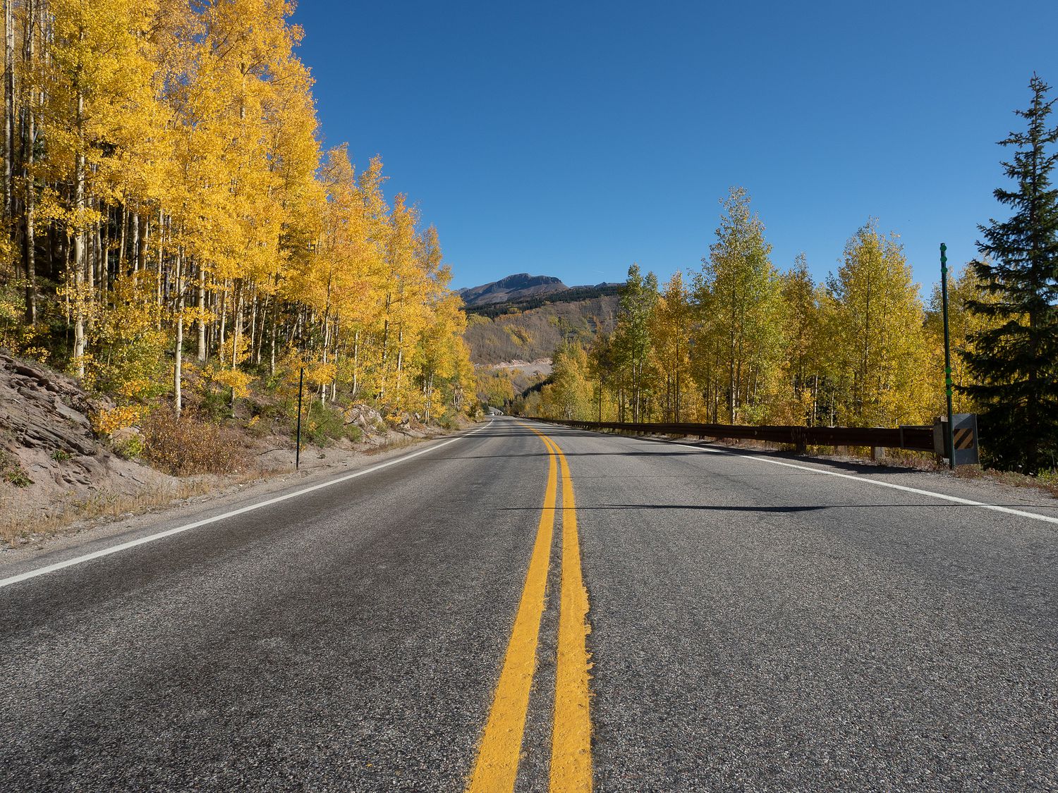
Once the truck was all loaded and ready to go, we turned north to take the road up to Silverton, Colorado, for a little more leaf-peeping. The road to Silverton and beyond is called U.S. 550, and a portion of it, which goes from Silverton to Ouray, is called the Million Dollar Highway. Supposedly portions of the road are difficult to drive and somewhat treacherous, but we had no issues and certainly weren’t worried. I guess it could be a little nerve-wracking in the rain or snow, but otherwise it seems pretty standard for a mountain road.
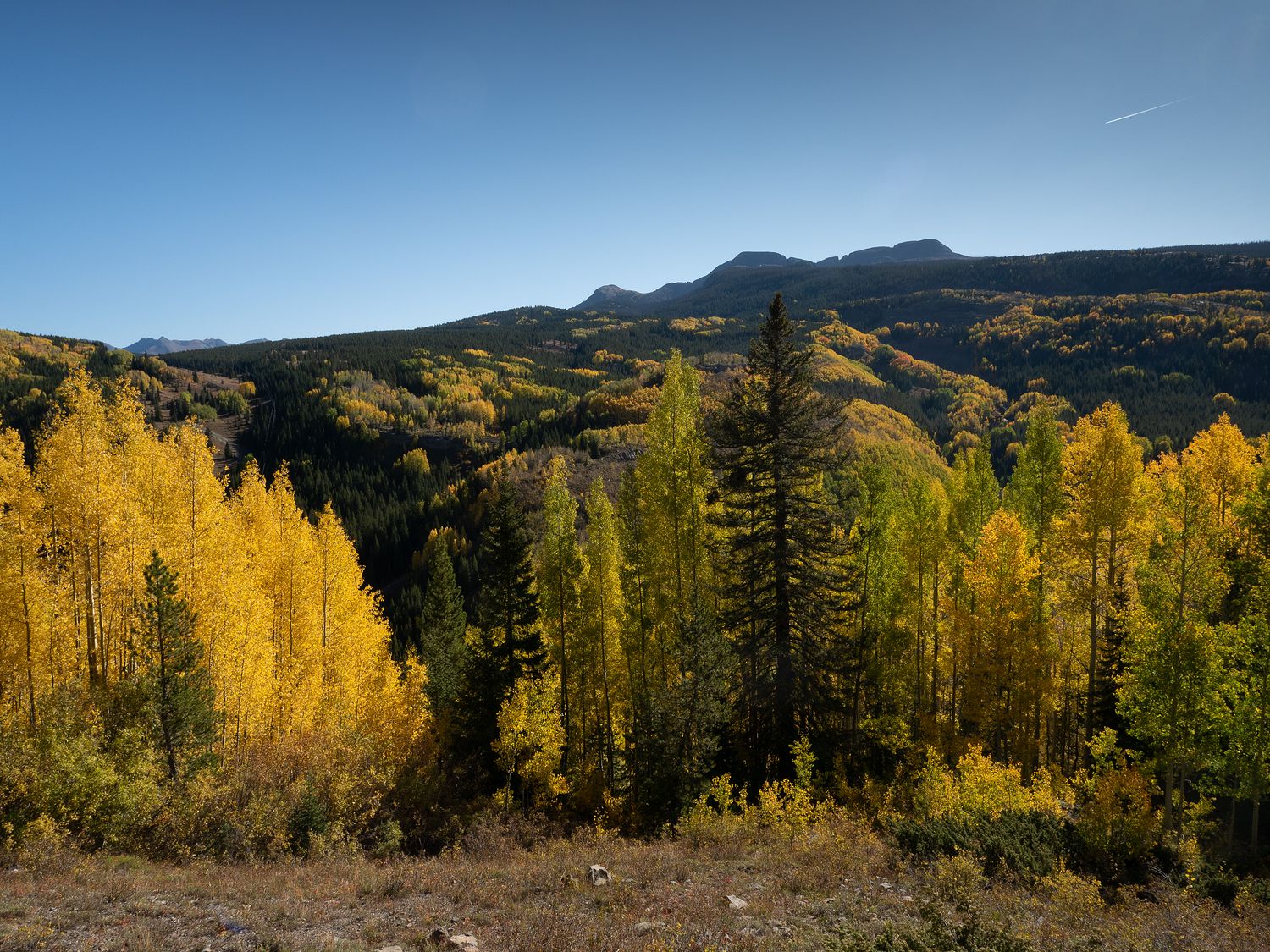
Along the road is the Sun Juan National Forest, which today was resplendent with bright yellow aspens. We had a great time pulling over time and time again to take dozens of photos of pretty trees before we ever made it to Silverton. We weren’t the only ones out there, either. We ran into a number of other leaf-peepers, some of whom said they do this every year. I think I would rather change things up a bit, maybe go see some sugar maples once in a while. Yellow is really awesome, but sugar maples do that leaf-color gradient thing, which is amazing. Someday, sugar maples. Someday.
Most of us were wearing shorts again, as the weather is still nice and mild, but Mom seems to think it is cold, so she’s been wearing pants and still hiding out in the suburban during some of our stops. Tomorrow we will have to find her a parka, so she can get out and enjoy the leaves, too.
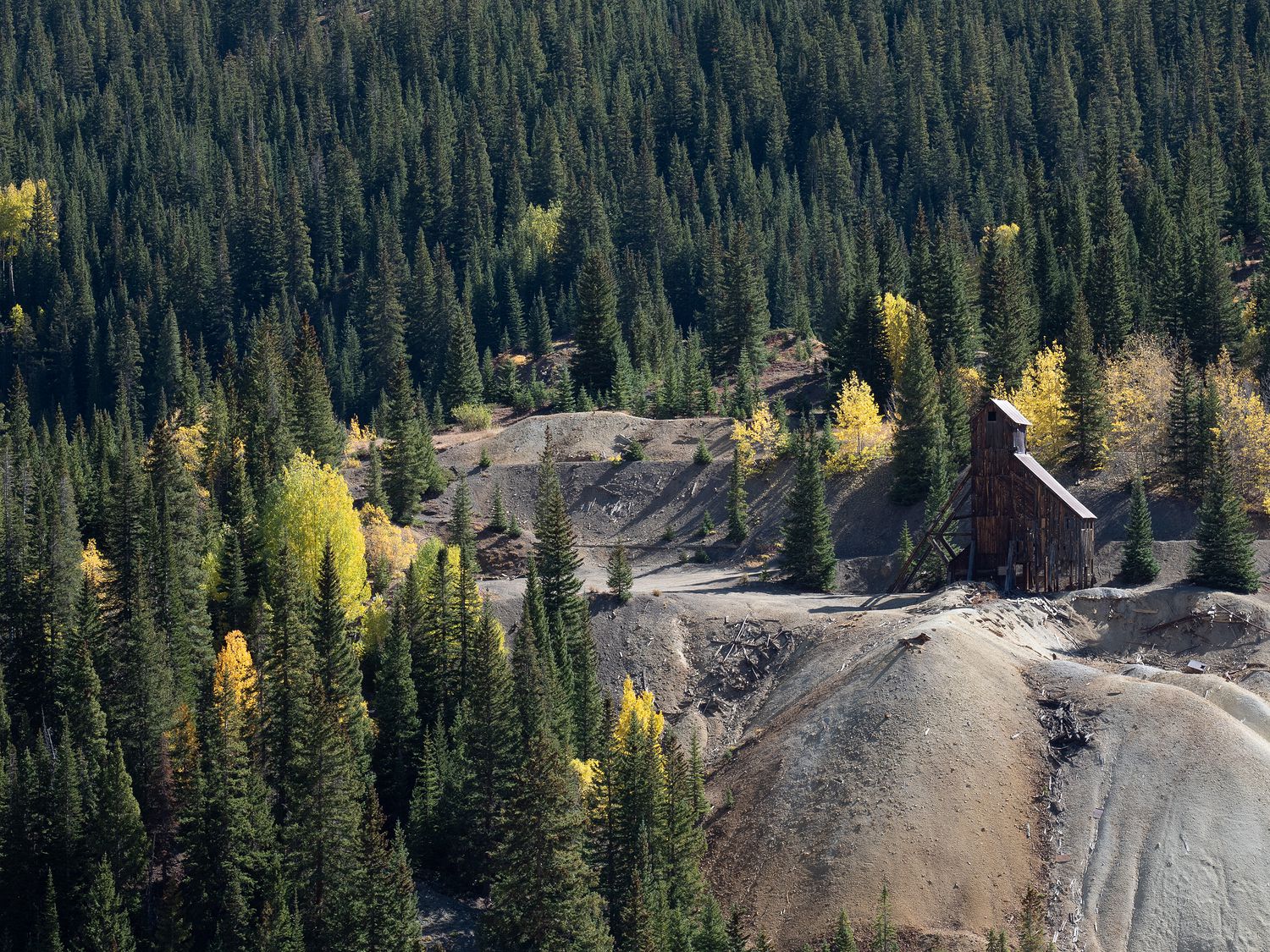
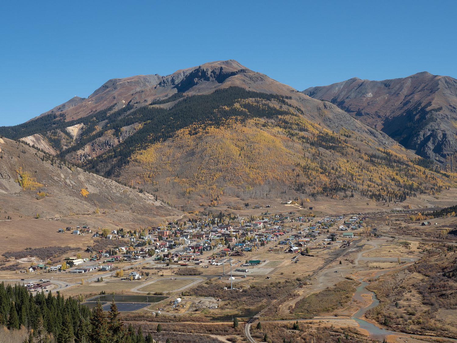
When we made it to Silverton, we stopped on the road overlooking the little tourist town to take some photos. It used to be a mining town of course, like many others in Colorado, but now most of their revenue comes from tourists. It is obvious that’s their main trade when you drive down into town, too. A lot of their shops and restaurants are cutesy and clearly cater to visitors.
In the area you can also stop to visit the ruins of the Idarado Mine, which had a plethora of different materials available, including (according to the signs at the mine): silver, zinc, lead, gold, and copper. There is a tunnel that travels 5.5 miles from the Idarado Mine all the way over to Telluride. Overall, it was not a very successful mine, from what I can gather. It was only actively mined for about ten years. Still, that was long enough for it to permanently mar the local landscape. Sometimes mining makes me sad. Luckily, Colorado is working to restore the area and do away with the damage. I wish them the best of luck! It would be cool to drive through one day and have signs be the only indication that there was ever a mine at that location.
The drive between Silverton and Ouray is a little more challenging, and apparently makes lists of most dangerous roads, but once again I contend that it really isn’t that scary. It might be a little worse heading south than it is going north, but it’s still no big deal. The drive takes you through the Uncompahgre Gorge and over Red Mountain Pass. Along the way, we drove through Ironton and past several red mountains, which are all suitably named. It is indeed bright red and iron-y through there, as you might expect from a region around an iron mine. Even the water runs red with iron. It’s kind of neat, and also kind of off-putting in an odd way.
The whole area is lovely, but it doesn’t have nearly as many trees, which meant that we were mostly done with our leaf-peeping for the trip. That’s not to say we won’t come across further pockets of fall color, just that they will become more scarce from here on. It’s not a terrible thing, but I will miss the brightly-colored leaves.
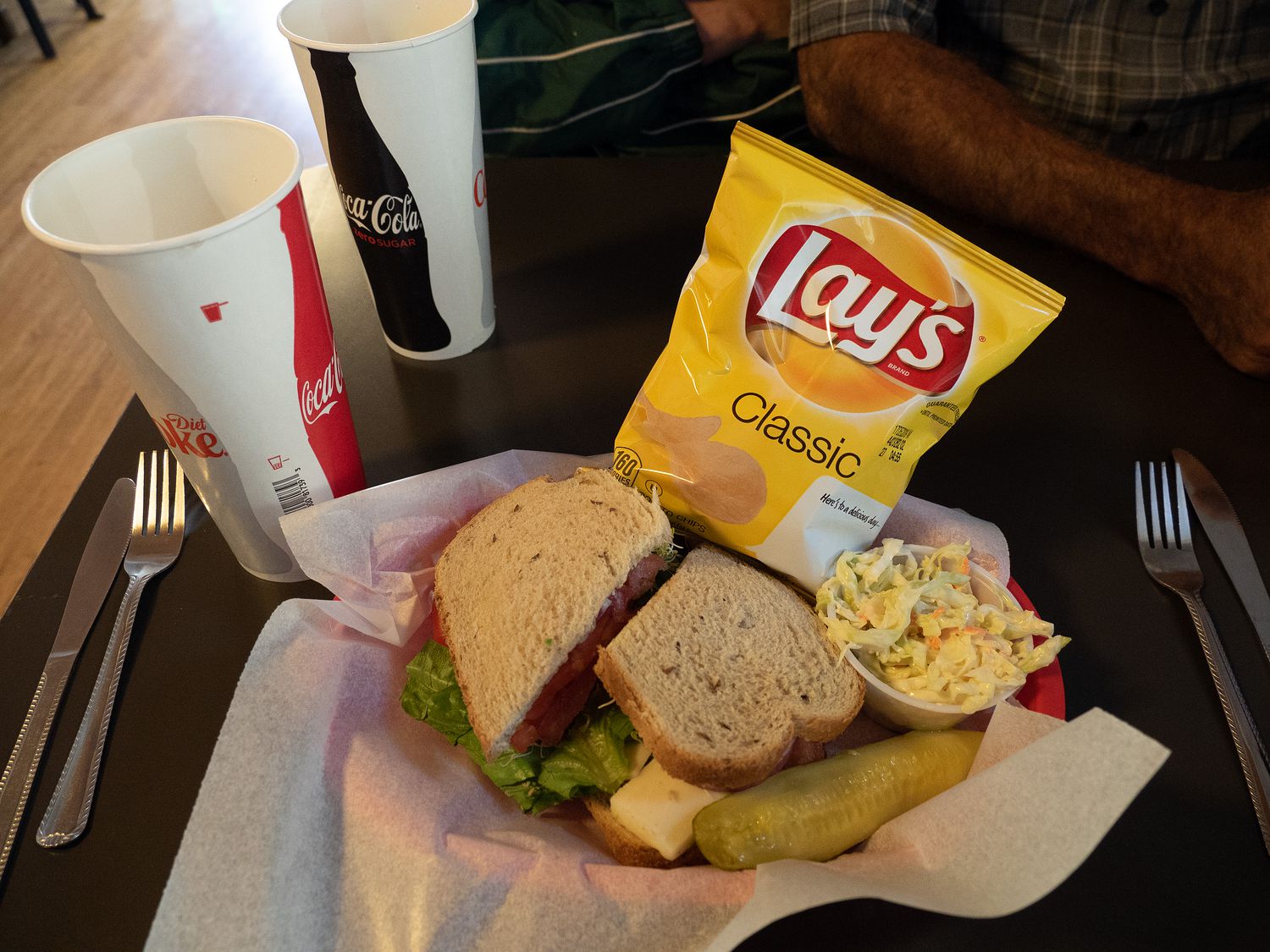
We stopped for our lunch in Ouray at a little sandwich shop. The sandwiches were just fine. Ouray is an adorable little tourist town as well, and is home to a three-legged brittany dog that Ripley (Okay, really Mark and I) knows from her instagram. He is missing one of his front legs, and takes his walks through town upright on only his back two legs, like he’s a person. It’s pretty cute. Unfortunately, we hadn’t planned to meet up with him, so we had to pass on through without a visit. We had too much to do to try to wait around for an unscheduled meeting.
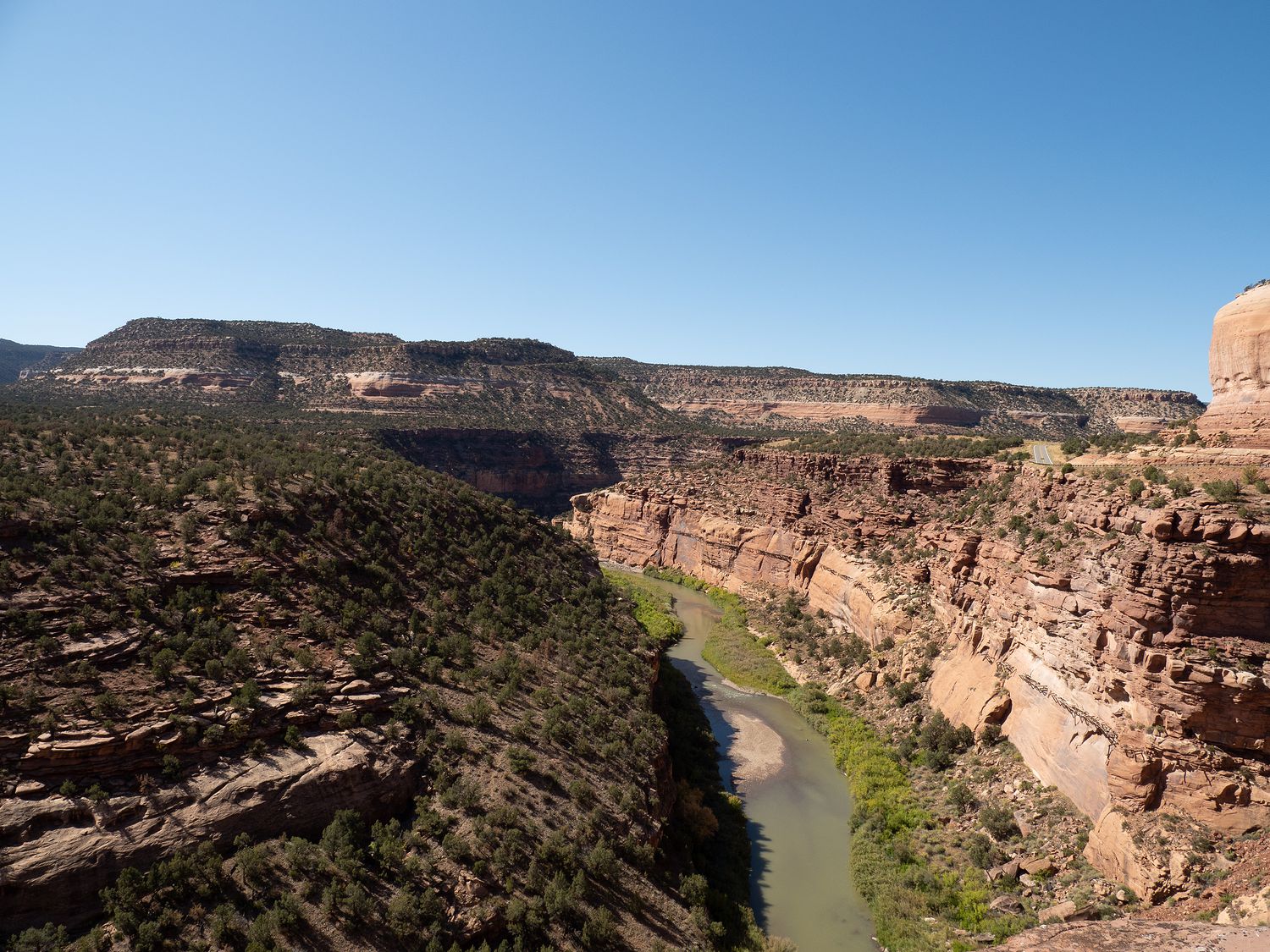
From Ouray, we turned west and drove about another two hours over to our next stop, which frequent blog readers may recognize from a previous trip: the Hanging Flume near Naturita, Colorado. Mark, Ripley, and I visited the flume in the summer of 2017, which wound down with a big Colorado trip in August. On Day 5, we drove through to visit the Hanging Flume on our drive between Montrose and Grand Junction.
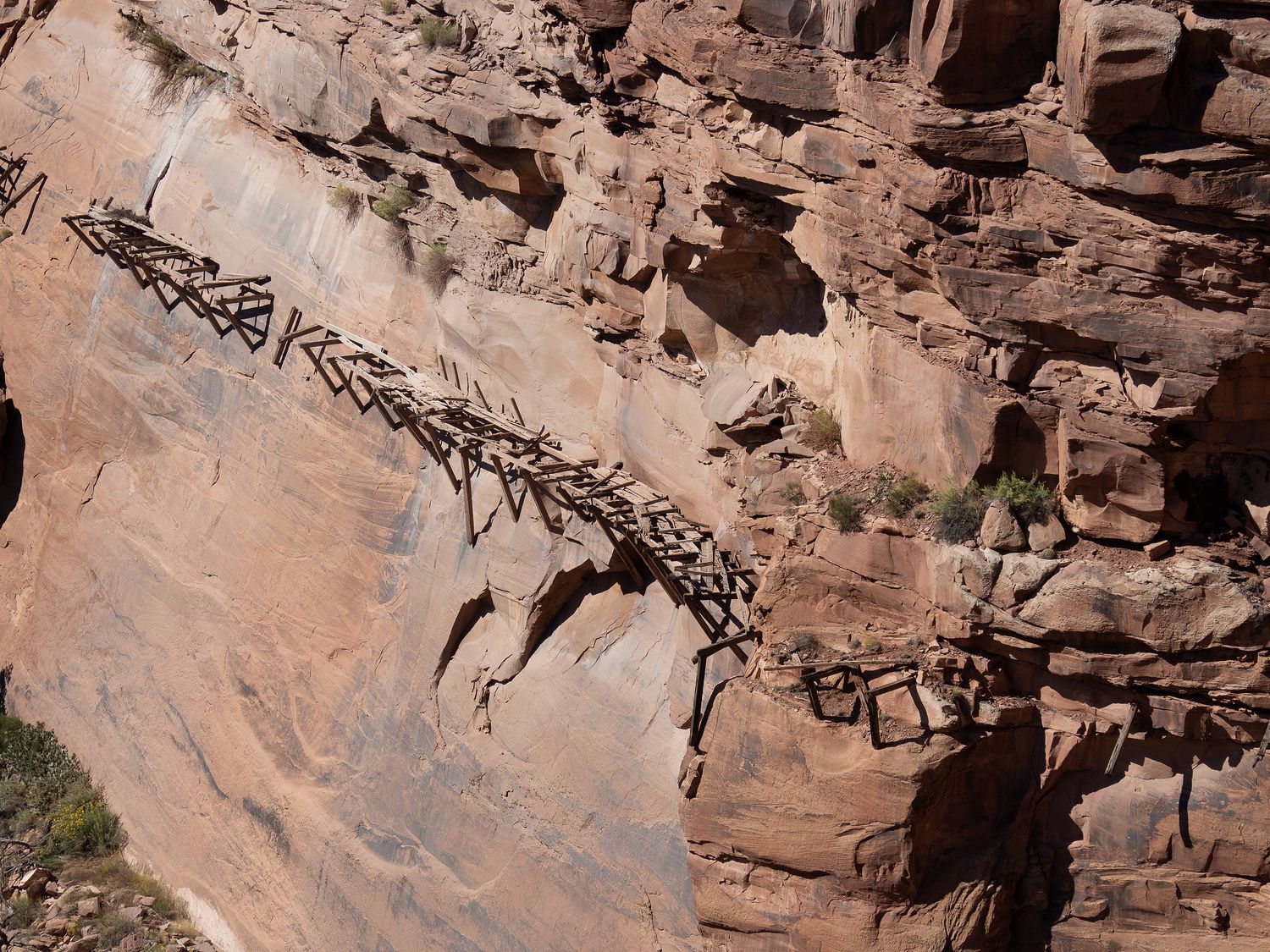
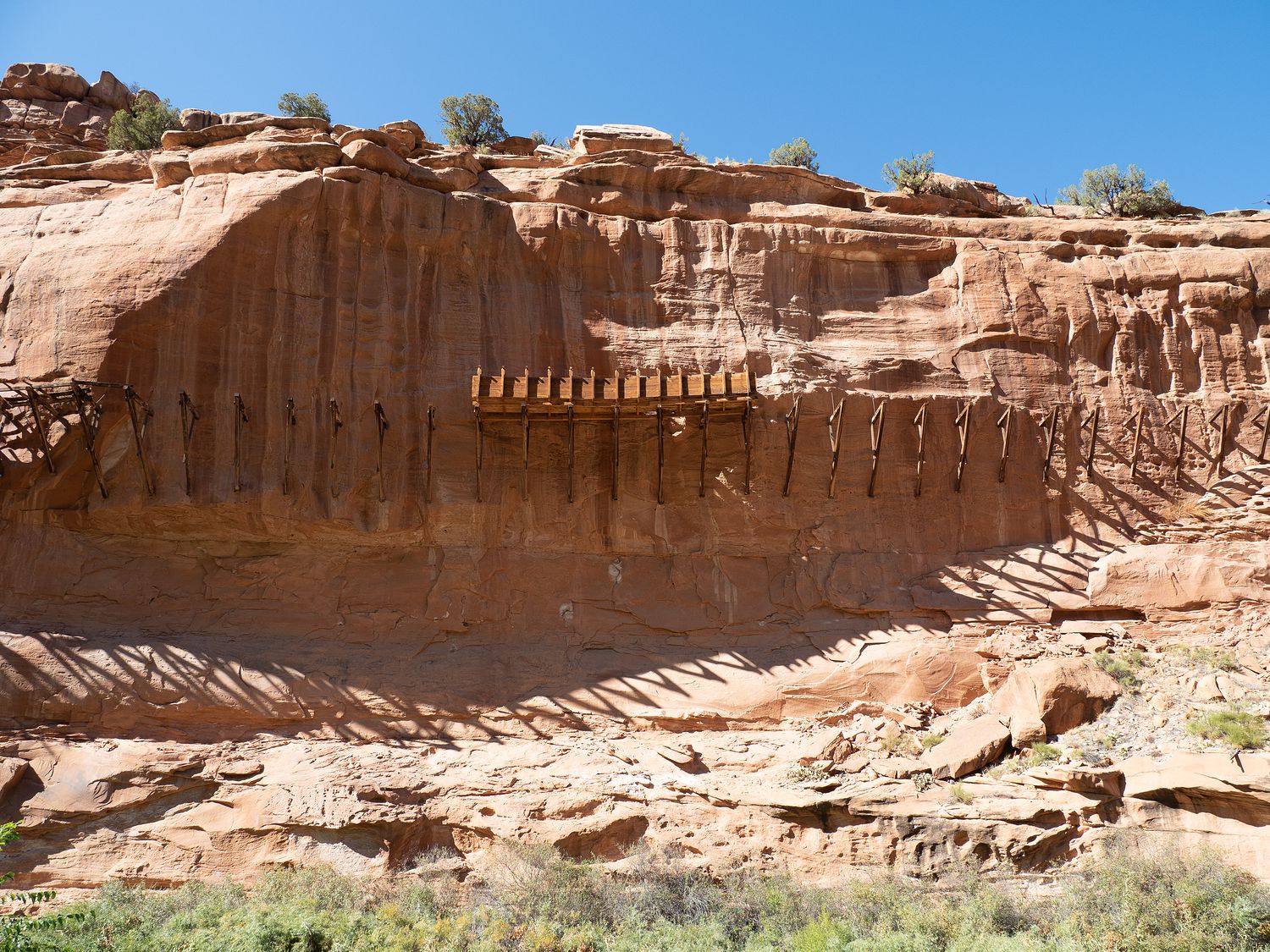
To give you a review, or to tell you about it for the first time if you weren’t a blog reader back then, the Hanging Flume is part of another old mine. To quote myself, “A flume is basically a water channel used to move materials through it via gravity. They are used frequently in logging, and in placer mining for gold, as was done here.”
The Hanging Flume, in particular, is a flume that stretched for 10 miles from the Dolores and San Miguel rivers to the mine, with 7 miles of it attached to the side of the river canyon’s walls. In case you were wondering, that is not how flumes are usually done. It was six feet wide and four feet deep, and was sometimes attached hundreds of feet above the canyon floor. The remnants of the flume, which was built in the 1890s, can still be seen today.
My parents have never visited, and Mark and I did not get the chance to drive the dirt road all the way through on our last visit, so this time, we had a little bit of a different plan. We stopped first at the overlook, where one can look down at the flume from the canyon walls above. We all stomped out to the fence at the edge of the cliff to look over. As always, Mark and Mom were a little braver than Dad and I, who stood a little from the fence.
We also visited the burro, which is a little donkey painted on the secondary level of canyon wall, next to the main road and just past the overlook. Supposedly the burro painting is a tribute to the many donkeys that worked in the mines. Regardless, it has been painted over many times, and has existed on the wall for a very long time, though I am not sure exactly how long. The current version is the same one we saw when we visited in 2017. That probably doesn’t surprise anyone.
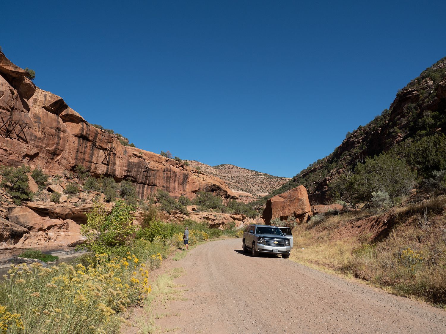
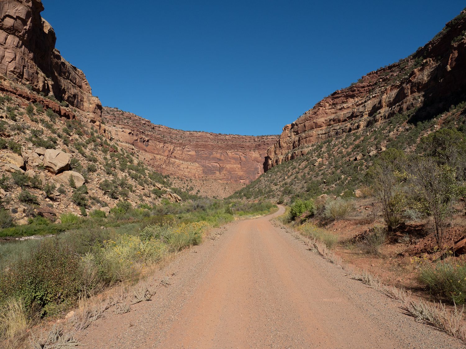
Once we had had finished at the top, we drove down into the canyon and beside the river to get a better look at the hanging flume. There’s just something fun about being on a dirt road right next to a river. It feels a little old-timey, even in a shiny new Suburban.
The remnants of the Hanging Flume are clearly visible along large portions of the first part of the drive along the Dolores River. You can see old posts sticking out of the canyon walls where the flume used to rest. There are no remains of the water channel itself, as it has decayed away. but the posts are cool on their own.
Further down, there’s a section of the Hanging Flume that was restored as part of a university project. You can see from that small section precisely how the flume would have looked during its heyday. I am actually a little surprised such a contraption ever worked for gold mining at all, though the signs seem to indicate that it didn’t work very well there. The gold in the river was the wrong consistency for the flume to work correctly.
It’s a little hilarious to drive through Colorado and see all of the failed attempts at mining. I guess everybody was desperate to get their slice of mining money back in the day. I guess they still are. At least there’s something charming about the stuff that is a hundred or more years old. The newer cash grabs haven’t acquired any of the dignity lent to the older projects by the passage of time.
Mark, Ripley, and I stopped and turned around last time at the confluence of the San Miguel and Dolores Rivers, which is where the road turns away from the Hanging Flume. We stopped once again at the confluence for some photos. As is often the case where two rivers meet, the Dolores and San Miguel run different colors, so you can actually watch the water swirling together as the rivers combine. It’s a neat phenomenon that’s not captured well on camera, since the color differences are often subtle.
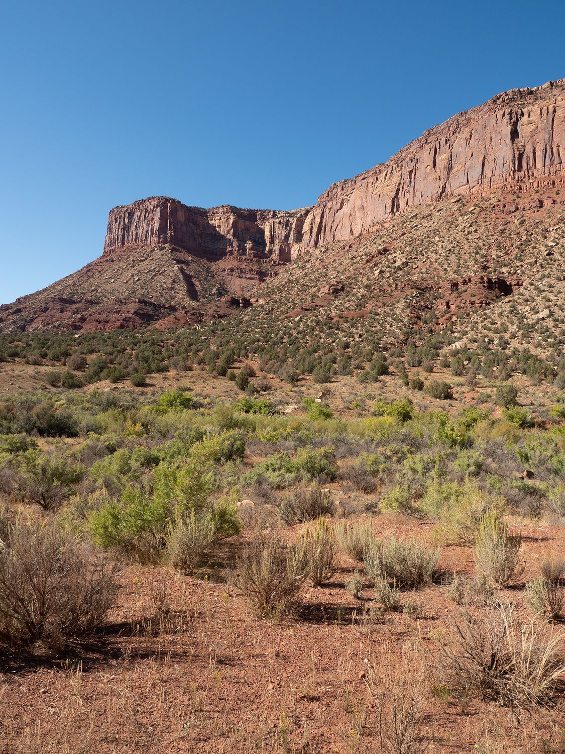
After the confluence, we ventured down a new portion of the road, which led us further through the canyon down Y11, which is the name of that section. The road travels past Martin Mesa, which is a dark red giant. It’s a neat drive, and a little slow, but certainly nothing spectacular. It does get you through the mesas faster, though, as you get to cut through rather than drive around. The dirt road surface means that it isn’t that much faster, but it is a little faster, and the view is lovely.
After our Hanging Flume adventure, it was still another hour and a half to Moab, which isn’t too bad. It was still reasonably early, too, so we had plenty of time left to enjoy our afternoon. On CO 90, we passed into Utah, then drove through La Sal and on over to Utah 191, which leads into Moab.
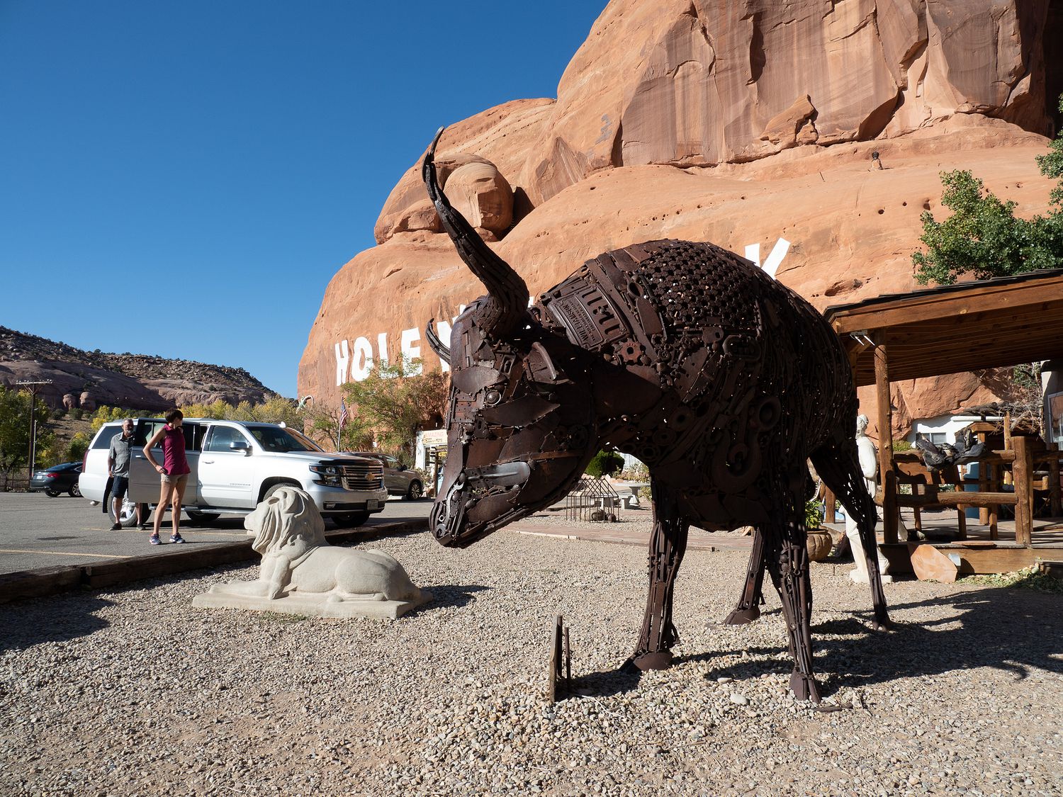
Along the way, we stopped at the Hole in the Rock convenience store, which can be a fun stop on a Utah trip. It’s a little bit like visiting Wall Drug or Clines Corners, though both of those are bigger and a little nicer. The Hole in the Rock features a house built into the canyon wall that you can visit, though we’ve never bothered. It costs money, and we haven’t ever had the desire to spend it just to see something like that.
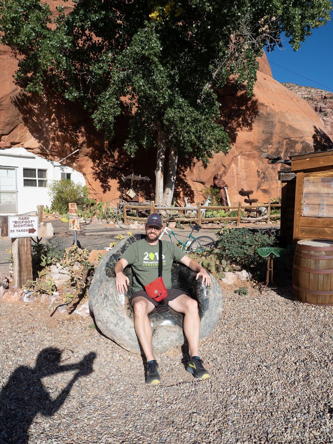
Mom had a good time looking in the little gift and jewelry shop, however, and the rest of us had a fun time goofing around in the chairs and reading the strange signs about Big Foot and various other strange attractions. For the most part, it’s just kitschy and dated, but that can be a lot of fun. I think people tend to call that sort of thing, “Americana.” I don’t think we bought anything, though. Even mom skipped it, though she looked carefully through all of the jewelry with semi-precious stones. That stuff is very popular in the Southwest, and it is her favorite kind.
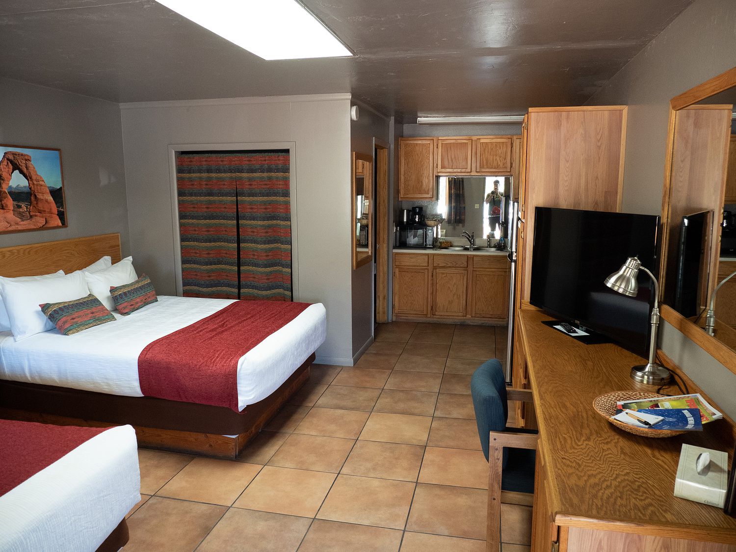
From the Hole in the Rock, it isn’t too far up into Moab. We cruised into town at a still early-ish hour, which was pleasant. It meant we got to have dinner during daylight, which is always nice. We stopped first at our hotel to unload our car and decide what, exactly, we wanted to eat. We are staying in Moab for two nights, so it is nice to be able to get everything out the car with confidence, since we won’t have to pack it up immediately tomorrow morning.
Our hotel room was cute, and looked like it was going to work well for us. It is adjacent to a little park, and has a nice patch of grass for the dogs to visit to use the facilities. It even had a couple of booklets about local restaurants and their menus, which was super helpful for picking a place for dinner.
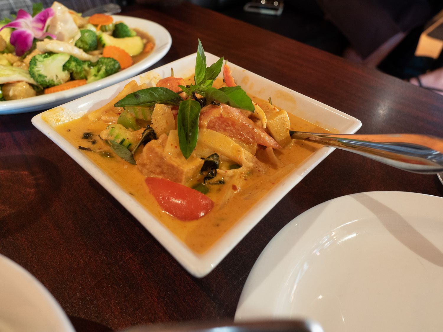
Mom wasn’t too hungry, so she told the rest of us to decide. We ended up talking Dad into going to a Thai restaurant with us, which was pretty cool. He’s not always an adventurous eater, so it is fun to get to take him to places with food that he has never had before. And Mark and I love Thai food. I think the last time we convinced him to try an ethnic food was either Indian or Greek, both of which we also love.
Our Thai restaurant had huge portions, and we got Dad to try everything. The food was very good, and Mom even had some gyoza, which are a type of dumpling, and were more suited to her palette than the more vegetable-heavy dishes the rest of us got. We brought back some leftovers, too, which I think Dad might have for breakfast tomorrow. Yay for another successful introduction to weird food!
After dinner we drove back to the hotel to rest and relax, It’s dark early, so we try to be inside before it gets there. It gets cold when the sun goes down, too, which is par for the course in the desert. Mom has had to take Sabre outside with a flashlight tonight, since there’s not much light around the hotel. It’s otherwise very nice, so we will let that slide.
Tomorrow we have a nice run to do around Moab, which Mark, Mom, Ripley, and I have all done before. Still, it is beautiful running back through the canyons here, and I’m excited to go. We’ve also got a number of things to do tomorrow, the biggest of which is a visit to Canyonlands. I am pretty excited. We didn’t do the place justice on our last visit.
– Trip Total : 1,125 miles –