– St. John –
As has become our habit here on St. John, we began our morning at 5am with a good coat of bug spray and a run up some really terrible hills. We get a little better at conquering them every day. I think if we lived somewhere with hills like this, we would eventually be able to run up those suckers without a second thought. Alas, that time has not yet arrived.
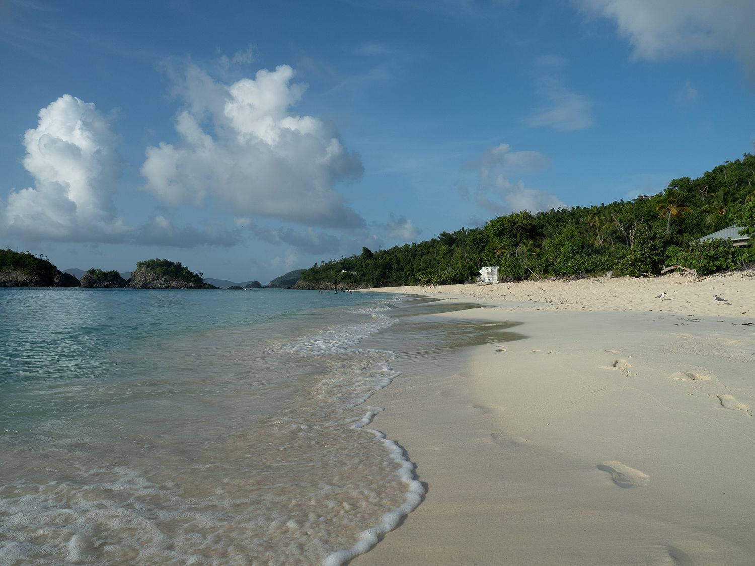
After our run, we went back to our hotel to have some breakfast and cool down before we hopped into the car to drive down to Cinnamon Bay for our morning swim. We’ve been able to change out our towels every evening here in St. John, so we can have fresh beach towels again every morning, and it’s been pretty nice. They don’t dry very well with the humidity here, so I’m glad we aren’t relying on them drying before we have to use them again the next day.
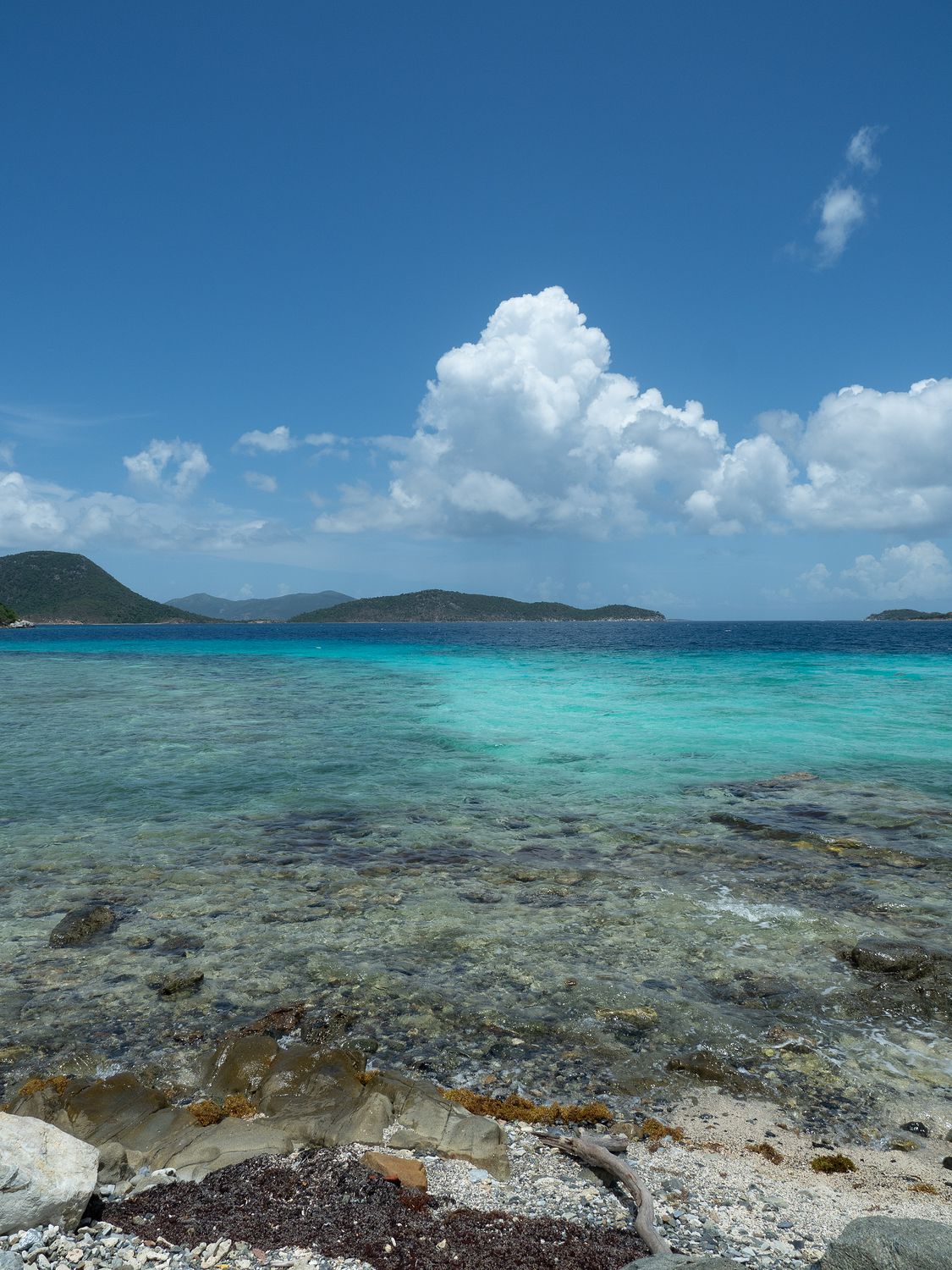
Cinnamon Bay was especially empty this morning. All of the previous mornings, there has been one other car in the parking lot when we arrive. There’s not usually anyone on the beach, but the car belongs to people who seem to be working on the amenities that Cinnamon Bay used to have, before the hurricanes in 2017. Most mornings at Cinnamon Bay, we’ve been serenaded by the dulcet tones of the chainsaw. I think it is a mess back behind all of the construction fencing. Anyway, they weren’t around today, since it is Saturday.
We had two interesting sightings at the beach this morning. The first was a strange red buoy that seemed to be approaching us from another bay, moving steadily towards us with minimal splashing. It took a while, but the buoy eventually resolved into a person, who came all the way over to our beach, swam around that giant cay in the photo above a couple of times, and eventually receded once again into the distance. The person had no life vest or anything, just that buoy to mark where they were in the water for passing boats. It was impressive. I mean, I can swim, but nowhere near that distance. Eesh.
Our second morning visitor was a sea turtle. After seeing several last night, and never has seen another at Cinnamon Bay, we were shocked to see one there this morning. Mark thought maybe we’d just gotten better at spotting them and they’d been there all along, but I’m pretty confident I would’ve spotted them if they had been breaking the surface of the water on one of our previous visits. Spotting critters in the distance (or in enclosures at the zoo) is one of my superpowers. Maybe my only one.
Eventually our turtle left and another couple showed up to use the beach, so we decided to skedaddle before it got too crowded down there. We drove back to our hotel to shower and pack up for the day. We were running pretty short of things to do on St. John by this time, so we had picked out the absolute last few things to do today to fill our last day.
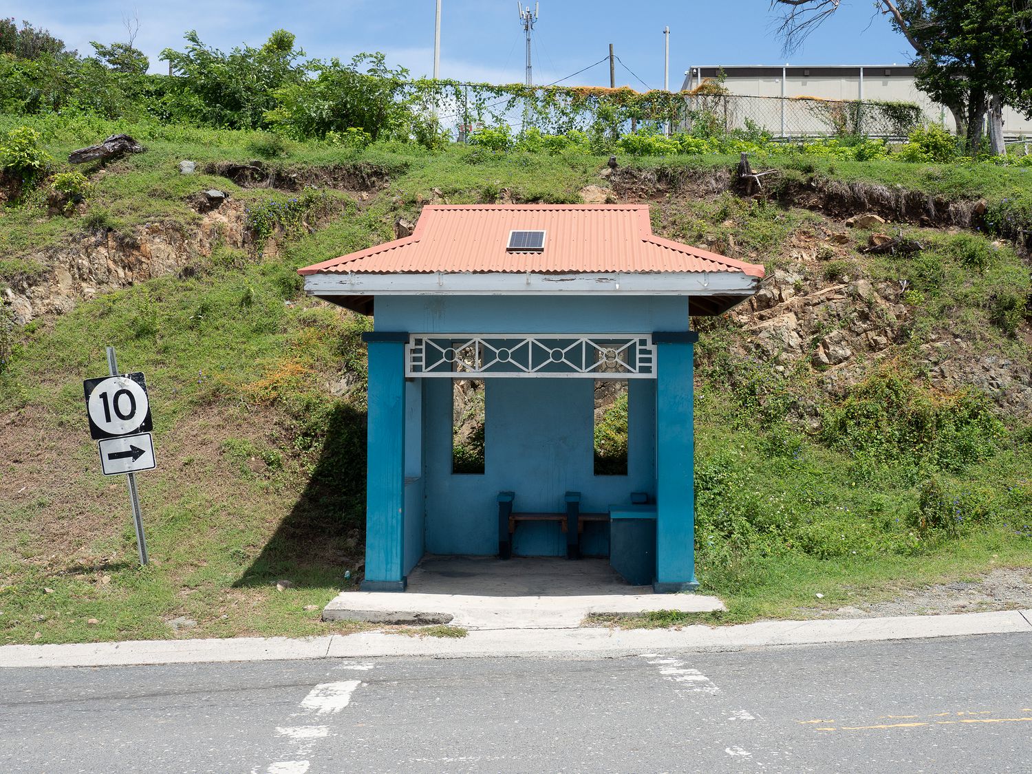
In addition to our few stops of the day, Mark had also decided he wanted to do a small photo project on the island. I don’t know if he will continue it when we leave the island and go elsewhere or not. Anyway, the Virgin Islands are full of little bus stops, most of which are concrete sheds with a bench or two inside. The first one Mark had picked out was along the Center Line Road, so we stopped for a bus stop photo. I’m not sure how interesting they are, but Mark seems happy, so that’s what’s important. The Bus Stops of the Virgin Islands project could never beat my favorite idea of his to date: Texas Stile, a photography series of stiles across the state of Texas. Someday we will get on that one.
Anyway, we took Center Line Road, which is definitely the busier and less interesting of the two main roads on the island, because we had one more road to cover out that way, a mountain road, and another large-ish plantation ruin to visit. We drove by it the other day and didn’t stop because it was a little too hot.
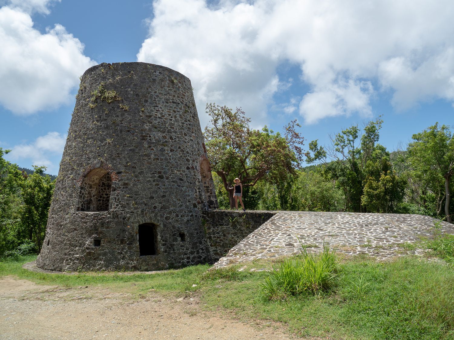
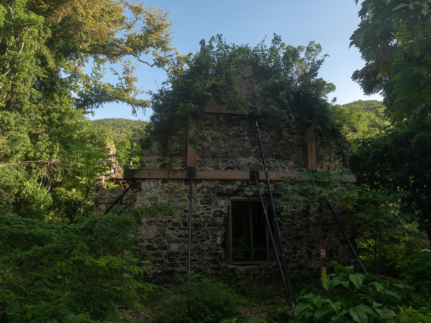
The ruins are the former Catherineberg Plantation, which was a sugar plantation through the 18th and 19th centuries, then eventually became a cattle farm before being registered with the National Register of Historic Places in the 1970s. It has a number of buildings that are in great shape for how old they are, and you can climb around on a lot of it without any danger. I wonder if portions of it have been restored to keep it stable. You can definitely see newer bricks in a handful of places.
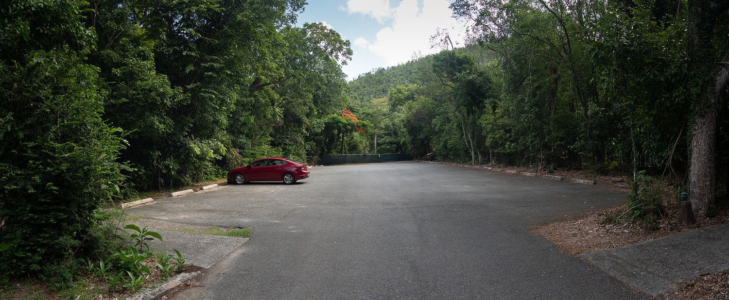
The road to Catherineberg is a small gravel road off of the main road, and it feels a little sketchy driving back there, since the road is rough and the trees start to close in pretty quick. The place only has one or two parking places, as well, so it must not be too terribly popular to visit.
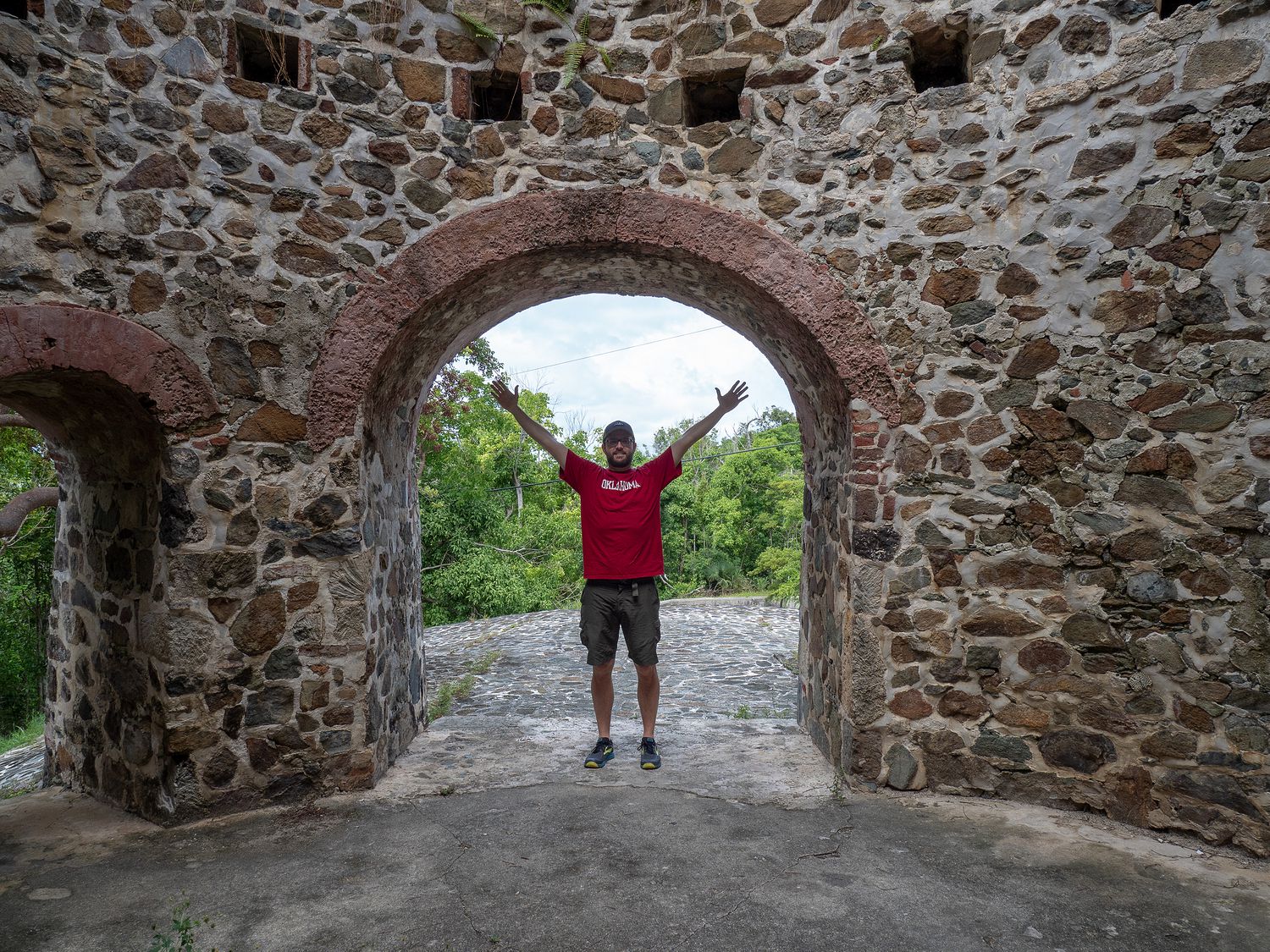
Mark and I visited the windmill ruins first. It’s quite a large windmill, as you can tell from the photo above, with Mark for scale. My absolute favorite thing about it, though, is that many of the stones used for construction are dead coral. I spotted it as we were walking out, though you’d think it would be more obvious. If you carefully examine the photo, you can see the rough, whitish-gray coral rocks in the walls to the sides of Mark. It’s kind of neat.
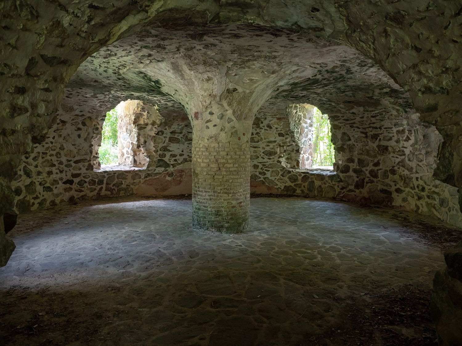
Beneath the windmill is a basement/cellar-type room, as well as several other small rooms, which are supported by massive columns. I really like visiting stone structures like that in hot places, as they are frequently much cooler than the outside air, especially since you are out of the sun, which is a big deal here in the Virgin Islands. The sun makes everything 10 times worse.
Catherineberg has another section that was once a partially underground storage area. It’s basically a big concrete-like pit now. It isn’t clear what they stored there, or whether or not it used to have a roof. I know they made rum there, which is true for a lot of the sugar plantations on the island. If they were storing rum, they would definitely want to keep it covered. I assume rum goes skunky in daylight like other alcohols, but I know next to nothing about it. I don’t drink.
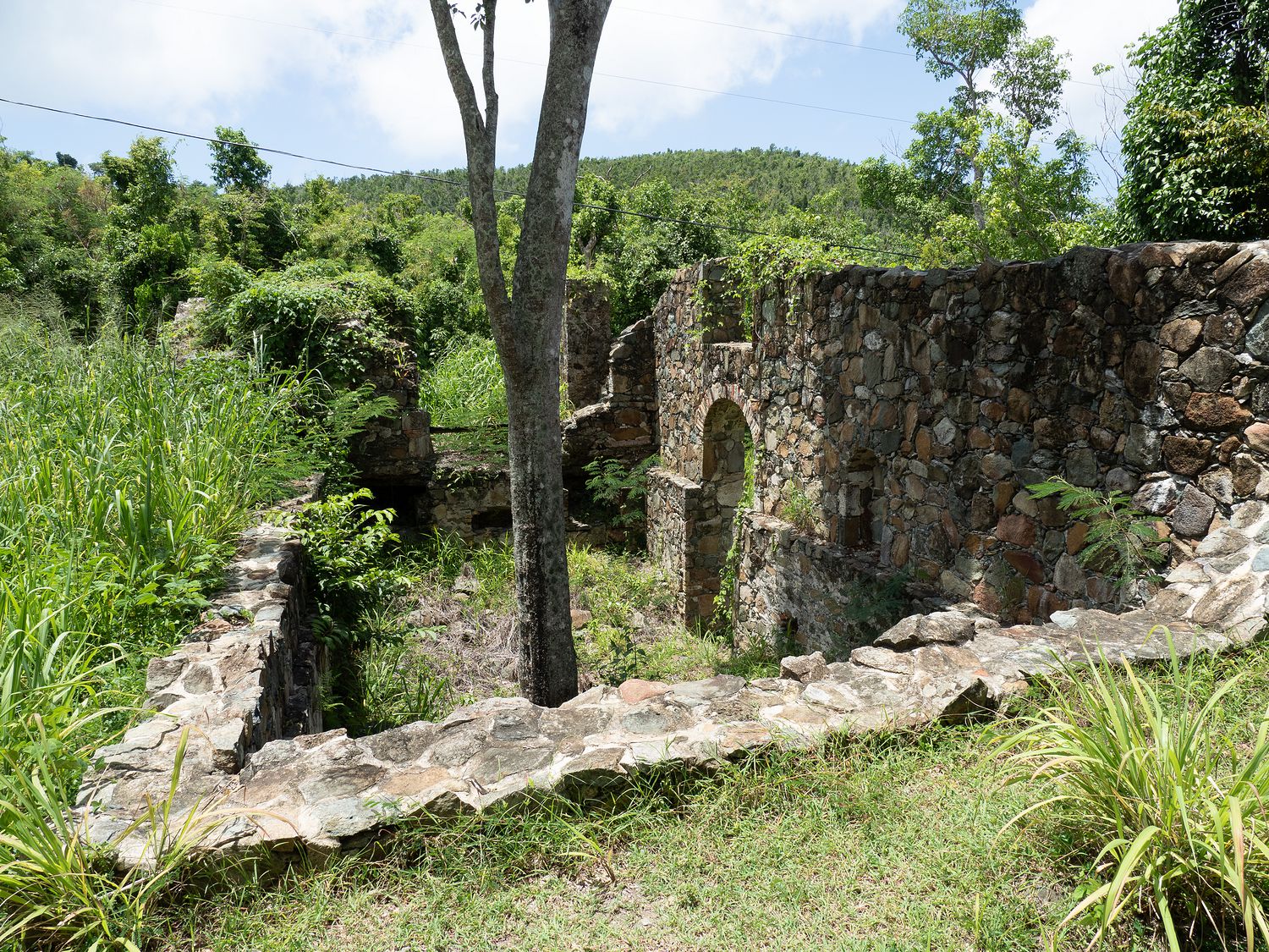
Nearby is another structure, though that portion of the ruin is much less stable and considerably less intact. They have up signs about not venturing out into that portion of the ruins, which is fine, really. It’s pretty cool to look at from above. I really wish they had more signs here at Virgin Islands National Park, because I can’t even begin to guess what the last building was for, exactly. Even Wikipedia doesn’t know. Regardless, they had to boil the sugar cane juice somewhere. They had to extract it somewhere. And they had to ferment and distill it somewhere (this knowledge, at least, Wikipedia has).
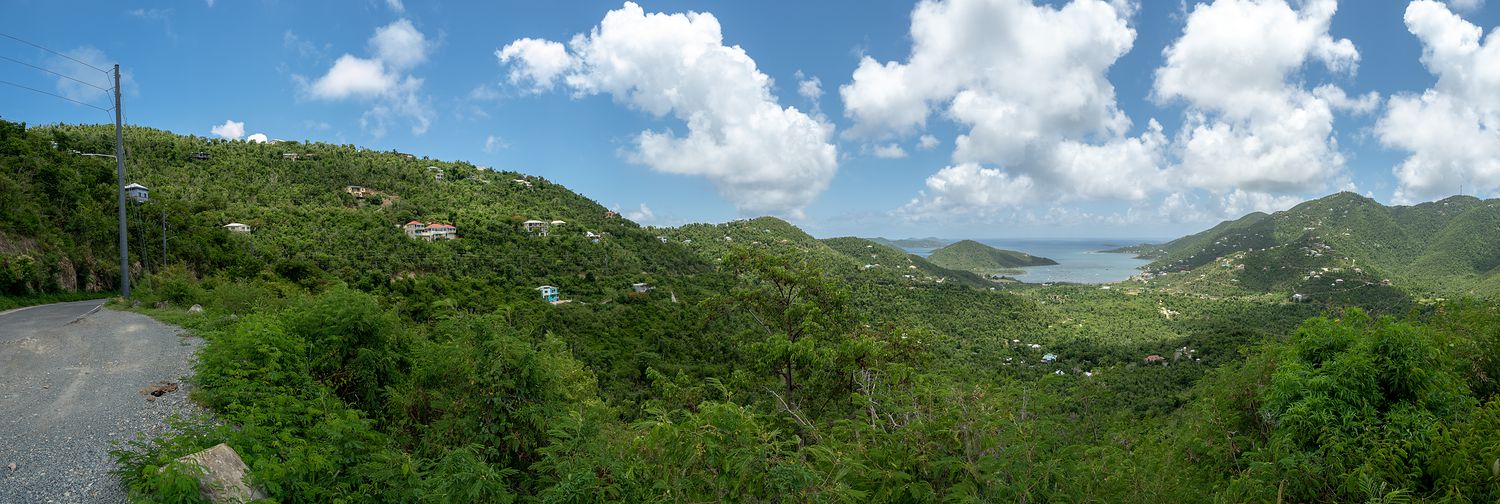
After we’d had our fun at Catherineberg, we got back on Center Line Road and headed towards Coral Bay. Down that way is the Bordeaux Mountain Road, which we had yet to take. It took us a little while to get over there, especially since we stopped for a couple of more bus stop photos.
The road started out fine, and not too different from any other road on the island. They did have a couple of nice viewpoints, but it was mostly just a road to get through to the different town areas. As we got closer to the end of it, however, right before we went back down into Coral Bay, we spotted a road sign. Road signs are not too common here, so we immediately took notice. It said, “steep grade.”
Boy, that sign did not lie. We went from way up on the top of a hill to way down on the bay in a very, very short amount of time. I have no idea what the grade was, but we switched to engine braking to bring the little car down the hill, and even then I was a touch nervous. Mark wasn’t, so it was almost certainly fine, but I think that is one of the steepest grades I’ve ever been down in a vehicle. And the random hills in the middle, as we were going down, were invariably blind hills, where you couldn’t see over the hood of the car. It was not my favorite thing on the island.
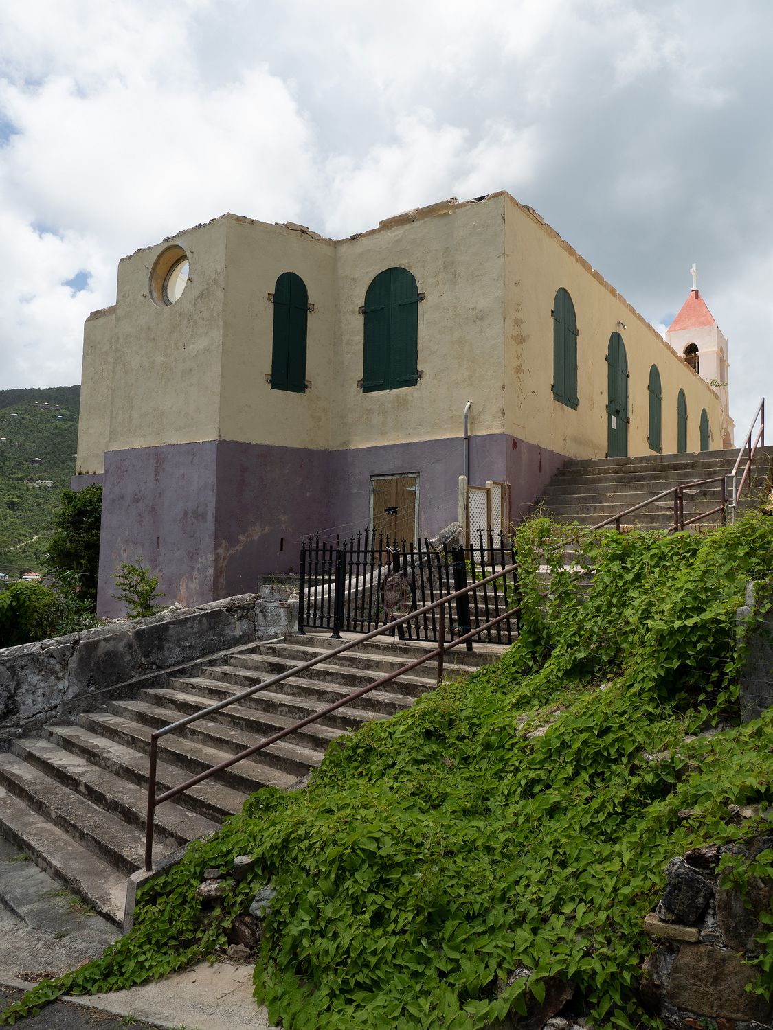
Back down in Coral Bay, we stopped for another bus stop photo, then pulled off at a church that was marked on our national park mark. It’s called Emmaus Moravian Church, and it has been there since 1782. Part of the building is also a “manse,” with the church itself occupying a smaller portion of the building. The manse was built in 1750. They still seem to hold services there, from what the signs said, so it seems to have stood the test of time. It could use a little paint, but is otherwise in pretty good shape. I wonder how many hurricanes that place and some of those ruins have seen.
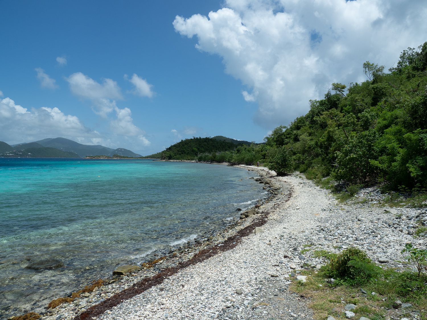
Originally we were planning to take Center Line road back to Cruz Bay, but we decided instead to cruise down our beach road (North Shore Road) again instead, since it is much prettier and we had a few lookouts we could do along the way. Since we were there, we visited Annaberg again, or at least the beach below the ruins. We didn’t want to walk out to those super warm ruins again, in the end, though originally we thought we were going to.
That area has such pretty water. It’s fun to look around at all of the other islands there. Many of the ones in view are part of the British Virgin Islands. The beach right beneath the ruins isn’t very nice, but it is only a short walk out to the real beach there. Once, we’d considered walking out to that beach, and on out to the point to take photographs, but we ultimately decided that the island had so many nice beaches that we didn’t need to walk out there. It’s too hot and there are too many bugs.
We took a leisurely drive back to our hotel along the beach road, pulling off when we could and generally just enjoying our last day on the island. We made it back to our hotel in time for a late lunch. Unfortunately, when we arrived, the power was out in our hotel, so it was hot in our room. We’d already planned to eat lunch in the room, so we opened the windows and it wasn’t too bad. We were glad when the AC came back on later, though.
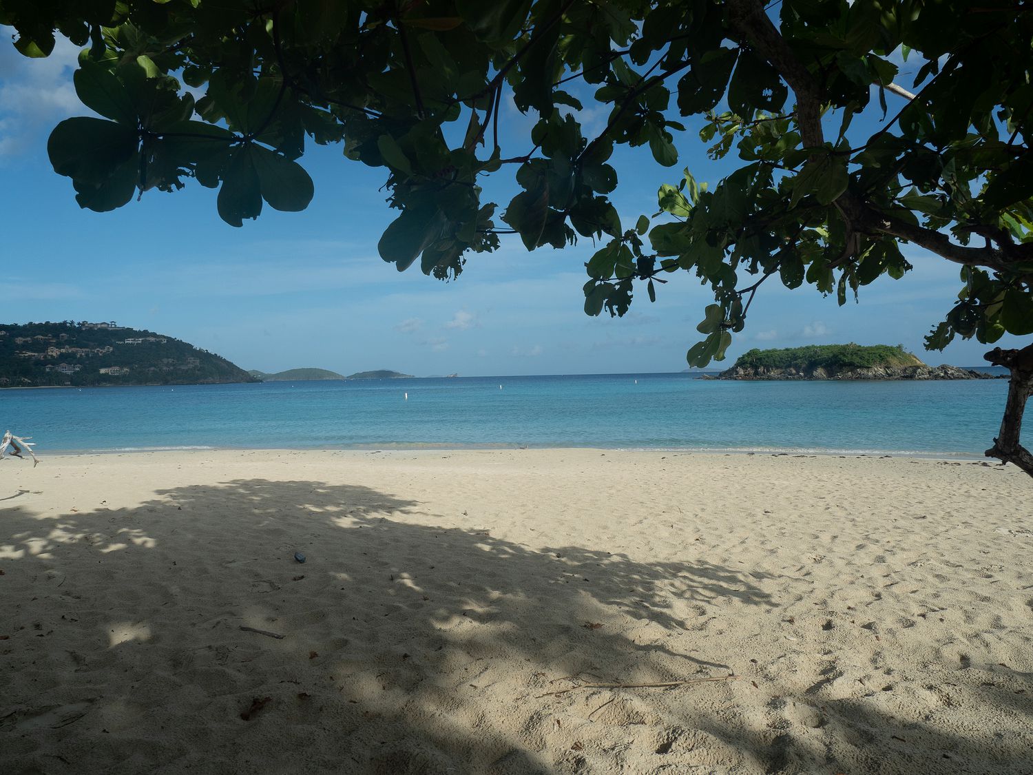
Our last beach to visit for this trip was Trunk Bay, which is the only beach on the island with amenities at the moment, and is one of the most popular beaches on the island. It also has its own ruins. Trunk Bay is pay to visit from about 9am to 5pm, which wouldn’t have mattered to us anyway, since we have our national park pass, but we’ve been visiting beaches after 5pm pretty much every day anyway, so this one was no exception.
We started with the ruins, which were propped up on long metal poles, and had signs all around warning about how dangerously unstable they were. We couldn’t get great photos of the thing, since the only place we could really reach did not have nice lighting, but the ruins were still cool to look at, though I am starting to burn out on sugar plantation ruins.
Trunk Bay has a huge bathroom facility with showers, a little cafe that’s open when the pay booth is open, and at least one rental shop for snorkeling equipment and the like. The bathrooms and showers were still open when we visited, but everything else had shuttered for the day. We were pretty used to beaches with no amenities by this point, however, so we weren’t too bothered.
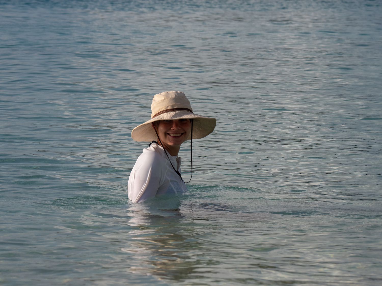
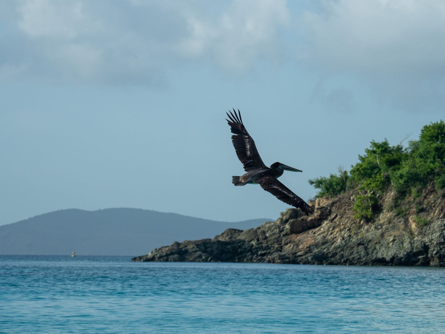
A couple of groups of people occupied the beach, but not too many. We took our pictures then went down and got in, once we’d donned our hats and rash guards. The water and beach were about as nice as any we’d seen, though not any nicer than any of the others, really. The beach was covered in pelicans diving for fish, though, which was fun. Mark spent some time trying to get good photos of them.
We’d been swimming for maybe 15 minutes when we started seeing marine wildlife. It started with thousands of tiny fish, swimming around us in massive schools. They brought stingrays, and Mark and I spotted two while we were there. Finally, things escalated, and Mark spotted a shark, so we high-tailed it up to the very shallow water, where I sat on the bottom in the surf, and Mark sat on the beach taking pelican photos. It was a small shark, and we’d probably have been fine, but there’s still something scary about being in the water with something with that many teeth designed to eat you.
Eventually, we got bored of wading in the shallows and packed it in for the day. We were surprised to spot some very friendly deer on the concrete outside the bathrooms where we rinsed our feet. They were tiny and totally unafraid of us. I wonder if people feed them, or if they just don’t have anything to be afraid of.
It didn’t take long for us to drive back to our hotel and shower off. We made ourselves a nice dinner of ramen, boiled eggs, and baby carrots. It wasn’t perfect, but it was nice enough, and it meant we didn’t have to venture out for another too-expensive sandwich. I’m a little tired of expensive sandwiches.
Tomorrow is our last day, so we’ve still got some packing to do this evening, though we will have plenty of time in the morning. Check out of our hotel is at 10am, and our ferry leaves at 11. We will have time to run and do the vast majority of our packing tomorrow. Our flight out isn’t until late afternoon, around 4pm, so we will have some time to kill on St. Thomas.