– Big Island, Hawaii –
We did our only big hike of the trip today. We got out of bed at 5, gathered up all of the stuff we’d need for the hike and stuffed down our breakfast. Unfortunately, while we’d intended to leave by about 5:20, we didn’t actually leave our room until about 5:40, but it would’ve been nicer to be even an hour earlier.
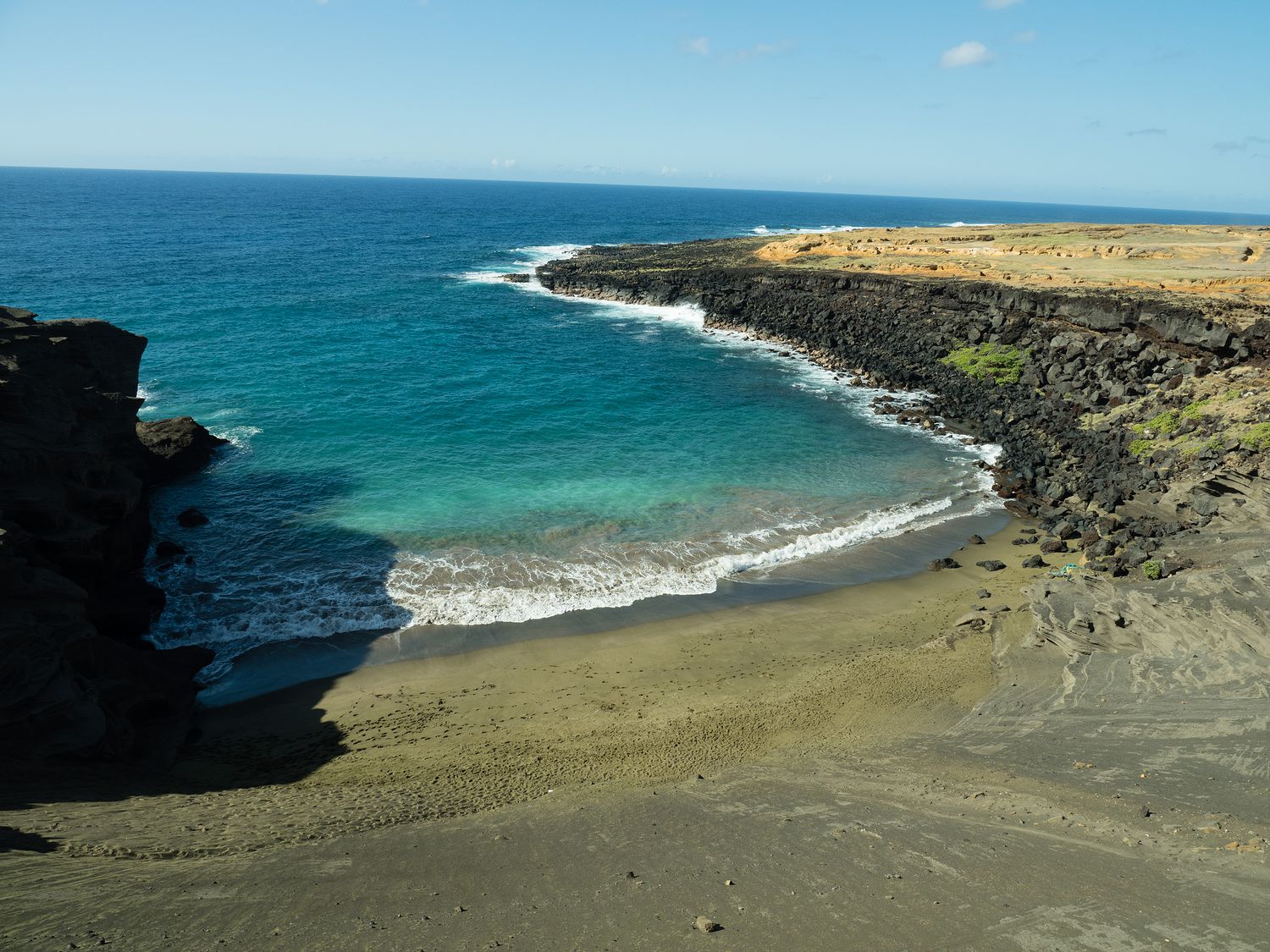
So where did we go? Papakōlea Beach, of course. What’s that? It’s a green sand beach! There are only four green sand beaches in the world, according to the internet, with the other three being Talofofo Beach, Guam; Punta Cormorant on Floreana Island in the Galapagos Islands; and Hornindalsvatnet, Norway.
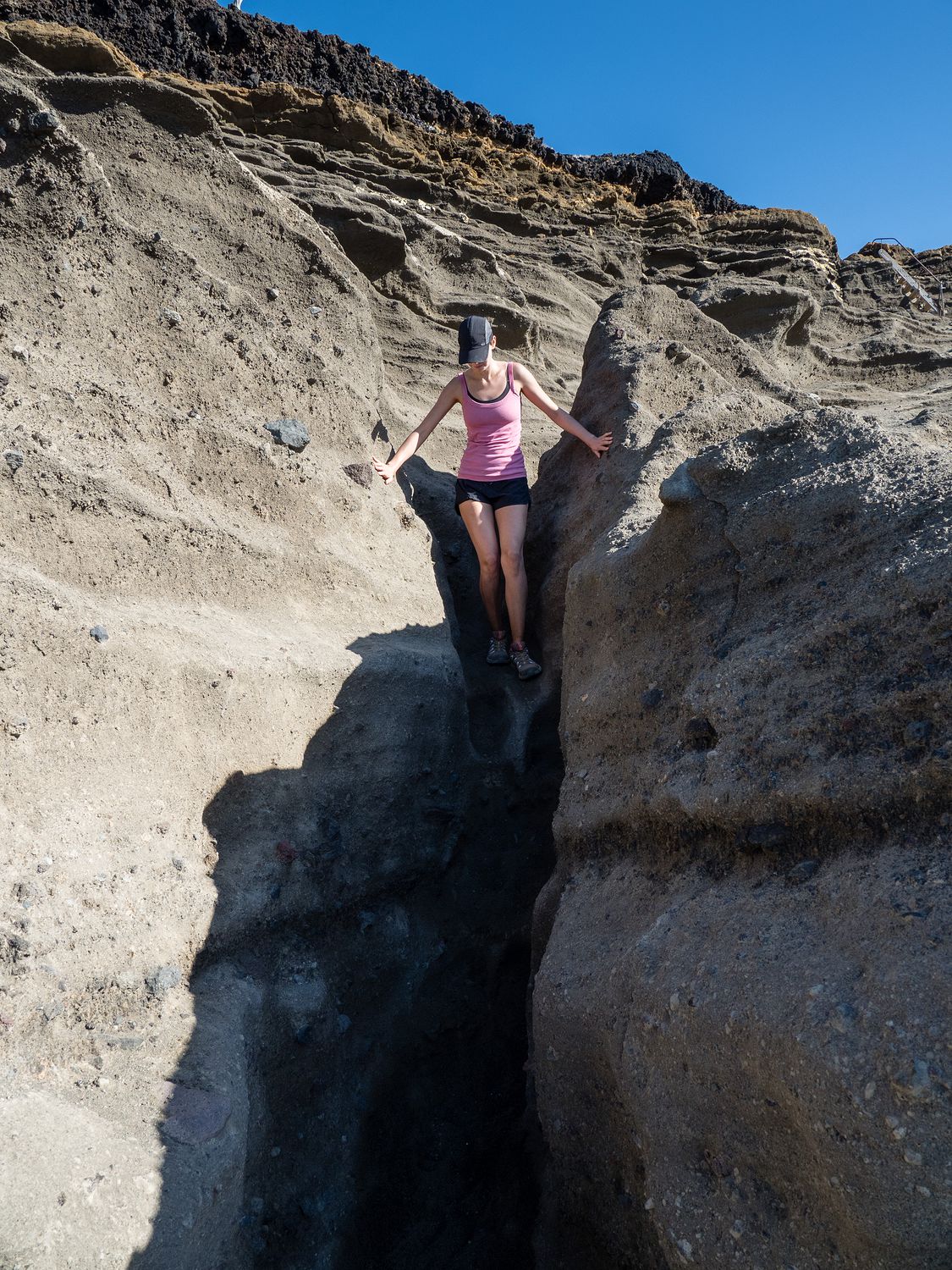
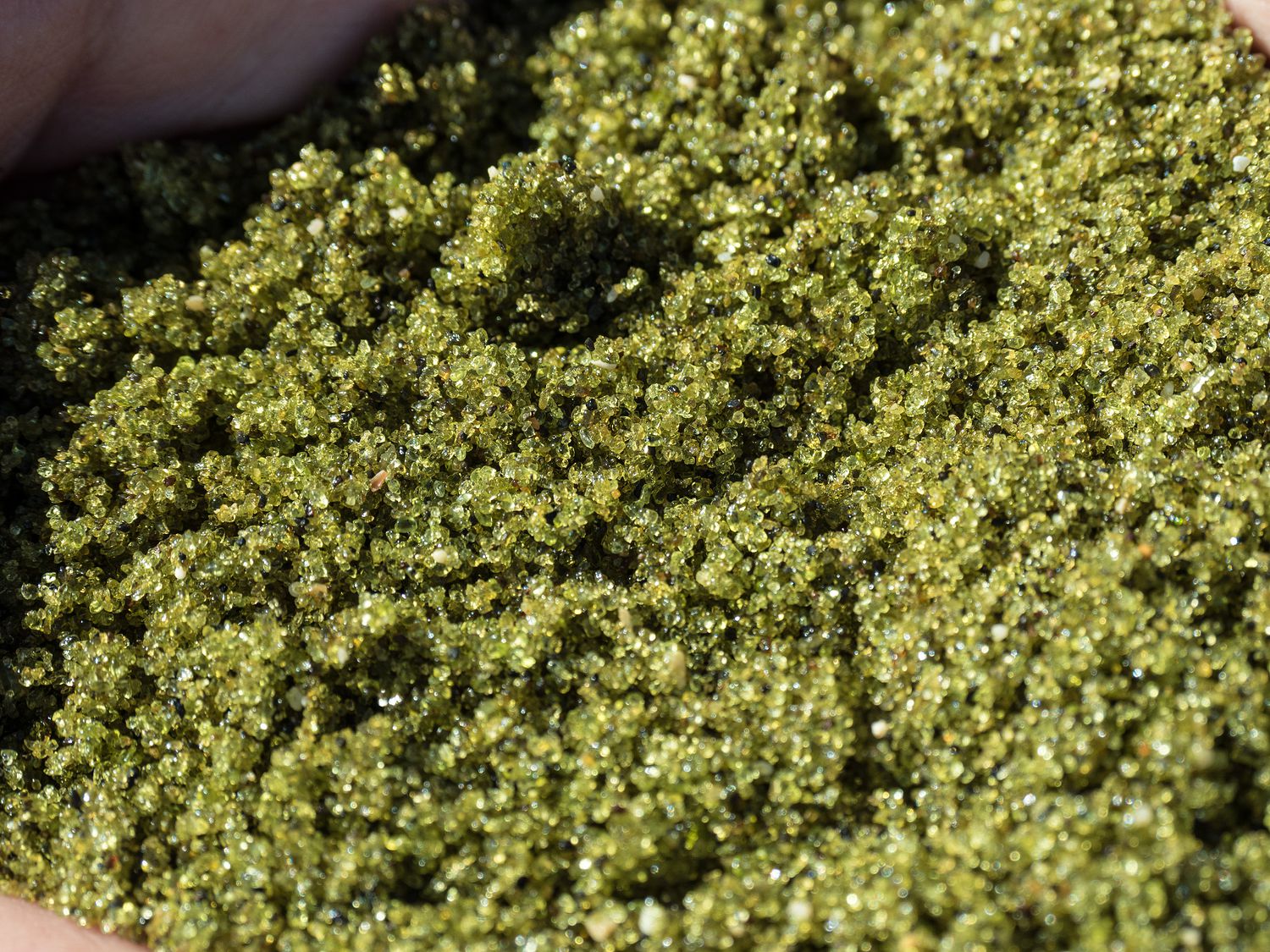
The green sand comes from olivine, which is a remnant of the cinder cone volcano that formed the beach here. Olivine, when of gemstone quality, is called peridot, which might be more familiar to some of you. You can see a picture of me climbing down the wall of the former volcano that leads down to the beach further down the page.
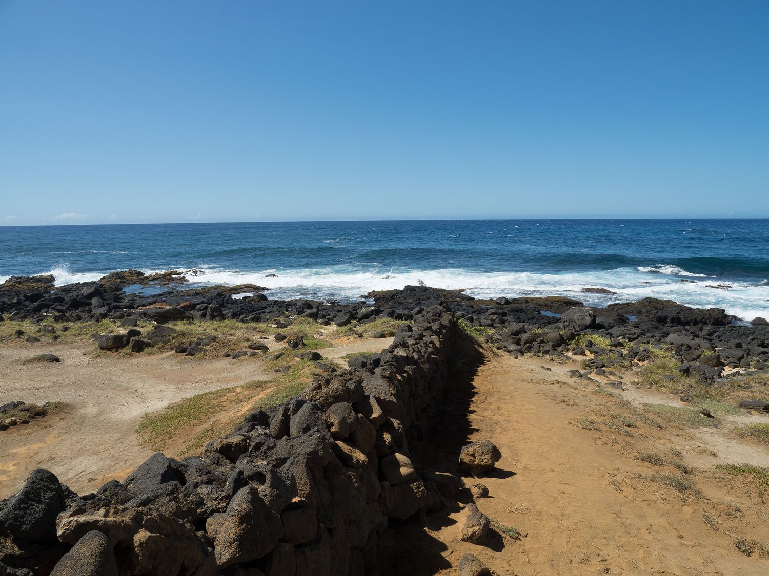
The parking area for Papakōlea Beach is about 1.5 hours from our hotel, and that meant that we were just arriving at the beach for our hike around 7am. It was already over 80 degrees, and the sun was high in the sky. Why is that important? Well, it’s a 5.3 mile round trip to the beach and back, and it is dry, dusty, and hot with no shade to speak of.
With that being the case, we bathed in sunscreen after we parked our Jeep. It’s actually pretty confusing at the trailhead. The beach is technically operated by the state, but in practice the people out there seem to do most of the work. The majority of visitors parked by someone’s house who was set up for them to do so, while we traveled a little further down the sketchy road to park in the same place we could see people parked on Google Maps.
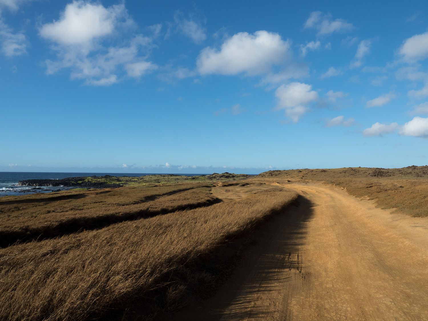
We were actually almost alone when we arrived. It wasn’t until later, when we were leaving, that we saw the cars. There are a ton of paths that all lead over to the green sand beach, a little over 2.6 miles from the parking area. They used to be tracks for 4x4s, but now access is restricted. Despite that, we saw a handful of vehicles on the roads, and read online that a local family makes money by taking tourists back and forth to the beach when they don’t want to walk.
The trail was very dusty and dry since this area of Hawaii is in a drought, but according to all of the information we read about it, it might’ve been dusty anyway. I stepped off into a deep track cut by a 4×4 and was in orange dust up to my ankle, so I can’t say I’m surprised.
All of the paths, and there are dozens, it seems, are different trails that cars have taken. Over time, most of them have worn deep ruts into the ground, so we generally found ourselves trudging through randomly winding and deeply gouged tracks. They all go to the same place though, and we eventually arrived around 9am, I think. It was a long, hot walk.
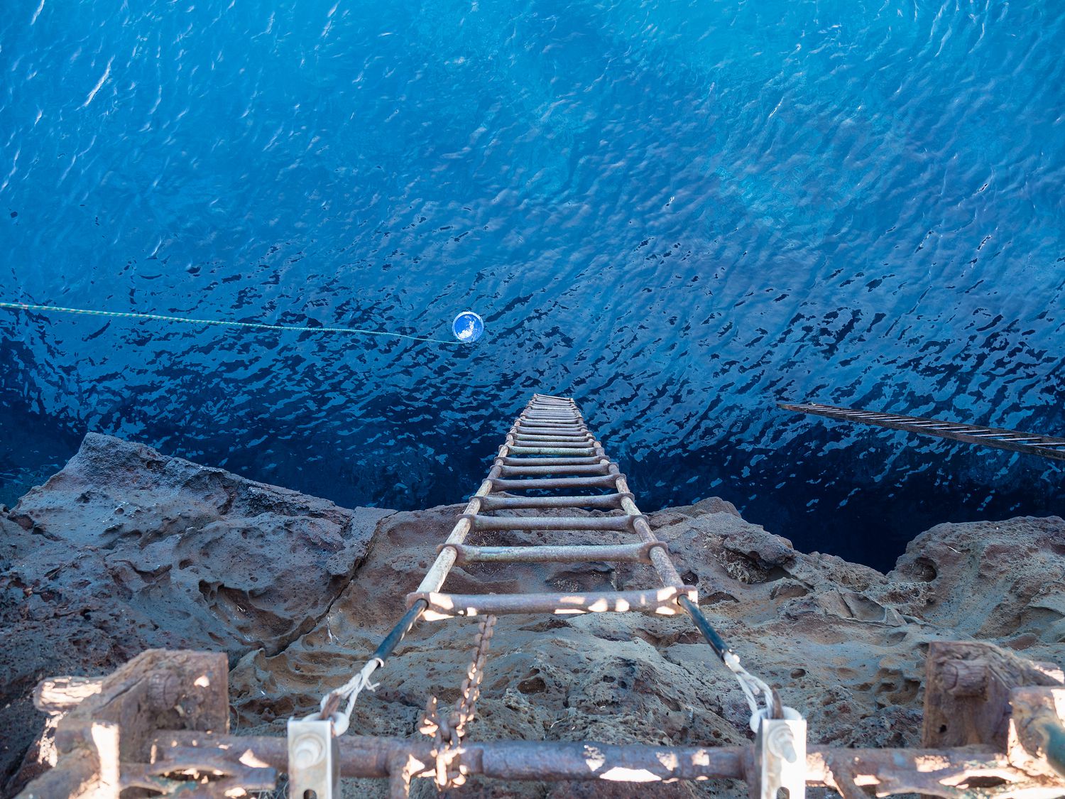
Once we arrived, I was horrified to discover that we now had to basically scramble down a cliff to make it to the bottom. I really don’t like heights, or enjoy the idea of falling, so creeping down the sketchy track etched into the side of the former volcano wasn’t fun for me, especially the bit with the rickety ladder.
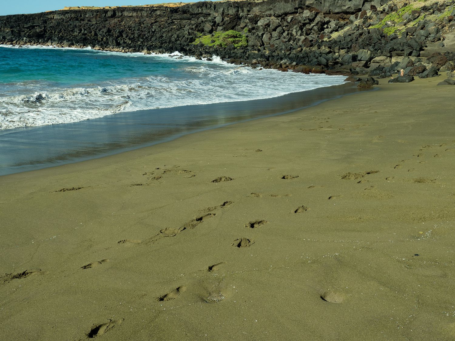
Still, we made it, and as we did, we realized that the beach wasn’t really that green. We’d read about that online, of course, since we were pretty well-prepared, but we were still a little disappointed. It can look green, but it’s much more likely in places where the sand is dry, and the sun is shining. The sand on the beach is heavily mixed with black volcanic sand, and that really changes the color.
Still, if you take your photos just right, in the right light and such, you can see why people call it green. We hadn’t packed swimsuits or anything, which in retrospect wasn’t smart, but we did play in the waves a little bit and dig around in the sand. We even spotted a bright red crab. I’ve never seen one before that wasn’t sandy brown in person. Despite our slight disappointment in the beach’s color, we found the whole area beautiful and well worth the journey down to it.
We spent perhaps half an hour on the beach before using one of our empty water bottles to rinse off our feet with ocean water and a bit of paper towel we’d brought along to dry them. Then we strapped back on our hiking shoes and headed back towards our Jeep.

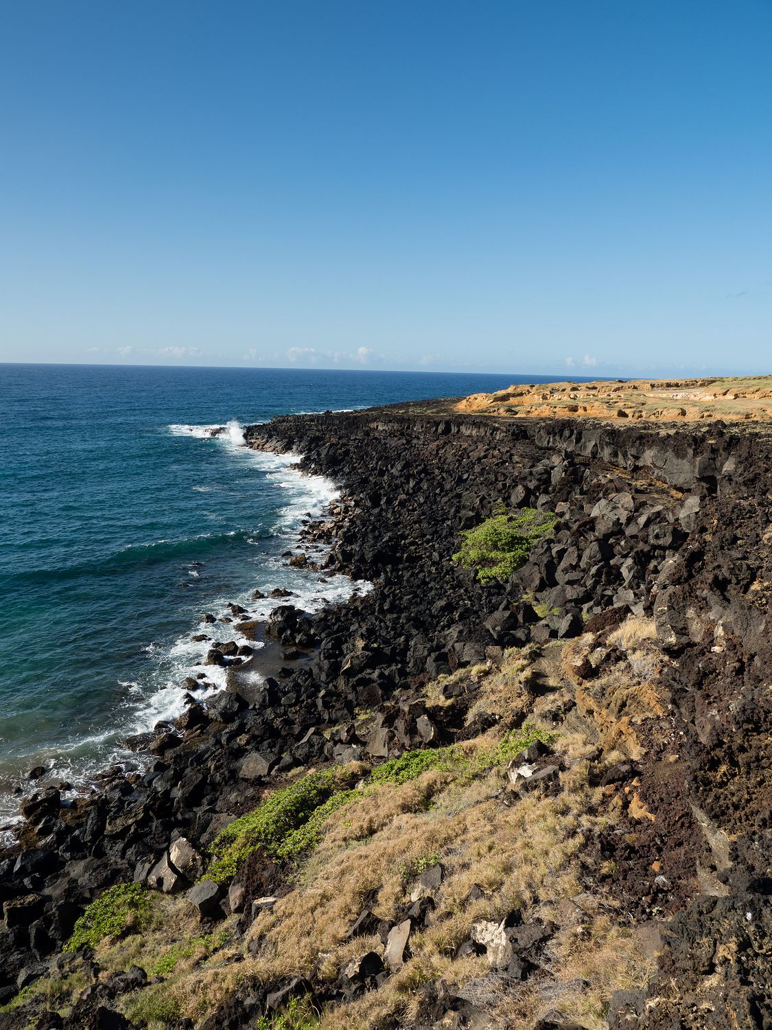
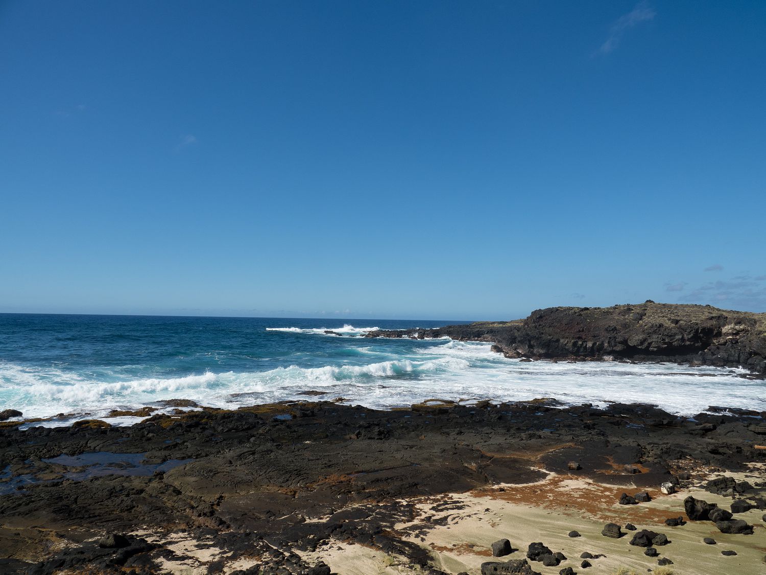
By now, it was miserably hot, and since we had no shade, there was no relief from the heat. Thankfully we had plenty of water and sunscreen, so while we were sweaty, we were relatively safe from the dangers of the hike. We still took a few more opportunities for some photographs, and as we walked a bit closer to the coast this time, we happened across another spot of a different, more rocky section of beach that had even greener sand than the beach we had just left.
This sand was genuinely, delightfully, sparkly green. We were very excited. Mark scooped some up in his hands for us to take pictures of, and up close in the sun, you can really see how odd the sand is. First, it is grainier than usual sand, and looks a bit crystalline. You can also really see that rich, olive color quite clearly. This sand was much drier, we noticed, I suspect that if the surf had been a little lighter on the main beach, it might’ve looked a bit more green. Instead, it was wet all the way up to the volcano’s edge, so the sand was too wet to look green.
We saw quite a few more people on our way back up the coast to our car. We were mostly trudging along with our heads down by that point, trying not to let the sun beat us down, but we still noticed quite a few more people. We’d only seen two couples on the way in, one on the beach with their 4×4 truck up at the top of the beach, and the other walking back when we were walking in. Now we saw several groups, and since that was only on one of the tracks, I imagine we missed seeing even more.
I’m glad we finished up when we did. It was just before 10am and we were just burning up. I can’t imagine making that hike any later in the day, even if you are planning to swim when you get there. That just means you have to carry more water.
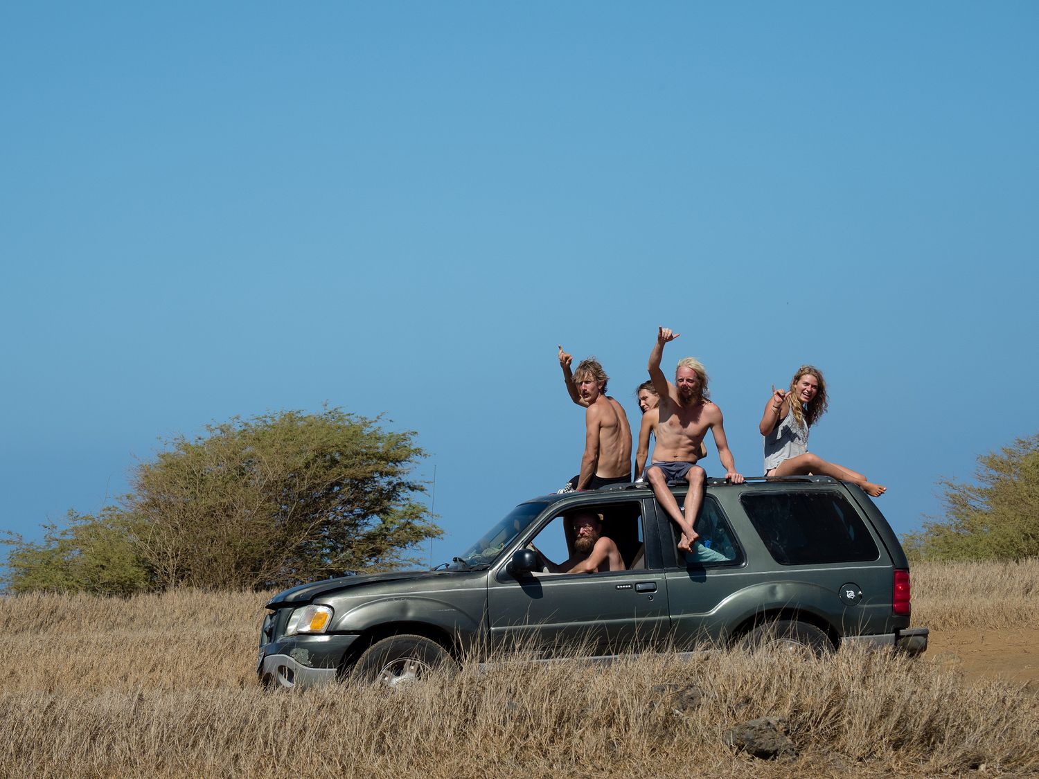
In addition to the hikers, we spotted another vehicle that looked like they were about to attempt to 4×4 trail out to the beach. It was on old Ford filled with hippies, and when they spotted Mark taking pictures as we reached our Jeep, they shouted and waved to get their picture taken. Here they are doing that hang-ten thing the people here do all of the time. I’m not sure what to call it, but we see it constantly instead of a wave.
Just down the road from the green sand beach, on another section of the same road we came in on, is South Point. South Point is the southernmost location in the United States. We had to drive over and see that, just to say we’d been there, even if we were hot and tired.
It was only perhaps a mile away, and after briefly enjoying our AC, we climbed back out of the Jeep and trekked over to the point and the sign telling us we were as far south as we could be in the U.S. It was cool to be there, but nothing spectacular in terms of view.
At the same place, there’s what’s called the South Point Cliff Dive where people jump off of a 40 foot cliff into the ocean below, then climb back up a rickety old ladder to make it back up to the top. There are several signs here warning people not to do it, but the ladder is still on the wall, so I’m not sure how much discouragement the signs really provide.
We saw two people about to do while we watched. We didn’t stick around to watch them jump, and I couldn’t even get close enough to look. Mark definitely took the picture you see below, looking out over the cliff. Just seeing the photo for the first time when I was picking photos out for this blog post made my stomach drop. I can’t even imagine climbing the ladder. I feel sick thinking about it.
Now that we were done out at the South Point, we clambered wearily back into the Jeep to make the 1.5 hour journey back to our room to take a shower and cool down. We didn’t make it until after 11am, which is pretty late for a shower, but man did it feel wonderful. You should’ve seen us scrubbing off all of the sunscreen we’d used back on the trail. I bet we polished off a third of the bottle.
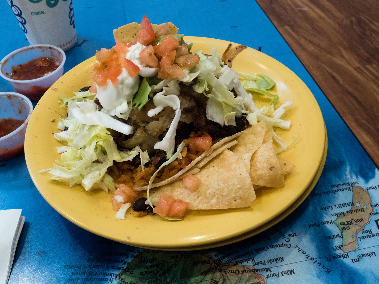
Once we were clean and cool, we realized that we were ravenous, so we made the 30 minute drive into Hilo to get our lunch before we headed down the road to do some of our more regular style of exploring. We ended up trying Maui Tacos, since we’d seen so many of them as we traveled across the various parts of the state. They were fine, though the veggie tacos we ordered we too giant to eat like tacos and had potatoes in them. Who puts potatoes in tacos? Way too many of their salsas were sweetened with pineapple juice, too. Everyone here must have a serious sweet tooth.
Vacation errands were next, so we stopped at a Walmart for some hand lotion and various other things, then filled up our gas tanks and stopped for our customary McDonald’s teas. With that out of the way, we turned our eyes toward our trip for the day, out to Rainbow Falls near Hilo and then up the northeastern coast of the big island.
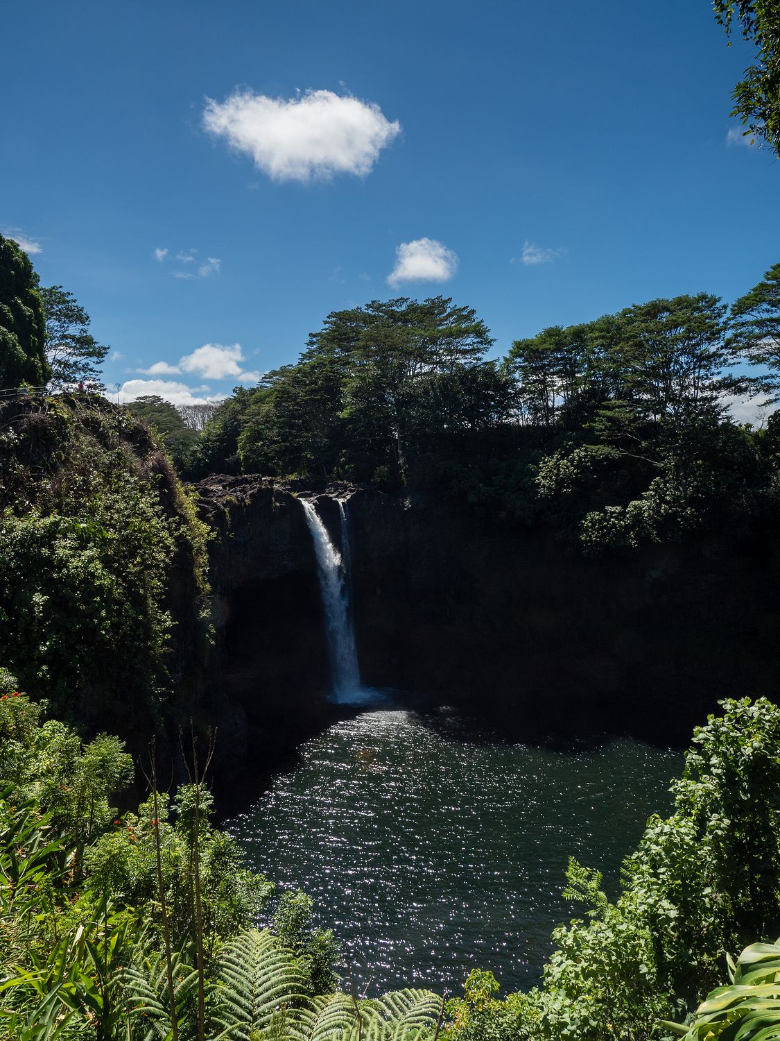
Rainbow Falls was fine, though once again I must say that I haven’t seen any truly impressive waterfalls anywhere in Hawaii. Rainbow Falls in particular had terrible viewing spots, and no easy way to get down to it to look closer. We were pretty disappointed, but luckily it is practically inside Hilo, so it wasn’t really out of our way.
From there, we took Highway 19 up the eastern coast of the island. Our first stop was at ‘Akaka Falls State Park, which of course had another waterfall. When we arrived, however, we found out that parking was $5, and it was $1 per person to walk down the path to the waterfall. We’d read online that no Hawaiian State Parks have parking fees or entrance fees, so we were skeptical of this, though eventually we conceded that the guy taking money for it seemed legit. Regardless, I refused to pay on principal, so we drove on.
Luckily, we did find something to spend that $5 on that was quite a bit more fun. Mark has been talking about getting a coconut on every island, and today we finally did it. We bought him a coconut. We stopped at a farm stand a little ways down the road from the falls where a nice lady that worked at the farm spent some time talking about coconuts with us before chopping one open for Mark to drink.
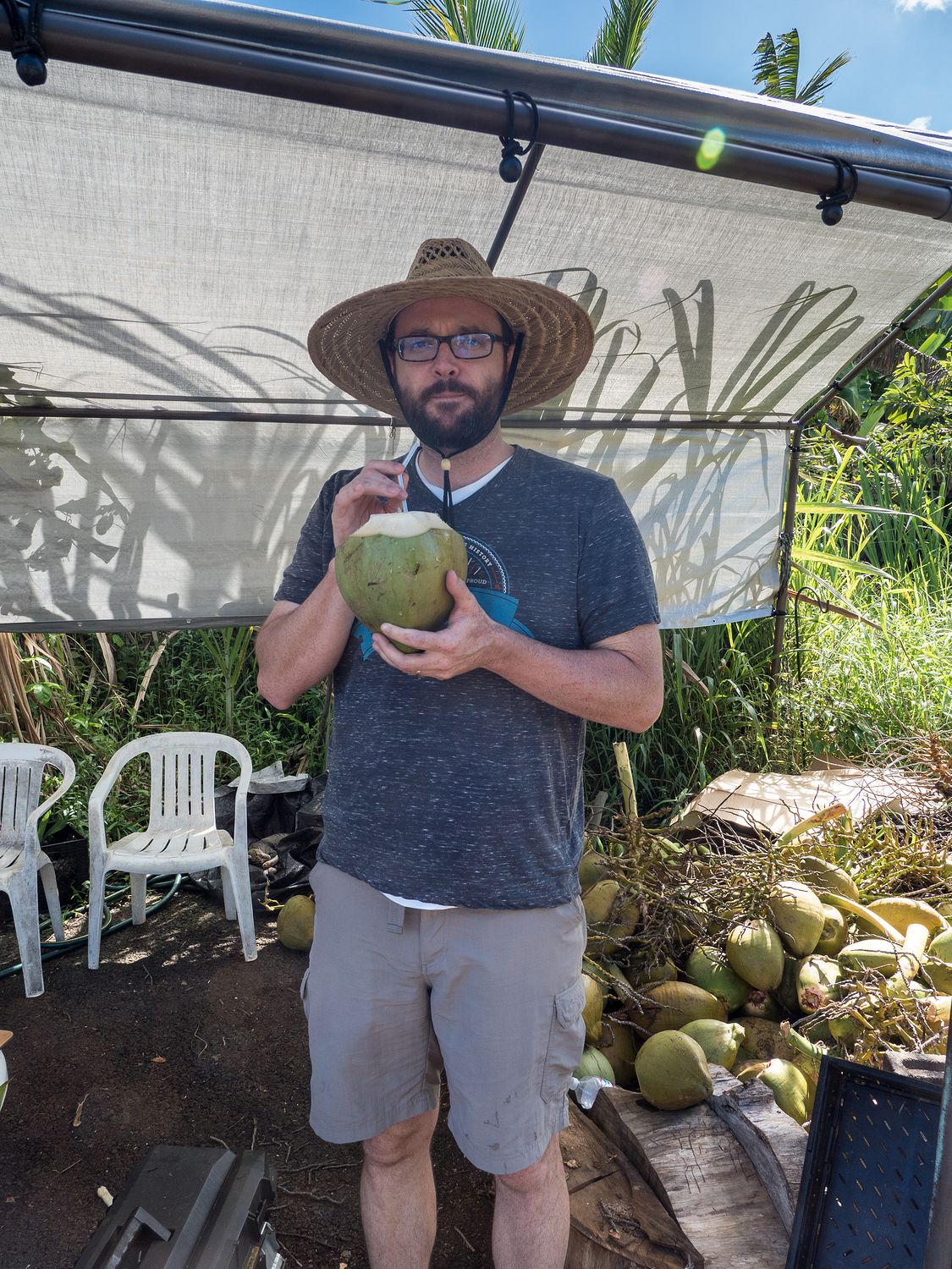
From what I understand, the coconut he had was picked today, and it had been growing for about 7 months, The older, drying coconuts you usually see in pictures and stores have usually been growing for 14 months or so. The first thing he did was drink all of the coconut water with a little straw after the woman chopped the top open for him. Then, with some serious machete skills, she chopped the coconut in half so he could eat the meat.
I’ll be the first to tell you that I hate coconut, including coconut water, so I was hesitant to try any of it. Mark asked me to, though, so I have to say that the coconut water wasn’t too bad. It wasn’t as sweet as the stuff you usually find in grocery stores. The meat was very different. Instead of being firmer, drier pieces, this was meaty and soft, and it didn’t taste much like coconut at all. It was bland, in a way, but also slightly sweet without that coconut taste that you expect. I didn’t mind it all all, and Mark really enjoyed it. It was especially fun since we had no idea what such young coconuts were like.
I’d also like to mention the coconut lady’s faithful cat, which was sleeping behind her chair until he heard the sound of the machete. Not long after, he was up and waiting, and as soon as an empty coconut husk was left where he could get to it, he went to town slurping up leftover coconut meat and water. I had no idea cats would eat coconut, but the woman said it was his main source of food during the day, and he loved it.
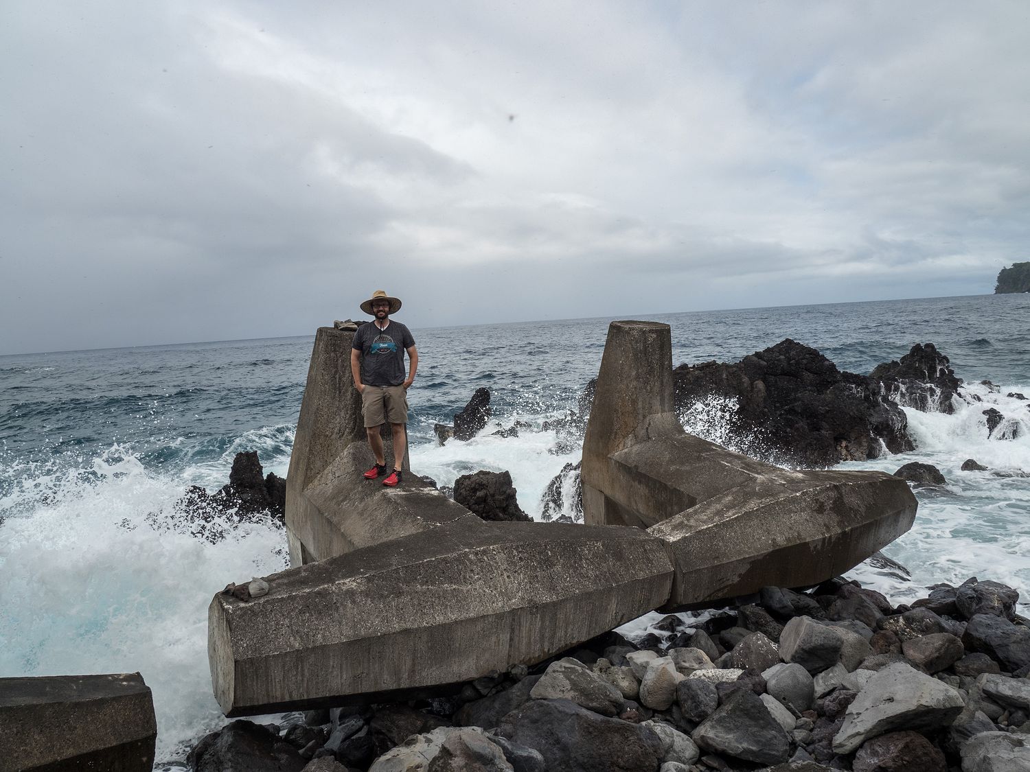
Further down the road, the weather started to turn a bit, and we found it sprinkling occasionally. We pulled off at Laupãhoehoe Beach Park to take some photos, and looking out the window, I saw what I thought were wispy raindrops. Instead, it turned out when we got out of the Jeep that they were massive clouds of thousands upon thousands of tiny gnats. It was absolutely terrible.
Despite the bugs, the view was neat, and we had to get out to take some pictures. Mark even walked out onto some breakwaters for me to take a picture. I know the surf looks sketchy in the photo, but I promise we watched to make sure it was pretty safe for him to go before he did. The water never got up that high, even when the waves were huge. I imagine it would have to be storming for the water to reach his little perch there.
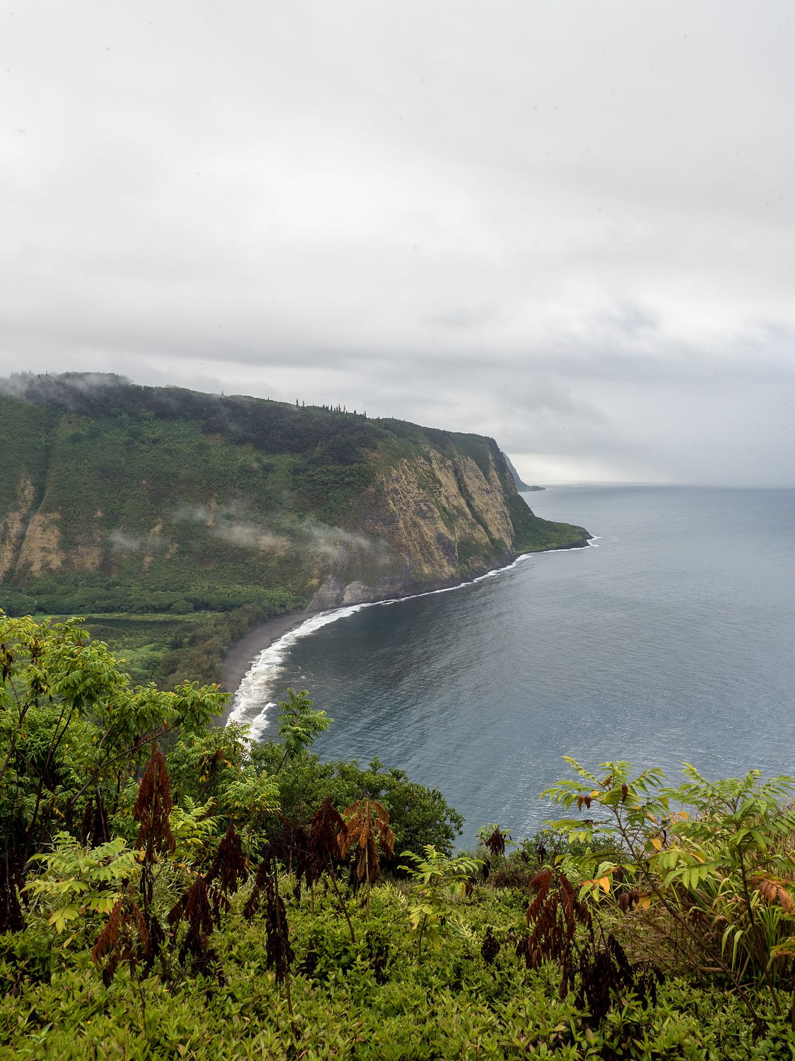
Our final stop along the northeastern edge of the island took us to Waipi’o Valley Lookout, where we braved the now rainy late afternoon to take some photos of a black sand beach and distant cliff. It was a pretty view, and a nice way to end the drive.
Next to the parking area for the lookout is a little track that slants off to the left, with huge signs warning that the road is for 4-wheel drives only, and has a 25% grade. The road, called Waipi’o Valley Road, goes off in two directions, one to a waterfall, and one down to the beach in our photo.
According to the internet, the road is the steepest in the U.S., and one of the most dangerous, despite its relatively short length. It has sections with up to a 45% grade, which can easily destroy brakes on the way down and stall engines on the way up. It is paved, but it is single lane and very curvy, with blind turns and a steep drop off. Despite that, we did see people going off in that direction. A tour guide at our stop was telling us that you can see 4 or 5 cars at the bottom of the cliff when you drive down the road, and that someone falls off of it every year.
That done, we made the long drive back to Hilo, where we stopped at a Safeway to get a few things for a snack-ish dinner in the car. It was just after 6, and we were too tired to bother with a restaurant. We made it back to Volcano and our room by 7pm.
Tomorrow we’re going to drive back up to Hilo for our run and a dip in the ocean (since we are nowhere near it here). After that, we’ll take a road up the northwestern side of the island, where we have a stop planned at a little vegetarian restaurant so Mark can try the vegetarian version of a locally favorite food, the Loco Moco.
– Trip Total : 1,141 miles –