– Page, Arizona to Durango, Colorado –
Oh my gosh. Today has been such a busy day that I’m surprised I’ve even managed to find the time to write this tonight. Let me begin by saying my day began at 5:30am, and I am absolutely exhausted. What a day.
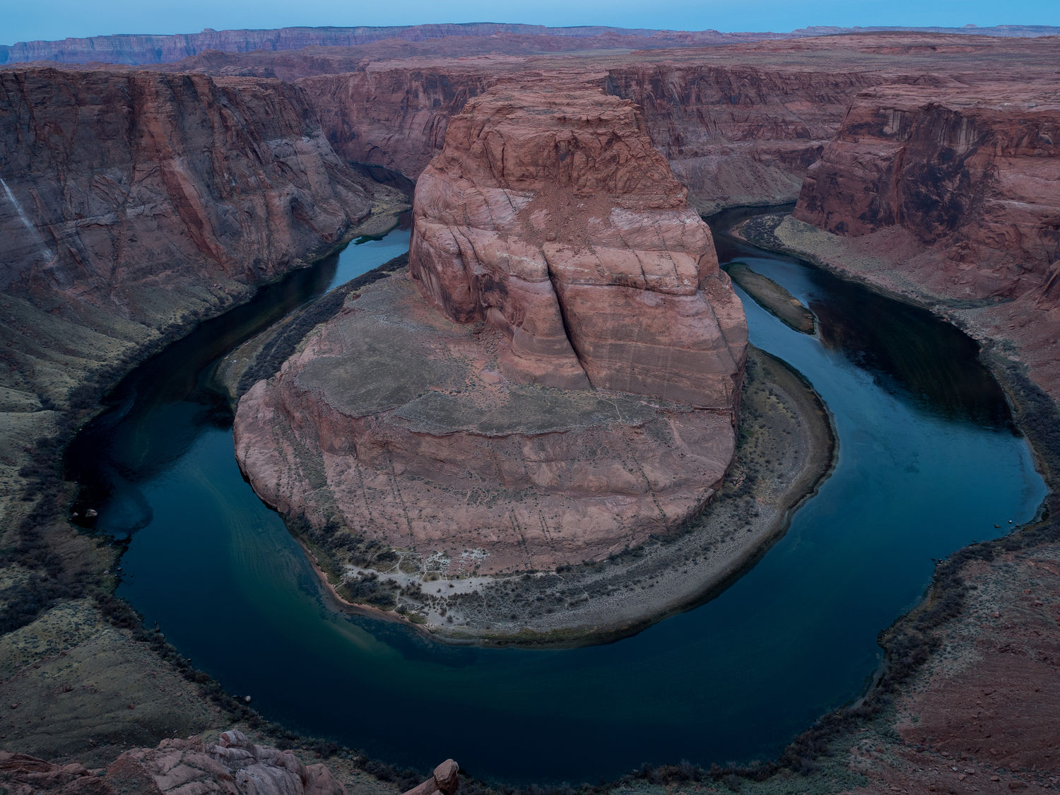
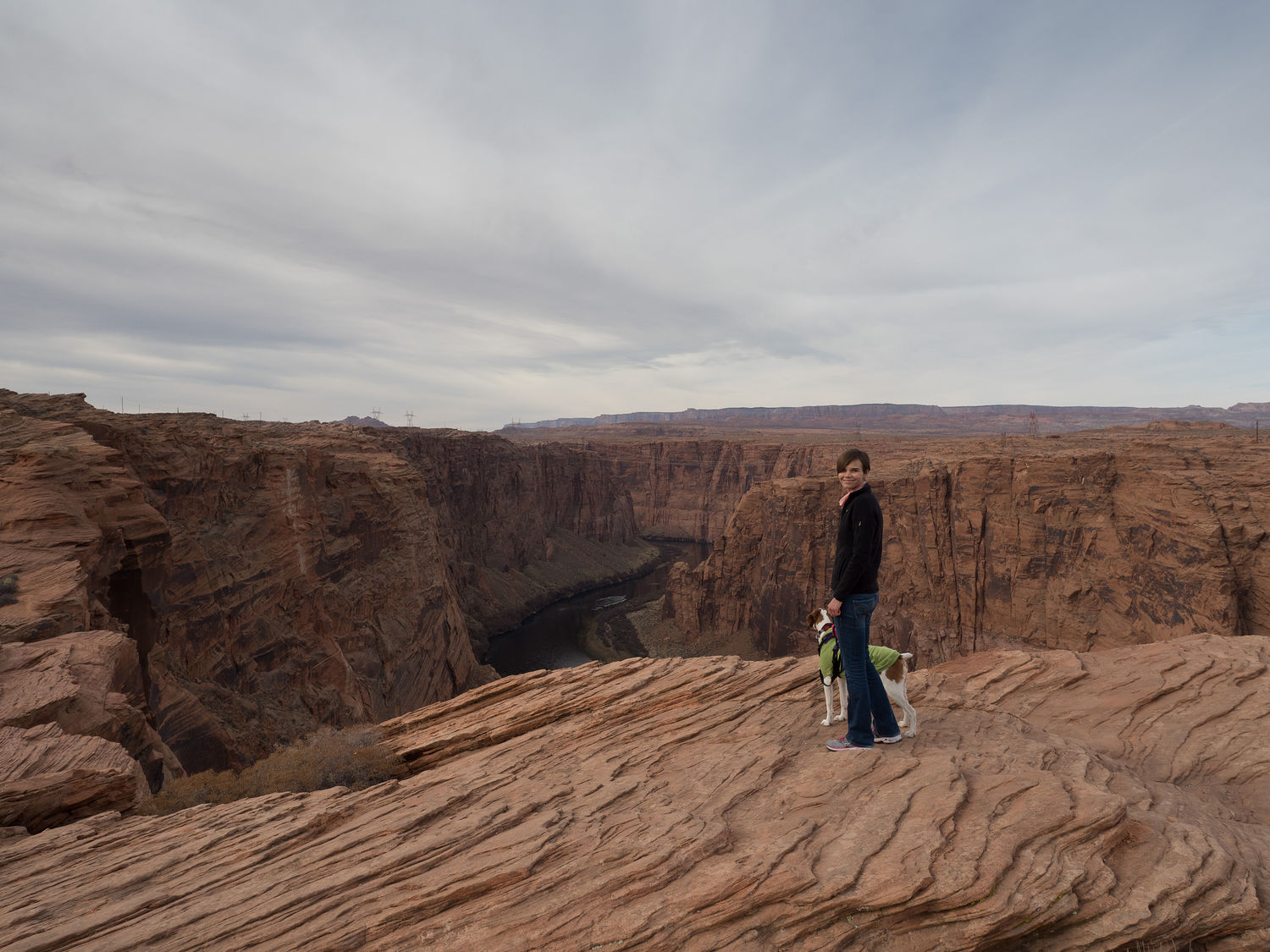
Like I said, we started early, dressed in our warmest running clothes, and immediately hopped in the car to make the 3/4 mile trek out to the lookout over Horseshoe Bend. We left the hotel just after 6, and arrived at the parking lot by around 6:15. We haven’t talked much about Horseshoe Bend, so if you haven’t heard of it, it’s a huge, horseshoe-shaped bend in the Colorado River, just downstream from Lake Powell in Arizona. It’s just outside of Page.
It was around 35 degrees and totally pitch dark for our hike out to the edge of the cliff to look down at the bend in the river. Mark had looked at other people’s photos before today and chosen pre-dawn, before the sunlight hits, as the best time to photograph the area. That meant it was very early. In fact, we were the first people at the overlook, though we were not the first people in the parking lot. I’m not sure where the other people from the first two cars ended up.
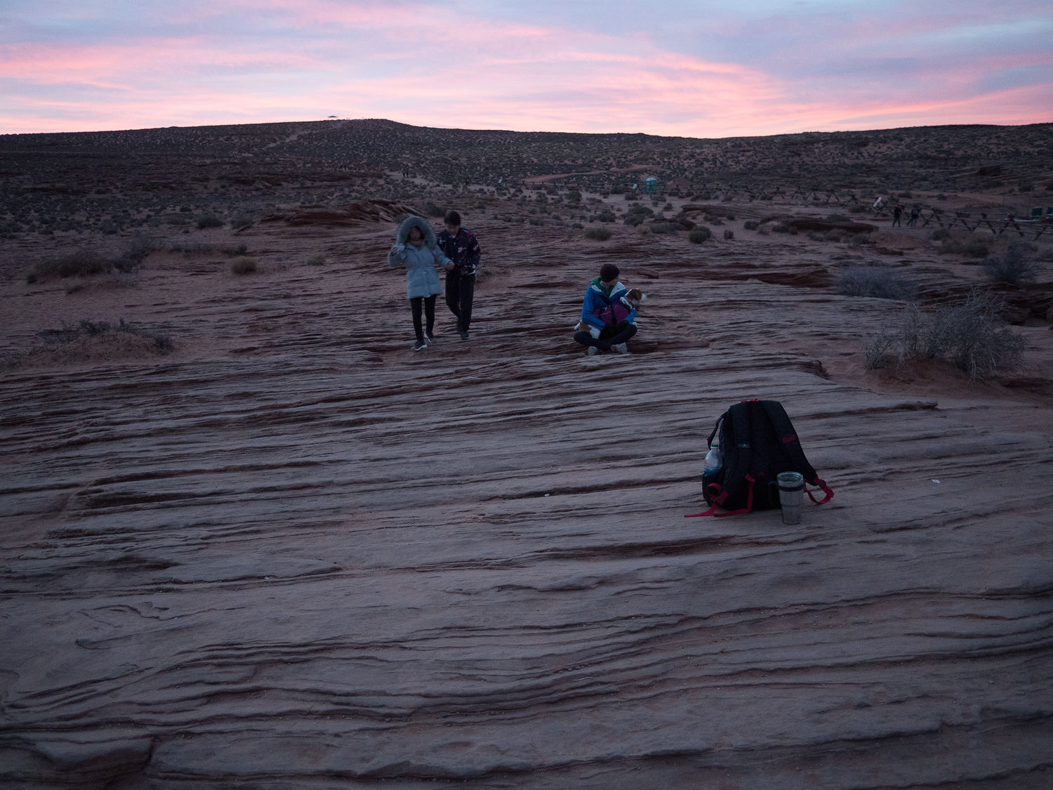
Regardless, the walk out was dark and frigid, and our little flashlights barely cut a path for us. I’m glad Mark has such a good sense of where trails are, because I am afraid I would’ve lost my way once or twice without him. As I had feared before we went out, our arrival at the cliff was somewhat abrupt, and I didn’t even realize we were there until Mark walked over to the ledge to have a look over. Ripley and I did not get so close, especially since it was not yet even false dawn.
Mark set up his camera and we waited, Ripley and I sitting a ways back from the edge, cuddling to stay warm while Mark futzed with his gear. Slowly, more people trickled in, and dawn approached. Just as the sun was about to break over the horizon, clouds swept across it, leaving it in shadow, and giving us even longer to take photos of the canyon in our chosen light.
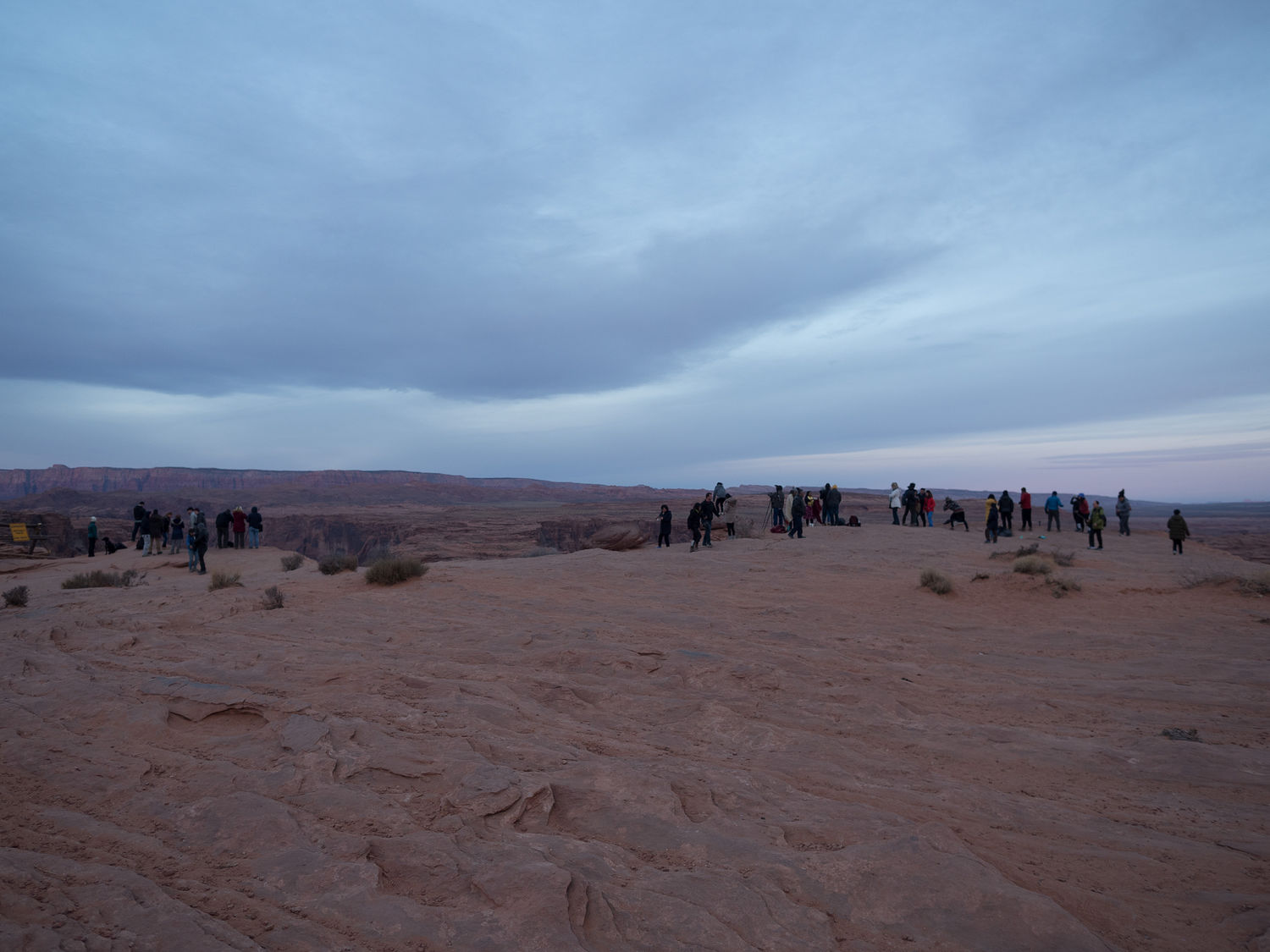
By the official sunrise time, which was somewhere around 7:40am, there were close to 100 people milling around the overlook, standing at the edges, trying to photograph the canyon. All of those people so close to the brink had me on edge, and the cold had really set in, since Ripley and I had been sitting so long. We got up and wandered around in an effort to warm up while Mark finished his pictures. They turned out beautifully, and I’m glad we went, but next time I will need a blanket and a little lawn chair. I’m also not getting anywhere near the cliff, where all of those crazy people were standing. In case you haven’t heard me say it before, I’m positively terrified of heights. I wonder if there’s ever been an accident, with so many people out at the cliff’s edge at one time?
We did not make it back to the truck until after 8am, which pretty well doused any plans for running, as we had way too many other things to do to day to spend another extra hour in Page. At least we’d hiked the 1.5 mile loop to the Horseshoe Bend lookout. We didn’t make it out of the hotel until after 9:30, but we did make it before the free breakfast ended, which is all you can really ask for.
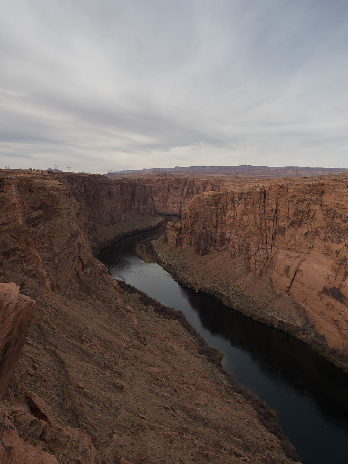
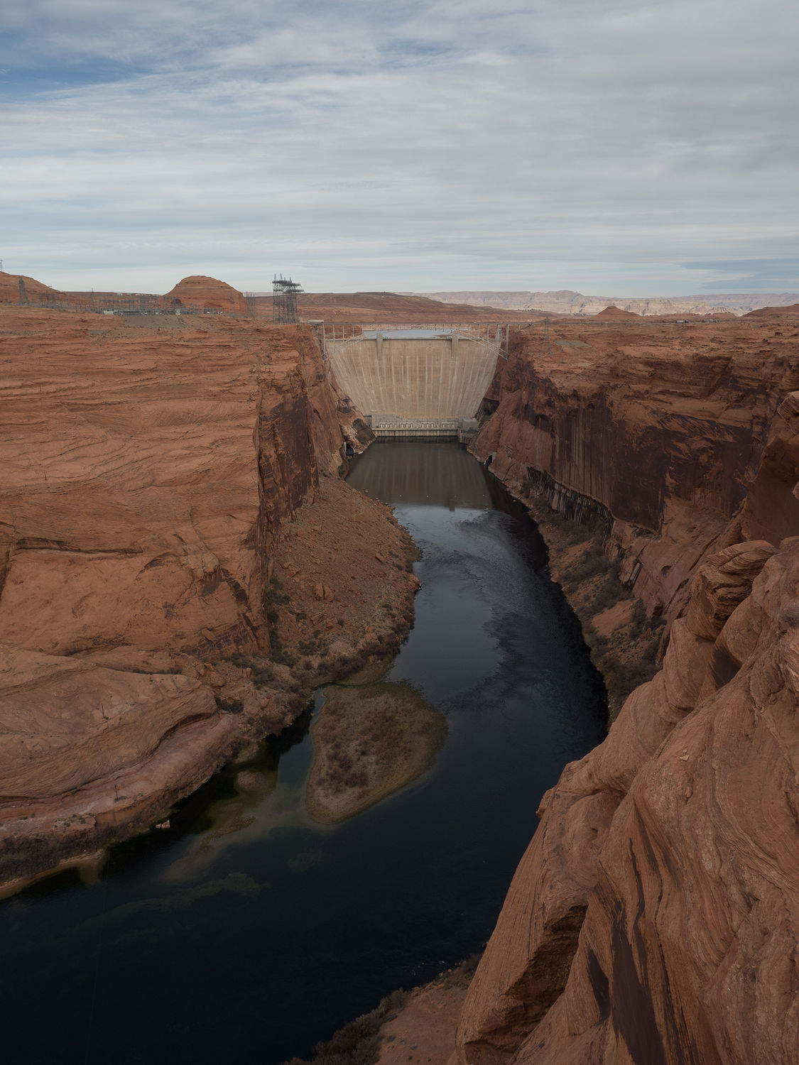
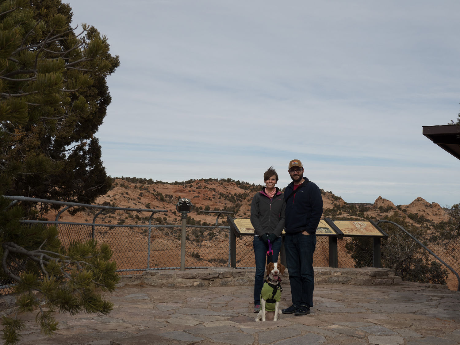
From there, we only drove a mile or two down the road to take a look at the Glen Canyon Dam, which required another little hike down to a scenic overlook. Driven by my horror at discovering half a pound of sand in my hiking shoes after our trip this morning, I decided not to walk out into the sandy overlook area where Mark went to take photos, but instead took Ripley up one of the rocky outcrops on the sides to look down at the river in the national recreation area below. Mark thought we looked pretty cool up there, so he snapped some photos of us avoiding the sand as well as his dam pictures.
The overlook is very pretty, and a nice substitute if you can’t make the Horseshoe Bend hike, though the trail is a little slick with fine sand on smooth rock as you descend to the overlook from the parking area. I advise caution if you stop. It’s a very short walk and there’s a handrail, though, so anyone reasonably able can make it.
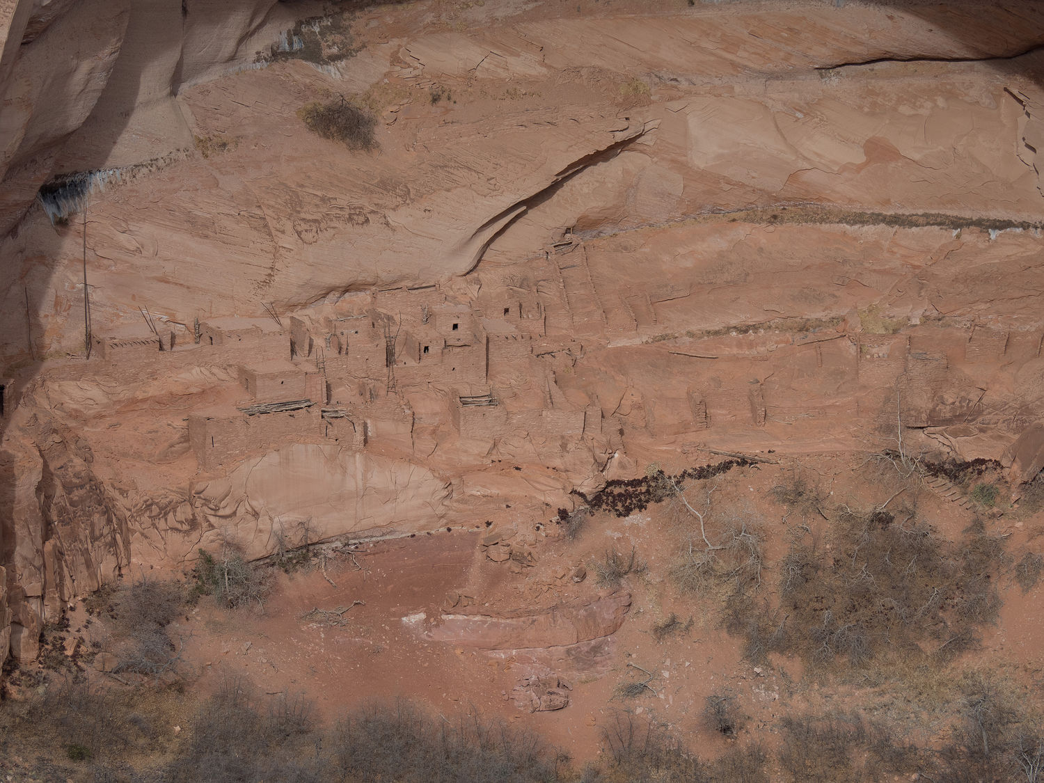
With that done, we stopped for teas at a local gas station and hit the road back into the Navajo Reservation. Our first goal was Navajo National Monument, which is composed of a set of cliff dwellings built by the Ancestral Pueblo peoples, as I mentioned in a previous post for this trip. Many of the national park service sites in this area preserve areas like this one.
Navajo National Monument in particular is home to the Keet Seel and Betatakin cliff dwellings, which as I understand it, can actually be toured with the guide of a park ranger. The first homes in these areas were built in the 1250s, then quickly abandoned. The reason for this abandonment, which occurred sometime around 1300, is hotly debated, from what I’ve read, but it was a time of severe drought, which might explain the fact that so many people abandoned such a well-built city.
Before we reached the monument, we stopped to buy a few groceries to top up our lunch supplies in Kayenta. The town is small, but it is the largest in the area, and the grocery store was well-appointed. We resupplied on cheese, pickles, crackers, tomatoes, carrots, and yogurt, all of which we promptly consumed along with some of our individual guacamole packets from our first grocery store stop a couple of days ago.
It’s funny, but stuff like this is an awesome way to keep yourself from eating fast food all the time on a road trip. I don’t know about you, but fast food always makes me feel bad later, so it’s great to be able to have a big cooler full of reasonably healthy things to eat for lunch, especially when you are in the middle of nowhere and your options are scarce.
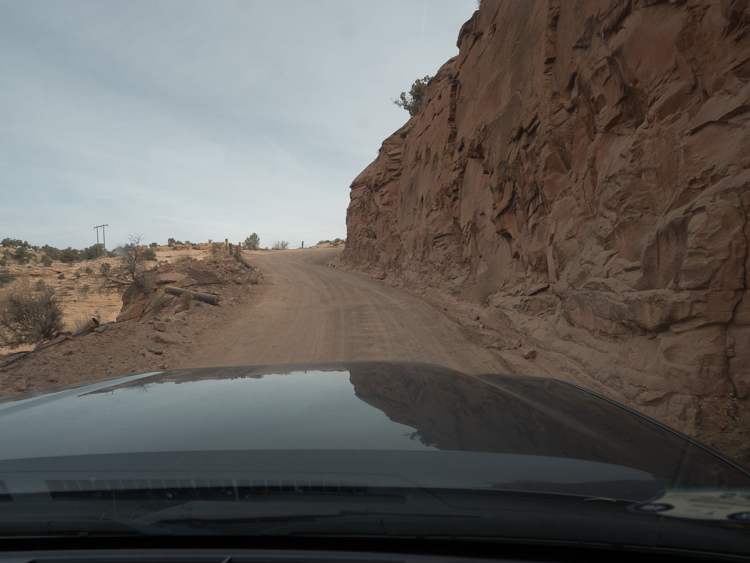
The roads back to the Navajo National Monument are interesting, to say the least. Mark got to briefly engage the 4-wheel-drive as we went up a steep gravel hill. Overall, they are not awful, but they have definitely seen better days. As we made it into the park, so kept seeing signs about not picking piñon nuts in the monument, which we didn’t really know was a thing. I suggested to Mark that it must be like pine nuts, not realizing that is exactly what they are. Apparently they are a very popular crop for locals on the reservation, but you are not allowed to pick them on federal land. They were very serious about it.
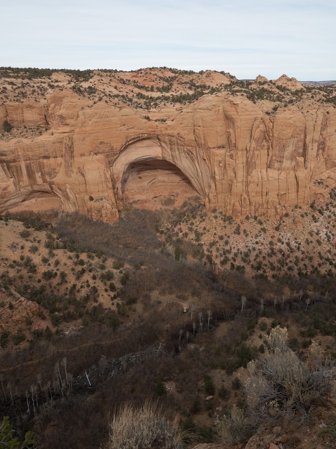
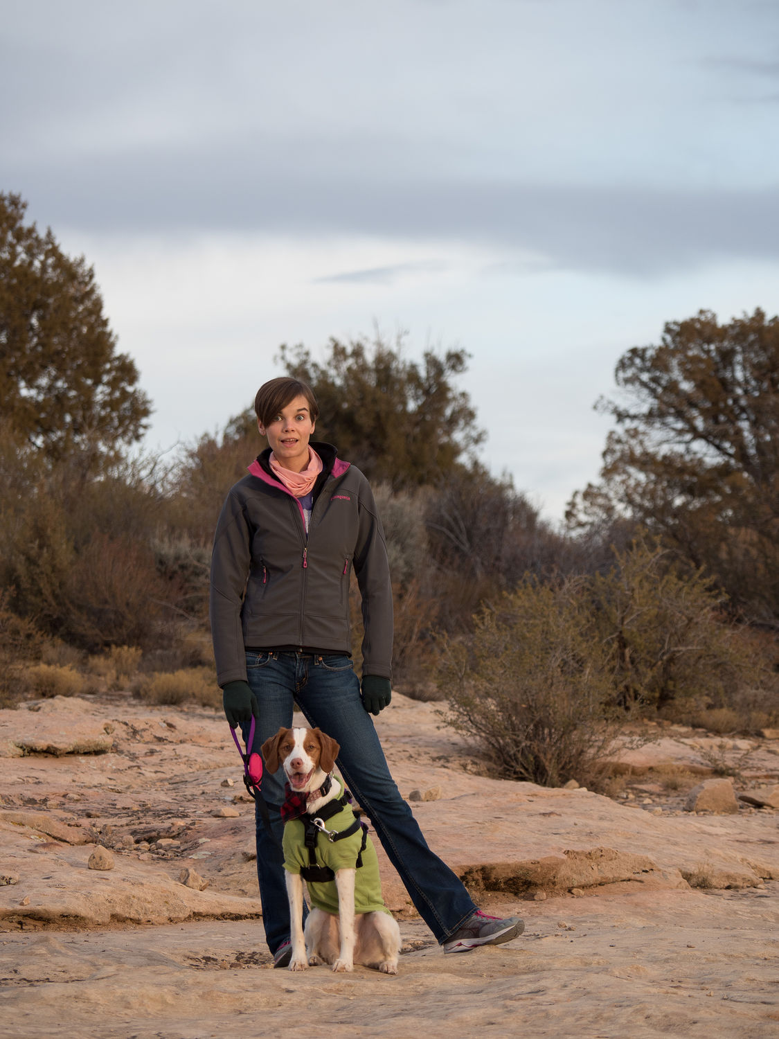
We stopped at the visitor center for the park, then took the mile loop trail around to see the closest cliff dwellings. We were only able to go to the overlook, where you can use binoculars (or your awesome zoom lens!) to see the dwellings in the distance. As I said before, I think you can take tours with the park rangers down into the cliff dwellings, and we definitely saw a trail down there, but we didn’t have time for that, and Ripley probably wouldn’t have been allowed to visit anyway. As it was, the whole family had a nice enough view of the cliff dwellings from the trail above, and Ripley had a great time on her hike along the mesa top.
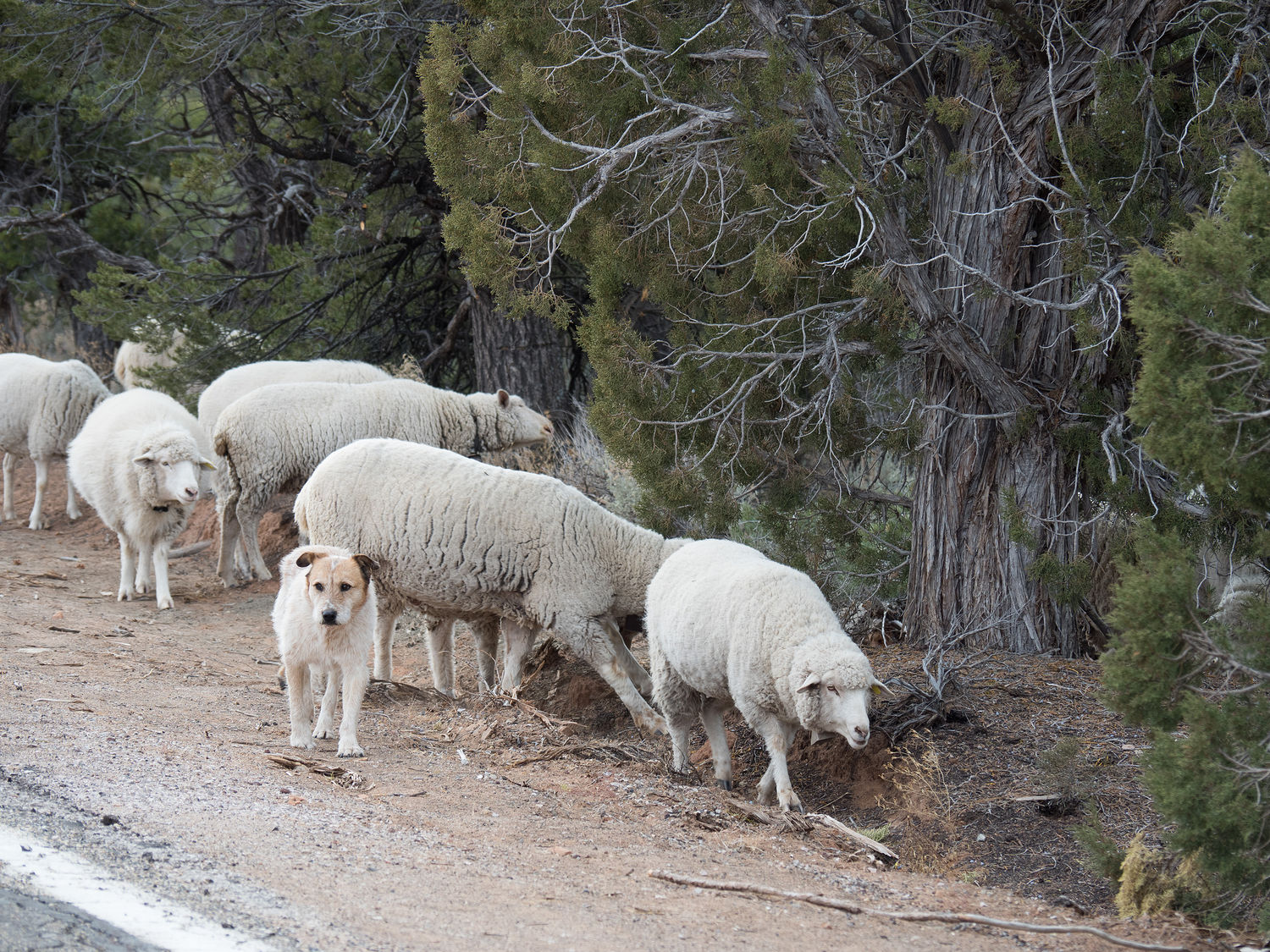
On our way out of Navajo National Monument, we spotted a dog with its herd of sheep. We don’t see that much in Texas, so we were surprised and pleased by the sight. The dog almost blended in with its charges so well that we didn’t spot it. The area around the monument is open range, and the dog was clearly taking the sheep, which were all wearing bells, out to graze for the day. He seemed to be pretty good at his job, too, because he kept the sheep out of the road as we went by. Such a smart boy.
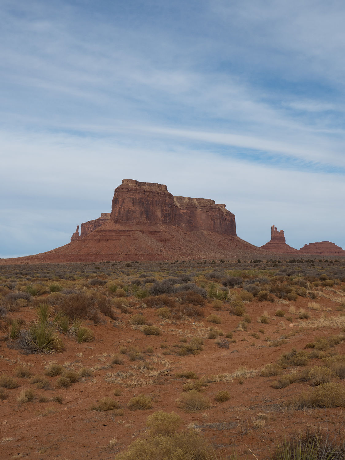
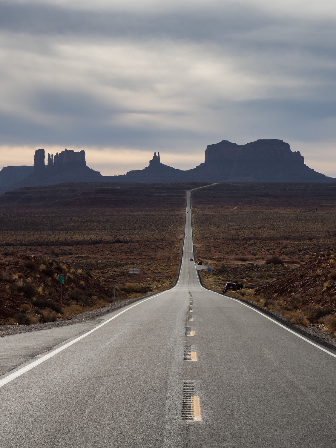
Once we were out of Navajo National Monument, our next goal was to drive through Monument Valley, which is on the border of Arizona and Utah. The park is in the Navajo Nation, so it doesn’t have a national park stamp, but it is pretty cool, nonetheless. Monument Valley is an iconic view of the American West, and if you think about it, I’m almost certain you can picture it, even if you’ve never been. I know you’ve seen it in a movie. It has its very own Wikipedia page just for listing its appearances in the media.
Neither Mark nor I had ever actually visited, though we have of course both seen it in pictures and movies, just like I know you have. It’s a neat place, with a flat, wide, open base and tall red sandstone buttes that jut up toward the sky. It reminds me a little of Colorado National Monument, which I suppose isn’t surprising, considering their proximity to one another. Still, it was worth the visit, even if all we really did was drive through.
We did stop on the way in and the way out to take a picture of the long, straight road leading into the valley, and the long, straight road leading out. These pictures are common, and they are often what you see of Monument Valley in the movies. Today was a particularly challenging day for the picture on the way out, with the sun right behind the peaks and the clouds overhead, but Mark did a great job catching it.
If you are wondering, yes, he did have to stand in the road for both of the pictures, just like dozens of other people at the little pull outs. There are even signs along the road to watch for pedestrians in the road, since this behavior is so common. I can’t say I approve, though we did get nice pictures from it.
With Monument Valley behind us, we were in a bit of a rush to get to our last couple of destinations for the day, since it was after 3pm and the visitor center at Hovenweep, one of our planned stops, closed at 5pm. We were even worried they would close a little early, since today is New Year’s Eve.
The roads to Hovenweep National Monument are really no better than the roads to Navajo National Monument. Most of the park is in Utah, but it is still in a portion of the Navajo Reservation, and the roads are not in good repair. That’s basically the story for this trip, I have to say. Poorly maintained roads are common in this part of the country. I wish the state or federal government (whoever’s job it is) would dump some money into getting them fixed.
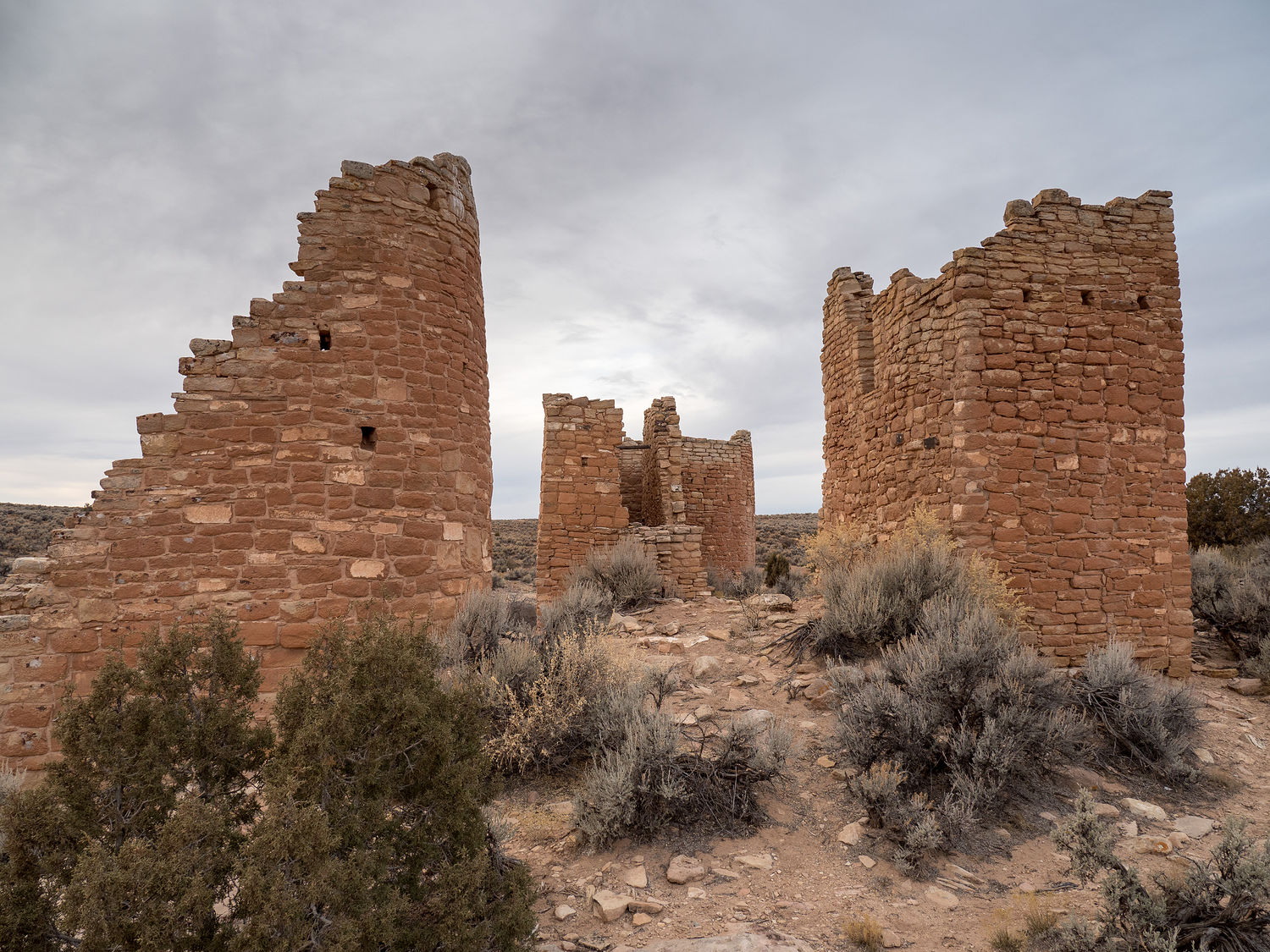
In any event, Hovenweep is another monument dedicated to Ancestral Puebloan Villages. The villages in Hovenweep are not cliff dwellings, but are instead free-standing towers and residential complexes. Much like the cliff dwellings in Navajo National Monument, however, the homes here were eventually abandoned around 1350, again most likely in response to a prolonged drought.
We finally arrived at Hovenweep just after 4:15, and we rushed up to find that the visitor center and still open, and the park was actually open 24 hours. I guess we aren’t very good at reading operating hours on the national park website, because we thought the park closed at sundown, which is perilously close to 4:15 this time of year.
Since the visitor center was still open, we were able to get a map and a stamp for our passport book. With that done, we unloaded the little Ripley monster from the truck to take a walk around a portion of the park to look at the ruins of the dwellings that remain. It’s a fairly long loop, and we did not have time to do it all, since it was getting dark.
We did manage to walk out to Hovenweep Castle, which is a particularly large ruin, and we saw several other buildings, including some very interesting towers along the way. As usual, Ripley had a blast wandering the trails with us, since dogs are much more likely to be allowed on the trails in any park in the National Park System that isn’t one of the 59 “National Parks.” It’s nice to be able to take her along.
Outside Hovenweep, we had planned to see some of Canyons of the Ancients National Monument, but the encroaching darkness put a damper on our plans. Winter can be such a hassle, right? Canyons of the Ancients is similar to Hovenweep, as it is home to several Ancestral Pueblos, but oddly enough it is operated by the Bureau of Land Management and not the National Park System, despite the name. That means no stamp, so I guess we didn’t miss too much, even if I still want to see it someday.
We were able to drive through Canyons of the Ancients, or at least a section, on our way over to Cortez, Colorado after we left Hovenweep. It wasn’t too interesting from the road, but I know there’s several other parks we need to visit in this area, and we will be back with more time to explore sometime in the future. From Cortez, we drove on into Durango and our hotel for the night.
It’s New Year’s Eve, so unsurprisingly, many things closed early for the evening, and it will be even worse tomorrow. We did manage to find an open Jimmy John’s for our dinner, which we ate back at our hotel room around 7:30pm. Did I say I was exhausted?
We should have plenty of time to run tomorrow, as we only have about 5 hours to drive for the day and everything will be closed, anyway. We are missing a couple of parks along the way because they are closed for the holiday. I’m sure we will be back, but it makes me sad that we have time to visit and just can’t. Looks like we will have to find some other way to entertain ourselves. Happy New Year!
– Trip Total : 1,375 miles –