– Watson Lake, Yukon Territory to Stewart, British Columbia –
We made it back into Alaska today. I know that sounds crazy, especially looking at our locations for today. But it’s true!
Mark and I got up early and walked Ripley through the woods this morning. It was raining, and the trail in Watson Lake still isn’t ideal (I mean, we can’t even run), but we made do. Ripley had fun charging through the grass and smelling the path. Even with the rain, it wasn’t too bad.
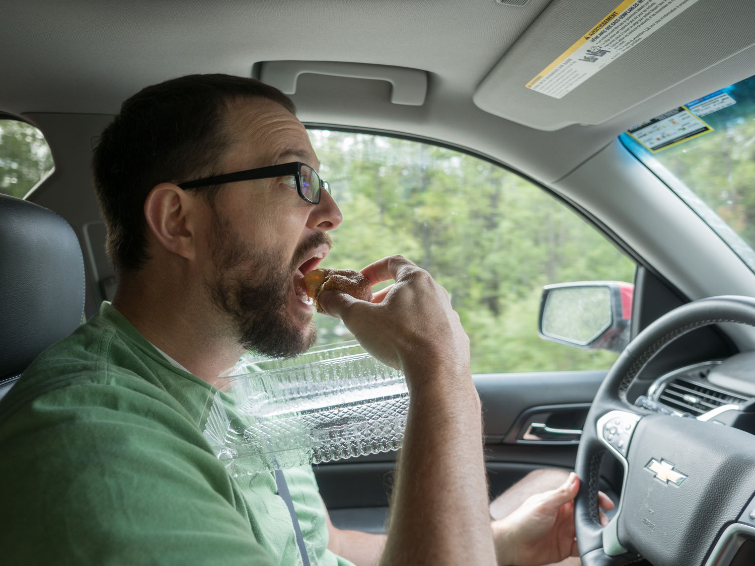
After we showered and packed up, we headed over to the local grocery store for breakfast, just like the last time we visited. Mark and Mom got the donuts that they’d been dreaming of since our previous visit. Apparently they are really good. I wouldn’t know. Cake donuts are not my jam. I like the bread-like ones.
Now that we’re all clear on my donut preferences, I’m sure we can move on. We followed the road out of Watson Lake. It was another foggy and damp morning. We had to stop at some construction, and Mark managed some decent photographs of the scenery during the lull. He was much more willing to get out of the Suburban that I was today. It was almost too cold for me.

I read quite a bit this morning, and we moved through our book at a steady clip. I don’t think I’ve mentioned it before, but now we are reading Deception Point, again by Dan Brown. I brought a box of books that I thought would appeal to everyone and we make a group decision on what to read. I’m sure we will finish this one and at least one more before we make it home.
Our first real stop of the day was in Jade City. There is practically nothing in Jade City except jade mining. It has a gift store, a gas station, and a cafe. They’re all named something related to jade. They were even cutting giant rocks of unpolished jade outside the gift store.

The place was actually pretty interesting. They made beautiful jewelry and figurines, and it was neat to watch the men outside cutting up the big stones. Mom found a ring that she couldn’t live without, and Mark was eyeballing a giant polished sphere of jade. The sphere was way out of our price range. All of it was expensive, I have to say. As someone who doesn’t do much shopping for stuff like that in general, I can’t tell you if the prices were reasonable for what the items were or not. Still, we had a good time looking around.
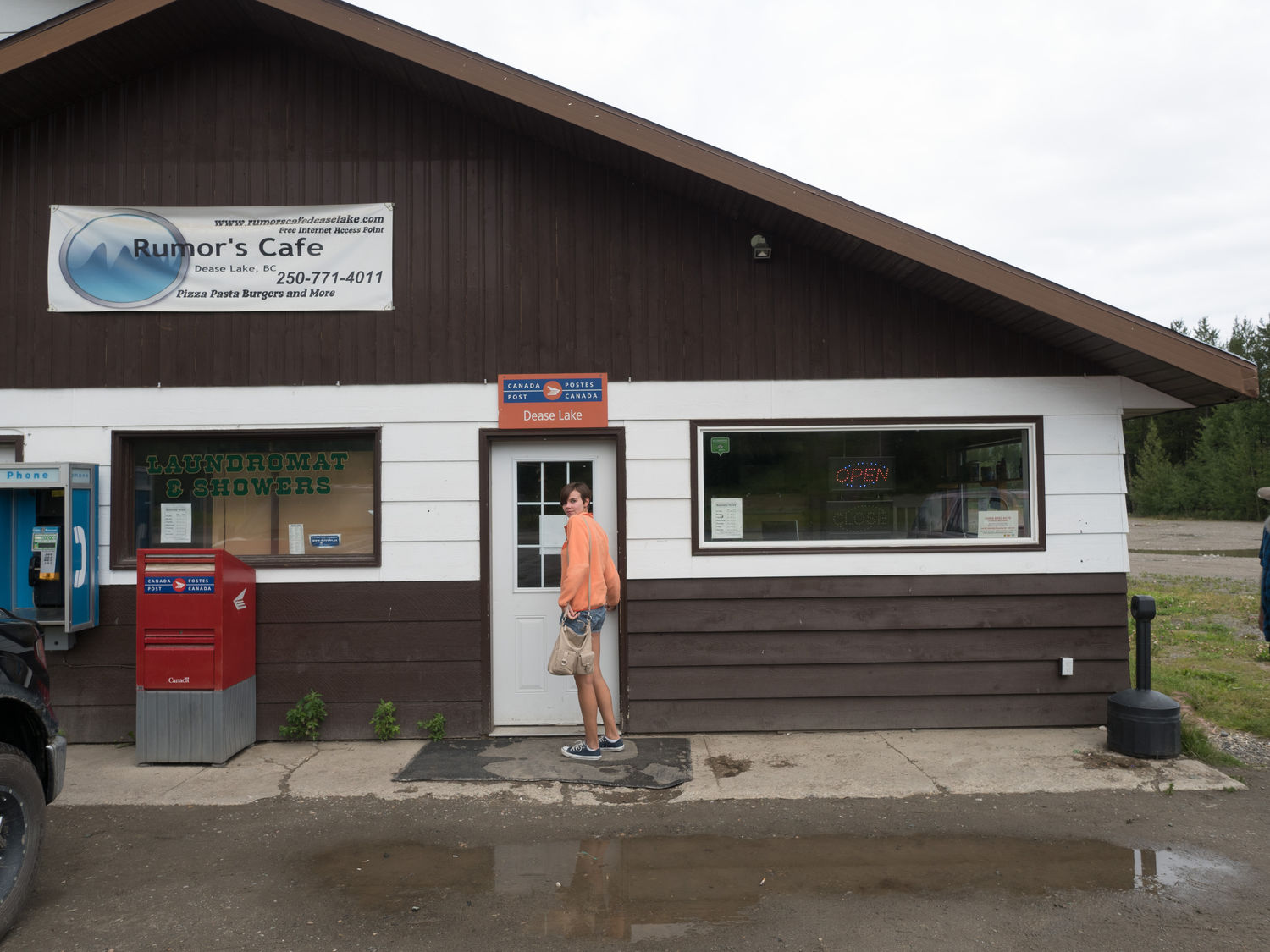
We didn’t stop again until just after lunch time, and everyone was getting hungry. The gas station we visited in Dease Lake was right next to a building that housed a cafe, laundry, showers, a post office, and several other local amenities. We decided that we’d eat there, since we didn’t expect to get many other chances, and it was still raining a little. We didn’t want to get wet trying to have a picnic.
The cafe was fine. My parents really enjoyed their pulled pork sandwiches. They managed to get basically everyone’s order at least slightly wrong though. Mark and I had grilled cheeses with tomatoes and a side salad (he acutally ordered potato salad, so there’s that). The side salads were pretty gross. It was several days old caggage and iceberg mix with prepacked Kraft Italian dressing packets. At least I got some vegetables, I guess.
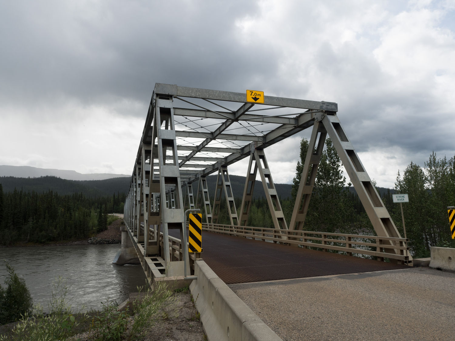
Outside Dease Lake, we pulled off so Mark could get some pictures of a local bridge. I won’t say he’s a bridge fiend (but he totally is). It was neat. We saw several like it later in the day. They are a bit like tunnels made up of a metal cage, if you know what I mean.
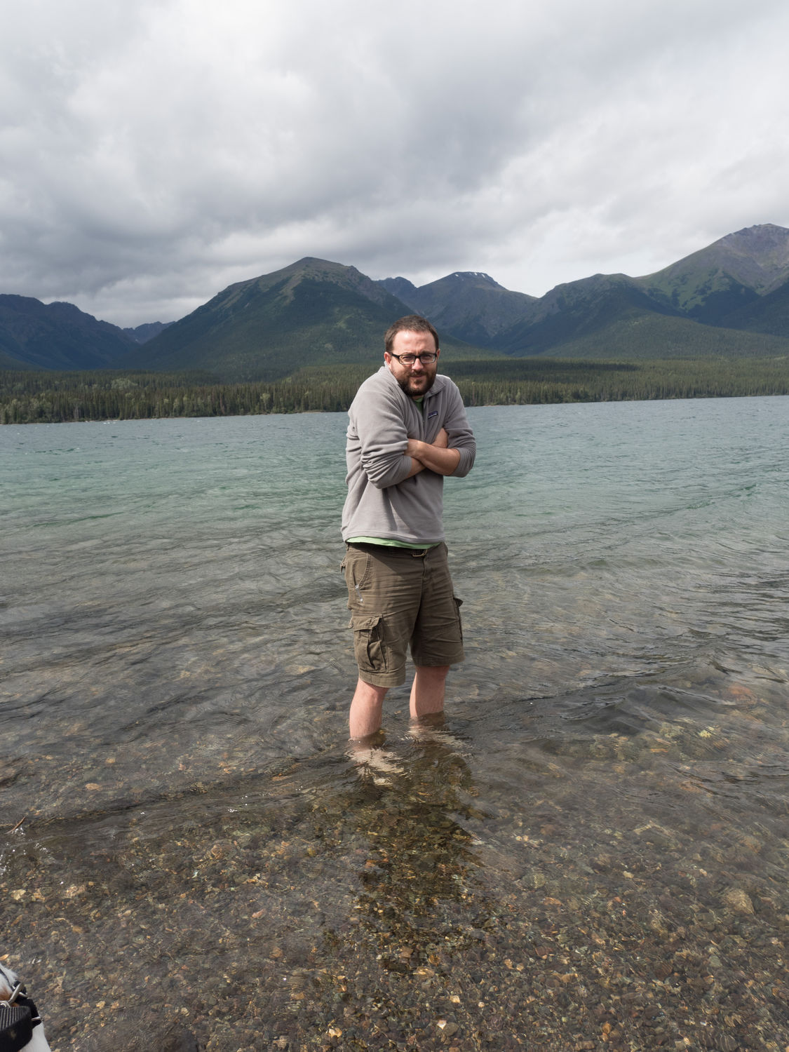
A bit later, past the town of Iskut, we stopped at a Tatogga Lake. Everyone got out of the car to stretch their legs and take some photographs. The view was spectacular (as so many of them are up here), and the lake was crystal clear. Mark promptly took off his shoes and walked in up to about his knees. He looked very cold, and the rocky shore hurt his feet, but I still think he had fun. He might be crazy, though.
Ripley was into it to, though. I walked her down towards the water and she immediately plowed in. The cold didn’t seem to faze her, because she kept trying to go in a little deeper. Maybe she wanted to go for an icy swim. Being the mean puppy parent that I am, I wouldn’t let her get any deeper than about mid-leg. She doesn’t know it, but she was much happier being dry.
She had a lot of fun splashing up and down the shore, and she didn’t get out until well after Mark had already retreated to a nearby picnic table to shiver and dry his legs off. She’s like a kid. You can’t tell her the water’s too cold. She’ll want to play in it anyway.
We made another stop at the Bell 2 Lodge a little further up the road, since the lake didn’t have any facilities. The lodge has a gas station and a cafe, but it is primarily a winter lodge. Are you curious why anyone would be open in that area in the winter? We were. It turns out their major business in heliskiing. They mostly stay open in the summer to keep the gas station running.
Things there were pretty expensive, and Mom was outraged by the price of a chocolate bar she wanted to get while we were there. They sold expensive cold weather gear (like Marmot and others) with their logo embroidered on the chest. Even their chapsticks were expensive.
From there, it wasn’t too far to the cutoff that took us out to Stewart. Stewart sits on a fjord that stretches 90 miles from the town to the ocean, according to The Milepost. It has a deepwater port, which I find interesting for such a narrow channel.
Our hotel was called the Ripley Creek Inn, and we made lots of jokes to each other and the owners about Ripley getting to stay free. We should’ve gotten a picture of her with the sign, but we totally forgot.
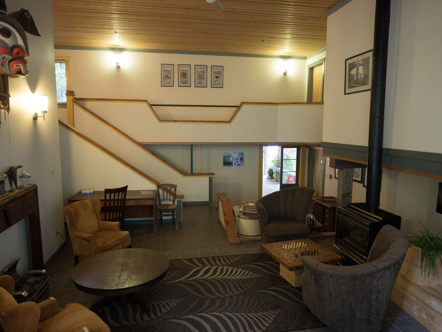
The hotel itself is adorable: the cutest we’ve been in, I think. It is made up of several small, very old buildings set on either side around a little, curving gravel road. One of the buildings used to house the town brothel. When we booked the room back in May, they asked if we wanted to stay in the brothel, but we declined.
The room was huge, and had soft beds and a table and dresser. The bathroom was great, and we had a giant window that looked back on two old tug boats. We also had a deck with a table and chairs. It was a great little place. I would stay there again in a heartbeat.
Now I bet you’re wondering, when did you get back into Alaska, exactly? Well, Stewart is right next to a town called Hyder, Alaska. The only way to get to Hyder is through Stewart. It is even in the same timezone as Stewart, unlike the rest of Alaska, which is an hour earlier.
Both towns have a gold mine, which I can only imagine is why Hyder exists in the first place. Otherwise it seems like a really strange place to put a U.S. town. Technically we weren’t far from Juneau and Ketchikan, but there was no reasonable way to get there without a personal boat.
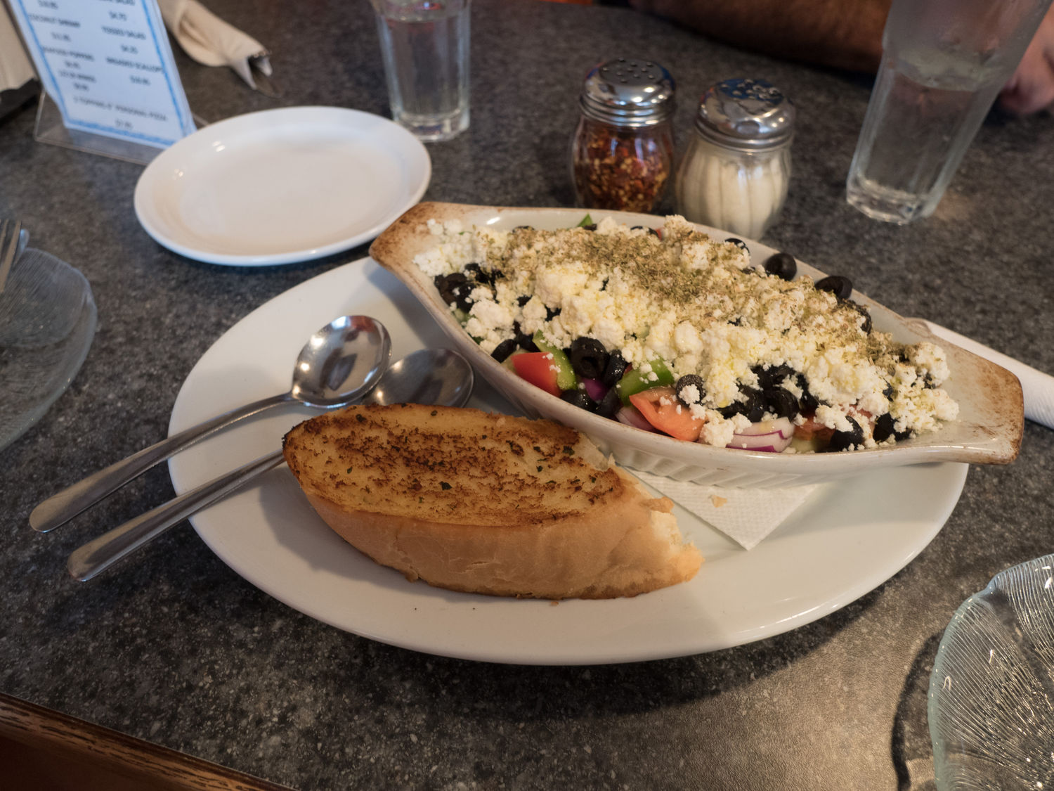
Since we wanted to visit Hyder, we headed across the street from our hotel and grabbed some pizza for dinner. That was fantastic too. Mark and I started with an authentic Greek salad (you know, without lettuce), which more than made up for the terrible salads from lunch.
It was pouring rain by this point. Stewart is a very wet place, as far as I can tell. We hoped the rain would let up soon, but there wasn’t much we could do about it. We only had so much time to spend in the town.
Once we’d eaten, we headed down the road into Hyder. There’s no border crossing into the U.S. there, but to get back, you have to go through Canadian customs. I guess all of the people that live in Stewart and Hyder have a passport.
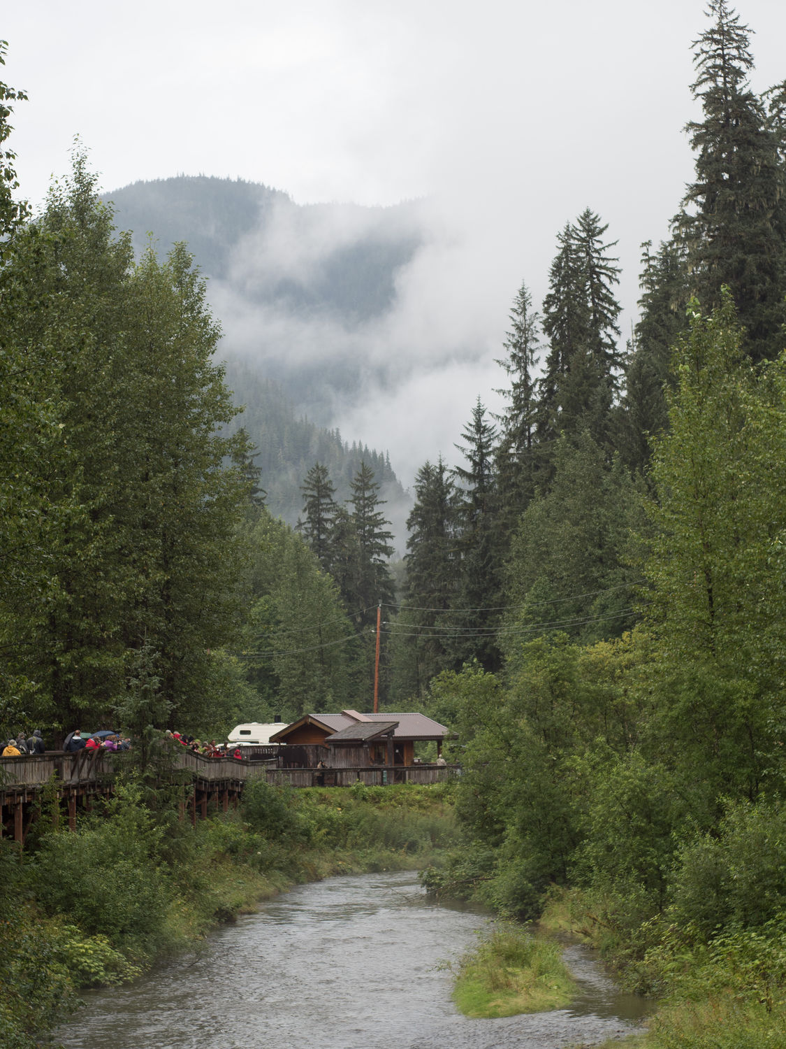
Just past the town of Hyder is the Fish Creek Wildlife Observation Area. This spot is meant to view bears(!) eating salmon from the river below. We stopped and parked our car. The signs were a little terrifying.
“Walk only on the deck!” they all said. There was a fenced and gated wooden walkway that lead from each parking area up to the obeservatin area. Other signs said, “Watch for bears crossing road!” and “Do not leave deck!” We took them very seriously and tried to stay in the walkways.
Entry cost us $5 a person, and they wouldn’t take our national parks annual pass. I guess, since the area was run by the forest service, they were allowed to do whatever they wanted. Whatever. We got our money’s worth.
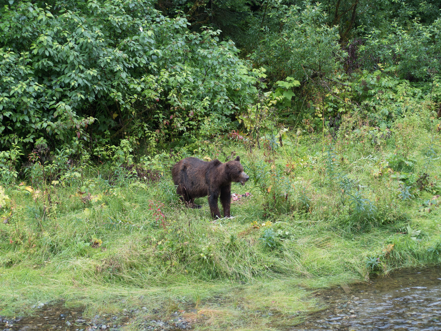
From the fee area, we walked back to a raised platform that look over a creek. We could see the salmon below struggling to swim up the stream. Just a little ways down the walkway, we saw our first bear.
The bear was sitting on the bank of the creek, chewing on a fish. We watched him and took photographs, shocked that it had been so easy. No waiting. No searching. There was a bear waiting for us.
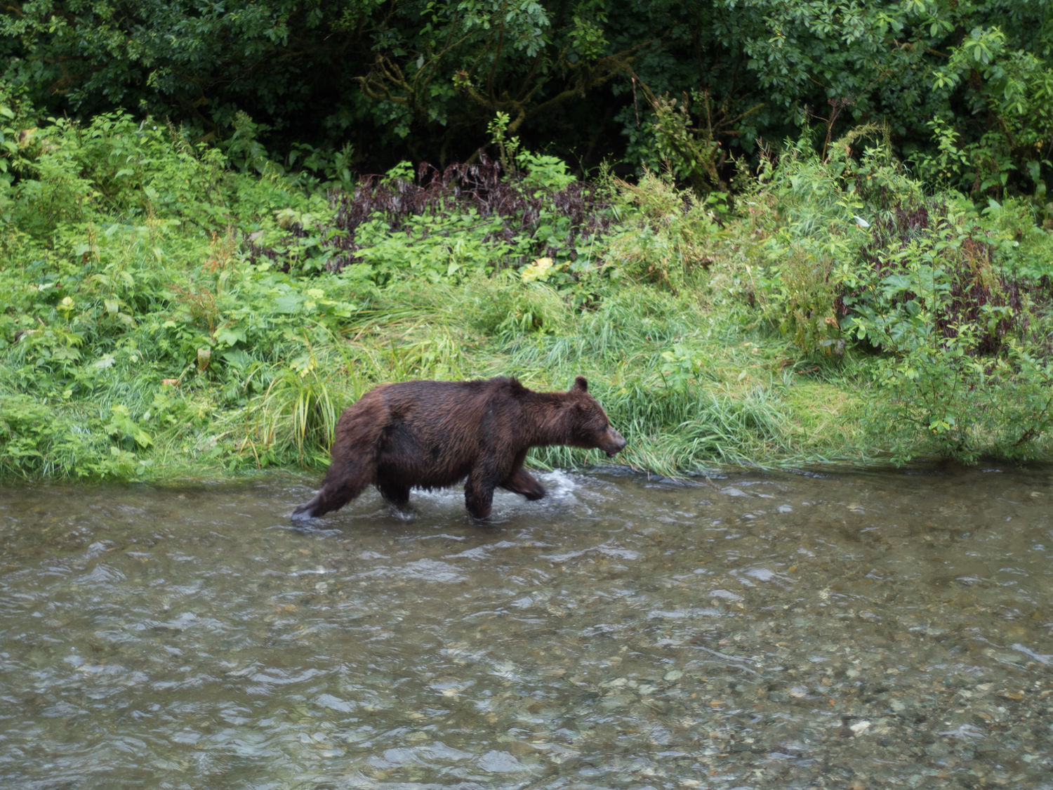
The bear’s jaw appeared to be broken in part, as part of his lip and what appeared to be a few teeth dangled from his lower snout. I felt a little bad for him, but he seemed to be getting him salmon down okay, and he looked pretty fat, so he can’t be doing too badly. Still, I doubt it feels great.
After a while, we saw another bear down at the other end of the platform. We hurried down to that end and watched this new bear splashing through the creek, looking for fish. Mom actually got a video of that one catching a salmon. It’s a pretty impressive shot.
The previous bear had finished eating by that time, and we took more pictures of him walking down the creek and past the viewing platform until he was almost out of sight. By that time, we were cold and wet, despite our hats and rain jackets, so we piled back into the car.
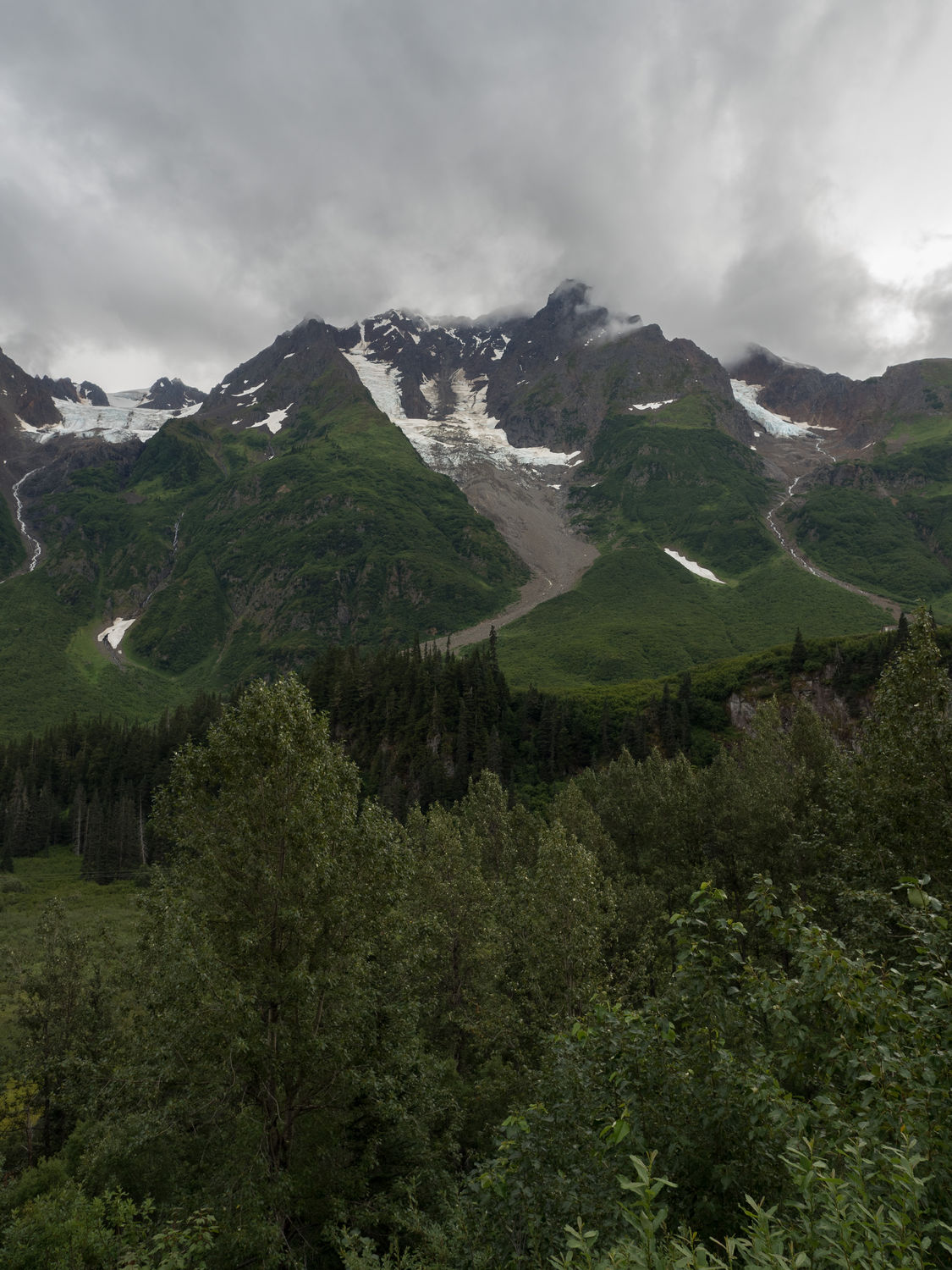
Mark wanted to drive up to Salmon Glacier, which was only supposed to be a few miles up the road. Once we got going, we realized the road turned into dirt. We weren’t too worried. Sure, it was getting foggier and it was still raining, but it shouldn’t be far back to see the glacier, right?
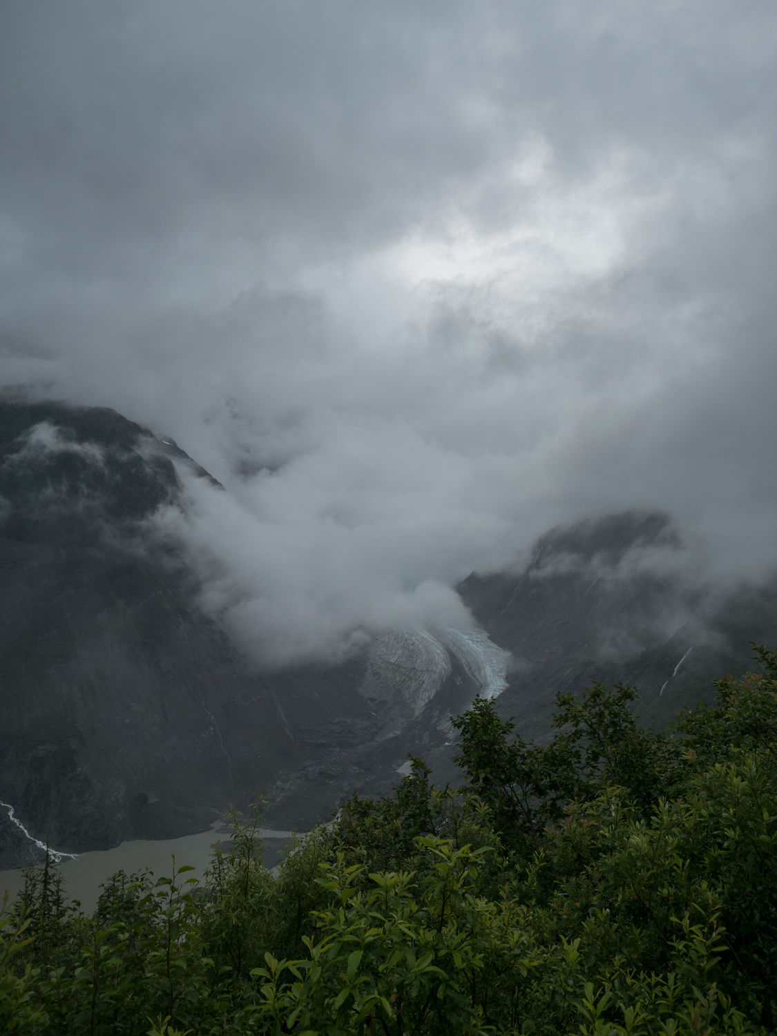
The roads got worse as we ascended the giant mountain we were apparently driving up. From the photograph in the brochure we were looking at, we thought the drive was going to take us to the foot of the glacier. Boy were we wrong.
We twisted up a mountain on slick gravel and through massive fields of pot holes on roads too narrow to really turn around. At first we joked about it, but then we realized that it was a little scarier that our jokes warranted.
Before long, we were all silent, Mark gripping the steering wheel and Dad refusing to look out of the window of the car. We made it all the way to the top before we realized we’d missed the glacier viewing area by 5 miles! We were at the summit.
Mark and Mom hopped out and took some photographs. Dad and I looked at the fog and the height and said, “Nope, too scary for me. You go ahead.” We turned around in the little parking area there, cold and understandably anxious about the descent and wondering how we’d missed the glacier. Weren’t we supposed to be able to park at the toe? They’d gotten photographs of it from the summit, where you could see it in the valley below. Had we missed a road?
On the way back down, we found the sign that marked where we were supposed to stop to view the glacier. It definitely wasn’t at the toe. Our brochure was very misleading. In fact, you couldn’t even see the glacier from the “Salmon Glacier View Point.” All I can say is, we didn’t die, and it was certainly an adventure. Next time maybe we won’t drive up the scary mountain in the fog to look at nothing.
We finally made it down the mountain and back into Hyder. At the Canadian border crossing, we chatted with the border patrol agent about our future stay in Hope, B.C., and he told us the place was terrible and we should stop somewhere else. It was hilaious, but the hotel is already booked. Hope, here we come. You come highly unrecommend by the Canadian border patrol. By the time we made it back to our hotel, it was nearly 11pm.
We’ve decided not to run in the morning. I don’t really want to go out there with the bears. I’ve had enough close wildlife encounters for the month, really. Now that I know the bears are out there, I will be staying inside my nice, cozy hotel room. I feef bad for Ripley, but again, she’s happier not being eaten by a bear, even if she doesn’t know it.
– Trip Total : 7,338 miles –