– Grand Junction, Colorado to Vernal, Utah –
I know I’ve called this our Colorado trip, but tonight we are actually spending the night in Utah. Don’t be shocked, now, we aren’t too far from the border. Tomorrow night we will be safely back in the state the trip was named for, though only for 2 more nights. Thursday night we are in Steamboat Springs, and Friday night we’re in Silverthorne. After that, it’s down to Santa Fe for Saturday night, then home to Denton on Sunday. It feels like the trip has practically flown by!
We started our morning at 6am today with a run down the Colorado Riverfront Trail. It’s a long, well-paved trail that runs parallel to the highway on one side and the Colorado River on the other. It isn’t perfect- sometimes you are close enough to the highway to breathe the smog, the distances are poorly marked, and there’s practically no shade. However, it is wide, easy to follow, and as I said before, smoothly paved. That’s more than we’ve had in other places, so I’m grateful for it, even if I wasn’t too enthused with its proximity to the highway.
Around 8:15am, we grabbed our delightful La Quinta breakfast, then packed up our room and our puppy to be out of the hotel around 9am. Our first stop was a gas station for fresh ice for our cooler and our morning tea before we were off to our morning destination today.
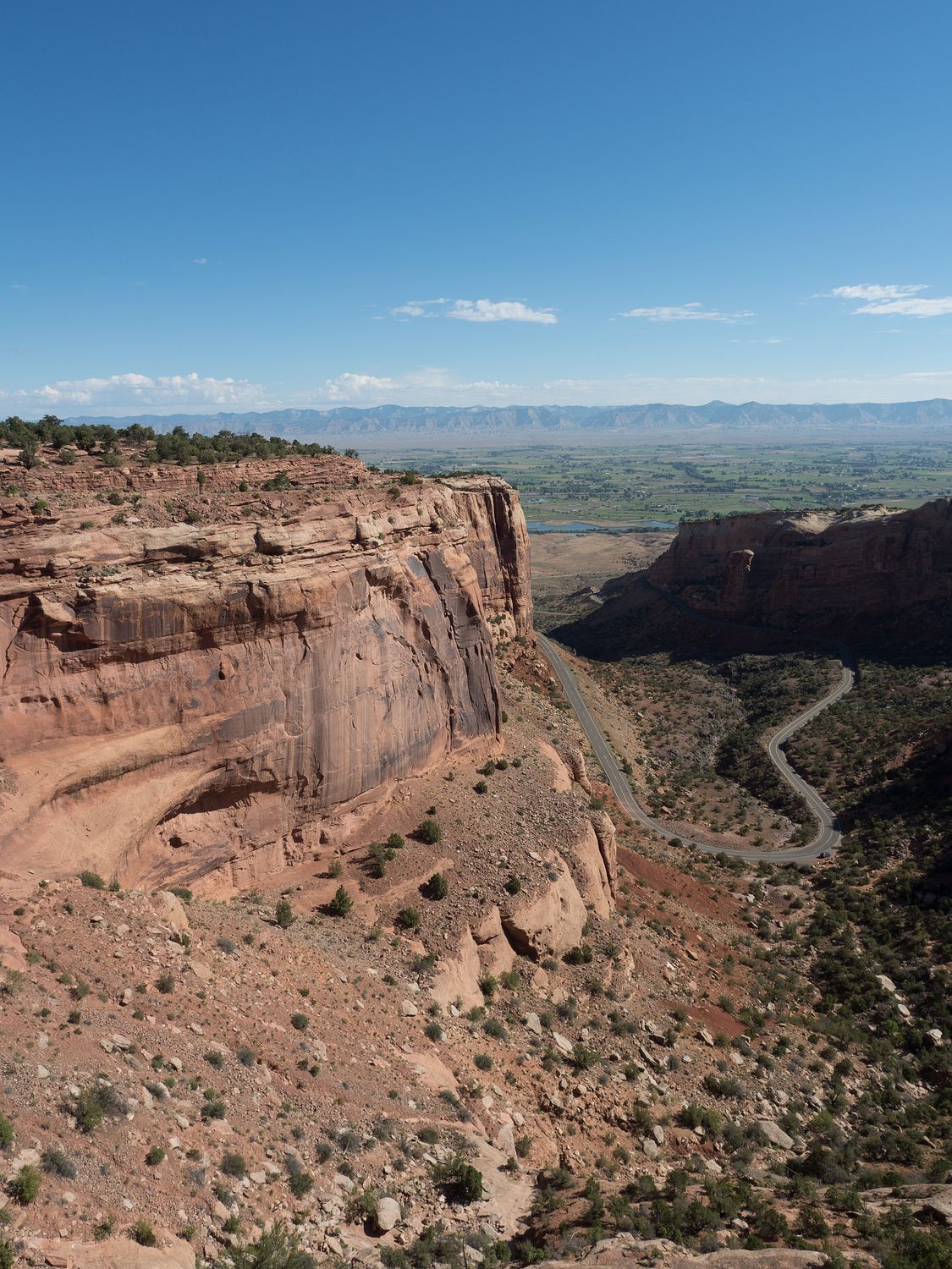
Have you ever heard of Colorado National Monument? I hadn’t really, until doing a little research about what national parks were here in Colorado for this trip. We wanted to make sure we weren’t missing any that might be interesting to see, and Colorado National Monument caught my eye because it listed a “scenic drive” as one of its primary assets. We love scenic drives, if you hadn’t guessed, and I’l really glad we didn’t miss this one. It is pretty awesome.
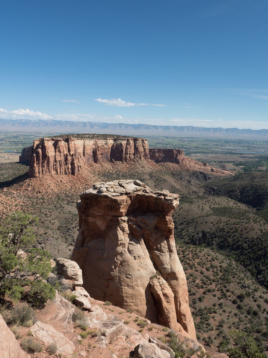
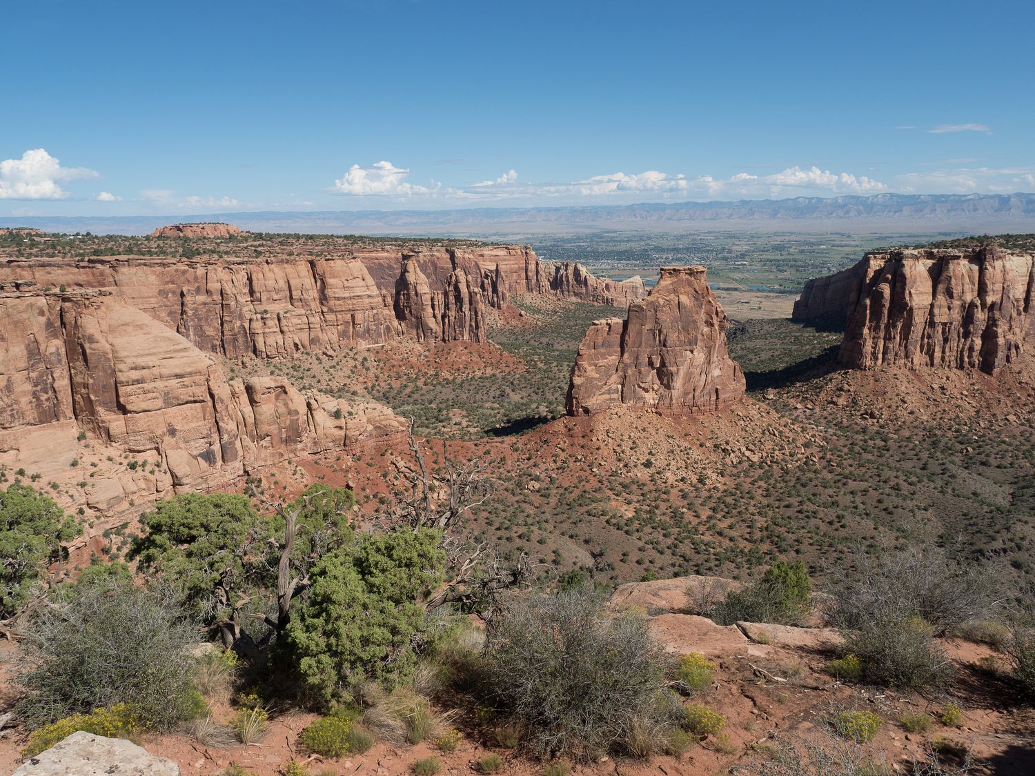
The monument is basically a big, 23 mile loop off of Highway 340 called Rimrock Drive. It covers about 31,000 acres of particularly spectacular canyonlands. We started on the end near Fruita, with the goal of ending back in Grand Junction for lunch.
There’s a visitor center at that end of the park, which we weren’t expecting, but were glad to find. We stopped in for a look around and a stamp in our stamp book. In the end, we actually bought a new stamp book instead. I am sure you’re wondering why, so I’ll give you the short version.
We originally bought our book in 2012. Each year, the National Park Services releases a sheet of stickers from the parks for that year. The passport book has a place for each sticker, and has 5 of these places. That means that after 5 years, you’ve run out of places to put the yearly stickers. So, even though we haven’t filled up our book with stamps, we bought a new one to for this year’s set of stickers, and will use that one from here on out. The other will relocate to a storage shelf, like a completed journal.
After the visitor center, the national monument has a series of pull-offs to look down into the canyon below. Most of the park looks down on Monument Canyon from different vantage points, but you eventually turn a corner and the geology of the area seems to switch to something else entirely. The color of the rock certainly changes from a deep, dark red to an almost greyish-yellow with tiny bits of red mixed in, and bushes growing up the sides. It’s a startling change.
We really enjoyed our visit to Colorado National Monument, and it doesn’t take long at all. If you don’t stop much, you can make it through the park in about an hour. It took us about two hours, with all of our looking around. I really enjoyed it, and can’t recommend it enough. It does have a somewhat higher entrance fee than a lot of other national monuments ($15 per vehicle), but we had our national parks pass, so we didn’t pay anything. It’s worth the $15, even if you don’t have a pass.
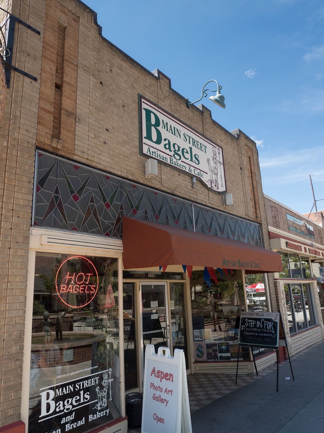
Our road came back down into Grand Junction about 11:45, and we decided to get lunch at a local bagel shop that was near the courthouse, since Mark wanted to stop there for some photos. It took forever (and by that I mean about 20 minutes) to get our sandwiches made, and even then they didn’t bring them out “to go” like we’d asked, but we finally managed to get away and eat them by about 12:30. They were great sandwiches, though I’m not sure that they were good enough to justify how long it took us to get them.
With that, we were done with Grand Junction and drove back into Fruita. We took Highway 139 due north from there toward Rangely, and the Colorado-side of Dinosaur National Monument, which was our next destination for the day.
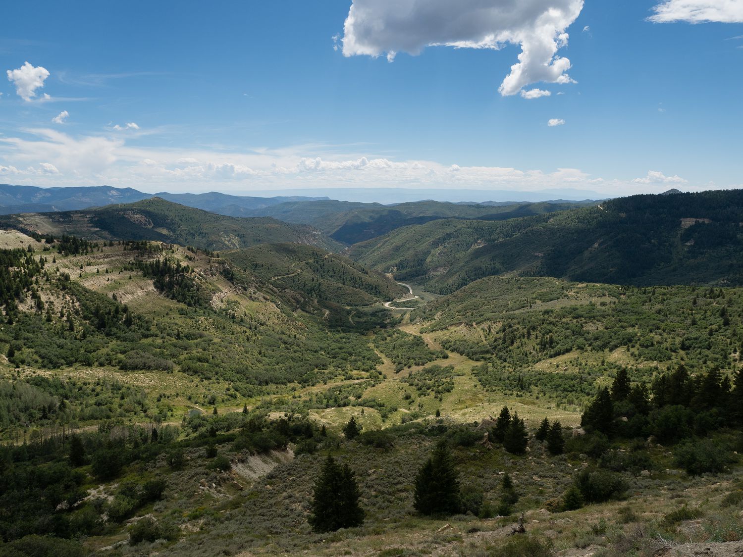
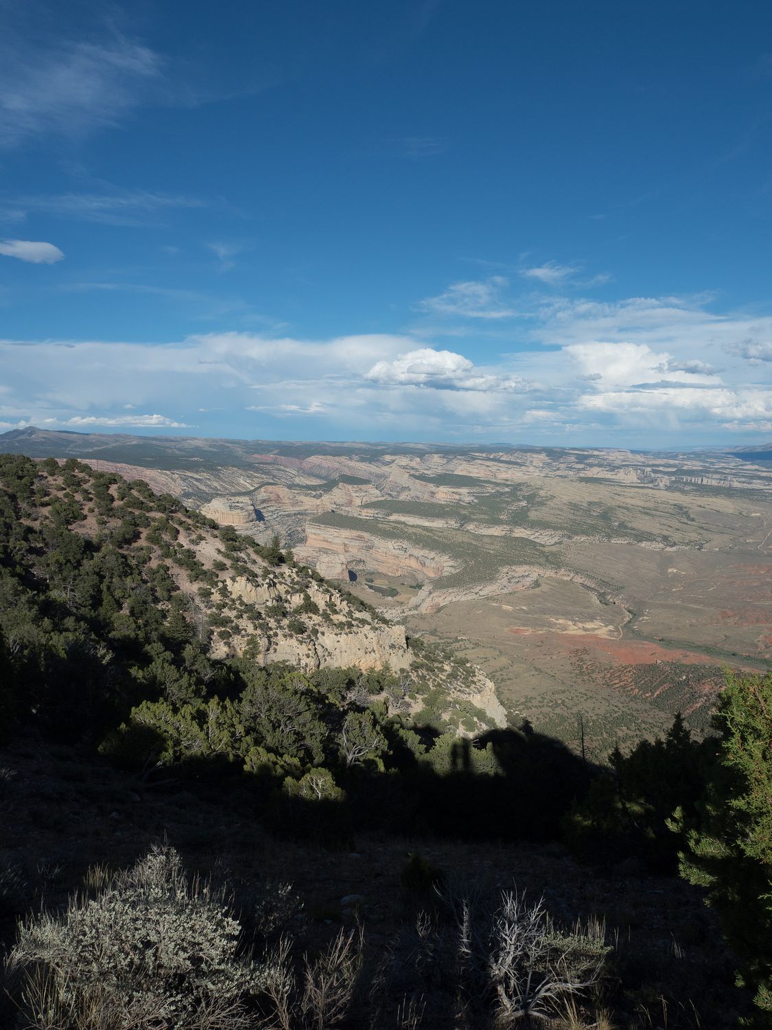
The road between Fruita and Rangely is at times boring, and at times lovely. We passed through several changes in climate, and nothing else. It’s 72 miles of absolutely nothing but nature and road.
The most spectacular views are from the Douglass Pass area, which summits at about 8,200 feet and looks down on vibrantly green fields like you see in the photo above. I don’t know that I would want to travel the road frequently, since it is so remote, but it was certainly nice to visit, given the scenery.
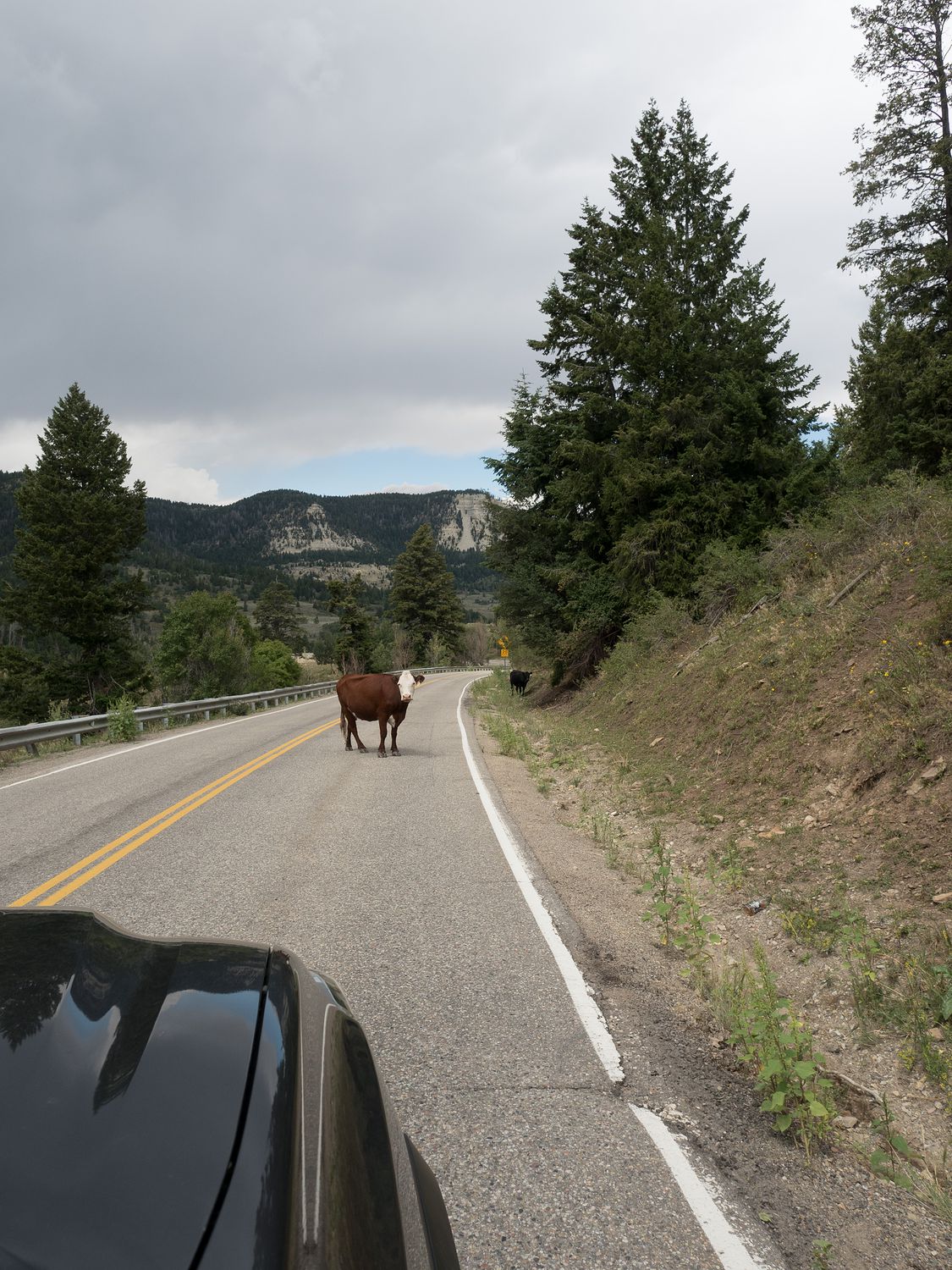
Along the way, we saw several signs warning of cattle potentially crossing the road. Now, I’ve seen lots of animal crossing signs, and I’ve seen deer, moose, elk, sheep, bison, and several other things hanging out in the middle of the road somewhere around a sign pointing out that they might be in the area. But I’ve never seen a cow in the road.
Today, I finally saw it. We were coming down from a peak and had just made our way around a corner and there she was, standing without concern in the middle of the highway, her friend watching from the road’s edge. She was totally uninterested in us, or in our need to get by her on the road. Only a little shouting and a bit of honking got her out of the way, and she seemed offended that we’d even asked. I hope no one hit her after we went past. She was a big girl.
Finally, we made it to what you might call “civilization” in Dinosaur, Colorado, around 3pm. There’s not much in Dinosaur, though you can tell they dreamed of it being more. The problem for the town, of course, is that the Colorado side of the national monument is the least visited side. The Utah side has the Quarry, which we will be going to see tomorrow, where you can see partially excavated dinosaur bones still in the cliffside in which they were found.
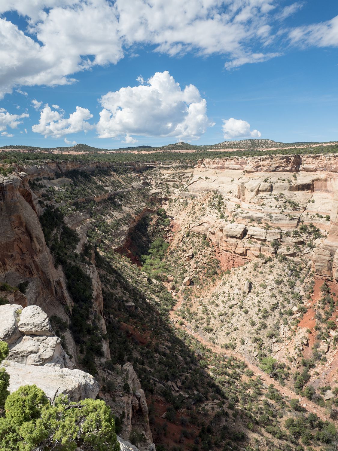
The Colorado side of the monument has a couple of canyons and a river, along with several dirt road tracks and campsites. It’s much more remote, and contains almost nothing related to dinosaurs, save for the fossils that almost certainly exist somewhere in the surrounding rock. The region has what’s called the Morrison Formation, which is a particular layer of sedimentary rock that’s dated to the Jurassic period. The Morrison Formation covers parts of Utah, Wyoming, and Colorado, and is considered the most prolific site for dinosaur fossils in North America.
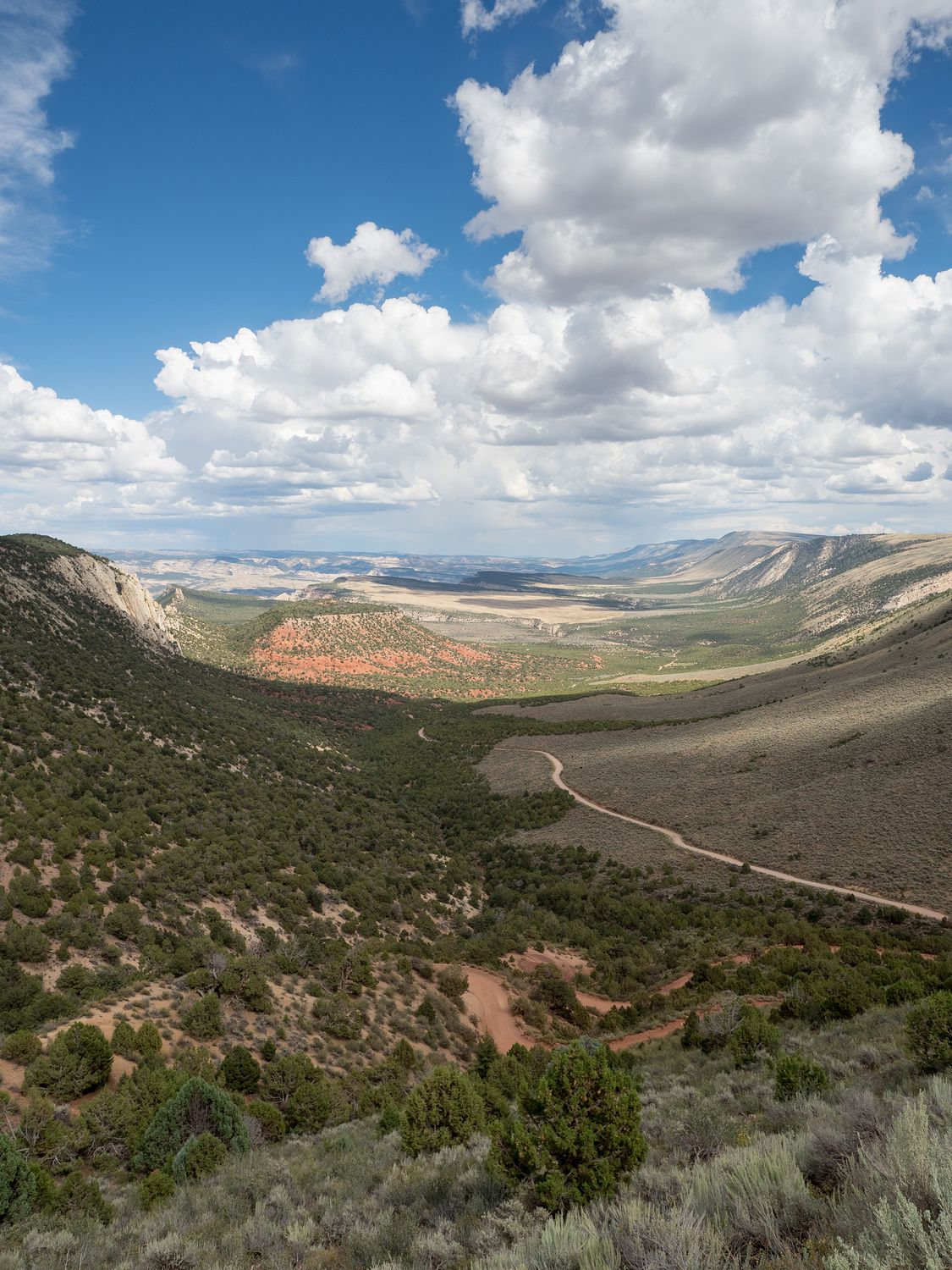
I have to say, we came to the Colorado side of the monument for the 4×4 roads, I suspect, though Mark would never admit it. From the town of Dinosaur, it’s only a few miles to the national monument’s Canyon Visitor Center, where we stopped to take a look around, get a stamp, and find out about the road conditions. Apparently the dirt tracks are not passable even with a 4-wheel drive in the rain, either from mud or from river flooding. Take your pick.
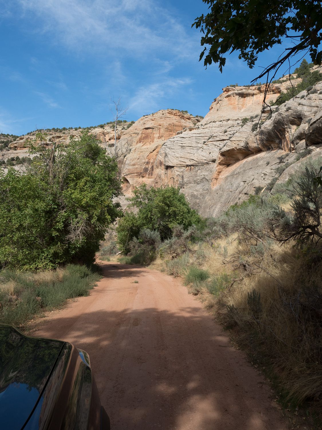
We were told conditions were great, people had been using the roads all day, and to enjoy ourselves. taking the advice to heart, we turned our Tacoma north and took Harpers Corner Road about 24 miles up to the actual entrance to the national monument (though technically they operate the road, so all of it is officially theirs). From there, we turned off onto Echo Park Road.
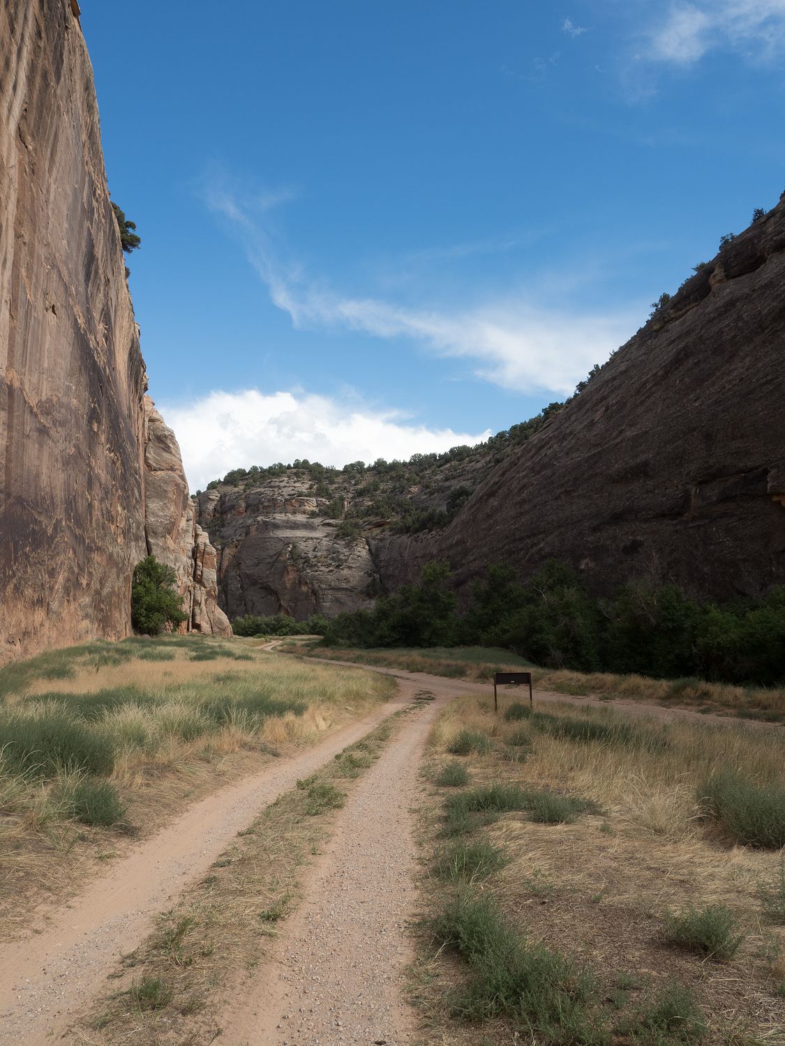
Echo Park is a campground down in the canyons in the national monument, as well as a boat launch site. It sits at the very bottom of the canyon, next to the Green River and the Steamboat Rock. It’s about 13 miles from the main road down Echo Park Road to the campground, and it takes about an hour to traverse, considering the condition of the roads. They technically allow non 4×4 vehicles down the road, though only high-clearance vehicles are permitted, and we only saw 4x4s on our drive. We only used 4-wheel drive once, though, and that was to climb back up the steep gravel road into and out of the canyon, so our wheels didn’t slip as we ascended. We probably wouldn’t have had to have it, but it felt nice to have it and not need to worry.
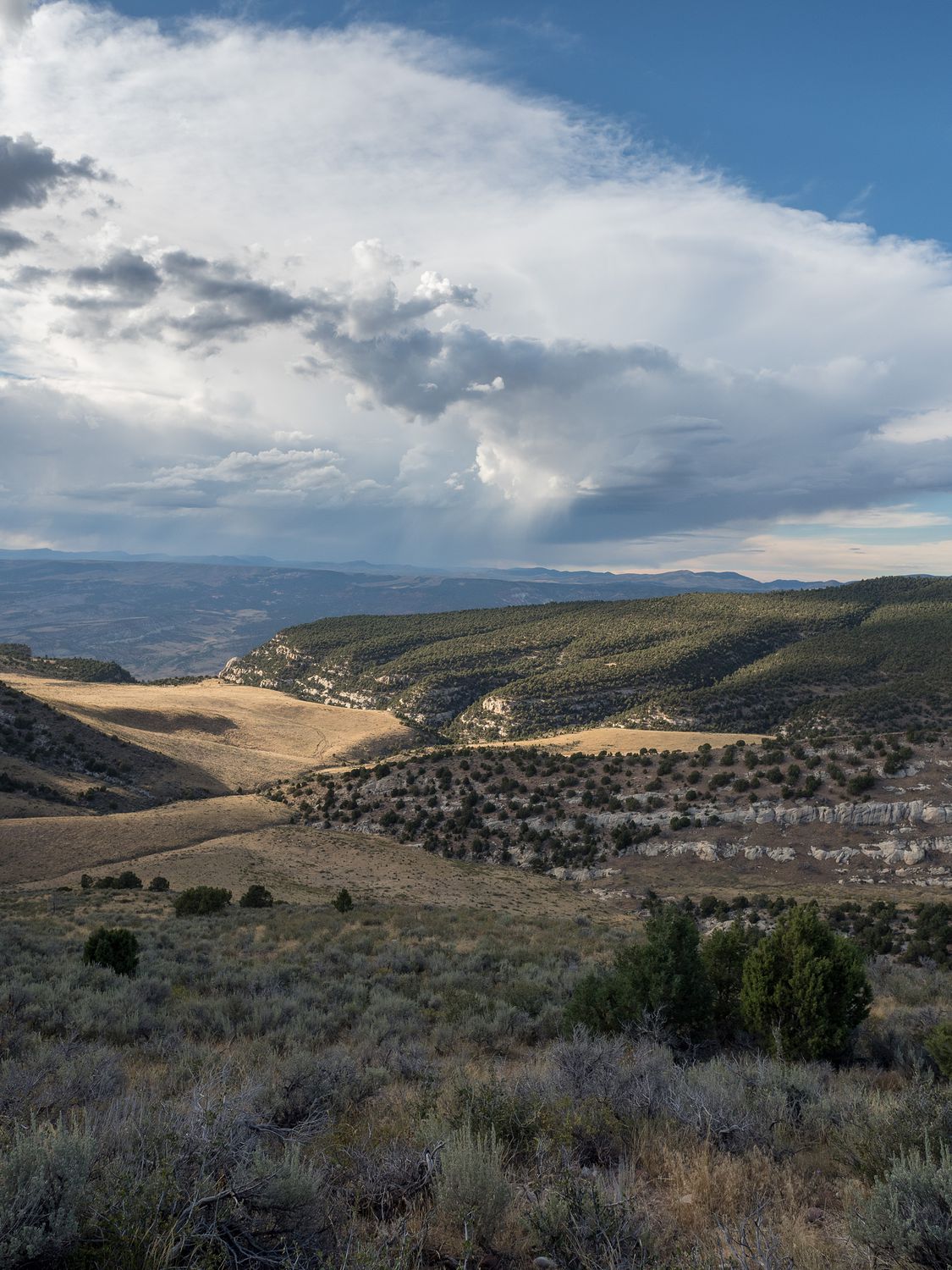
Most of the road is pretty empty, rapidly descending into a portion of the canyon at first, then driving through a flat, grassy section, then dropping again down to river level, where you have to cross several low water-crossings to get back to the campground. Portions of the road a washed or rutted out in places, and a few places are covered in soft sand. It’s not a bad road, but something to consider if you’re ever visiting.
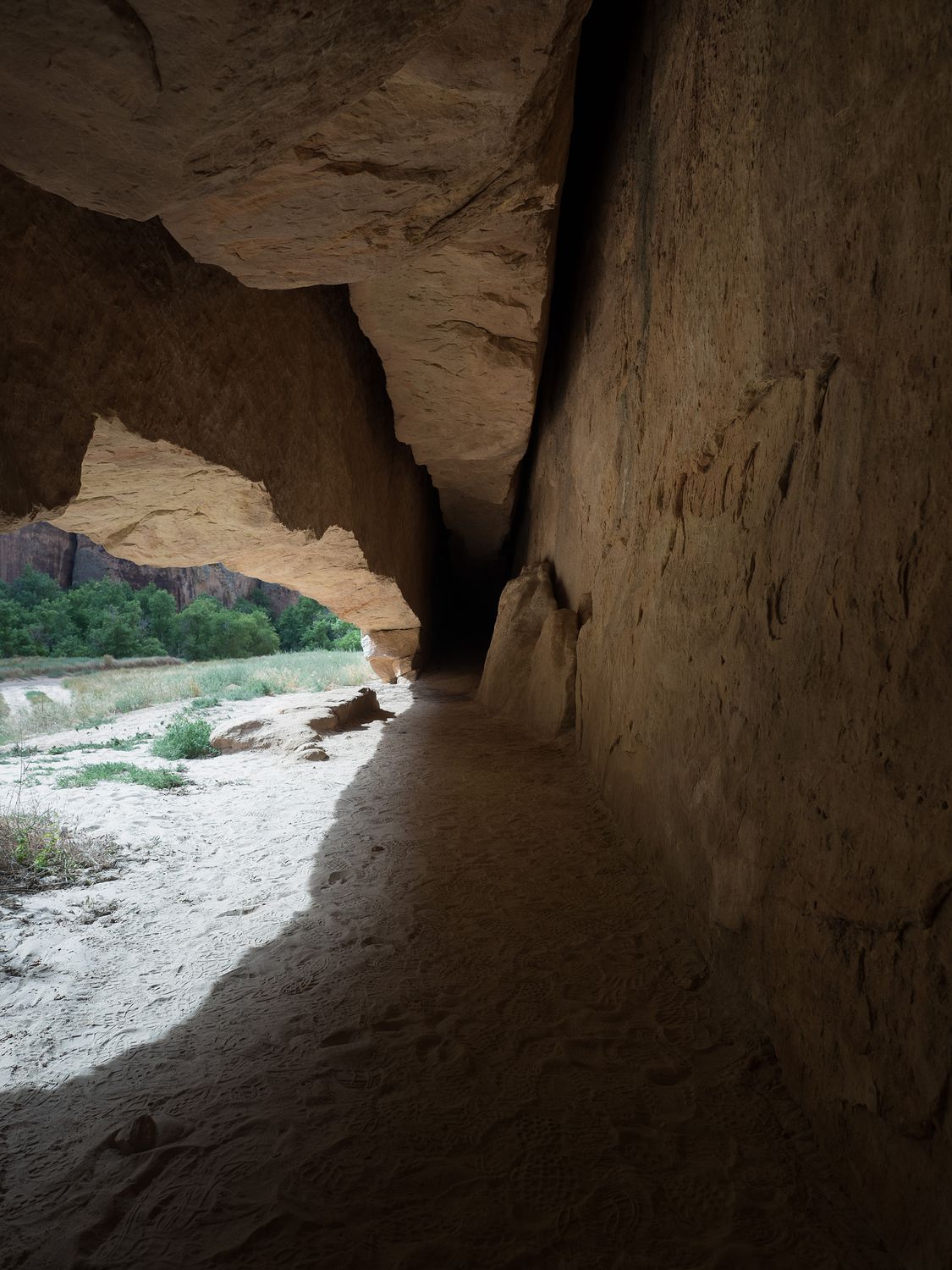
We stopped briefly along the way to check out some petroglyphs and what’s called the Whispering Cave, which is a bit of rock that’s broken off of the cliff face but remains up against it, creating a sort of small cave at the very bottom. It’s perhaps 25 degrees cooler in the cave than outside, which makes for a bizarre feeling when you climb into it, especially since it is so tiny.
There’s also the ruins of a homestead just before you reach the campsite, but we decided to visit those on the way out. Our major goal was Steamboat Rock, which was at the very end of the road.
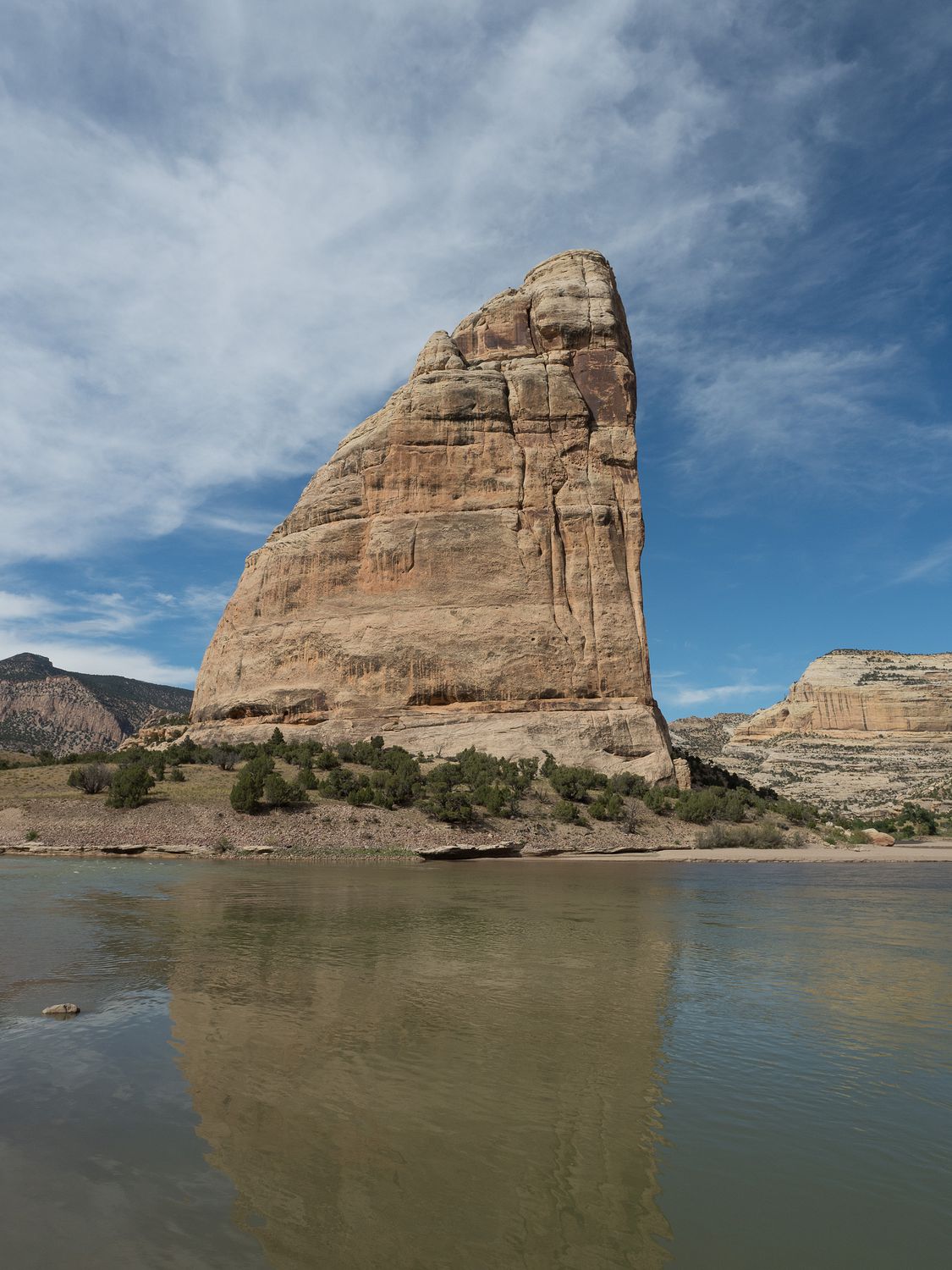
Steamboat Rock is a large rocky formation jutting alone out of the canyon floor where the Green and Yampa rivers come together. You can see it from the boat launch in Echo Park Campground, and from a trail along the side. Unfortunately Ripley wasn’t allowed on the trail, so we couldn’t see the rock from the side, where it is supposed to look like a steamboat. Instead we took our photos from the front, and had to be satisfied with that. Ripley really wanted to get in the water, and thought the fact that we wouldn’t let her was particularly offensive.
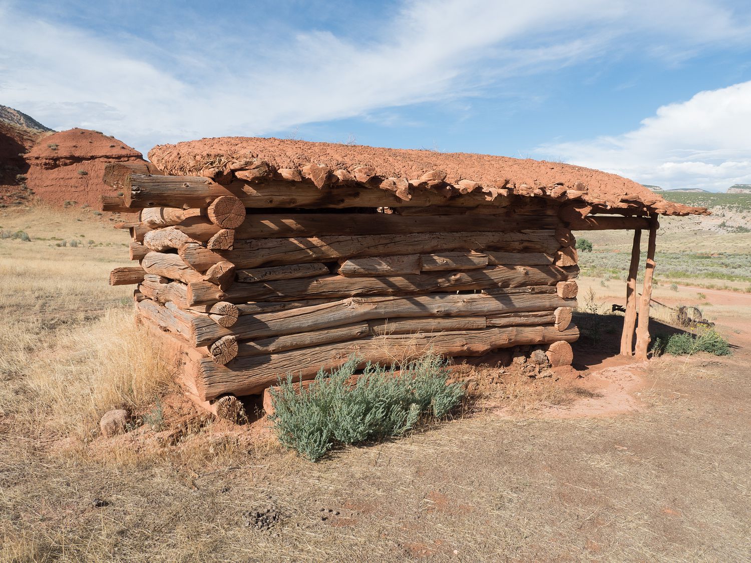
Around 5m, we finally turned to leave the Echo Park area, but we stopped first at the two settlements we’d seen on the way in. We don’t know much about the first, save for the fact that it is a low, log structure with a sod or mud roof. There wasn’t a sign about it, so we just don’t know much. It’s not too far from the other, so it is possible that it is part of the ranch. Maybe a storage building or root cellar? Maybe even a separate cabin?
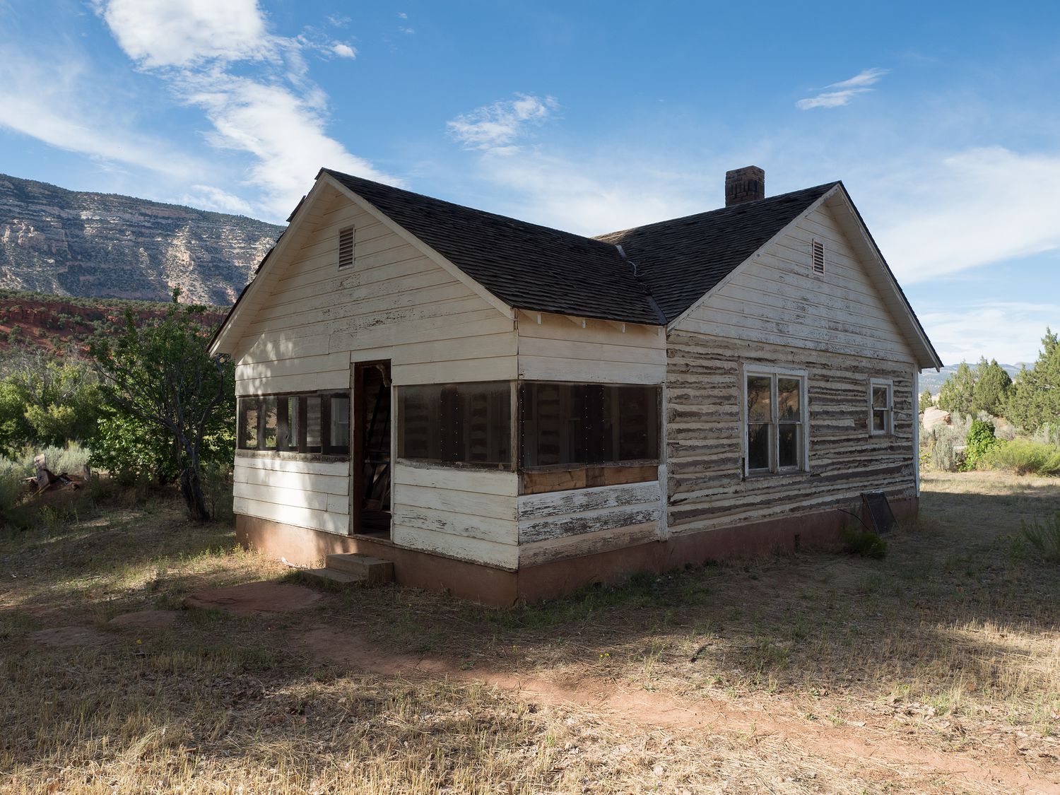
The second area is what used to be the Chew Ranch. The Chew Ranch was established in 1900, and operated for around 50 years. The area has a house built in the 1940s, several sheds and outbuildings, and the remnants of pens and fencing. The park acquired the land in 1919, but the family was allowed to remain until the current residents had passed away, which didn’t happen until sometime in the 1970s, though the ranch itself had ceased to operate some time before then. That house is newer than mine, though not in as nice of shape. Of course, I have electricity and running water. And Home Depot.
Since it was getting late, after we left the ranch we hustled out of the Echo Park area back to Harpers Corner Road. We made good time, and were back at the top of the Canyon by 6pm. We still had to finish the main paved road through the park.
We stopped at several overlooks to take in the sights we’d missed from the canyon floor, including a particularly nice view of the Echo Park area, where’s we’d just left. Just like yesterday, I love looking back at where we’ve been and seeing it from a different perspective.
We didn’t make it back out to the town of Dinosaur until after 7pm, and then we had to drive for another hour to Vernal, where we are staying for the night so we can do the other part of Dinosaur National Monument in the morning.
We didn’t get our dinner until almost 8:30, which ended up being Jimmy John’s sandwiches. It wouldn’t have taken so long, but our hotel is way outside of the main part of town and it took us almost 10 minutes to get there each way.
Tomorrow morning we will get up extra early to go do the Quarry Hall in Dinosaur National Monument. Ripley isn’t allowed inside, so we will be leaving her at the hotel while we go do the museum. We want to make sure to get to her back before checkout time at our hotel, so the alarm is set for 5am. Dinosaur fossils, here we come.
– Trip Total : 1,710 miles –