– Mesa, Arizona to Roswell, New Mexico –
It has been a very long day. We have packed way too many things into one 5-day trip. I wish we could’ve done 6 days, or even 7. Alas, Mark and I are teaching a Software Carpentry event on Wednesday and Thursday, so we will just have to endure. No breaks for us.
Today began early, and we also lost an hour when we crossed into New Mexico, so we didn’t make it to the hotel tonight until just after 11pm. We spent way too much time this morning having fun to make it in at a reasonable hour. At least our day was spent enjoying ourselves, instead of driving around missing parks that we had intended to see, like we did on Saturday.
We had our run along the canal in Tempe. We stayed in Mesa, of course, but around Phoenix, all of the suburbs sort of blend together. I think Tempe is my favorite, but I could be biased since the main character in the Iron Druid Chronicles is from Tempe, and the author just makes the place sound so coo. Regardless, the run along the canal was nice enough, though not perfect. Unfortunately, the path has to cross the streets, instead of going under or around them, so we crossed busy streets multiple times, including one that didn’t have a light or stop sign at all. I’ll be honest, it felt pretty sketchy, but we didn’t have a choice, and it was obvious that was what we were meant to do. People must cross there hundreds of times a day.
We stayed in a Motel 6 last night, since the La Quintas in the Phoenix area are insanely expensive. It was fine, if not overly nice. Honestly, my biggest problem with it was the fact that we were next to the office, and the employees kept coming outside to stand next to our door (where the trash can was) and smoke in the middle of the night while talking loudly. I think I could have cheerfully murdered one gabby lady along about 3am.
Most of today was really about driving, though we did get some great stops in. Mesa did have a Quiktrip, which I think I mentioned yesterday, so Mark and I started our morning with Quiktrip tea, coffee, and ice for our cooler. Mark got a breakfast burrito from there too, but I had nuts and banana chips from the cooler. I am not a fan of the Quiktrip breakfast for some reason. Mark offered to take me somewhere else, but unlike him, I’m fine with trail mix breakfast. He is not a fan.
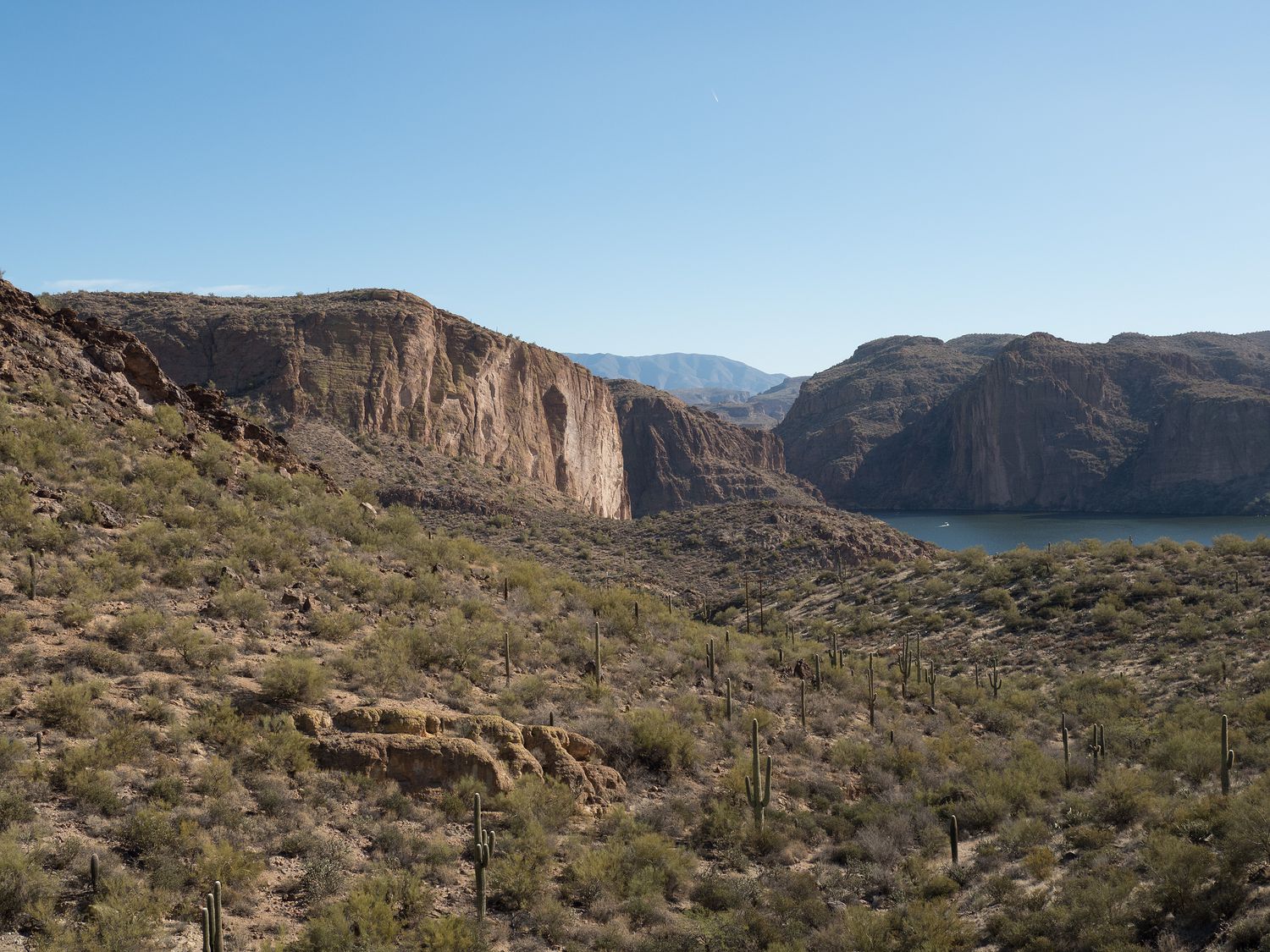
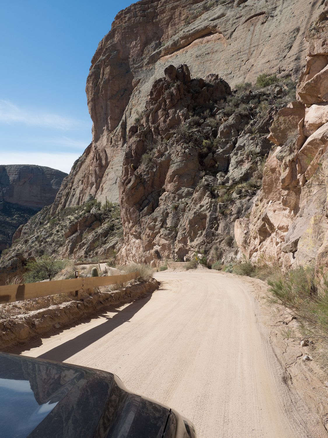
Our first drive took us from Mesa up into the Superstition Mountains, along the dirt Highway 88. The road winds along through the mountains beside the Salt River. It’s a spectacular drive, and if you are comfortable with dirt roads that take a while to traverse, I highly recommend it. Mark, who had wanted to take that road in particular, didn’t even know how cool it was before we went. We were very pleasantly surprised. The road is lined with mountains and saguaro cactus, and drives by several small lakes in the valley along the Salt River. It is truly gorgeous. Portions are a little sketchy, as you can see in the photo above, with sections of road that are very narrow (basically one lane), descend very abruptly, and do not have much of a guardrail, but if you aren’t afraid of heights like I am, they aren’t bad at all. As long as you are going slowly enough, they are perfectly safe, and like I said, the scenery is well worth a few minutes of nerves.
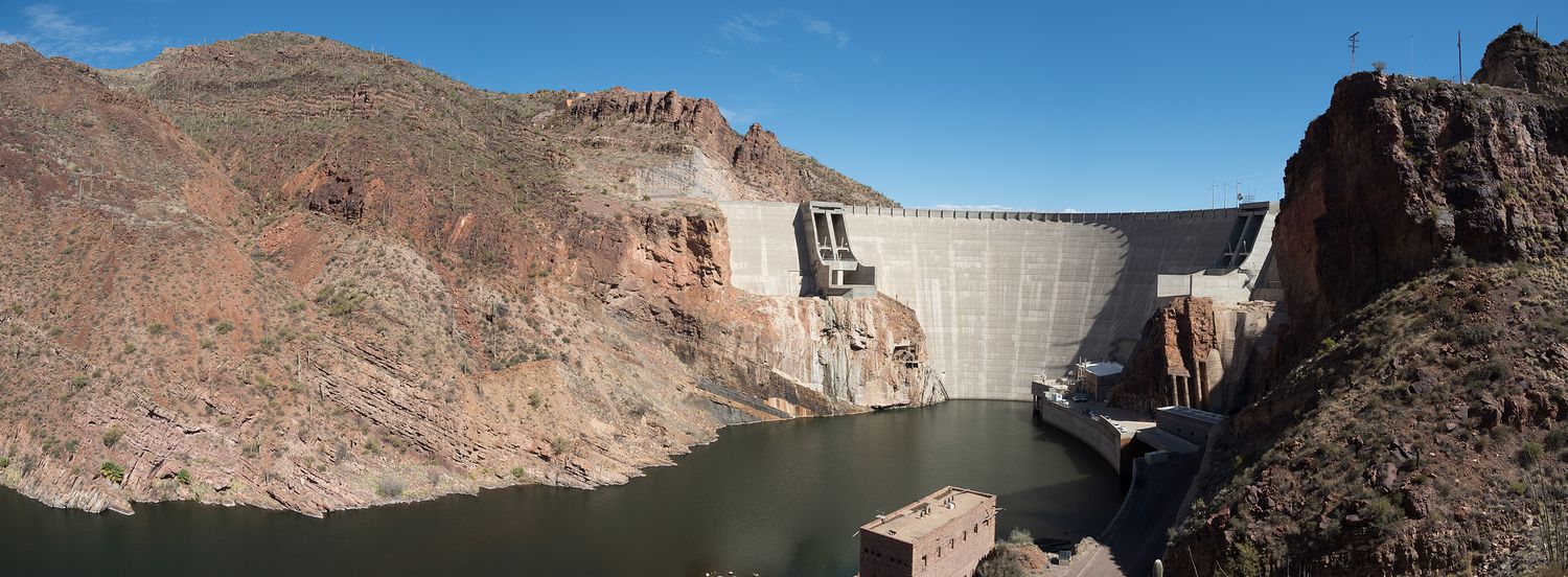
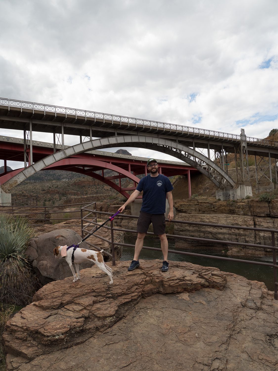
Highway 88 comes out where the Salt River has been dammed up to create Roosevelt Lake, in the tiny town of Roosevelt. At the very end of the road, we pulled off to walk out and take a look at the dam. There’s a few big stops here, where travelers on the larger highway that runs north and south along the lake can come over to the sketchier road and see the dam. According to the signs at the stops, the original dam was made of huge bricks cut from the canyon surrounding the river. The new dam was built in the 1980s with steel and concrete, and the old dam was demolished. While we walked out to the overlook, a helicopter landed just below us at the dam controls, which was very cool to see. We didn’t get any photos since it landed too quickly, and once it landed, it was out of sight beneath the canyon walls. We waited for a while, hoping we would get to see it take back off, but it never did and we had to move on.
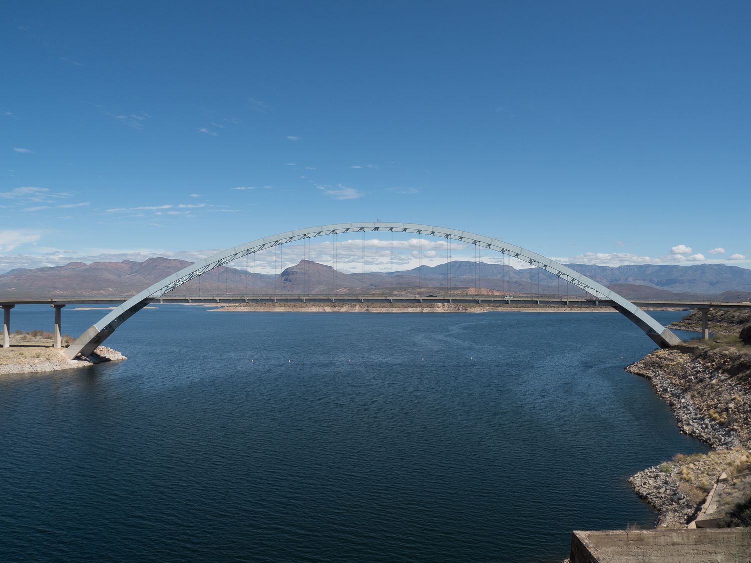
From the dam, we drove out onto the larger paved road, 188, and took a few photos of the bridge over the lake and the mountains in the distance. The lake looks a little low, but it is impressively large. I was surprised by how large the Salt River was in this area, as well. You really never expect to see this much water in Arizona.
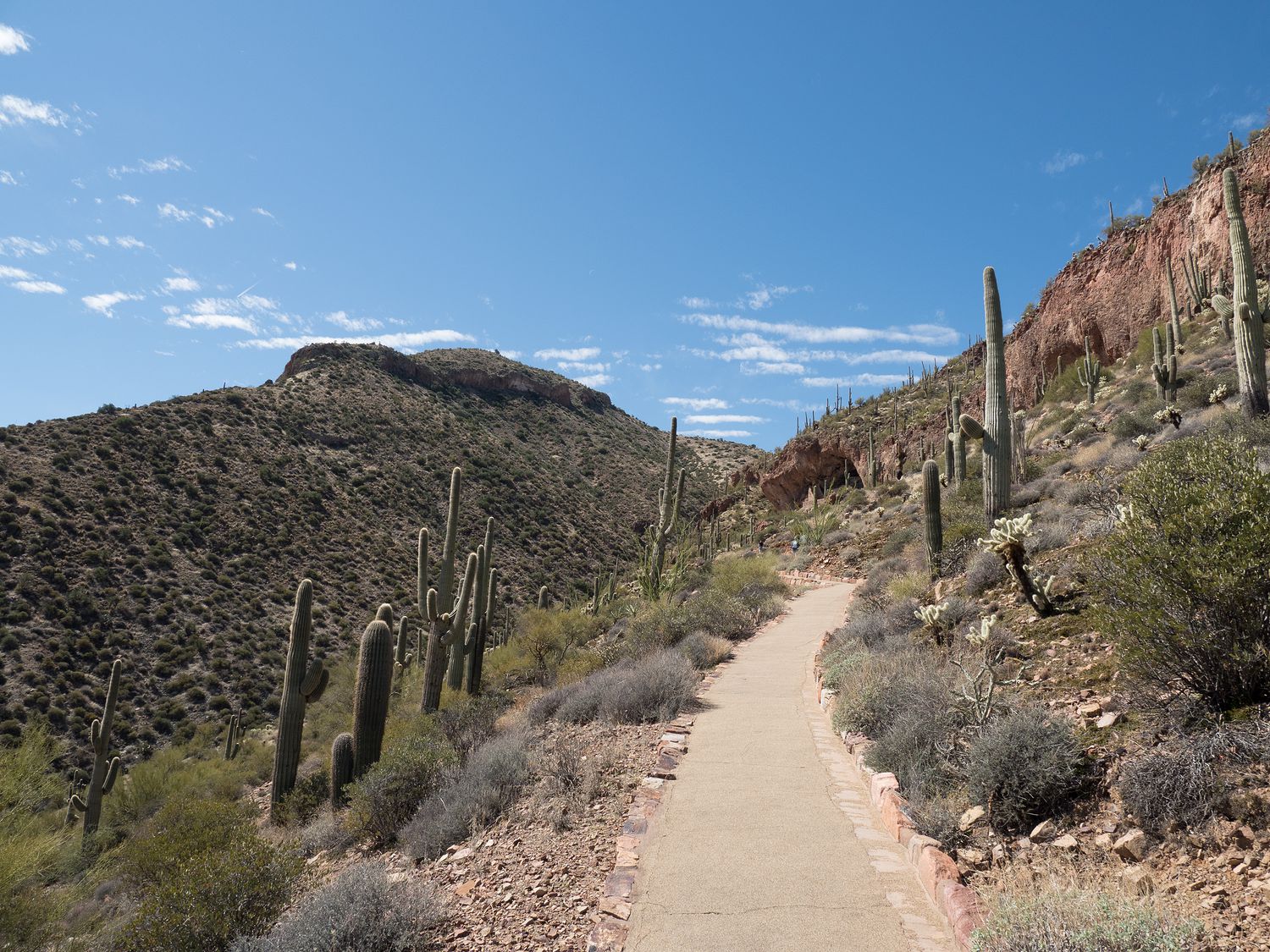
It isn’t far at all from the turn onto Highway 188 until you get to Tanto National Monument. The little park was much busier than we had expected it to be, but we were lucky enough to find decent parking. We walked up to the visitor center while Ripley waited in the car to pick up our map and our national park stamp. It was around 11 am or so, and we planned to do the 1-mile loop hike up to the lower cliff dwelling in the national monument, since Ripley was allowed to come, so we were already a little behind schedule, but we didn’t care too much.
It was warm, but not bad. We still put on our hats and filled up a water bottle before the climb. The walk up to the cliff dwellings is very steep, and it was a little hilarious watching out-of-shape tourists climb up the nicely paved path, panting and sweating, despite it being 70 degrees. We got a lot of resentful glances as we breezed passed them, and several offers to rent Ripley, who was steadily pulling me up the hill. They thought it was helpful, but little do they know, it’s actually obnoxious. If only she would stop choking herself on her harness trying to tug her way up the slope.
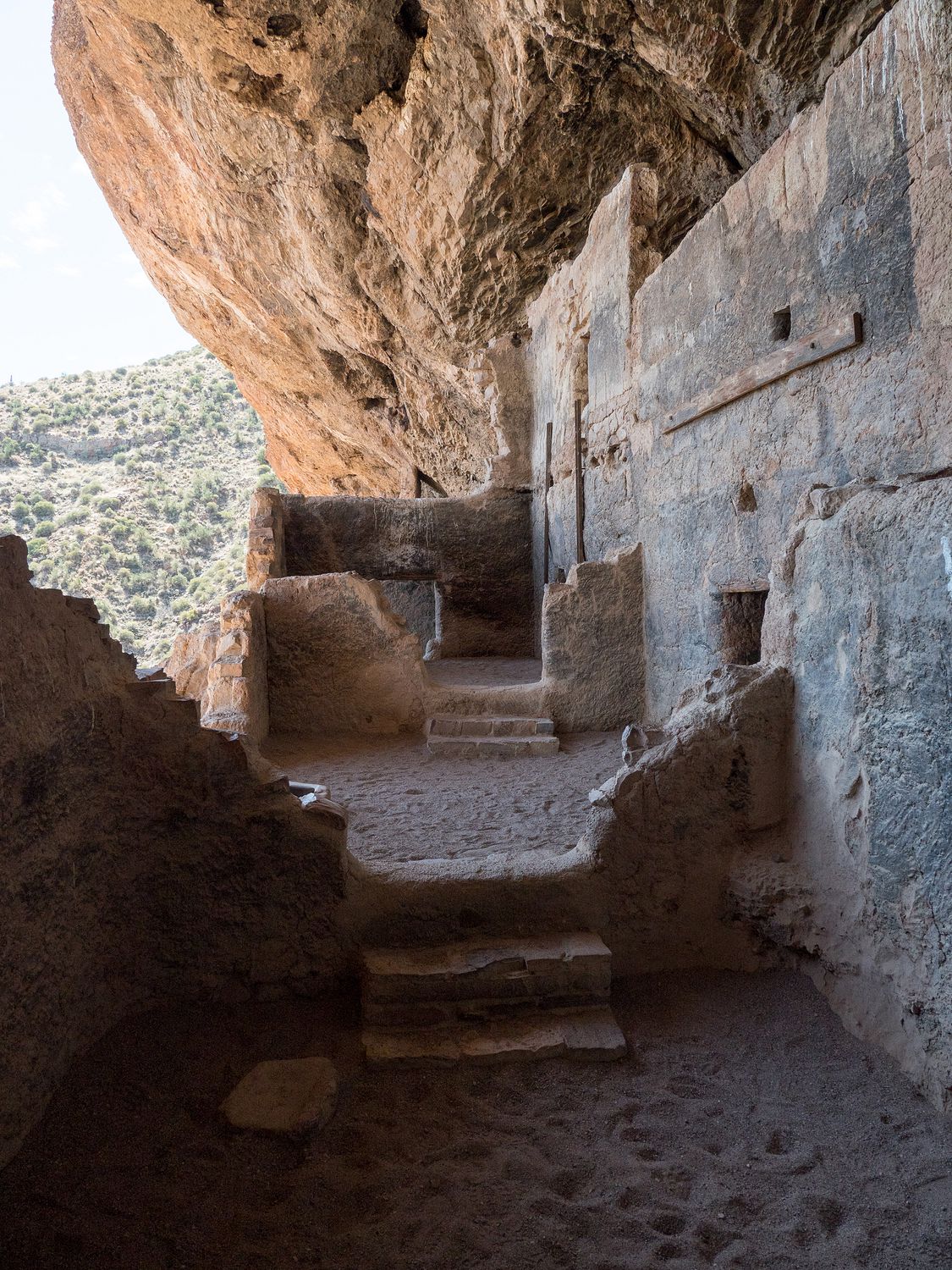
Tanto National Monument, as I mentioned, is home to cliff dwellings used by the Salado people during the 13-15th centuries. Like many other cliff dwellings in the southwest, they were abandoned during the 15th century. The monument has upper and lower cliff dwellings, and the upper cliff dwellings are only accessible on ranger guided tours from November to April, and the tours take 3-4 hours. The lower cliff dwellings are much easier to access, and while you can visit them during the summer, the park recommends that you do so before 11am, though they allow visitors as late as 4pm.
Again, Mark and I didn’t have any trouble, but a lot of people did. It is a vertical climb, a mile total, and even the way back down can be hard on your knees. The cliff dwellings at the top are cool, but were filled with children today. I guess we should’ve expected that over spring break, though it made it difficult to get good pictures. It’s also worth noting that while Ripley was allowed on the trail, she was not allowed in the cliff dwellings, so we had to switch off at the base of the cliff dwellings (not very far from the top), while we each had a turn looking inside. At least there was shade for Ripley and the waiting parent down there.
It was after noon when we finished at Tanto National Monument. We hopped back in the truck and continued down 188 to Globe, Arizona, where we switched off onto US Highway 60 for another cool drive through some Arizona mountains. In Globe, we dug our lunch out of the cooler to eat along the way. I’m really digging this cooler lunch thing. It is so much faster than trying to find something we will eat in some random small town. It’s saved me from many a subway meal, I think.
There isn’t a lot between Globe and Show Low but mountains and desert, though we did finally stop seeing saguaro cactus. I almost miss them. They were starting to feel like the local trees. A good portion of the drive travels through the Fort Apache Reservation, and the road runs mostly along canyonland. It is another very pretty drive, but it is much more accessible, as the road is a real highway, not dirt, and traffic moves a lot faster.
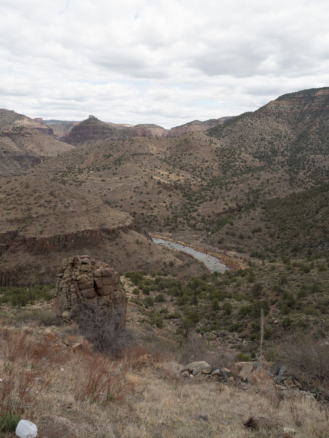
We stopped briefly along 60 where we once again ran into the Salt River at the Salt River Canyon Rest Stop. Mark stopped here on a road trip with a coworker for a conference back in 2004. We even have photographic evidence of his visit. The rest stop has a new fence around the edge of the canyon that stops you from walking out so close to the edge as he did in the previous picture, which we made a minor attempt to recreate. He wanted Ripley in the photo with him, and he looks a lot cooler these days (it’s obviously the beard), so it’s not exactly the same, but you get the general idea.
Ripley had a lot of fun walking around while we took pictures. I would say that she was tired of being cooped up in the truck, but I can’t imagine how that could be the case, given that she had been for a run and a hike this morning. I keep wondering when we are going to wear her out, but it just never seems like we quite accomplish it. She’s always ready to go again 15 minutes later.
Highway 60 took us all the way over to Soccoro. We thought about stopping Pie Town to see if they had any pie, but by the time we were there, it was after 6pm. The time changed at the New Mexico border, and since we still really wanted to stop at the Very Large Array between Datil and Magdalena, we were chasing daylight.
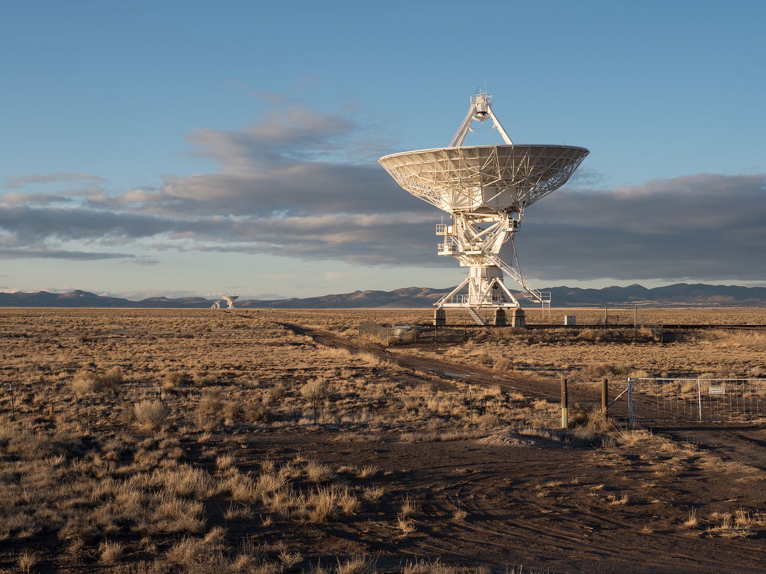
We made it there before 7pm and got some great shots of the VLA at sunset. We have visited the VLA before, although not with Ripley. If you aren’t familiar, the VLA is formally called the The National Radio Astronomy Observatory’s Karl G. Jansky Very Large Array. It’s a series of 27 radio telescopes (with a dish diameter of 82 feet), arranged in a Y-shape, mounted on tracks that can spread the telescopes up to 13 miles apart, and is used to observe the characteristics of objects in space, such as black holes. You might recognize it from the movie Contact. It is worth mentioning that in the movie, the telescopes are used to search for aliens, but that isn’t what they are for in real life. The movie is based on a book by Carl Sagan that imagines a similar set of telescopes in the area. Yes, that Carl Sagan.
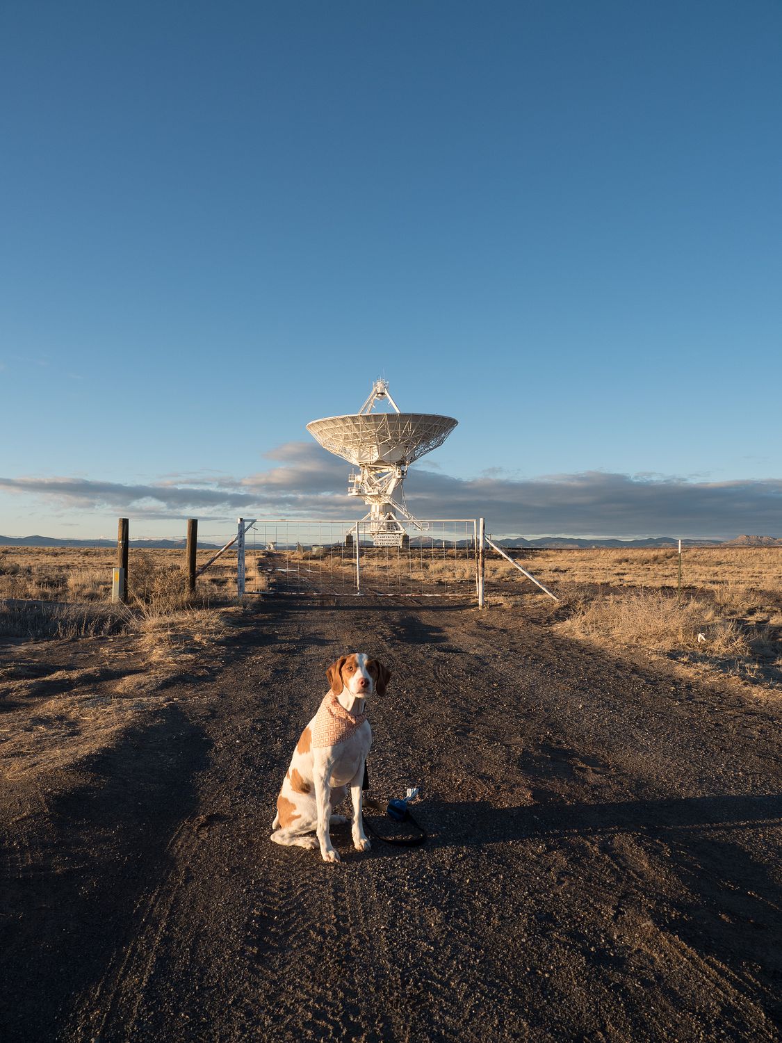
We did not get too close today, as it was very late in the evening and we still had more than 3 hours of travel left to Roswell, but the telescopes are huge. Mark has visited several times, and he and I visited together in 2011, before little Ripley was even born. That time, we were able to go to the visitor center and whatnot to really enjoy the site. If you ever get the chance, I urge you to do the same. The VLA is amazing, and well worth a stop.
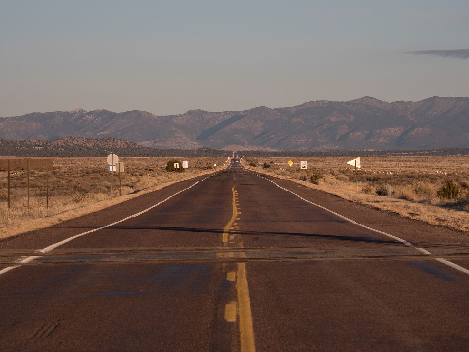
From the VLA, it is still 50 miles to Socorro, and from Soccoro, we had another 2.75 hour drive to Roswell. From Socorro, we took Highway 380, which we will take all the way home tomorrow. We had to call and warn our hotel that we would be getting in after 10pm, and could they please not give our room away. We also bought dinner in Socorro. Subway. Sigh.
Tomorrow is a shorter day from Roswell to Denton. We should have plenty of time to run in the morning and get some silly pictures of Ripley with the Alien decorations all over Roswell. With us getting in so late tonight though, we will see how much sleep we get. It’s only a 7ish hour drive, but the time changes again. I wish Daylight Savings Time would’ve left us alone.
– Trip Total : 2,031 miles –