– Tupelo, Mississippi to Vicksburg, Mississippi –
Well, I can’t say we had the greatest run today. Running doesn’t seem to be very popular in Tupelo, and is at least unpopular enough that they really don’t have any infrastructure for it. I guess that isn’t totally surprising. Mississippi isn’t exactly Colorado. Anyone that runs here must do it on the streets, which is lame. Mark, Ripley, and I had to run in one of the local parks on a washed out nature trail (Music Bend Nature Trail) that is really just a big part of the frisbee golf course. At least they have a dog park, though both times we visited it has been completely empty.
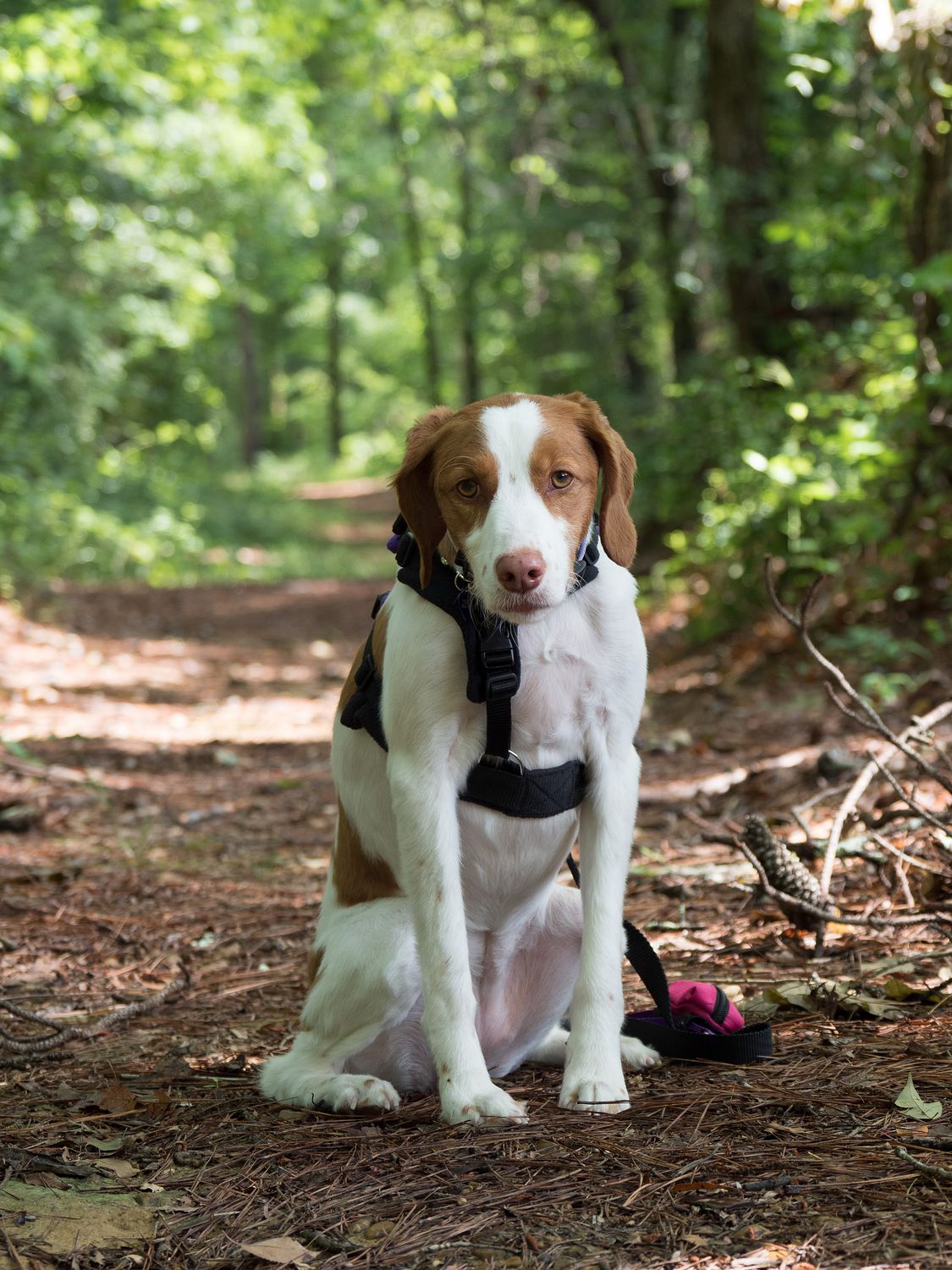
As soon as we finished our run through the trees and across roads with no pedestrian crossings, we dropped Ripley into the dog park, which she thoroughly enjoyed. Would you believe that girl can still run around a dog park like a maniac, even after she’s just finished running 4-5 miles? She also found her way into a mud hole and covered her feet in filthy, impossible to rinse away mud, so she had to have a bath when we got back to the hotel. I wonder if she would’ve jumped into the mud pit if she’d known her adventure would result in a bath. I guess knowing about the consequences of her actions is hardly her strong suit.
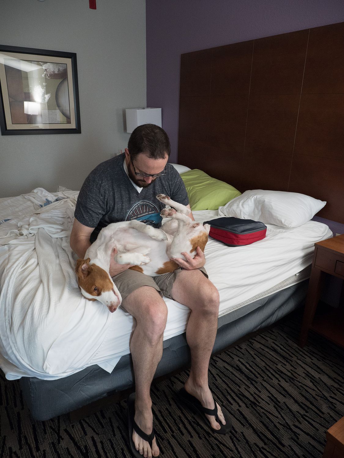
Of course, since we ran through the trees, we had to worry about ticks. While I was showering with Ripley, one washed off of her and bit my foot, which gave me serious heebie jeebies. I really really hate ticks and fleas. Give me flying insects any day instead of the crawly sort. Mark had to rescue me with Ripley’s tick-removal tweezers post-shower. I couldn’t bring myself to do it. Afterwards we took turns checking everyone in the family for more ticks. Ripley’s heartworm preventative/flea medication kills ticks, but they have to bite her first, which is inconvenient. In any event, everyone else was fine this morning, so we grabbed our breakfast and drove back up through Tupelo a bit to get onto the Natchez Trace Parkway, where we would spend most of our day.
The Natchez Trace Parkway’s speed limit is about 55, and it winds through the trees just outside of most of the towns it passes through. There are no services along the trace, so you have to leave it to find gas or food. You definitely feel like you are in the middle of nowhere while you drive down it, even when you are near a city like Jackson. All along the parkway are designated stops for various things to see, where you can usually find several tourists. We weren’t starting at the top of the trace, which begins in Nashville, so we missed a good portion that runs through a more mountainous area.
I know I mentioned this in yesterday’s post, when talking about the visitor center for the Natchez Trace Parkway, but the trail is a total of 444 miles long, and was first a natural footpath for animals, then a trail used by American Indians, and eventually, a wagon route used by European settlers for trade along the Mississippi River and as a postal route for communication back to the settled portions of the United States. Meriwether Lewis (of Lewis and Clark fame) died on the Natchez Trace in 1809. The route was eventually usurped by steamboats on the Mississippi River. Today it is a National Parkway, though the road doesn’t follow the exact route the Trace once took, as a footpath is quite difficult to turn into a real road. The speed limit never exceeds 50 miles an hour, and while you do see the occasional farm along the road, it is basically entirely clear of businesses and commercial traffic. The Trace is littered with scenic and historical points of interest, so many that we didn’t have time to visit all of the ones we drove past.
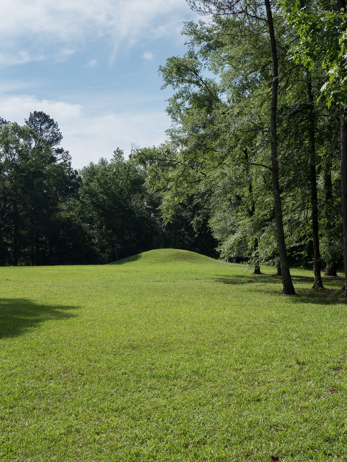
Our first stop was at the Bynum Mounds, which is exactly what it sounds like: a site of ancient Indian burial mounds, these from the Miller Culture. The site originally had 6 mounds, but 5 of them were excavated, then two restored for public viewing/education. According to signs at the mounds, modern people still visit the site and occasionally conduct ceremonies or lectures there.
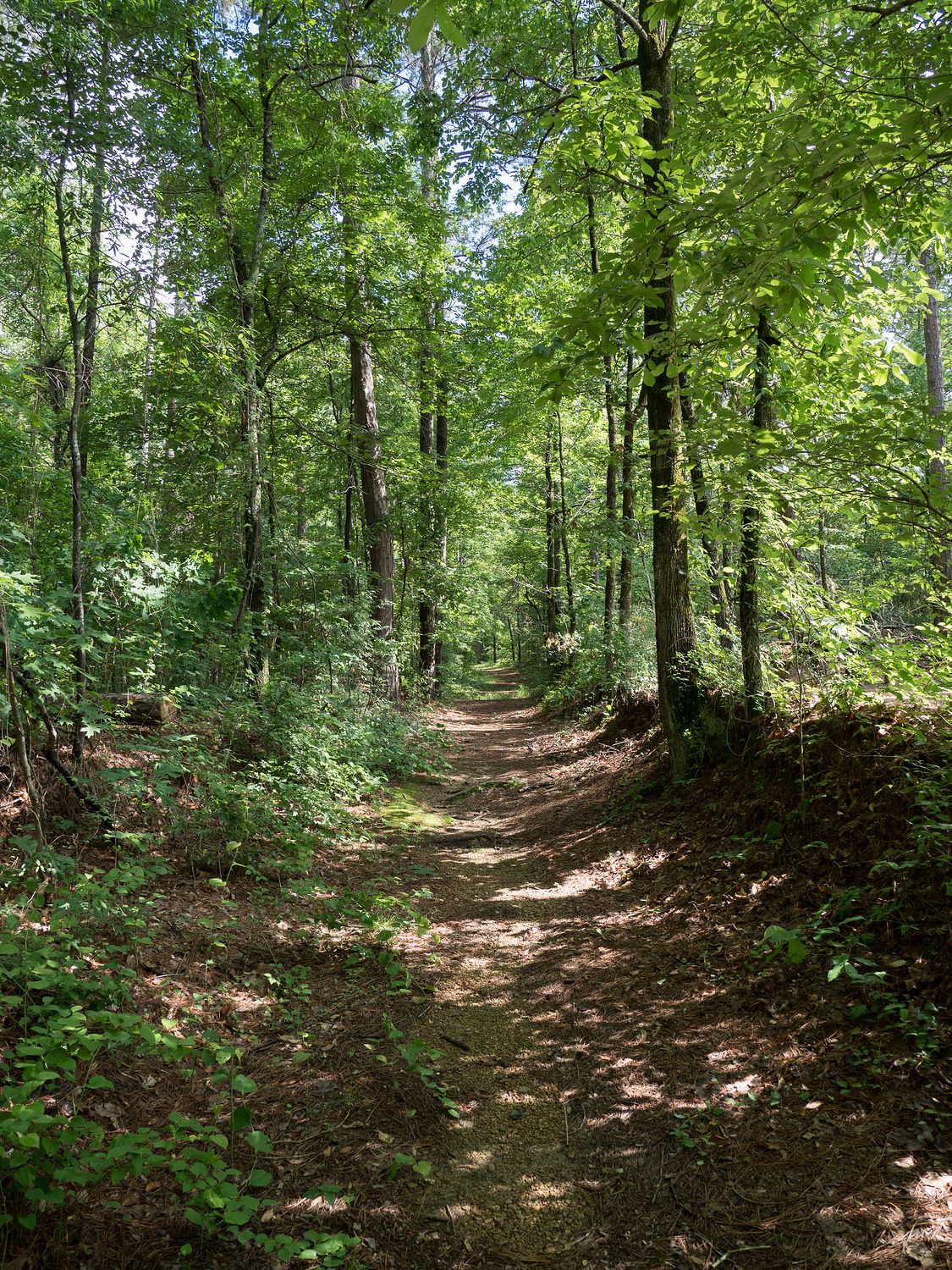
Another early stop was at a section that they call the “Old Trace,” where the former foot/wagon path is still visible. It’s a beautiful path, soft earth shaded by trees. It’s amazing how the path makes you feel like you are deep in the woods, even when you are only a few hundred feet from the main road. We pulled Ripley out to take some photos, but she was less-than-impressed with us and was much more interested in looking around for tiny forest creatures to try to eat/play with. She grew bored quickly, and we gave up and moved on.
Between this “Old Trace” stop and the Cypress swamp a ways down the road, we didn’t stop too much. We did pull off of the parkway a time or two for gas, bathroom breaks, and tea, but mostly we enjoyed the quiet road and the scenery. We had more things to see later in the day, so we didn’t want to spend too much time looking at things that were no longer there. That’s a bit of a feature with some of the stops along the Trace: the stop just ends up being a sign, telling you that there used to be a mission there, or once upon a time there was an inn at this spot. It’s a little strange, but I guess I get what they were going for. The Trace is very popular with bicyclists, and those stops provide convenient places to pull off and look around for people trying to cycle 444 miles. (P.S. – the bikers looked pretty warm out there in the Mississippi heat).
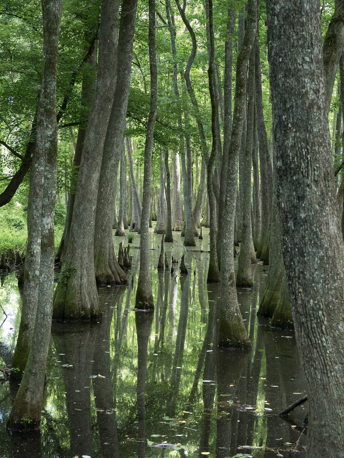
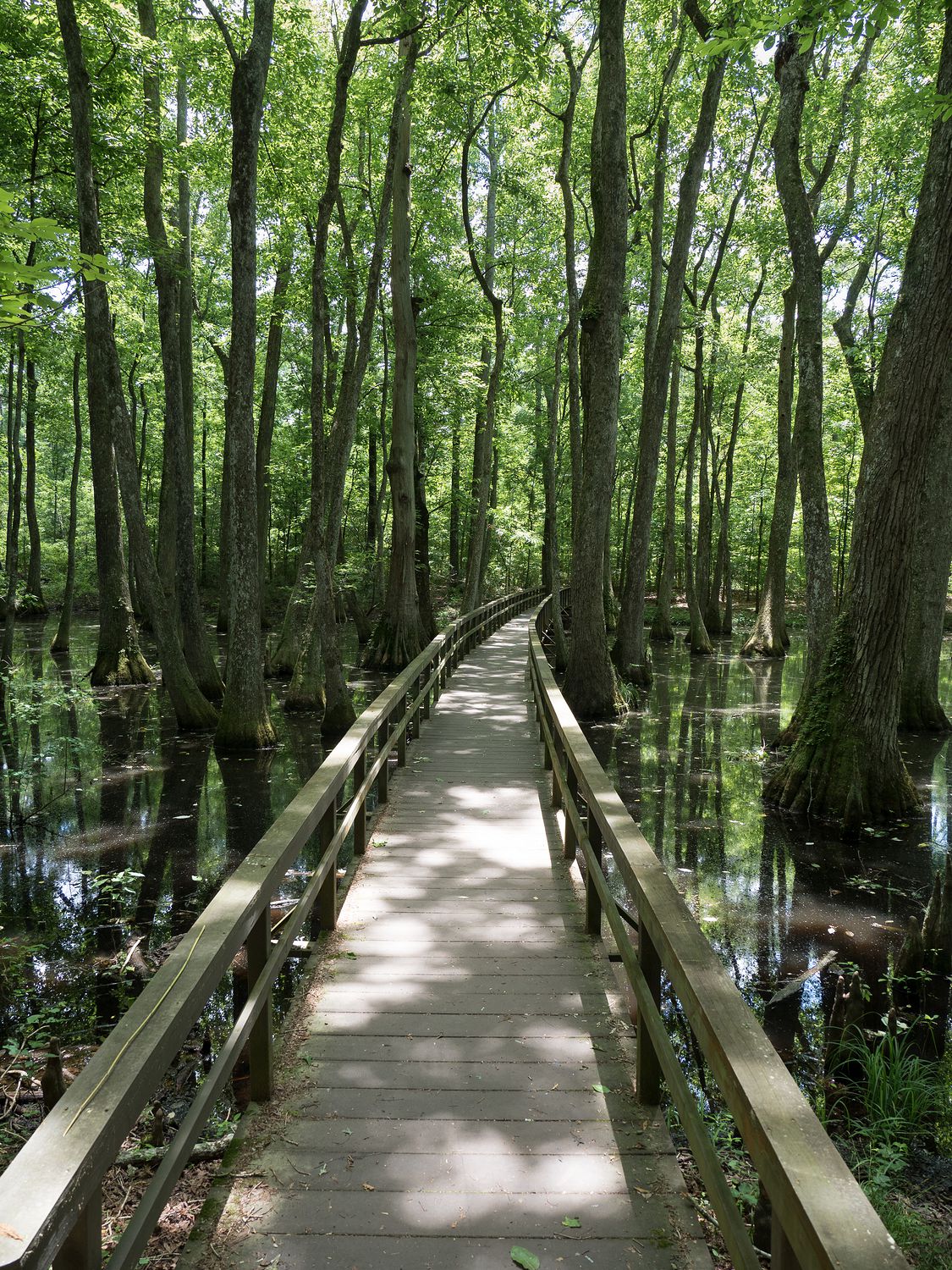
We did pull off at the stop for the Cypress Swamp, which was quite popular with other travelers along the road. The stop consists of a nice boardwalk that leads back into a swampy sections among the cypress trees along the road. We don’t see many places like that, especially around where we live, so it was neat to look around. It reminded be a bit of Congaree National Park, though we have only visited that place in the winter. Unfortunately the bugs and mosquitoes were unrelenting, as you might expect of a swamp.
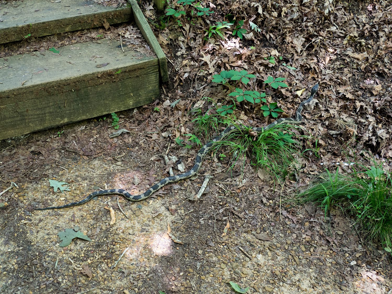
Another unpleasant aspect of this particular stop was the snake. Ripley and I stepped over a snake on our way back to the stairs up and out of the swamp. Mark nearly had a panic attack trying to get us away from it, but he couldn’t get the word “snake” out of his mouth, so we had no idea what he was upset about and very calmly walked over the thing without even noticing. It was very sedate, and did not care about us at all. I am pretty sure it was a chicken/rat snake, especially given how long it is, but if anyone has any better idea, feel free to comment. I know it wasn’t a rattlesnake, copperhead, or cottonmouth, which are the important ones to rule out down here. Otherwise, I try not to worry too much.
Mark went back down to the boardwalk after the snake encounter, while Ripley and I went back to the truck to get her some lunch and some water. We waited while he took some photos with his analog camera. I considered waiting with him, but the heat, snakes, and biting insects were a powerful deterrent, so I turned on the AC in the truck and waited in comfort. He came back with bug bites, too.
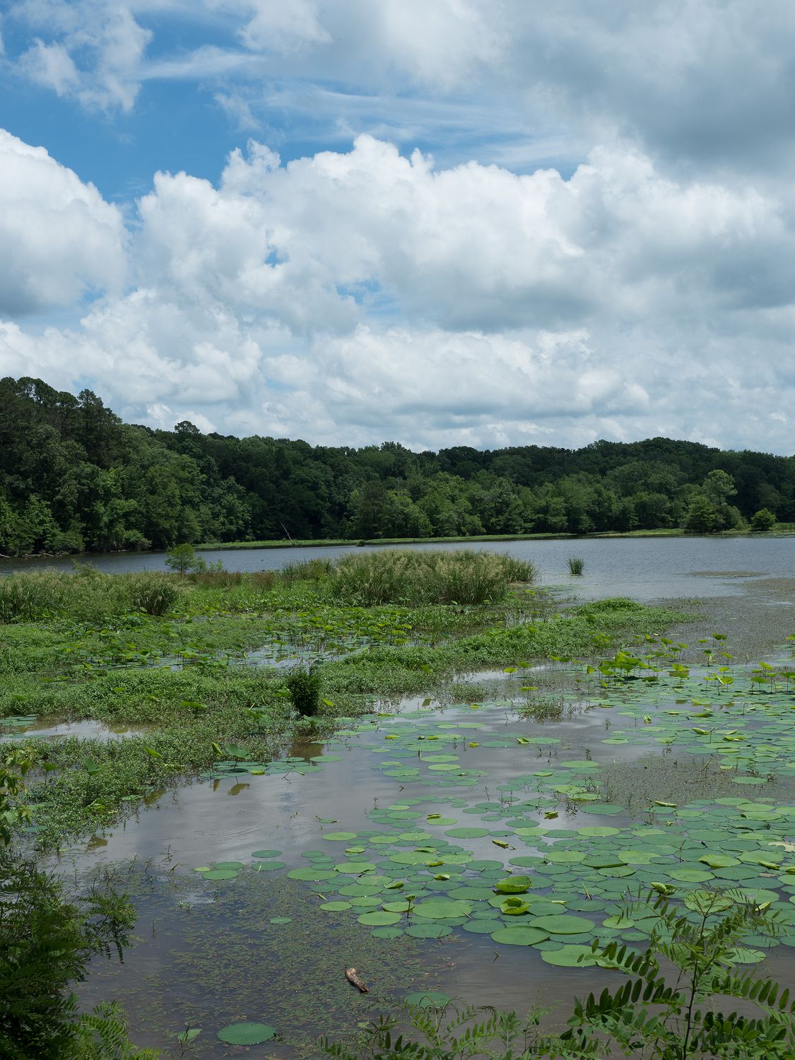
We actually backtracked a bit after the Cypress Swamp, and went back up to the River Bend area, which had bathrooms. The stop is also a popular picnic area and a boat ramp, as the river widens out into the Ross R. Barnett Reservoir in that area, just north of Jackson, Mississippi. Since it was a Sunday, it was a popular spot. One of the coolest things about it for me was the lily pads on the surface of the lake. I feel like I only ever see those on TV and in movies. It’s nice to know that they can be real, too.
A bit later, still just north of Jackson, we pulled out onto a real road to buy ourselves some Pita Pit for lunch. For whatever reason, I’ve been craving it for a couple of days, so I was glad to finally spot one around lunch time. Mark had to go in and get it while Ripley and I waited in the car, since it is just too hot to leave her down here, so it was good that we had the chance to go to the bathroom back at River Bend. It wasn’t too difficult to get back on the Trace from our stop, and we ate our pitas on the road.
We didn’t stop again until we came to the Rocky Springs ghost town, which died out after a series of catastrophes that culminated in the spring for which the town was named drying up. A church that still holds services is about the only thing left at the site, though you can walk through a little forested area and see signs that show where some of the buildings probably were. I found a tick on Ripley while we were walking around back there, so we didn’t stay for too long. The heebie jeebies drove me away.
From Rocky Springs, it’s only about 50 miles from Natchez, where the parkway ends, but we still had a couple of stops to make: two on the Trace and a couple in Natchez. It was getting later in the afternoon, but we weren’t paying as much attention as we should’ve, so we probably wasted a little time. Our next stop was Mount Locust, at milepost 15.5, which is the location of one of the oldest buildings in Mississippi.
Mount Locust was, at one time, what was called a “stand.” Nowadays, we would call such a place an “inn,” but they didn’t do so at the time. It is the only such lodging place still standing along the Trace. It was originally only a farm, but the growing number of travelers walking past the farm eventually led the owners to turn the place into an inn. That lasted until use of the Trace slowed, then the inn catered to locals looking for a quiet place to vacation. During this time, the farm also served as a cotton plantation, and after the Civil War and the death of the original owners, the place slowly declined. Today, the National Park Service preserves the site as part of the Natchez Trace Parkway.
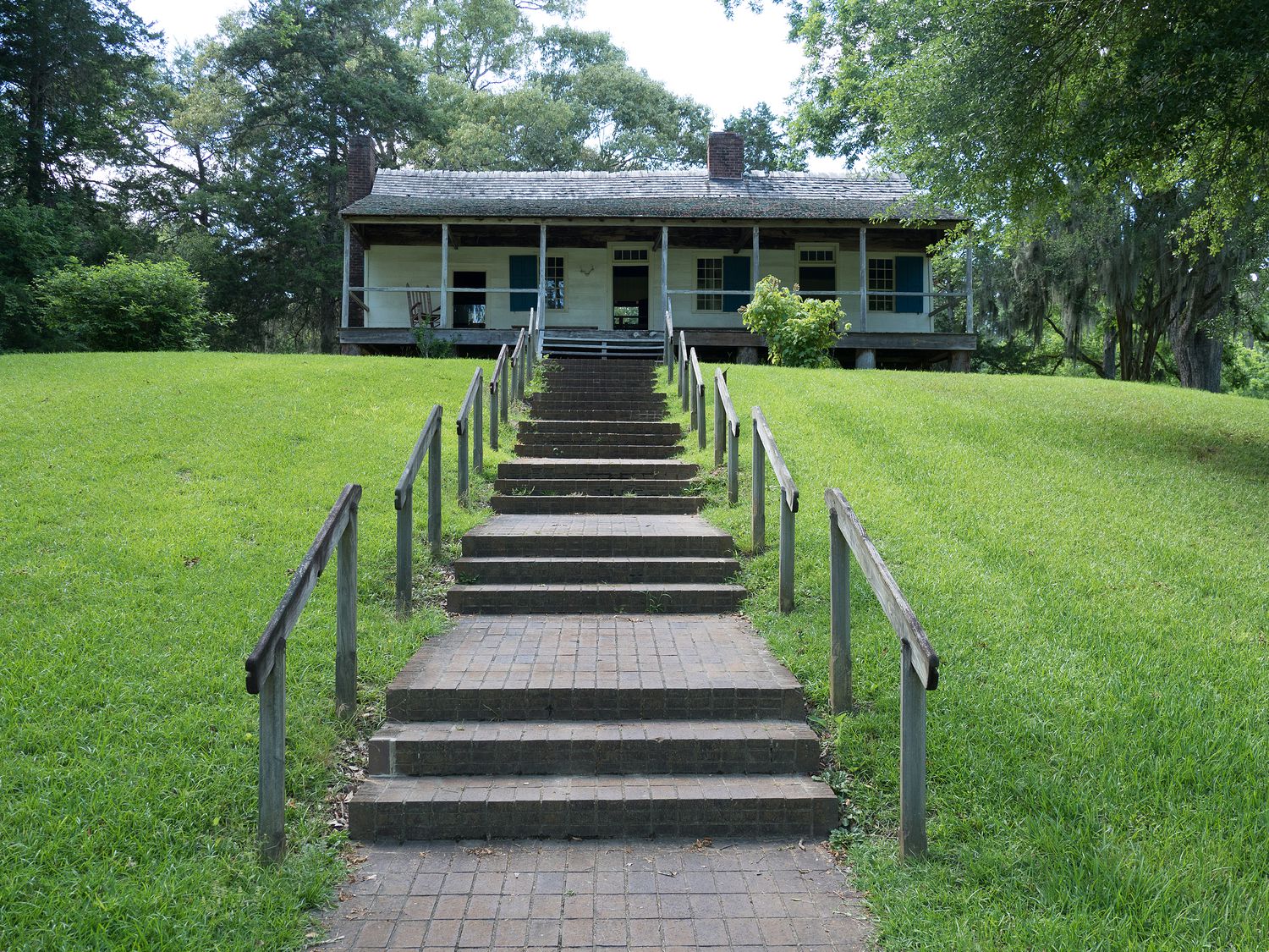
Mark, Ripley, and I walked back to visit the remaining inn building, which was neat. It’s hard to imagine the place really serving as an inn, given how small it was, but maps show that they did have several other buildings at one time. It’s also interesting to see common household items from times past: shoes, farm equipment, beds. It’s funny how much things have changed in the last 150 years.
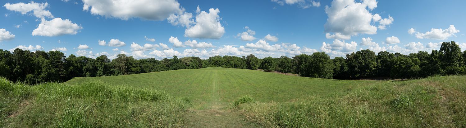
Our final stop along the Trace was at Emerald Mound, which, as you might expect, is another burial mound. Emerald Mound is technically its own National Historic Site. It was created by the Plaquemine culture as a burial mound and ceremonial center, and was used by later cultures as well. It is the second largest mound of its type in the United States, with the largest being Monk’s Mound in Illinois.
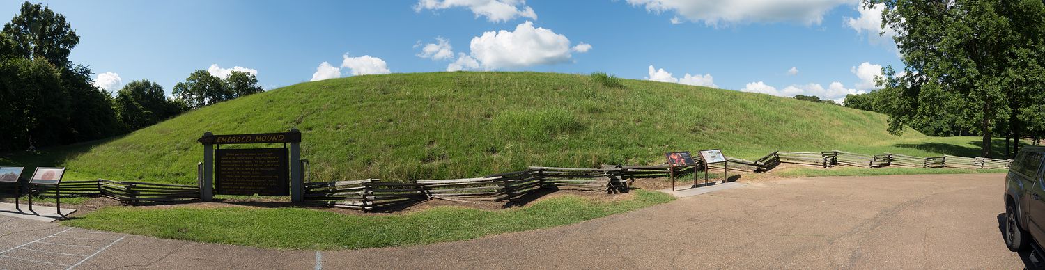
The mound covers 8 acres, is 35 feet high, and is crowned by two smaller mounds on it’s flat top, for a final total of 60 feet high. The thing is just enormous, which is why I’ve included two panoramic photos of the mound, so you can get an idea of what it really looks like. It’s wild to think that people did this with buckets and shovels. I got hot just walking up the thing in the summer heat, so I hope they did most of their building in the winter. It’s very pretty from the top, and I can understand how such an enormous construction would feature heavily in a group’s cultural and ceremonial practices. It’s too bad that we don’t know enough about the culture that built this mound to say with any certainty what those practices might have entailed.
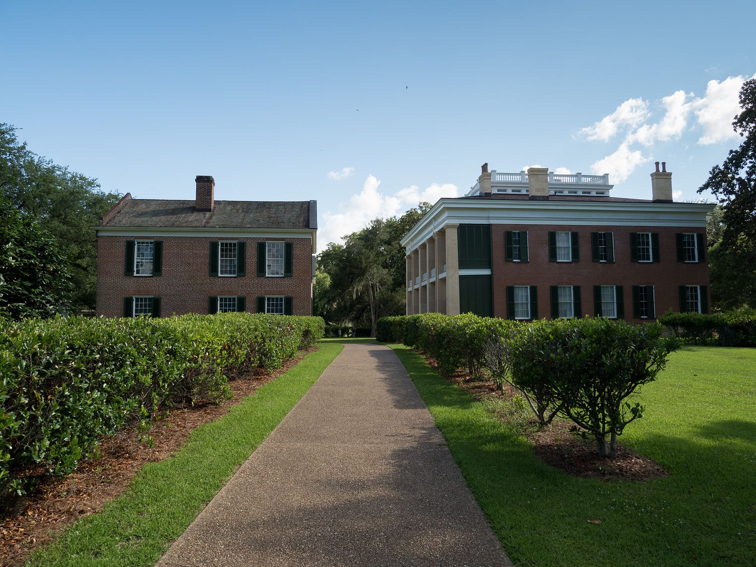
When we climbed back down from the mound, we realized we were dangerously close to closing time for the Natchez National Historical Park just a few miles away in Natchez, so we hopped back in the truck and rushed into town. Luckily, we made it to the Melrose Estate and its visitor center minutes before closing time, so while we did not get to look inside the buildings, we did get our stamp, and we did get some photos of the grounds. It’s a beautiful place.
Natchez National Historical Park commemorates the rich history of the Natchez area, and has three major sections: The Melrose Estate, which is a prime example of an antebellum manor house, The William Johnson House, the home of a free African American barber from the same time period, and Fort Rosalie, a French fort from the 18th century that isn’t open to the public. We didn’t see the fort or the other house, but we were lucky to have made it in time to see anything at all, so I’d call it a successful trip. Maybe we will try to visit again if we come through in the winter, when we would have time to explore.
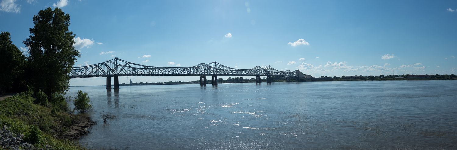
From Natchez, we still had to turn around and head back up to Vicksburg for the night. We stopped briefly to get some photos of the Mississippi on our way by, then turned north. We could have stopped in Vicksburg earlier, of course, but we would’ve missed the historical park, and the end of the Natchez Trace, so we chose to drive all the way down to Natchez this evening. Tomorrow morning we will do Vicksburg National Military Park, since we didn’t have time today.
When we made it to our hotel in Vicksburg, we ordered pizza for dinner, and Mark bought us a jug of unsweet tea from McAllister’s. Both restaurants were basically right next to our hotel. He’s my hero. The pizza was mediocre, but the tea was delicious, so I’d call that a wash.
Tomorrow we might run through the park, if we are feeling up to it. We’re pretty tired tonight, and it is incredibly humid here, so I’d say the odds are 50/50. We might get up and go run, or we might sleep in. We will set the alarm early and decide then. Tomorrow is the last day of the trip, so we will be back in our own beds tomorrow night. These short trips are always a bit of a whirlwind. It feels like we’ve been away for a week!
– Trip Total : ??? miles –