We’re getting the band back together! Okay, so the only one of us that is musical is Mark, and maybe Ripley, when the occasion calls for howling, but you get what I mean. We’re taking another giant summer roadtrip, just like the Alaska Trip that was the impetus for this website’s launch. Once again, our team consists of Mark, Ripley, me, my parents (Ed and Katy), and their dog, Sabre. This year’s epic adventure will take us to the exotic (hah!) nation of Canada.
On this visit to our lovely neighbor to the north, we will be touring The Maritimes (New Brunswick, Nova Scotia, and Prince Edward Island), along with Newfoundland and Labrador, which together make up what’s called Atlantic Canada. Obviously we will also be driving through the eastern United States, as well as the province of Quebec, which I believe will be my parents’ first visit to a place where the predominantly-spoken language is not English.

We have taken several trips with my parents since our Alaska trip back in 2015, but none so ambitious since. The total for this Atlantic Canada trip should fall somewhere between 9,000 and 10,000 miles. The final total for the Alaska trip was 10,533 miles, so in all likelihood, this trip will fall a bit short of that distance, but not by too much. The number of days is exactly the same- 24 days, or just over 3 weeks. We will leave early on a Friday afternoon (taking the morning to prepare and pack), and stay that first night in Little Rock, Arkansas. The second day and the very last day will be the longest, each totaling over 10 hours as we strive to cover as many miles as fast as we can.
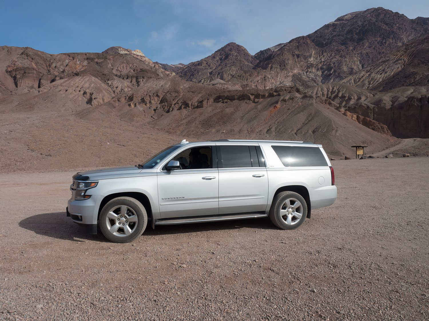
In general, we strategically plan our trips this way. We’ve driven through the southern United States many times, and we don’t have any exciting things to see between basically home and the Canadian border. With two or more potential drivers, this is even easier to do than it is more Mark and I alone. Unlike the Chevy Suburban we rented for our Alaska trip, which only Mark and Dad could drive, because they were the only ones allowed to do so by the rental policy, the Suburban we are taking on this trip belongs to my parents, and any one of us can drive it. I’m sure I’ve mentioned this in a blog post before, as they bought the Suburban not long after the Alaska trip, and we’ve taken it on several trips since then, but for any potential new readers, taking our own vehicle will be a lot better, and a lot cheaper, than the rental. If nothing else, we can cover the silly thing in dog hair with impunity.

For this trip, we’ve decided to try to purchase a national park pass for the Canadian National Parks we will be visiting, as we are visiting enough of them that it should be cheaper in the long run to pay for the annual pass than it would be to pay for each park individually. I haven’t made the purchase yet, but I expect to make it in the next two weeks or so, assuming that we are allowed to do so, as non-citizens. I figure money is money and it will be fine, but I won’t be sure until I’ve done it. By the time the trip starts, I’ll be able to update everyone on how that works out and what the specific rules are pertaining to the Canadian National Park Pass.
| Canadian National Parks |
| Gros Morne National Park |
| Terra Nova National Park |
| Cape Breton Highlands National Park |
| Kejimkujik National Park |
| Prince Edward Island National Park |
| Fundy National Park |
| Thousand Islands National Park |
As for why we are purchasing the pass, I expect the list above will make that pretty clear. These are all of the parks we will most likely visit during our tour through Atlantic Canada. It’s possible, but unlikely, that we will miss one or two of them. I think we need to start keeping a list of Canadian National Parks we’ve visited. We keep one for the U.S., and we are quite close to finishing it, at least for the 59 major parks. If you’ve been following our recent posts, we are going back now to get the smaller parks in the U.S. National Park System. Maybe we will eventually finish that one too, but for now, it’s nice to know the parks we need to see when we have occasion to visit Canada.
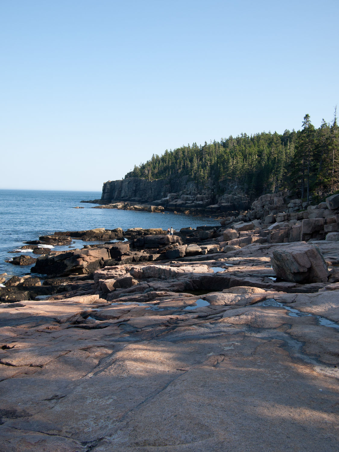
We will also get a few U.S. National Parks on the trip. We’ve actually all been to Shenandoah National Park, as my parents both lived in Virginia during their childhoods, and Mark, Ripley, and I visited it several years ago. Mark, Ripley, and I have also been to Great Smoky Mountains and Acadia, but I know my parents haven’t been to Acadia, and I’m not sure whether or not they’ve been to the Smokies. It’s a little further away from the area where they grew up, which is close to D.C. Regardless, we are definitely going to score some nostalgia points for them on the way home, when we visit Shenandoah.
| U.S. National Parks |
| Great Smoky Mountains National Park |
| Shenandoah National Park |
| Acadia National Park |
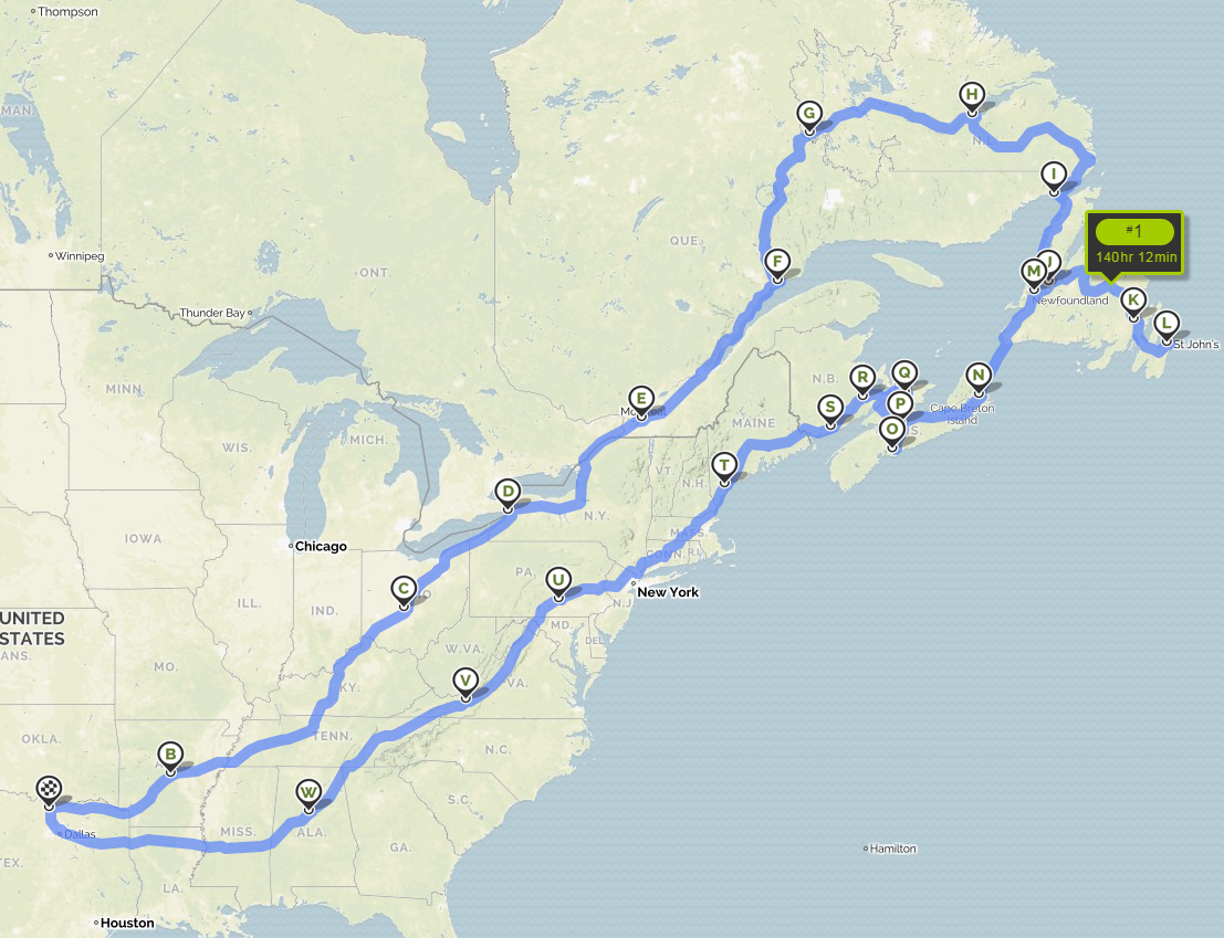
The route home was perhaps the most debated portion of the trip. We knew we wanted to visit Niagara Falls on the way up into Canada, which made the route up a little more concrete, but our route home was much more ambiguous, given the fact that it didn’t matter once we came back down through Maine. We’ve been planning since January, and didn’t try to book hotels until early May, so we had some time to discuss it. In the end, to help us make route decisions, we did a lot of research about the things we wanted to see in each state/province that we wanted to pass through, and made a Google map with all of those locations pinned. Once we had the map, it was easy enough to choose a route that took us through the largest number of things we wanted to visit without taking too long to complete the trip.
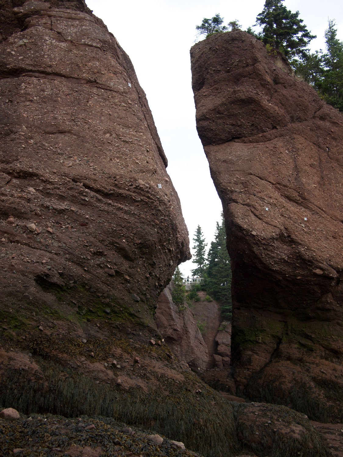
That left us with this plan. As you can see from the table below, we’ll be moving quickly up into New York to see Niagra Falls, then heading on into Canada and up into Quebec, then through the vast emptiness of Labrador, briefly back into Quebec, and then over to Newfoundland. We will spend quite a bit of time in Newfoundland before we take a long ferry over to Nova Scotia, then down to Prince Edward Island. From this area and on down, we will be experiencing tides in the Bay of Fundy, which has the highest tidal range in the world. Mark, Ripley, and I have been through the area before, and we loved it. The featured image at the top of the page was taken at the Hopewell Rocks on the Bay of Fundy. Unfortunately we didn’t blog about it, as it was before our Alaska trip, which started the blog.
After Prince Edward Island, we will travel down through New Brunswick, mostly along the coast into Maine, where we will make our stop in Acadia National Park. From there, we will drive south through Pennsylvania, into Virginia and probably along the Blue Ridge Parkway down to Alabama and then home. Once we’ve finished the area around the Great Smoky Mountains, we will really be booking it for home. It will be a Sunday, and Mark, at least, has to work the next day. He’s the only one.
| Day # | Departing From… | Arriving In… |
| 1 | Gainesville, TX | Little Rock, AR |
| 2 | Little Rock, AR | Columbus, OH |
| 3 | Columbus, OH | Buffalo, NY |
| 4 | Buffalo, NY | Montreal, QB |
| 5 | Montreal, QB | Baie-Comeau, QB |
| 6 | Baie-Comeau, QB | Wabush, NL |
| 7 | Wabush, NL | Happy Valley-Goose Bay, NL |
| 8 | Happy Valley-Goose Bay, NL | Blanc-Sablon, QB |
| 9 | Blanc-Sablon, QB | Deer Lake, NL |
| 10 | Deer Lake, NL | Deer Lake, NL |
| 11 | Deer Lake, NL | Clarenville, NL |
| 12 | Clarenville, NL | St. John’s, NL |
| 13 | St. John’s, NL | Corner Brook, NL |
| 14 | Corner Brook, NL | Sydney, NS |
| 15 | Sydney, NS | Halifax, NS |
| 16 | Halifax, NS | Truro, NS |
| 17 | Truro, NS | Charlottetown, PEI |
| 18 | Charlottetown, PEI | Moncton, NB |
| 19 | Moncton, NB | Saint John, NB |
| 20 | Saint John, NB | Portland, ME |
| 21 | Portland, ME | Harrisburg, PA |
| 22 | Harrisburg, PA | Radford, VA |
| 23 | Randford, VA | Birmingham, AL |
| 24 | Birmingham, AL | Gainesville, TX |
I’ve made a map of our trip using MapQuest, so you can get a rough idea of what it will look like. I originally tried to use Google Maps, but it maxes out at 10 stops for some silly reason, so I had to switch to MapQuest, which I haven’t used since I first got my license more than ten years ago. Remember when you had to print directions to get somewhere? I feel like I’m dating myself. Also, get your crap together, Google! How can MapQuest do something better than you?
I expect I will have a few more preliminary Atlantic Canada posts, leading up to the big day in early July. I’ve got one about Ripley’s updated backpack in the works, and I may post one about our general packing style for a trip of this length, as well. It’s worth noting that a reasonable portion of this trip will be over gravels roads (up around F, G, H, and I on the map) and that area will be quite remote, so packing carefully will be very important for this trip. More posts to follow. Everyone is getting very excited about this one!