– Halifax, Nova Scotia to Truro, Nova Scotia –
Boy was it rainy today. It started with our run this morning, which was at first foggy, then misty, then decidedly damp. Not long after we made it to the hotel, it began to rain in earnest. It was never heavy, but it rained for a good portion of the day. It was still warm-ish in most places, but the rain made it unpleasant to be out of the car.
Our hotel had breakfast, so we did that, then topped off the ice in our cooler and set out on our drive a few minutes later than usual, closer to 9am than 8:30. The rain slowed us down a little. It was easy to pack up the car, though.

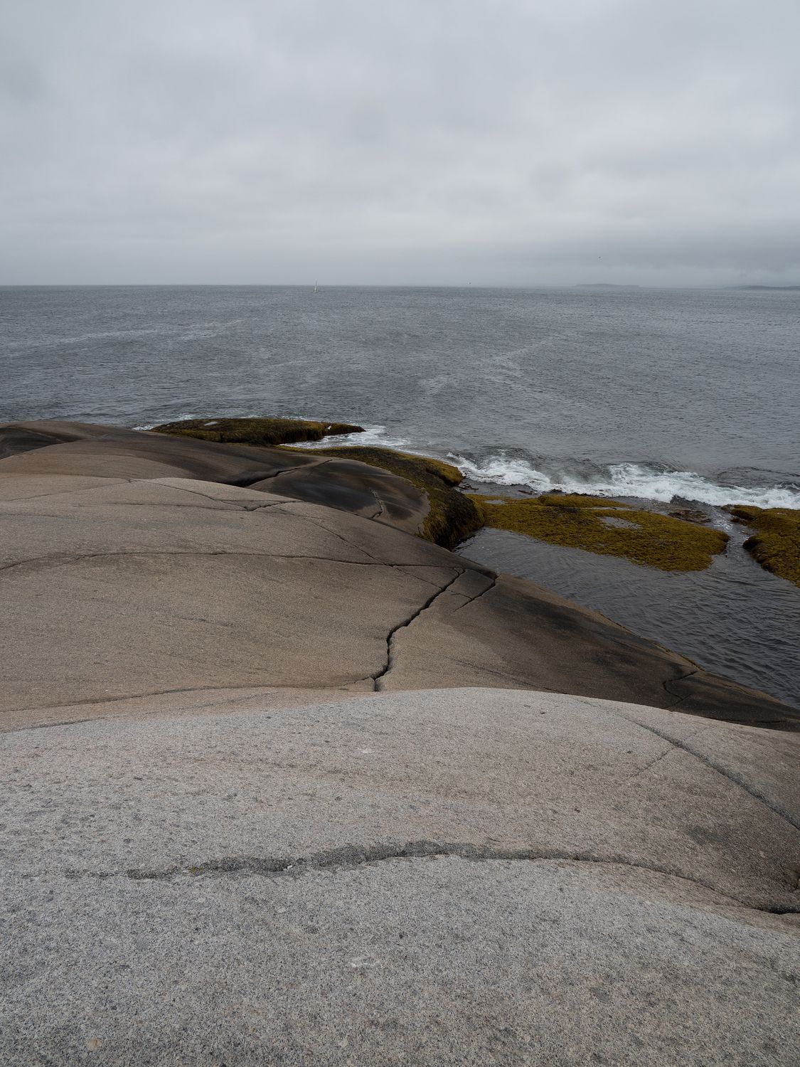
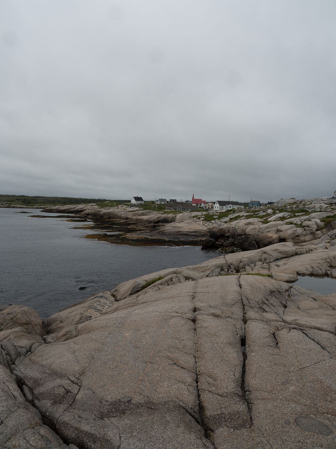
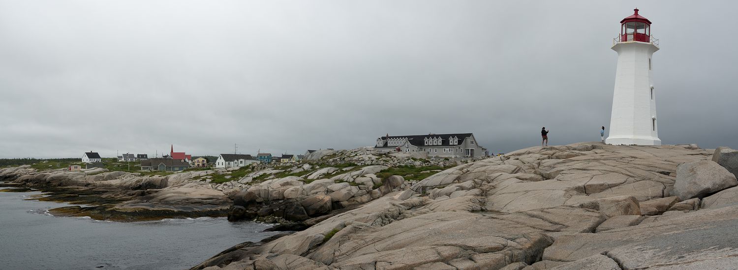
Our first stop of the day was just south of Halifax at Peggy’s Cove, which is where you can find Peggy’s Cove Lighthouse. A picture of that lighthouse on its rocky outcropping is considered an iconic image of Canada. It is one of the busiest tourist attractions in Nova Scotia, though you wouldn’t know it from this morning. I guess the rain (and the fact that it was still only about 9:30) was putting off visitors.
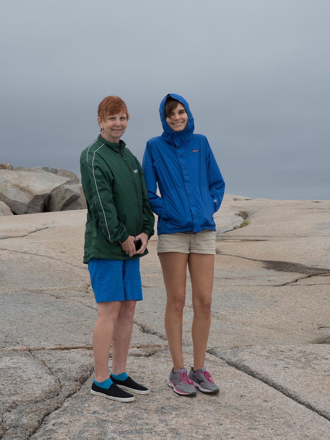
The lighthouse stands on a huge outcrop of granite boulders. It is really cool. Dad thought it looked a little too much like a cliff, and he didn’t want to come, so Mark, Mom, and I ventured out into the rain. It would’ve been nice to get a photo of Ripley, too, but it was just too wet to spend long enough out there to get that done.
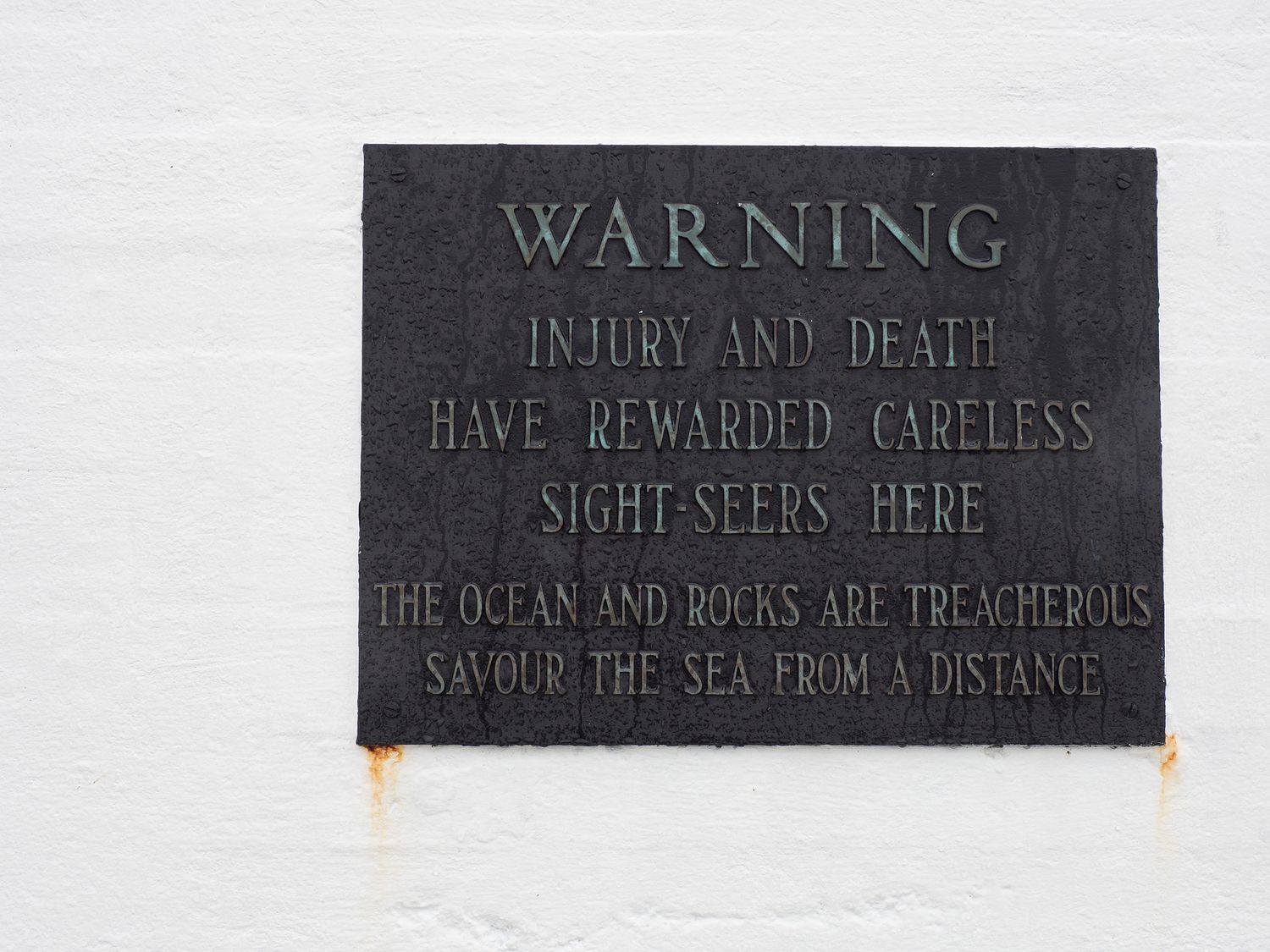
As you can see from the warning photo above, the area can be dangerous, especially when it is stormy. Fortunately, our rain was very sedate, and the water was calm. The rocks were mostly dry, despite the misty rain, so we had no trouble navigating around the lighthouse.
It was chilly and wet, but I’m really glad we went. That’s the best lighthouse we’ve seen by far. I can see why it is an iconic image. I only wish it could’ve been sunny with a few puffy clouds.
When we finished at the lighthouse, we followed the coast around to two little towns that are supposed to be pretty cute: Chester and Lunenburg. Chester came first. We didn’t take too many photos, since it was rainy, but we did tour the town and the coast there in the car.
Lunenburg was even better, with a really pretty “old town” area with brightly colored shops and houses, very old buildings, and narrow streets. We drove through the old town area, looking at all of the little restaurants and shops. It’s a really cute place. It was too dreary for most of the tourists, but a few brave souls were out despite the rain. It would probably be fun to come back in nicer weather, with more time to look around.
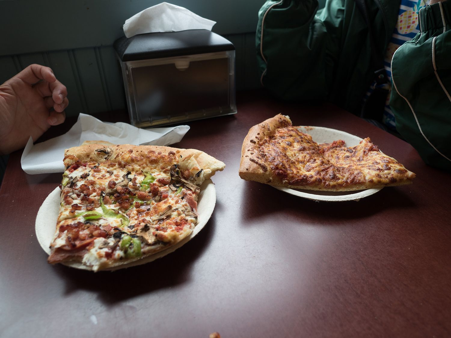
We continued down the road until we made to to Bridgewater, which we explored as well. This time we were looking with more of an eye for lunch. There wasn’t much there, despite its size, though we were able to go inside all at once and eat, since it was cool enough outside for the dogs to wait.
In the end, we stopped for pizza. It was fine. I’m starting to think this is actually the trip of the burger and fries, instead of the pizza trip. Pizza was almost a welcome break from veggie burgers at this point.
Here, we decided to change our plans a little. Originally, we’d planned to drive down to Kejimkujik National Park’s seaside portion, then complete the loop around that end of Nova Scotia before going back to Truro along the northern part of the coast.
Given the dreary weather and the time it had taken us to complete out morning adventure, however, we decided to cut off the end of the island and instead travel up through the middle section, past the main part of Kejimkujik National Park. We had Wifi at lunch, and decided that portion looked a little nicer, anyway. It was a lake and trees instead of another seascape.
With that decision made, we turned away from the coast and drove up through the middle of the island toward the national park. The rain cleared and lightened a little, though it didn’t go away entirely.
The park includes a big lake of the same name in its center, and a national historic site that covers about 4,000 years of civilization from the native Mi’kmaq people. We received a brochure upon entry to the park that told us about native boat carving lessons. Wouldn’t it be cool to carve a whole canoe?
Our first stop was the visitor center, where we stopped to get an idea what we wanted to see in the park. It wasn’t huge, especially the driving portion, but we could see several places we wanted to stop.
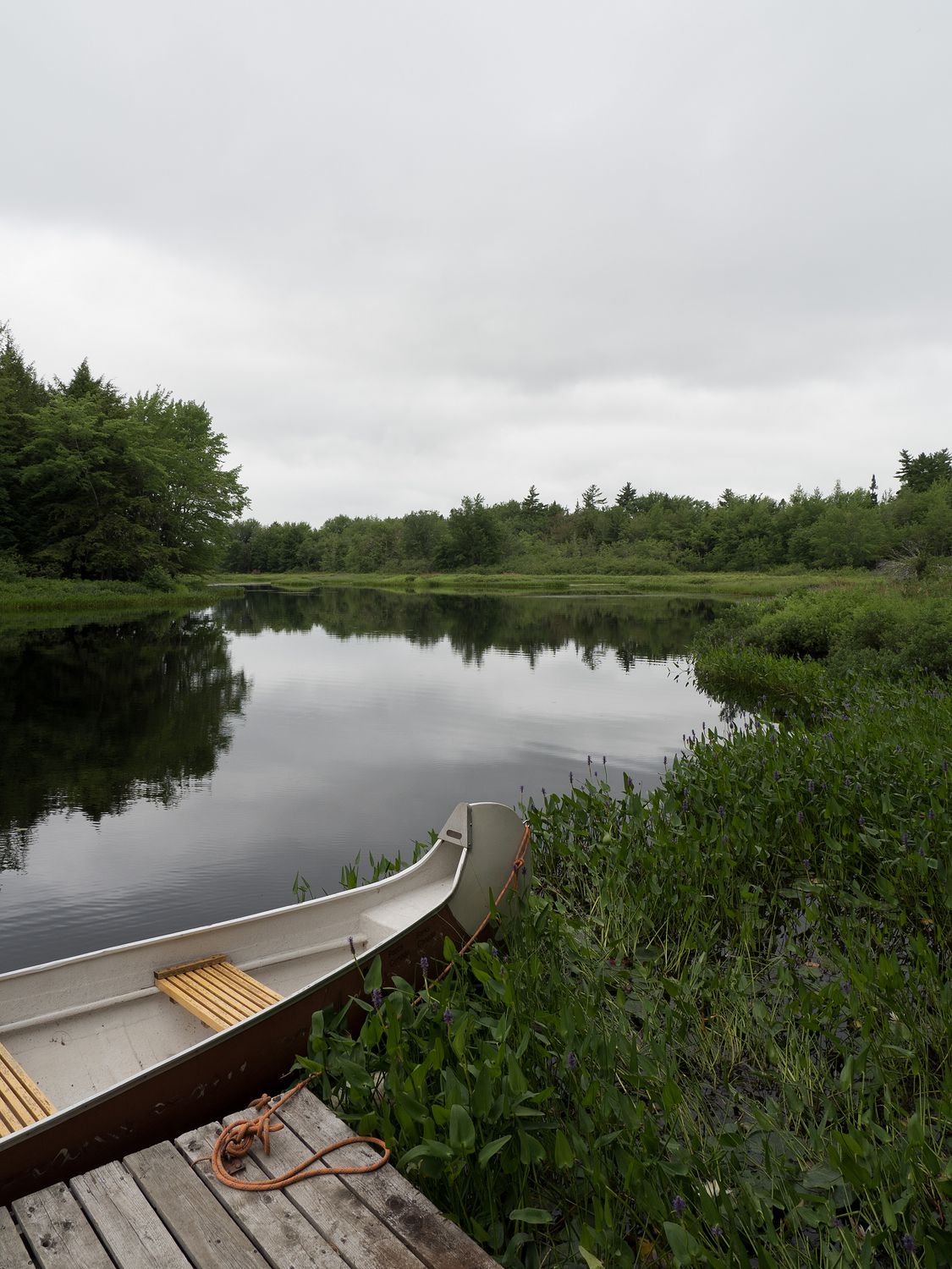
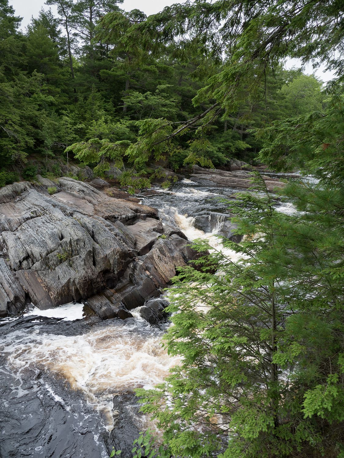
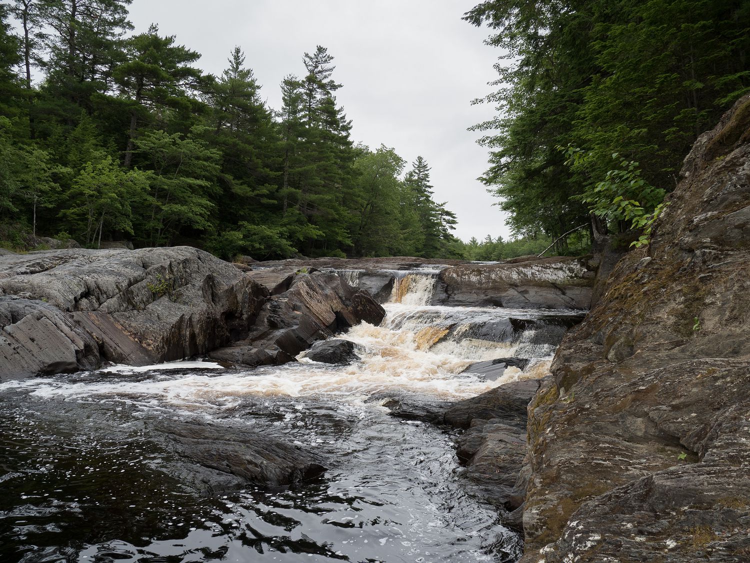
For one thing, the “largest waterfall in the park,” was just about half a kilometer behind the visitor center, so we all decided to go. We even unloaded the dogs. It was barely raining for the moment, so it seemed like a good time to explore. The trees and forest were a little different in this area from some of the other places we’ve been.
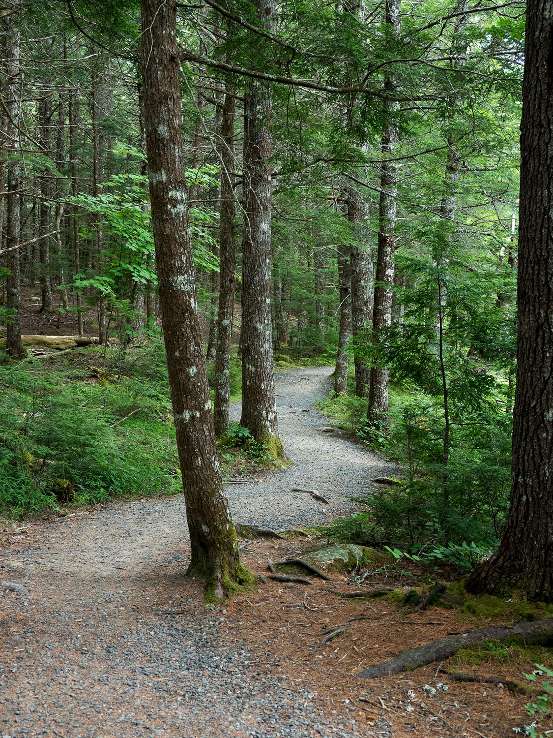
It was a nice, mostly flat trail back to the waterfall. On the way, we stopped by a little pond with one of those carved canoes at a little dock and took some pictures. The water was incredibly still, save for the few sprinkles hitting its surface. It looked almost like glass.
There were people swimming at the waterfall. I was a little surprised. It was warm, I guess, but it just didn’t seem like a comfortable place to swim. The area had a couple of warning signs about the area being moderately dangerous to swim in, as well. The two women we saw underneath the falls didn’t seem to be having too much trouble, though. Luckily they mostly swam out of our way for photos.
We walked the half kilometer back to the car, then drove down the park road a little farther. There was a viewing platform, which had us excited, but it turned out not to have been maintained in ages, so you couldn’t actually see anything over the trees. It was basically a worthless viewing platform. Alas.
From there, we also visited a beach, which was very popular. A ton of kids were swimming there. One group was made up of about ten teenage boys, and all they did was try to tackle each other and scream, “bro” at the top of their lungs. We’ve been calling each other bro ever since.
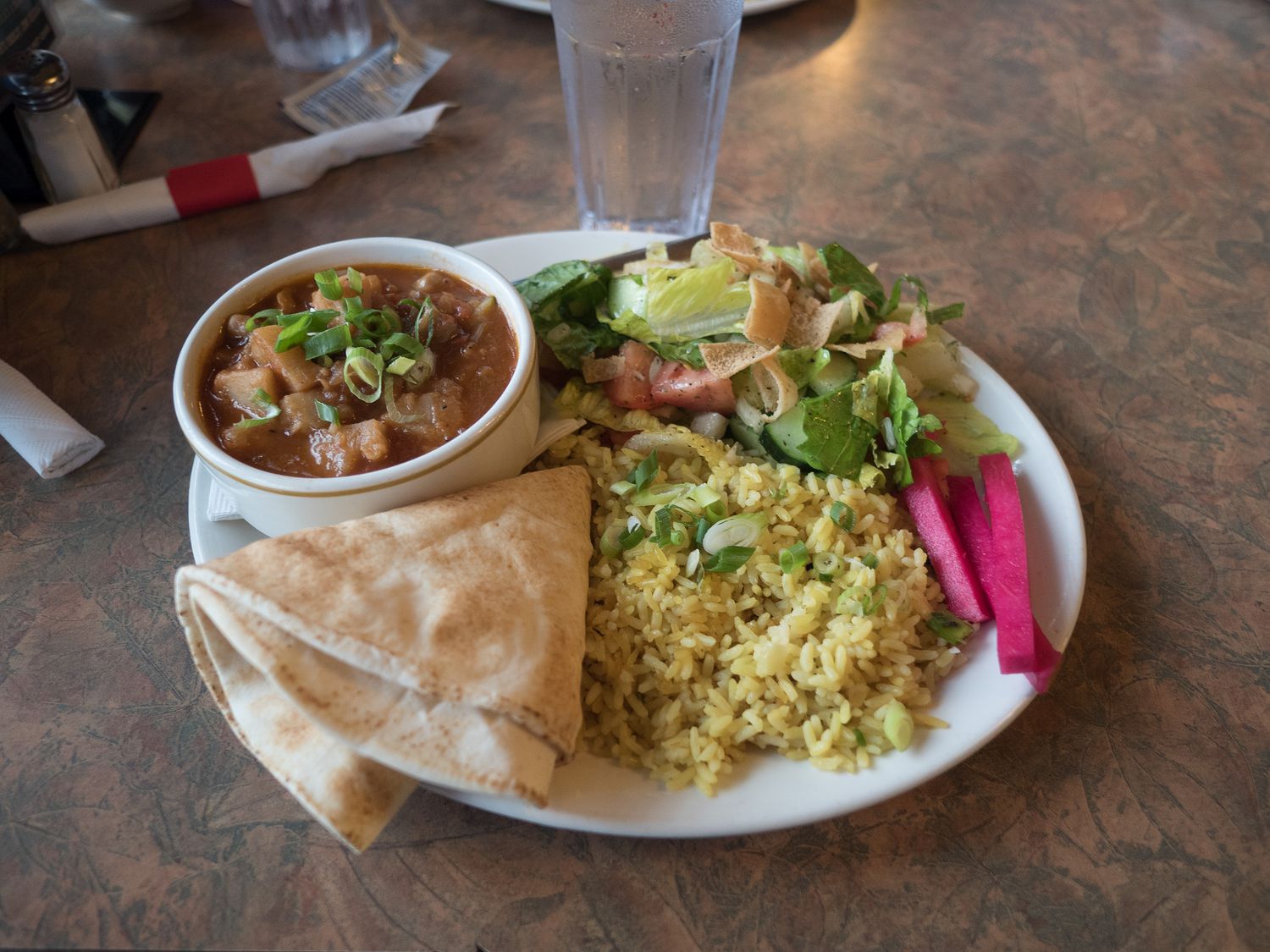
We switched drivers before we left the park and turned up the north side of the coast to head back to Truro for the night. In Wolfville, we stopped for dinner at Joe’s Food Emporium, which was basically a brew pub. We had to park a little way away from it, since it was on a packed main street right down from the local university. It had burgers, seafood, pizza, and Lebanese food, oddly enough.
Mark and I were really excited. We ordered delicious Lebanese food, Dad had fish and chips, and Mom had the chicken parmesan. The portions were huge, and the food was great. I highly recommend it if you ever find yourself there.
When we finished eating, the rain had started up again, pretty hard this time, and we got more than a little damp hurrying back to the car. In addition, we’d left the windows open for the dogs, and our doors and the edges of our seats were a little damp. Luckily the seats are leather, so they dried off easily with some paper towel.
The drive to Truro didn’t take too long after that. Tonight’s motel is by far the worst we’ve stayed in on the entire trip, but it is survivable. I think Mark might even leave a bad review of it on Trip Advisor. We don’t make the effort to do that very often. No free breakfast, and the internet blows. At least there’s a nice running trail.
Tomorrow we finish Nova Scotia and drive over onto Prince Edward Island. In the morning, we’re going to visit the Joggins Fossil Cliffs, which I’m pretty excited to see. I hope the weather is better. The weatherman is saying it will be, but I don’t entirely trust him. We’re in Charlottetown tomorrow night. I love Charlottetown. If I was forced to move to Canada, that’s where I’d go.
– Trip Total : 6,055 miles –