– Great Falls, Montana to Radium Hot Springs, BC –
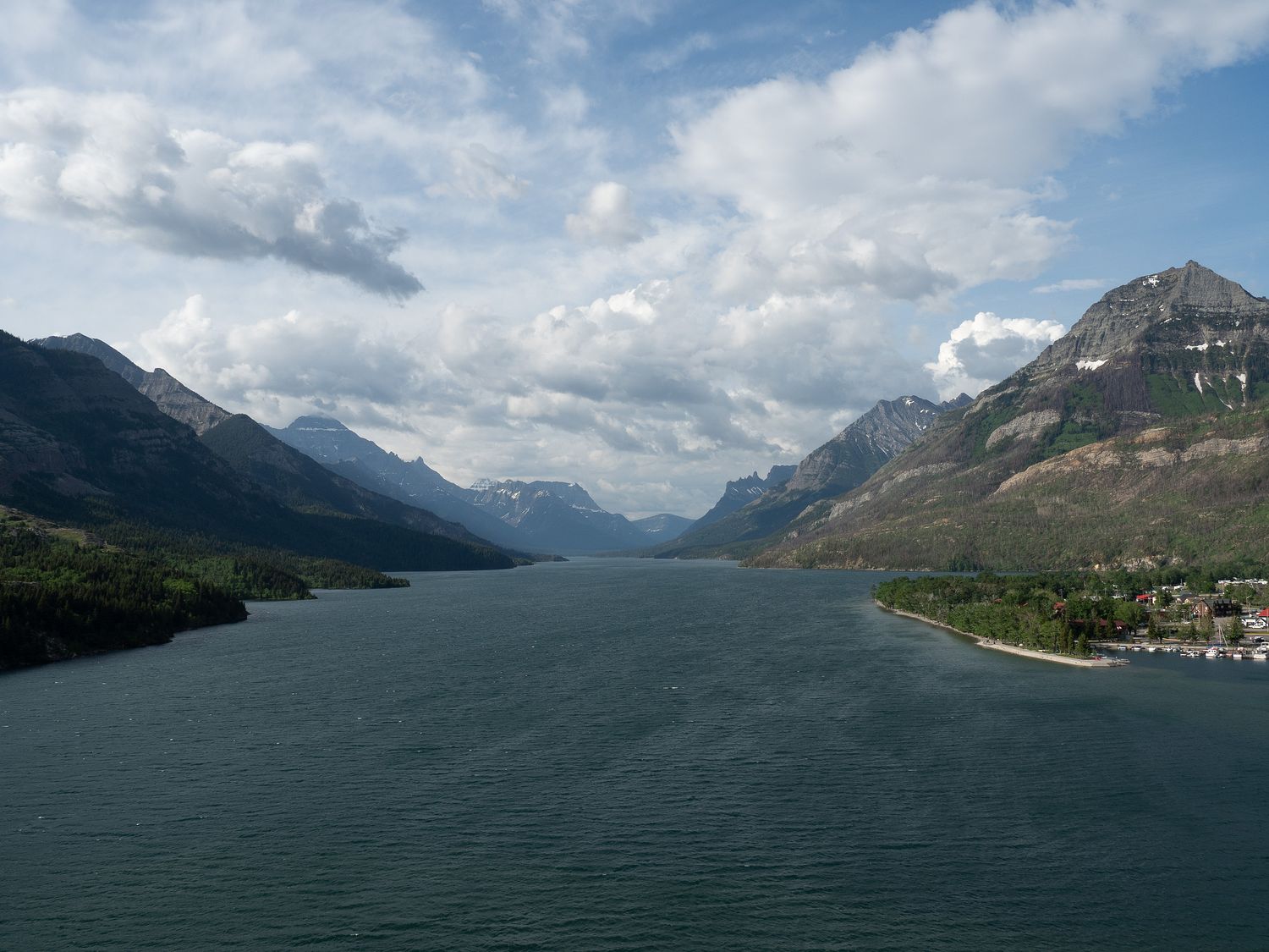
It may have rained here last night, but it was a lovely morning. We were up at our usual 5am and ready for our run. There’s a trail that runs along the water and the road leading into the park, and it’s generally pretty nice, save for a few places that are literally right on the road. Otherwise, the path is only near the road, and of course the scenery along the path is absolutely gorgeous.
With the rain cleared up, the mountains were completely clear, though we could see clouds hovering on the other side at the very top. The only real problem with the weather this morning was the terrible, constant wind. On the run out towards the park entrance, the wind was at our back, and everything was fine. Unfortunately, when we turned, we were running directly into the wind. It nearly knocked me over a time or two, and sometimes it felt like I wasn’t moving at all. We did make it back, of course, but running into the wind is not very fun.
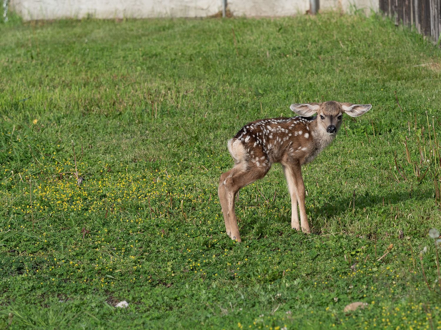
On our way out this morning, we had noticed a deer in the backyard of the house right next to our parking space, but we didn’t pay much attention. Deer aren’t usually that exciting, and we’ve seen tons of them before, so we just pointed her out to one another and went on our way.
On our way back, we noticed the people who owned the house had opened the gate to their yard, but nothing else had changed. We could still see the deer. However, after Mark and I had showered and Mark went back outside, he discovered the reason the deer hadn’t left: a tiny, spindly-legged, fairly new fawn. As you can see, it was adorable, and not afraid of us, and looked a little angry with its outsized ears. I wonder if the poor little fella will grow into them. The fawn and its mom stayed right outside our room next to that house the whole morning.
Our hotel didn’t have anything to offer in the way of breakfast, so we looked around town, but Waterton Park (the little town in Waterton Lakes National Park) doesn’t have much in the way of restaurants, so unless we wanted coffee or a waffle, we were out of lake. Mark was trying to tell me he was going to die of starvation if I didn’t feed him soon, so he had breakfast from the cooler. His near-death status dramatically improved after he ingested his granola bar and hard-boiled egg.
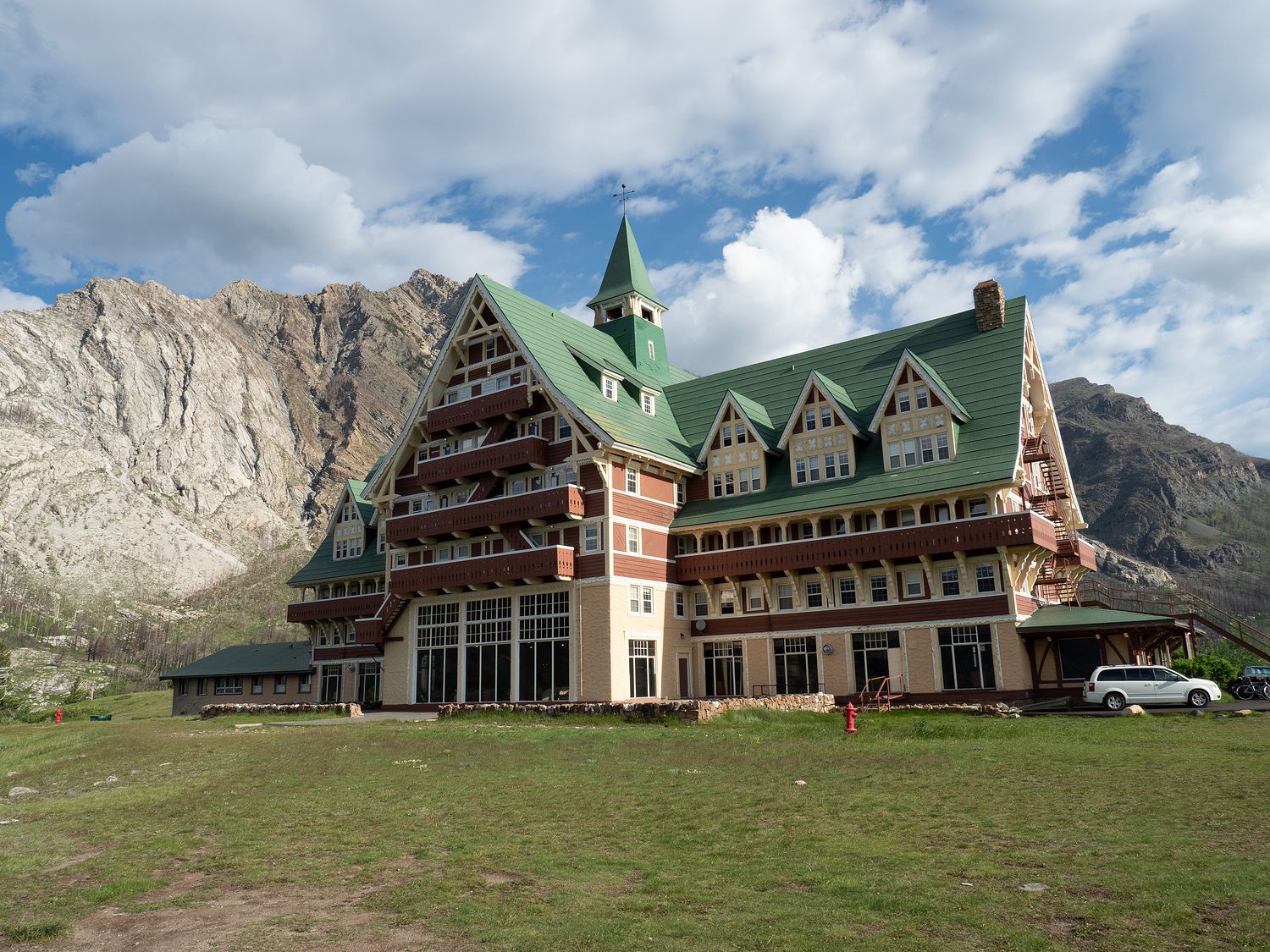
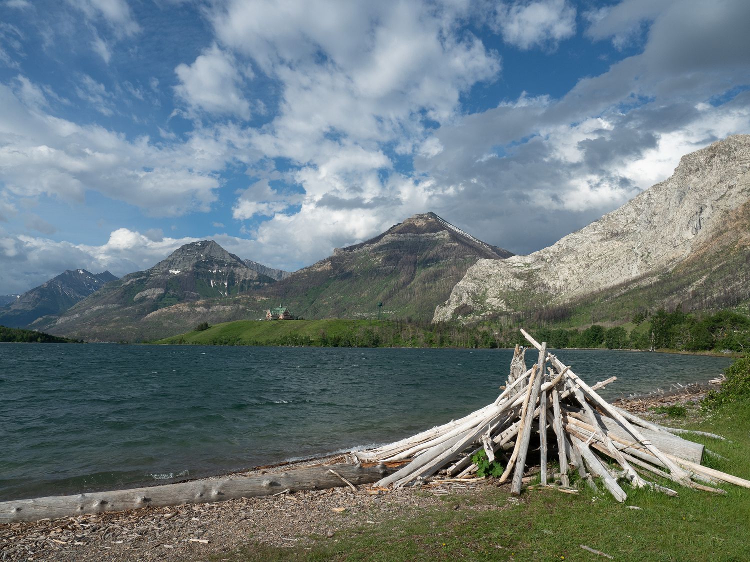
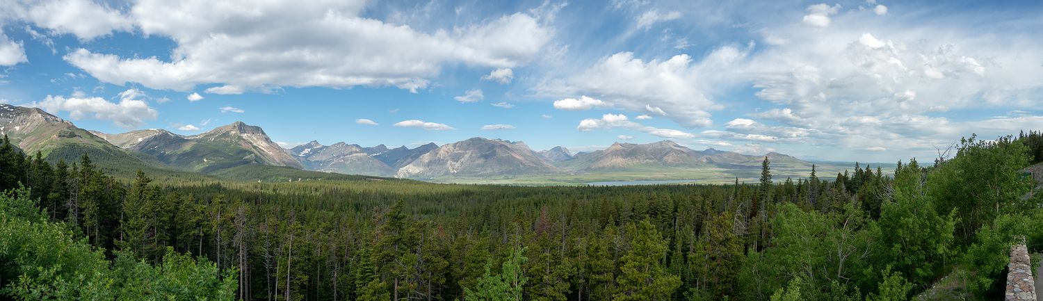
Yesterday the rain and the position of the sun had prevent some of the awesome photos we wanted to take of what we could of Waterton Lakes National Park, so we drove through town and at several of the views we’d scouted out along the running trail/road to get our pictures. One stop was at the Prince of Wales Hotel, which occupies a lovely spot on a hill that juts out into the lake. The building is very interesting, too. They serve high tea every afternoon in the hotel restaurant, if you’re into that sort of thing.
I think yesterday I mentioned that I’d explain a little about what’s going on with Waterton Lakes, so here’s the scoop. Most of the park is closed. You can only get to the town. The three major drives through other portions of the park are completely closed. Even the visitor center for the park is gone.
In 2017, the Kenow Fire burned 38% of the park. According to the Parks Canada website, 80% of the hiking trails were affected. Many of the roads, trails, signs, buildings, picnic and parking areas, and bridges were damaged or destroyed during the blaze. The Akamina parkway won’t reopen for at least another year or two, according to the ranger we talked to in Waterton Park, and the Red Rock Parkway (which we had been excited to see) might be open this fall. The entire Red Rock Parkway is open to hikers and bikers, but we didn’t have the time to cover the ground on foot, since it’s quite long.
While we were a little disappointed by the closures, the park was so lovely that we were not disappointed that we’d gone, even though we missed quite a bit of the park. We will have to go back when everything is open again. There are a lot of parks on our list to go back and visit again.
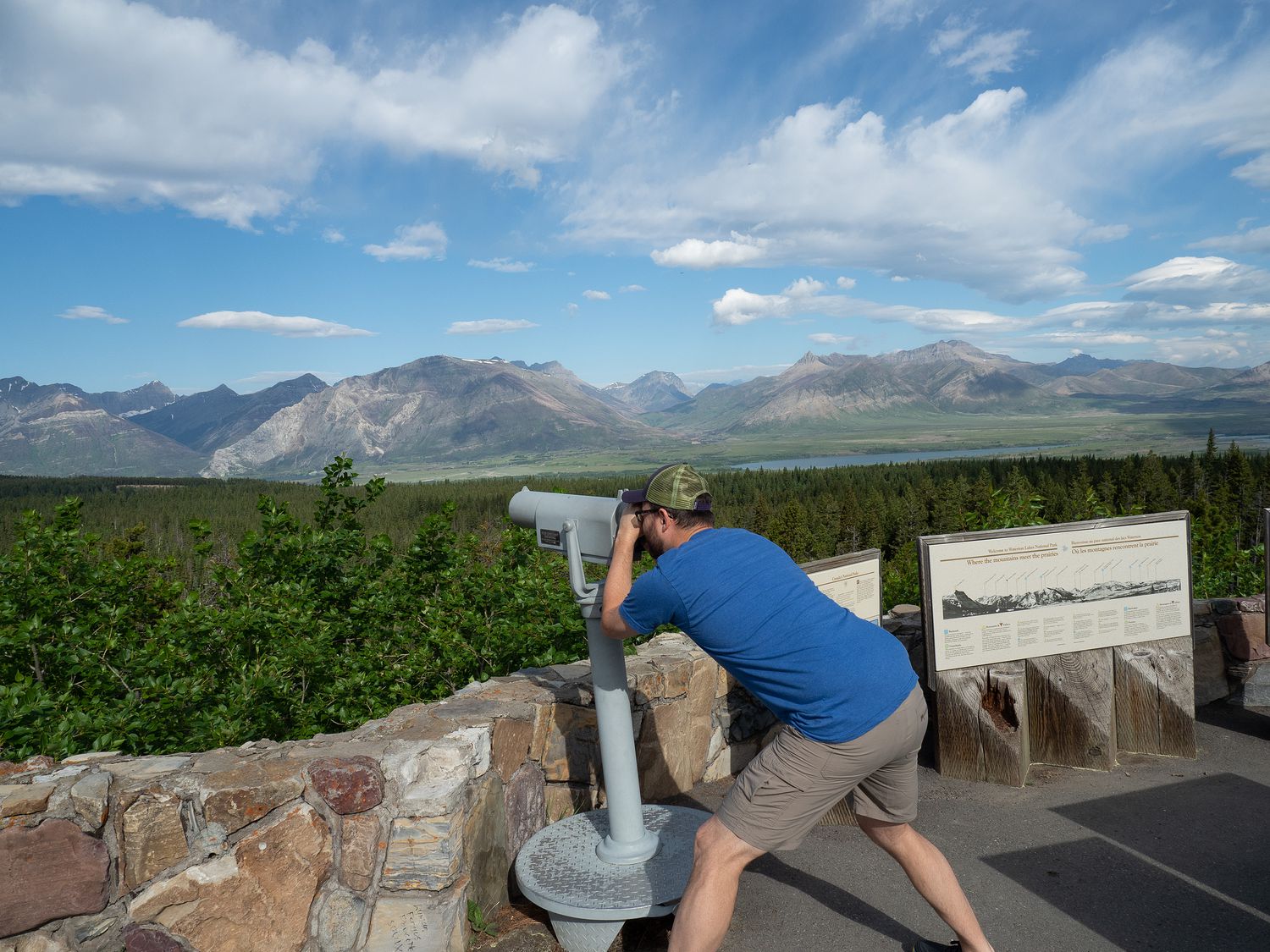
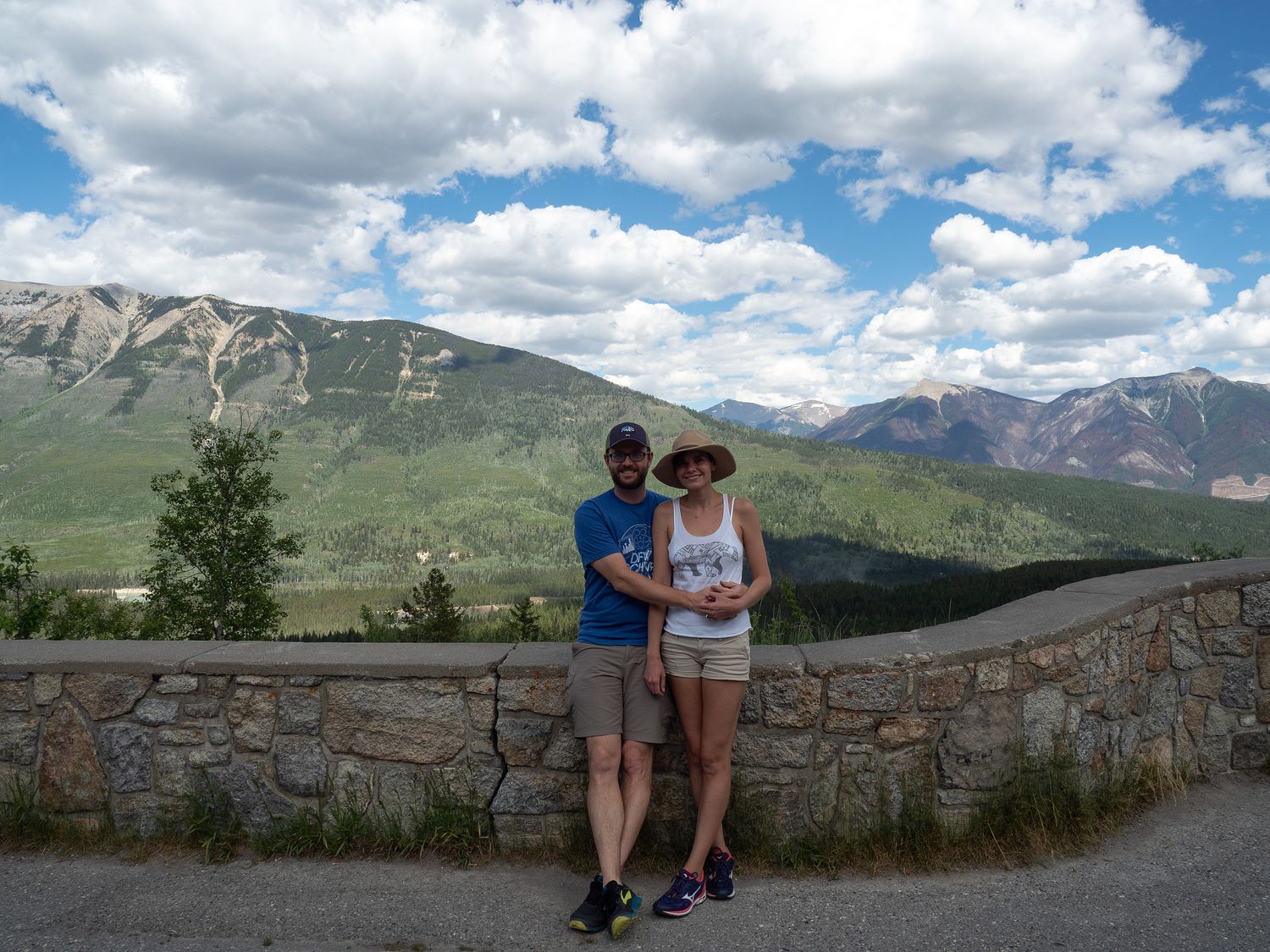
After we’d taken all of the photos we wanted in Waterton Lakes, we drove back a little ways toward the border crossing we used yesterday to get some shots that would’ve been into the sun last night. They were beautiful this morning. Even the clouds that threatened rain had moved on. Also, in that photo with Mark in it just below this paragraph, you can see a sign with pictures of the mountains in the distance. The sign identifies each of the mountains, and it’s the best example of its kind that I have ever seen. I could easily identify every mountain. Normally, those signs are so weird looking that the corresponding mountains are never obvious. Props for the awesome signage, Canada.
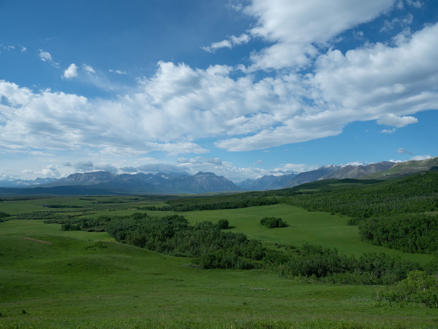
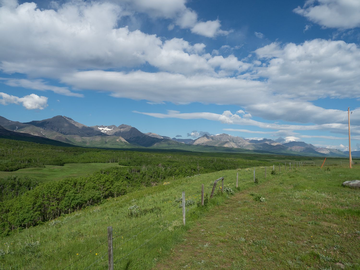
Once we’d finished backtracking, we turned around and drove towards our next destination: Radium Hot Springs, at the edge of Kootenay National Park. The drive was so lush and green. It almost looks fake in the photographs, but I promise you that everything out there was really that wonderful, vibrant green. It feels like you are in a movie or a video game, given how perfect the scenery is. It’s just too perfect. Can you have the Uncanny Valley effect for grass? (Here is the second best grass I’ve ever seen, if you really wanted to know.)
Waterton Lakes is in Alberta, and in Canada, Alberta is largely farm country, especially down here. It is weirdly like a Canadian version of Texas, with farm trucks and cows and old men with beer bellies wearing baseball caps and overalls. We stopped at a gas station and Mark ending up chatting with the attendant, who we could’ve picked up and plopped back down in Childress and he would’ve fit right in, save for the accent.
In Pincer Creek, we stopped at a Walmart Supercentre (hehe) for the most ridiculous reason. This morning, I dropped our bottle of face wash on the bathroom floor, and the lid shattered, so it will no longer stay shut. So, we stopped into Walmart to pick up a replacement. The travel-sized containers were all too small, so we ended up with a condiment bottle with a little snap on cap. It’s as ridiculous as it sounds.
Anyway, the total drive from Waterton Park to Radium Hot Springs is about 4.5 hours without stopping, so we did have a bit of driving ahead of us for today. We also crossed over from Alberta into British Columbia, which happens around Crowsnest Pass. Just before the pass is a town called Frank, and we noticed something particularly unusual about the town as soon as we drove into it.
Something terrible had clearly happened in Frank. On both sides of the road as the town came into view, we could see a huge swatch of what was obviously some kind of terrible rockslide. We didn’t know what had caused it, or why it was there, but we were determined to find out. It’s hard to even describe how bizarre and dreadful seeing such a mess feels when you’ve never seen or heard anything like it before.
As it turns out, the event was called the Frank Slide. In 1903, back when this section of Alberta was still part of the Northwest Territories, Turtle Mountain collapsed, dropping 121 million tons of limestone on the town of Frank and the Canada Pacific Railway and killing around 70-90 people.
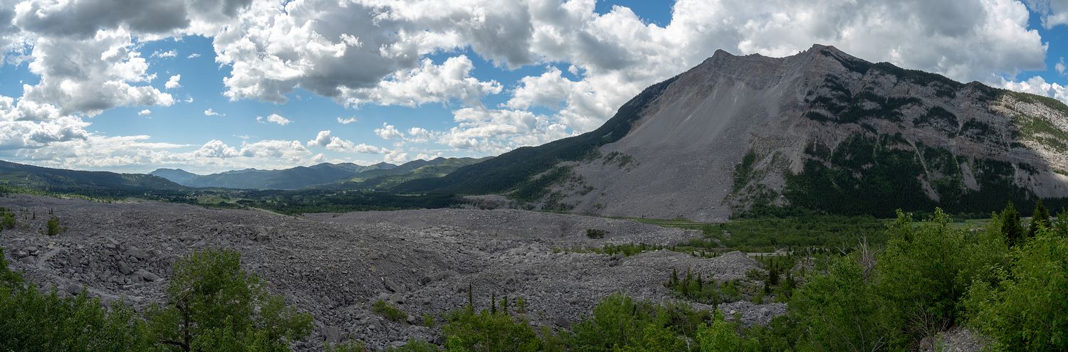
The picture really doesn’t do it justice. According to Wikipedia and the signs we read, the mountain was unstable because of its natural formation, and the coal mine that was dug deep into the side of the mountain made it even less so. The miners were said to feel tremors working in the mine long before the collapse. The owners of the coal mine, of course, deflected the blame after the fact, but to me it seems pretty clear that the mine had something to do with it. A mountain that had stood for thousands of years collapsed only two years after the mine was built. You do the math.
The Frank Slide is the deadliest landslide in Canadian history. There’s an interpretive center/museum that looks down on the rockslide, and we drove up the hill to take a look down at the devastation and have a look around the museum. We didn’t end up actually visiting the museum, but we did look at the signs and viewpoints around it. I’m a little glad I don’t live anywhere where landslides might be a thing to worry about. I’m happy with my little chance of tornadoes and hail the size of baseballs, thanks.
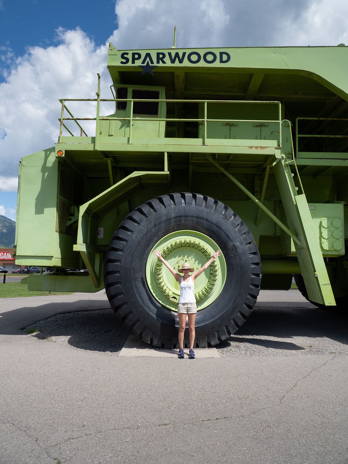
After we left Frank, we drove on into BC. Mark spotted a sign for the largest truck in the world along the road, so we had to stop by to get some photos of it. We thought we might’ve seen one like it up in Labrador, but we were wrong. This truck was even bigger than that one. It’s the Terex 33-19 Titan, and as you might expect, it is used for mining.
Funnily enough, it is the only truck of its kind ever created, as after it was built, General Motors realized that there was actually no market for the thing, since it was just too large. It served faithfully for 13 years before being retired to its current home outside the Sparwood Information/Visitor Center. I think Mark (and pretty much everyone else) wanted to drive it. Unfortunately, the engine didn’t make it into the display.
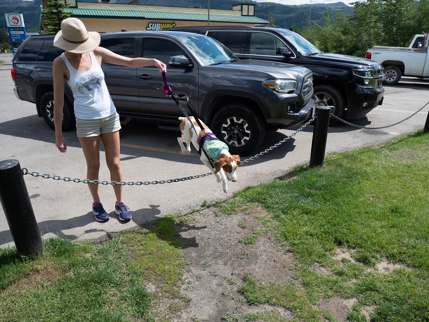
We took some cute photos of Ripley jumping over a chain fence next to the truck, right before turning around in the parking lot to go get some lunch. The truck shares space with an A&W, which if you read along with our Atlantic Canada blog, you’ll remember has an awesome veggie burger made by Beyond Meat. We went and got one. It’s as good as we remembered. Their fries are actually good too. I wish A&W back home were as good.
With lunch finished, we soldiered on down the highway. It gets a little flat between Waterton Lakes and Radium Hot Springs, though you can still see mountains in the distance. I guess that’s why it makes such good farm land. It was quite a bit warmer than it has been lately as well, with temperatures reaching 81°F and more. It was wonderful. I’m a warm weather girl.
When we finally reached Radium, we checked into our hotel and unloaded our stuff. We stayed at the Radium Chalet, which is quite nice, though old. Our room had a living room, kitchen area (no stove or anything, though), balcony, and separate bedroom. It was spacious and nice, and the staff were very friendly.
If I had it to do over though, we would’ve stayed one town back, in Invermere. While Radium is nice enough, and our hotel was good, Radium doesn’t have much in the way of food or running trails, and Invermere is a little bigger and a little nicer overall. Someday when we come back through here, we will stay in Invermere instead.
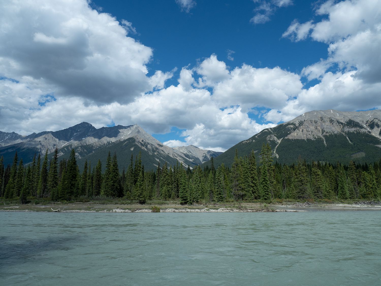
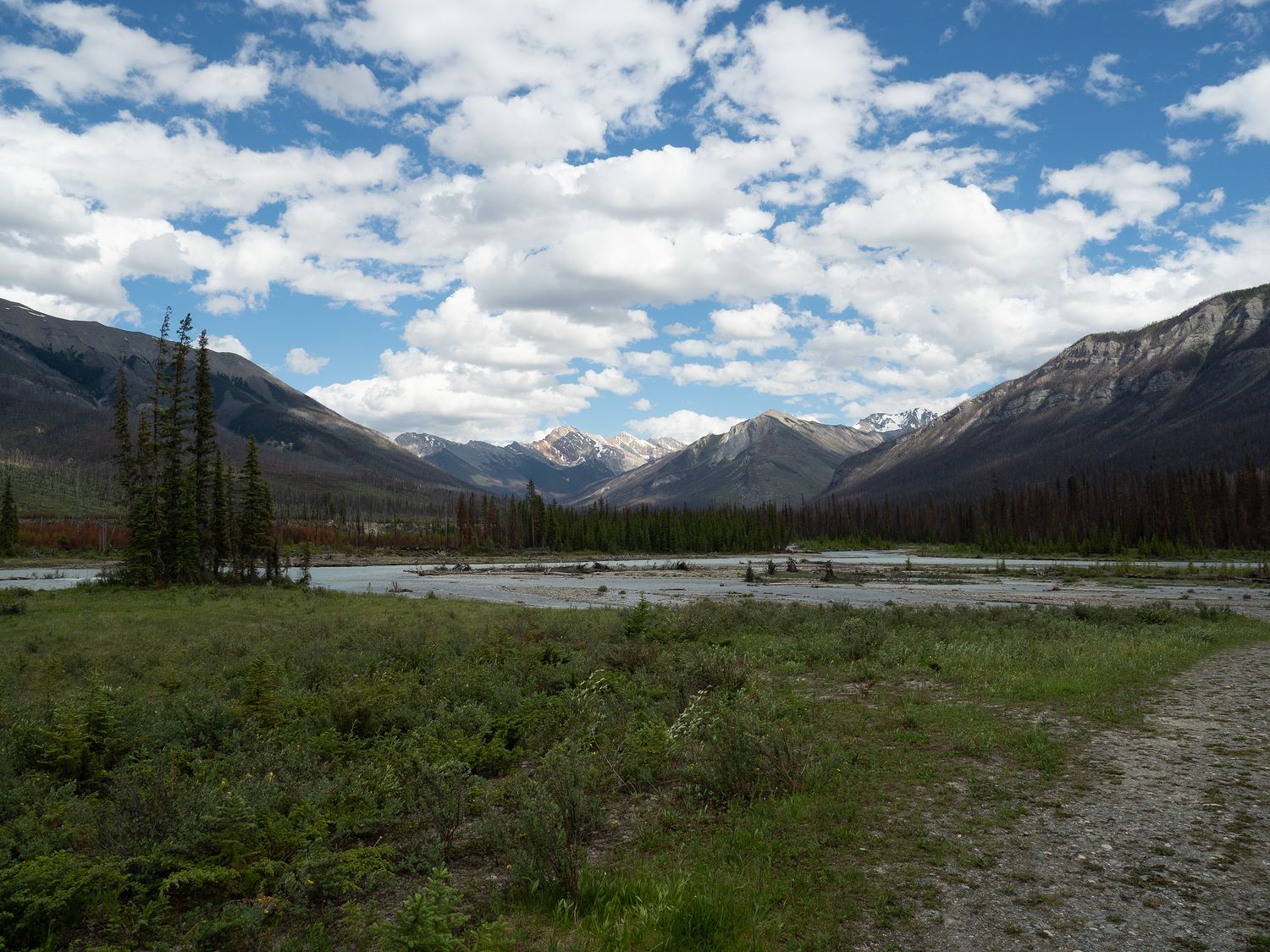
Once we’d unloaded, it was around 3:30, and we decided to venture out into Kootenay National Park, to see how much of it we could visit today. We actually managed most of the park, as several of the stops along the way are closed. Apparently it is bear season, and many of the trails and lookouts are closed because of bear-sightings in the area. Another stop, Marble Canyon, was closed for construction.
Still, the park is beautiful, and the wonderful weather made it a joy to drive around and stop to look at things. We did have to plan some stops for tomorrow as well, since the sun makes some of the photo opportunities a little difficult that late in the afternoon.
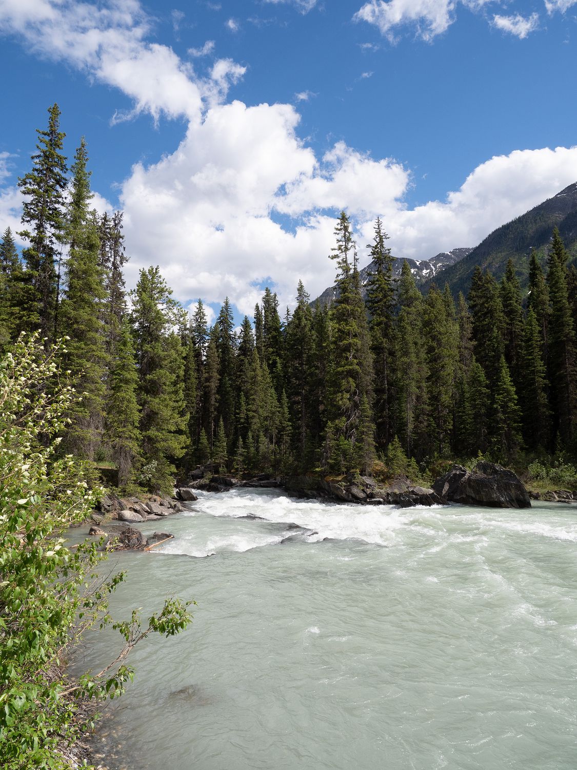
As you might’ve guessed, Radium Hot Springs is named for the local hot springs, and just inside the park is a pool where bathers can visit to take a dip in the hot springs. I think we will take a look at that tomorrow morning, though I doubt we will go for a swim. Ripley wouldn’t appreciate us leaving her in the truck for that long, and I’m not too great at tolerating hot water like that. It looks neat, though. We’re also planning to hike out to the Paint Pots, which are little puddles along the water that contain pigments that were once used as paint. It’s about 4km round trip, so we will have to see what things are like when we get there tomorrow morning to see what we want to do for sure.
We made it back to our hotel around 7pm and once again had cooler dinner. We’ve been very good about eating from our food supplies on this trip. Sometimes we bring lots of wonderful things to eat and eat out every day instead. This time we’ve had to restock our food supplies to keep up with how much we are using it instead of eating out. The price of restaurants and the general lack of choice have something to do with it, I bet.
Tomorrow we will finish up Kootenay National Park and then drive on over into Banff. We are there for two nights, and we’re going to try to see as much of the park as we can in our visit. We’ve also still got Yoho, Jasper, Glacier of Canada, and Mount Revelstoke. It’s a Canadian National Park frenzy up here.
– Trip Total : 2,300 miles –