– Banff, Alberta to Revelstoke, BC –
Today was our big park day. Once we left Banff, we saw three more national parks before the day was done. It was a long day, even though the drive was only about 3.5 hours or so. Three parks is a lot to see in a day, and its four if you count the fact that we were still in Banff for an hour this morning.
Our morning didn’t start off as we had planned, since it was pouring rain when we woke up to run. We were pretty sad about it, but it had been going for a while, and the radar showed that it wasn’t going to stop anytime soon, so we went back to bed until 6:30am. I guess the extra sleep was nice, but our run in Banff yesterday was a lot of fun, and I was looking forward to doing it again.
It rained steadily while we showered and packed, and continued to rain while we loaded the truck. Since they didn’t have a luggage cart or anything, we had to haul all of our stuff out piece by piece in the wet. Mark did the brunt of the work. I just finished the packing while he loaded the car and convinced Miss Ripley to do her business out in the rain before she had to get into the truck for a while. She wasn’t easily convinced, but I am not sure that counts as the same kind of work Mark was doing.
In any event, we briefly considered a stop at Tim Horton’s, but we decided that it took too long yesterday to bother with today, so instead we stopped by the grocery store. We mostly did it so Mark could get a coffee at the Starbucks inside, but they also had a nice juice that I had with my lunch the other day, so we each got one of those to go with breakfast.
Once we’d finished in the town of Banff, we hustled off down the highway toward Lake Louise. We stopped a couple of times for photos along the way. It may have been raining, but some of the scenery was still spectacular, and the rain had been lightening a bit. By the time we did make it to the turnoff for Lake Louise, the sun was starting to filter through the clouds.
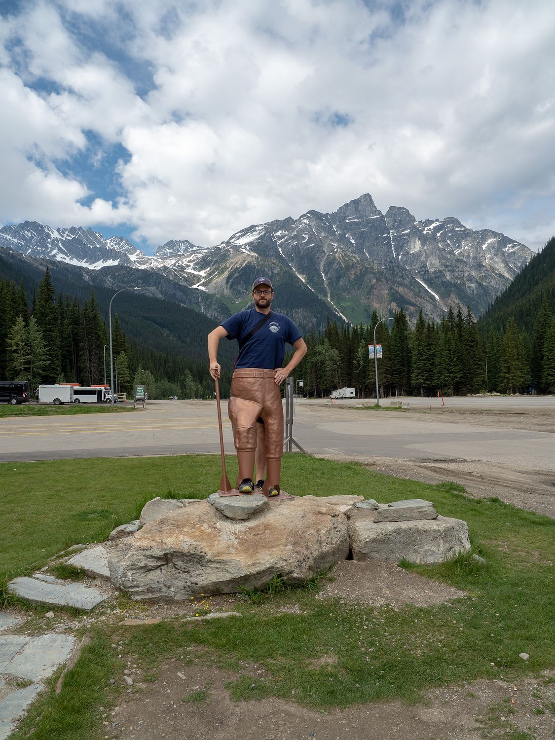
Just past Lake Louise is the turnoff for Yoho National Park, which was our first real stop of the day. Yoho is another spectacular park, and of the three new parks we visited today, Yoho is the one that I recommend most highly. You can miss the other two and not miss too much, but Yoho is amazing and definitely deserves a trip, especially if you are already here for Banff and Jasper.
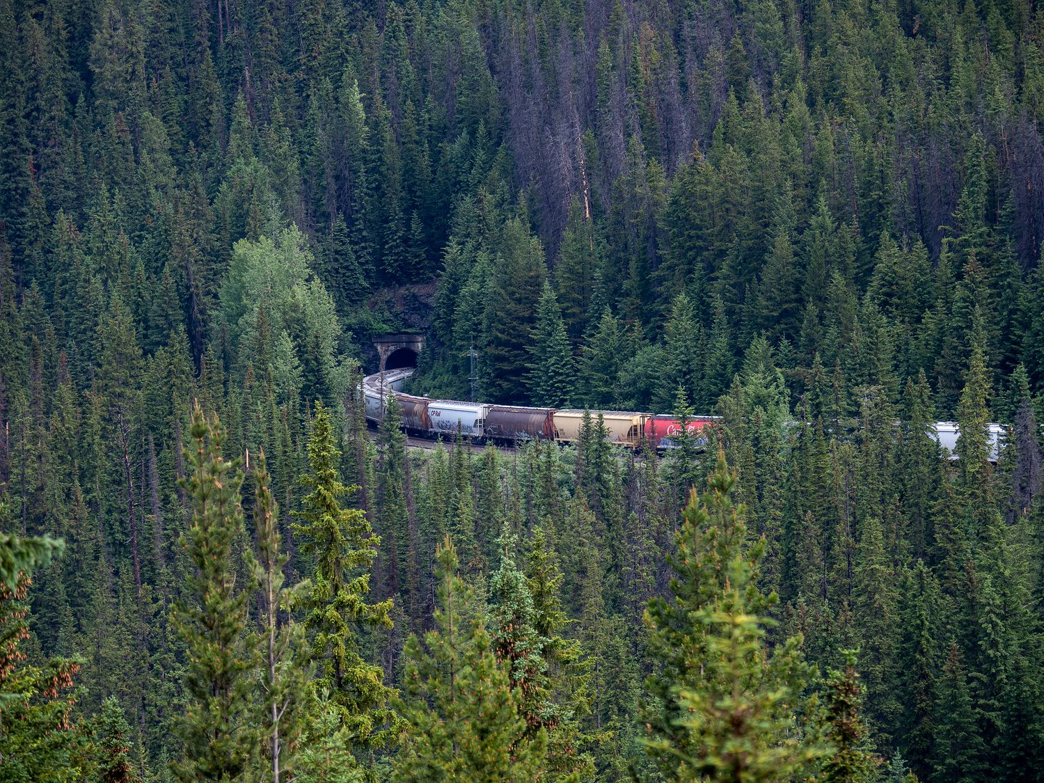
The first stop in Yoho for us was at the Spiral Tunnels viewpoint. For a little backstory, if you will, once upon a time, Mark and I went to the Omni Theater in Ft. Worth to watch one of those 360° movies in their round IMAX theater. The movie was called Rocky Mountain Express, and it was about building the Canadian Pacific railroad through the rocky mountains. Obviously the area we are in features heavily in the film, as we are right in the rocky mountains, and right in some of the most difficult terrain the railroad had to traverse.
The Spiral Tunnels are the second solution to the problems the engineers faced when building the railroad through this area. The problem was that the tracks, “had to ascend 1,070 feet along a distance of 10 miles from Field at 4,267 feet climbing to the top of the Continental Divide at 5,340 feet. The narrow valleys and high mountains limited the space where the railway could stretch out and limit the grade.” (More here.) This meant that trains had to ascend an enormous hill in a short amount of time to get through the mountains there.
The Spiral Tunnels achieve this feat by tunneling through the mountains to increase the distance the train has to climb the gradient. Thus, the grade of the railroad is reduced. The train will loop completely around itself twice while it navigates through the upper and lower tunnels. I don’t feel like I’ve explained this perfectly, so I highly recommend reading more about it if you are curious. You should also watch the Rocky Mountain Express movie if you can find it. Just be careful if you get motion sickness like I do, because it’s a little tough to watch.
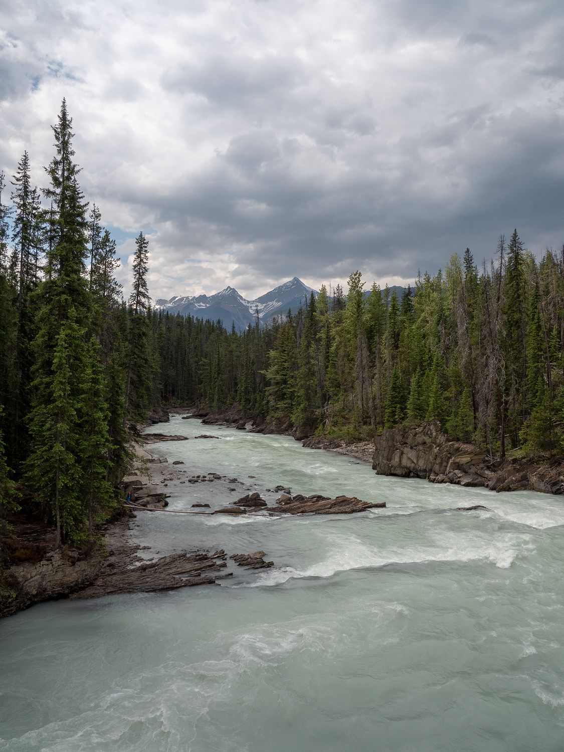
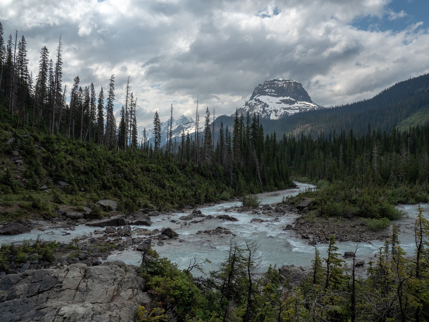
After the Spiral Tunnels lookouts, we turned up Yoho Valley road to head back to the second tallest waterfall in Canada. Along the way, we also stopped at the Meeting of the Waters viewpoint, which looks out on, as you might expect, the confluence of two rivers. Here, the Kicking Horse River and the Yoho River merge, and you can see the water joining together, as the water in the Yoho River is gray with glacial silt, and the Kicking Horse River is much clearer. It isn’t obvious in the photo, but it was cool to see.
On the way up to the waterfall, there is a place to leave trailers, and plenty of signs telling vehicles over 21ft to turn back, that they won’t be able to make it up the road. At first, these warnings seem strange, as the road is flat and easy. All at once, you suddenly come upon a series of switchbacks that basically go straight up the side of a tiny mountain, which definitely explains the reason they don’t want any long vehicles on the road. If you drive an RV or bus up the switchbacks, you have to back up the first section, then drive straight up on the second, then back up the last section. There’s no room for even remotely large vehicles to make the turn. It’s pretty cool, but I wouldn’t want to be the one backing my rental RV up that slope. Luckily our truck made the turns handily, and we just got to watch a bus driver tediously haul himself up the road.
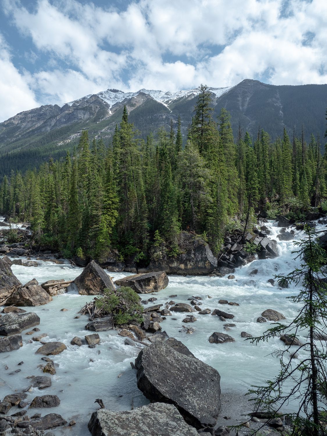
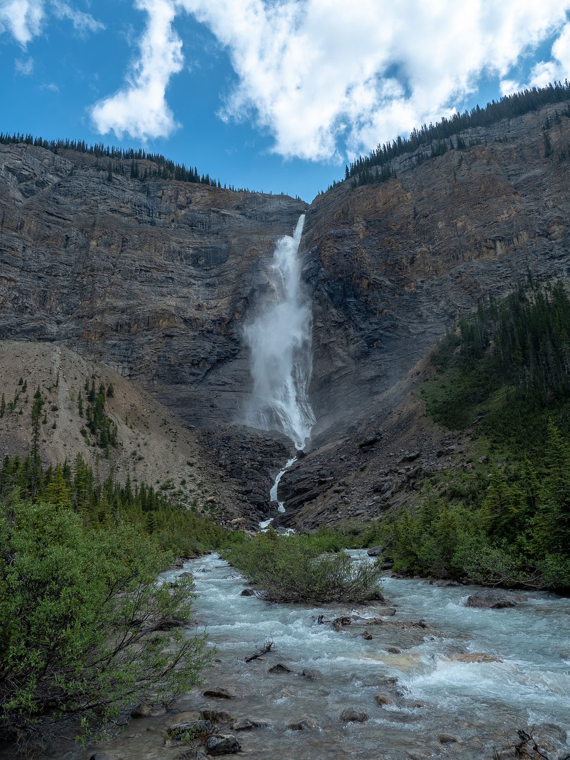
All told, it was about 14km to the waterfall, and the drive was definitely worth it. We had no idea how big the waterfall would be before we saw it, and it is seriously impressive. The water comes over from the top of a huge cliff and falls way down into the valley, kicking out of the side of the cliff where a promontory juts out into the water’s path. It’s very cool.
We hiked back to basically the foot of the waterfall to get our photographs. By now, the rain had stopped completely, and the weather had warmed up to just over 60 degrees. Mark and I had started the morning in pants, but we were ready to change into shorts during our walk to the waterfall. There were a ton of people out looking at it, and you could even walk up the rocks beside it to get a little closer. We elected to stay dry at the bottom of the waterfall, though I think Ripley could’ve easily been convinced to climb up to the water’s side. She was having a blast, and kept making friends with the other hikers along the way.
After the waterfall, we drove into Field, the little town on Highway 1 in Yoho. It didn’t have much to interest us, so we pushed on the the next road up into the park. This road went badck to Emerald Lake, but along the way, we stopped at the Natural Bridge.
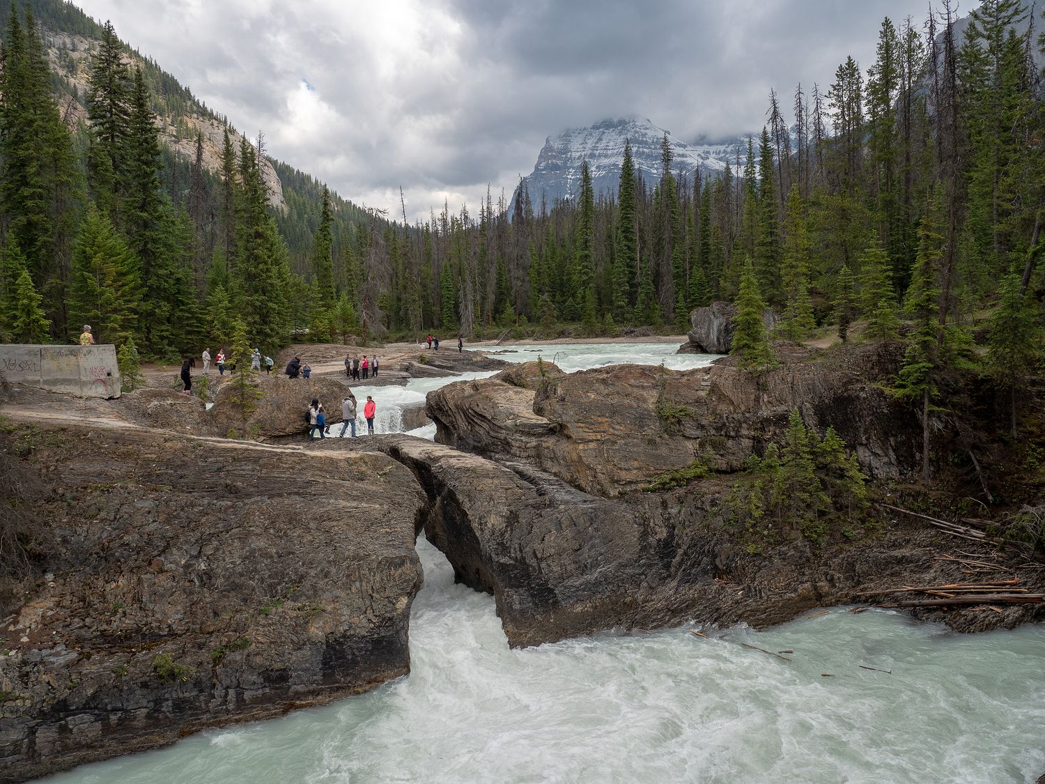
The Natural Bridge is a former waterfall that collapsed when the standard water levels for the river lowered to the point that the water no longer rushed over the tops of the rocks. Over time, the water wore through the rock, leaving it to flow through where it once flowed over. Now the little chasm that is left forms a natural bridge over the river, though that too will once day collapse as the river wears the rock away. This area was packed with people, which surprised us a little. We hadn’t expected to see so many travelers out this way, and we had no idea what was coming next.
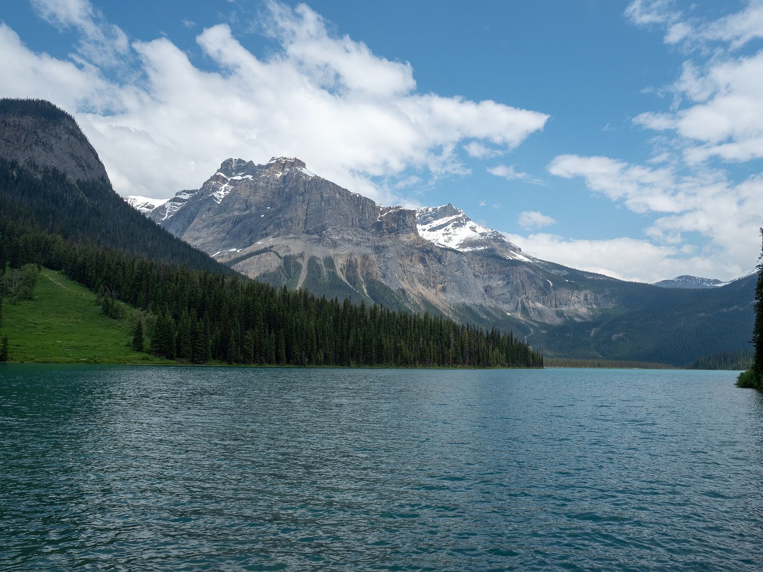
Parking for Emerald Lake was insane. Not only was the parking lot full, but the sides of the road way back from the parking lot were full. There was no way we were going to find a place to park, and since we weren’t planning to boat or hike around the lake, we decided that our best chance for photos of the lake would be if I hopped out while Mark made a circuit of the parking lot.
I rushed over to the bridge leading out to the hotel there by the lake and took some cool photos of the lake and the mountains behind it. Emerald Lake doesn’t seem as green as the Vermillion Lakes did, but the grass and trees in the background were a vivid green, which made up for it. I heard people along the bridge I was standing on talking about how this lake was better than Lake Louise, but they are wrong. Don’t let anyone tell you otherwise. It is pretty, but it is no Lake Louise.
Once we’d finished at Emerald Lake, we were basically done with Yoho. The time had changed along our path, knocking us back another hour to Pacific Time, which meant it was only about 11am when we rolled out of the park and into the city of Golden. We stopped there for lunch, but couldn’t find anything better to eat than A&W, so we had our veggie burgers again. Don’t think I mean better as in “tastes better,” because honestly those A&W burgers are pretty great. Mostly I mean better for us, and maybe something that isn’t a chain. That’s usually the goal for meals on trips, but we haven’t had much success at that so far on this one. We changed into shorts in the restaurant.
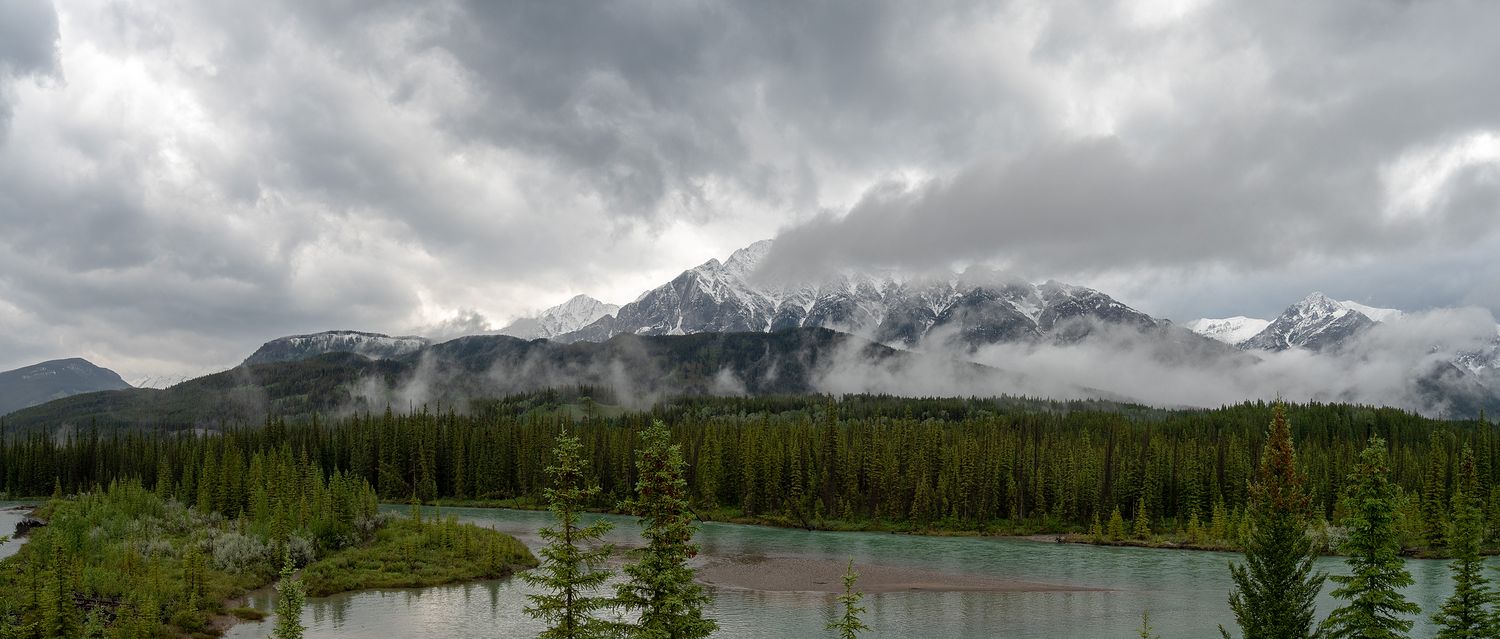
After Golden, we continued along the road to Glacier National Park of Canada. It’s a bit of a funny name, but they do that to distinguish it from the Glacier National Park we visited in Montana a few days ago. It’s certainly not as cool as that one, though it does have some nice views.
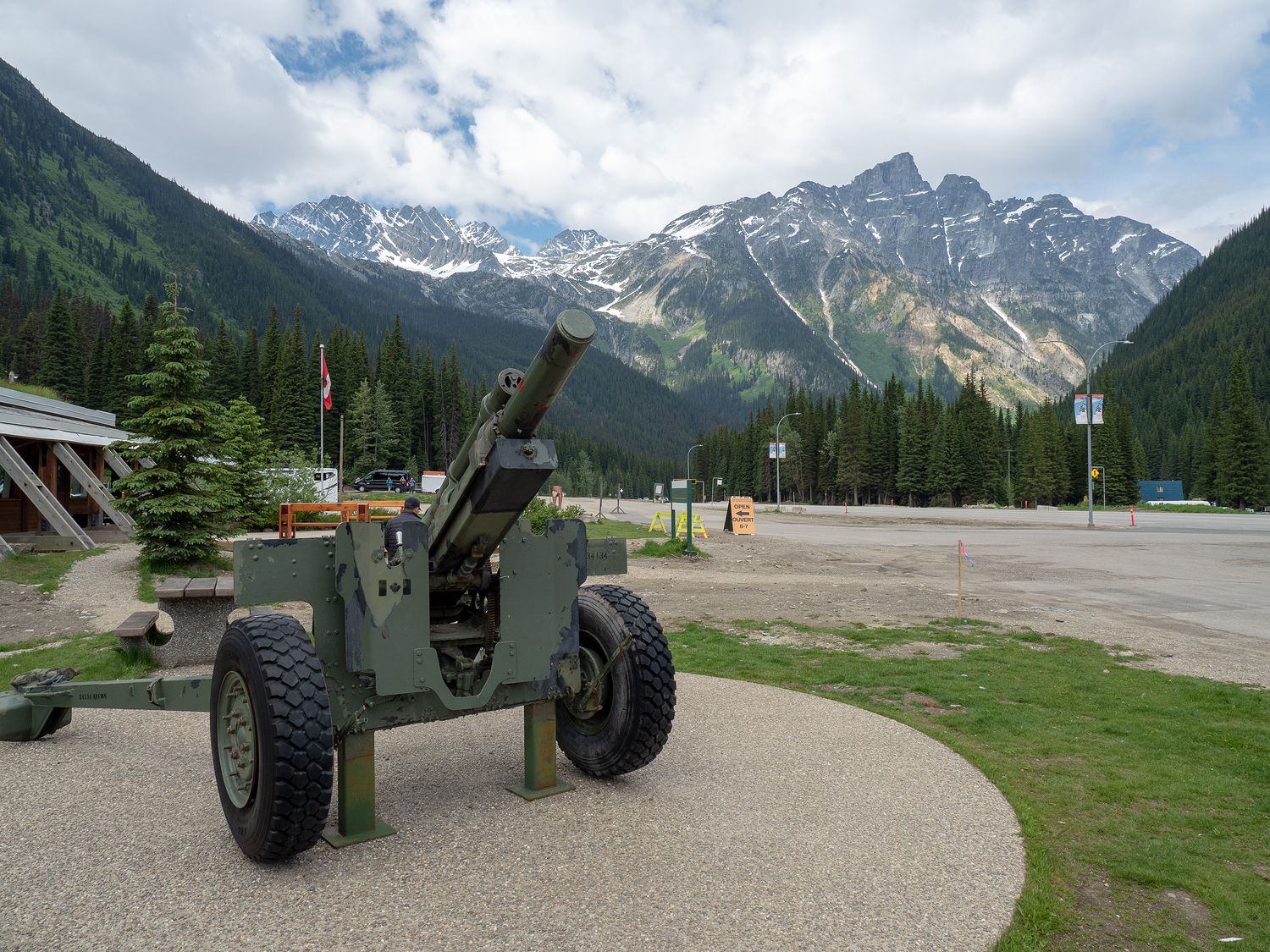
At the tops of Rogers Pass, which is the highest part of the road through Glacier, we stopped at the museum to take a look around. The museum talks about the difficulty of getting the railroad through Rogers Pass, another difficult portion of track mentioned in our Rocky Mountain Express movie. It’s a little funny to think how much railroads shaped these parks we’ve been visiting.
The museum also has a few heavy artillery guns. Would you like to guess why? I was joking with Mark that they must shoot down the snow with them, and lo and behold, the signs told us I was correct. These guns were used to create controlled avalanches, to make traversing Rogers Pass a little safer. That’s a job I could enjoy. Bombing snow down off the mountains sounds like a good day at work.
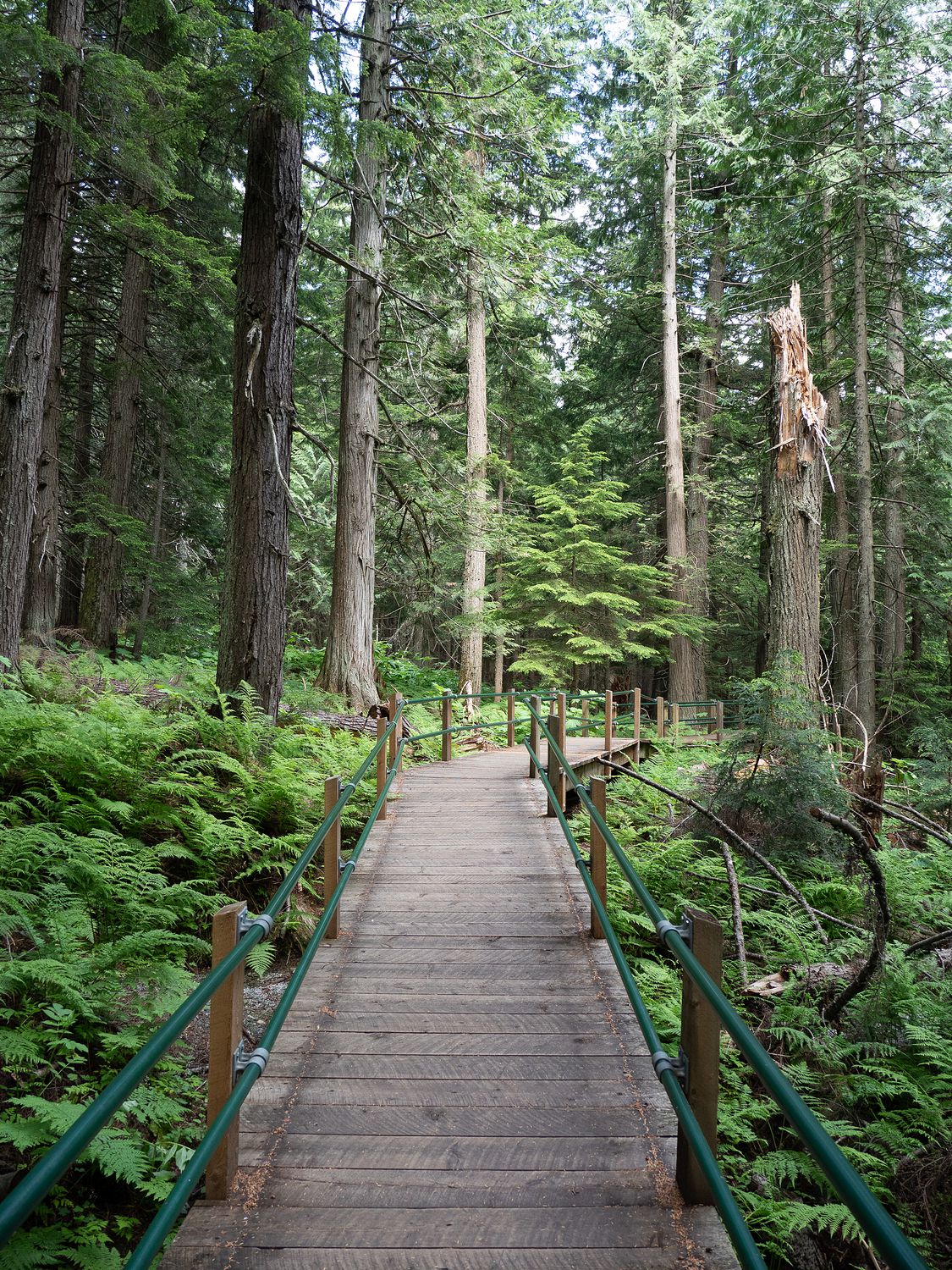
Along the way through Glacier, we also stopped at Hemlock Grove Boardwalk, which is a raised boardwalk that travels through an old growth forest. The trees were huge, and Mark and I had fun trying to guess which trees were what. The siding of our house is made of hemlock, which is an unusual siding for a house, especially in our area. I will be the first to tell you that I am terrible at identifying trees. All I can tell you is which one is a coniferous and which is deciduous. I can also identify aspens, because who can’t, right? Mark is the family tree guru, which isn’t saying a lot.
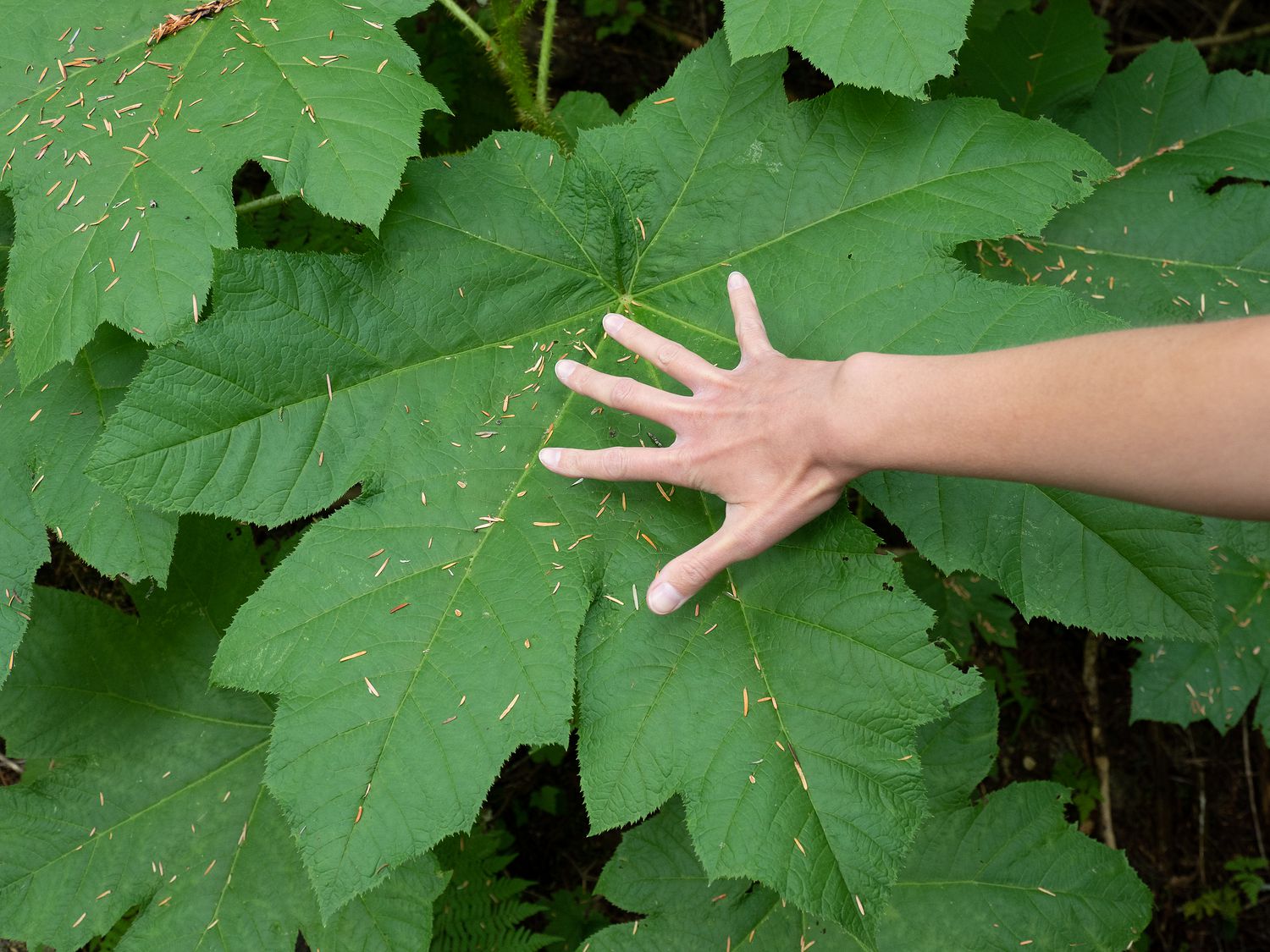
Ripley had a good time dragging me down the boardwalk. The trail had some kind of plant with leaves that were the size of her whole body, and they were everywhere. I’ve noticed in the Canadian national parks that many of the signs in areas like this are not very helpful, as they will talk about when the boardwalk was built and other things like that, instead of telling you anything about what you are actually seeing. It makes me wish my internet worked up here, so I could google these things on my phone while I’m thinking about it.
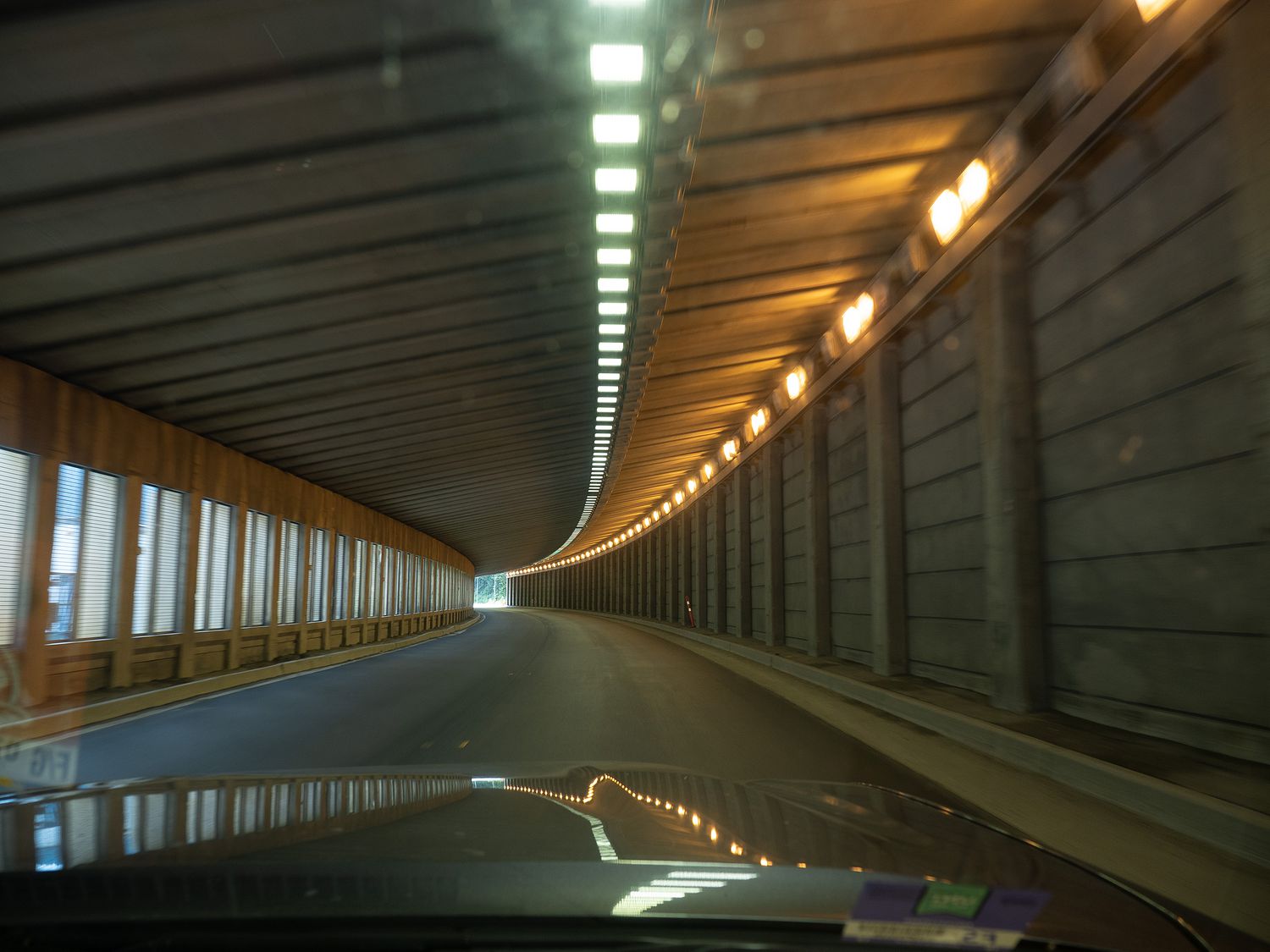
On our way out of Glacier, we drove under several tunnel-like things, which turned out to be what you would basically call an avalanche deflector. They probably have a serious name, but if I read it on the signs, I’ve already forgotten what it was. They are positioned underneath slopes that are typically unstable when covered with snow, and they are designed to send the snow and rock off over the highway and down into the valley below instead of in the road or on top of cars going by. It’s really neat, and not something I would have ever thought about.
We wrapped up in Glacier not longer after, and continued down the road to our final park of the day. The last park, Mount Revelstoke, was just outside the town we were staying in for the night, which is also called Revelstoke. It was getting later in the day, so we were glad to be getting close to our hotel for the night, but also pretty glad that we would finish out three parks today. If we hadn’t, we would’ve needed to visit them in the morning, which would’ve made tomorrow a much longer day.
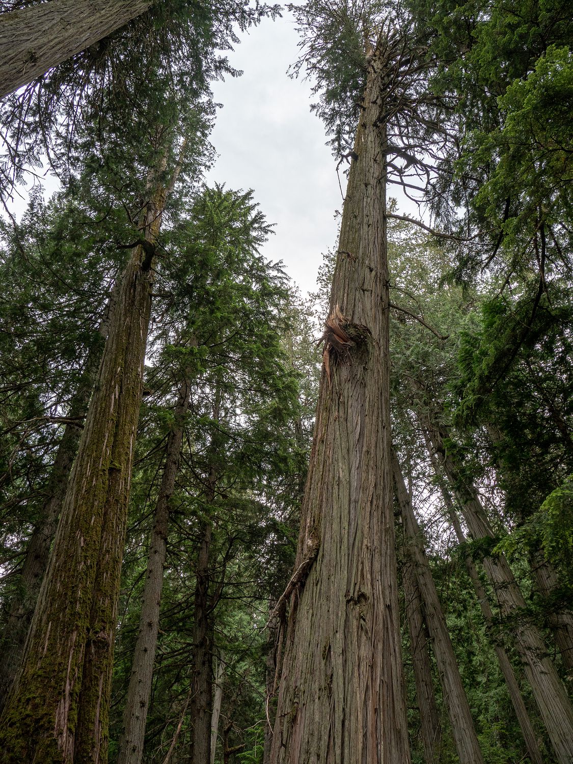
In Mount Revelstoke National Park, we stopped off at the Giant Cedars boardwalk, where we got to see, you guessed it, giant cedars. The word “giant” is no exaggeration, because they are massive. The signs mentioned that many of these trees were more than 500 years old. It is incredibly difficult to even imagine what this forest might’ve been like that long ago. I wonder what the rest of the area looked like then. Columbus landed in the Americas in 1492, which would’ve been about the right time. I wonder if anyone lived there at the time.
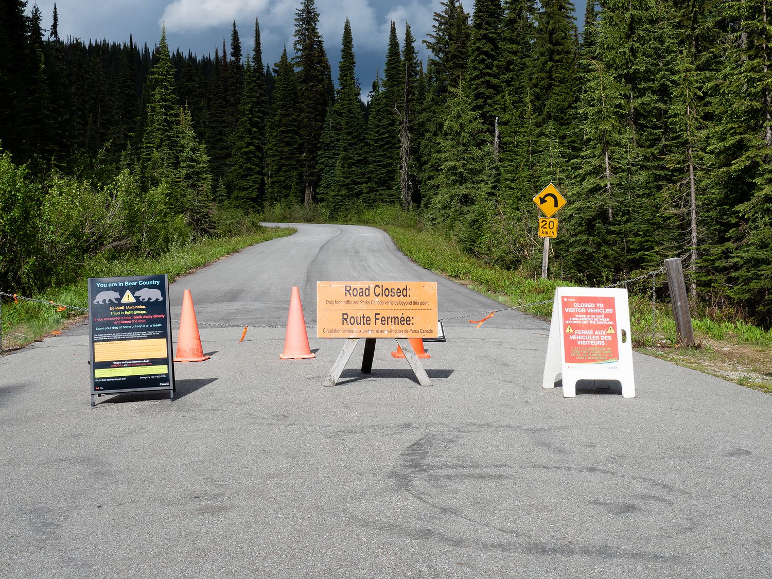
Once we finished staring up at the giant cedar trees, we continued down to the city of Revelstoke, where we were able to turn off to take the road to the summit of Mount Revelstoke. We dutifully wound our way up the mountain (it was nearly 80° by now), stopping every so often to take some photos off of the viewpoints, despite the sunshine doing its best to ruin them.
Unfortunately, it turned out that the final portion of the road leading to the summit was closed to vehicles due to snow, and we couldn’t actually get to the top. Talk about disappointing. Everything looked fine where we stopped, but I guess it must’ve been snowy enough at the top. Who knows? I just wish the park ranger at the gate had mentioned that the road was closed, but I guess he couldn’t be bothered. Mark even asked him what we needed to know, and he basically just shrugged at us. He clearly took his job seriously.
Once we reached our forced stopping point, we turned back down the mountain and went to our hotel for the night. We decided to have cooler dinner instead of trying to find something in town. The hotel we are staying in here, the Stoke Hotel, is cute and has been remodeled recently. It looks great for an older motor inn. They have breakfast, too, which will be a nice change.
Tomorrow we will get up and run on a path that’s right next to our hotel, then head back to Lake Louise again, only to turn north into Jasper. We are actually at our hotel in Jasper for 4 nights, so this is the last time for a while that we will have to pack up everything in the morning when we are ready to leave.
– Trip Total : 2,914 miles –